- Applewood, Colorado
:"Applewood redirects here. Applewood may also refer to wood cut from an
apple tree".Infobox Settlement
name = Applewood, Colorado
other_name =
native_name =
nickname =
settlement_type =census-designated place
motto =
imagesize =
image_caption =
flag_size =
image_
seal_size =
image_shield =
shield_size =
image_blank_emblem =
blank_emblem_type =
blank_emblem_size =
imagesize =
image_caption =
flag_size =
image_
seal_size =
image_shield =
shield_size =
image_blank_emblem =
blank_emblem_type =
blank_emblem_size =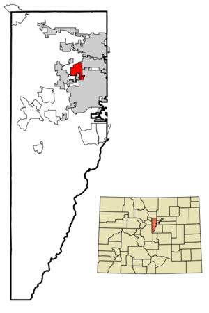
mapsize = 250px
map_caption = Location in Jefferson County and theState of Colorado
mapsize1 =
map_caption1 =
image_dot_
dot_mapsize =
dot_map_caption =
dot_x =
dot_y =
pushpin_
pushpin_label_position =
pushpin_map_caption =
pushpin_mapsize =
subdivision_type = Country
subdivision_name = USA
subdivision_type1 = State
subdivision_name1 = flag|Colorado|name=State of Colorado
subdivision_type2 = County
subdivision_name2 = Jefferson CountyGR|3
subdivision_type3 =
subdivision_name3 =
subdivision_type4 =
subdivision_name4 =
government_footnotes =
government_type =unincorporated community
leader_title =
leader_name =
leader_title1 =
leader_name1 =
leader_title2 =
leader_name2 =
leader_title3 =
leader_name3 =
leader_title4 =
leader_name4 =
established_title =
established_date =
established_title2 =
established_date2 =
established_title3 =
established_date3 =
area_magnitude =
unit_pref = Imperial
area_footnotes =
area_total_km2 = 12.5
area_land_km2 = 12.5
area_water_km2 = 0
area_total_sq_mi = 4.8
area_land_sq_mi = 4.8
area_water_sq_mi = 0
area_water_percent =
area_urban_km2 =
area_urban_sq_mi =
area_metro_km2 =
area_metro_sq_mi =
area_blank1_title =
area_blank1_km2 =
area_blank1_sq_mi =
population_as_of = 2000
population_footnotes =
population_note =
population_total = 7123
population_density_km2 = 569.8
population_density_sq_mi = 1484
population_metro =
population_density_metro_km2 =
population_density_metro_sq_mi =
population_urban =
population_density_urban_km2 =
population_density_urban_sq_mi =
population_blank1_title =
population_blank1 =
population_density_blank1_km2 =
population_density_blank1_sq_mi =
timezone = MST
utc_offset = -7
timezone_DST = MDT
utc_offset_DST = -6
latd = 39 |latm = 44 |lats = 59 |latNS = N
longd = 105 |longm = 9 |longs = 18 |longEW = W
elevation_footnotes = GR|3
elevation_m = 1771
elevation_ft = 5810
postal_code_type =
postal_code =
area_code =
blank_name = FIPS code
blank_info = 08-02575
blank1_name = GNIS feature ID
blank1_info = [http://geonames.usgs.gov/pls/gnispublic/f?p=gnispq:3:::NO::P3_FID:1867076 1867076]
website =
footnotes =Applewood is a
census-designated place (CDP) in Jefferson County,Colorado ,United States . The population was 7,123 at the 2000 census.Geography
Applewood is located at coor dms|39|44|59|N|105|9|18|W|city (39.749779, -105.155008)GR|1.
According to the
United States Census Bureau , the CDP has a total area of 4.8square mile s (12.5km² ), all of it land.Demographics
As of the
census GR|2 of 2000, there were 7,123 people, 2,954 households, and 2,055 families residing in the CDP. Thepopulation density was 1,473.6 people per square mile (569.4/km²). There were 3,067 housing units at an average density of 634.5/sq mi (245.2/km²). The racial makeup of the CDP was 94.59% White, 0.38% African American, 0.51% Native American, 1.22% Asian, 0.11% Pacific Islander, 1.47% from other races, and 1.71% from two or more races. Hispanic or Latino of any race were 4.38% of the population.There were 2,954 households out of which 26.7% had children under the age of 18 living with them, 58.9% were married couples living together, 7.3% had a female householder with no husband present, and 30.4% were non-families. 25.2% of all households were made up of individuals and 11.4% had someone living alone who was 65 years of age or older. The average household size was 2.40 and the average family size was 2.87.
In the CDP the population was spread out with 22.2% under the age of 18, 5.6% from 18 to 24, 24.0% from 25 to 44, 29.5% from 45 to 64, and 18.6% who were 65 years of age or older. The median age was 44 years. For every 100 females there were 95.6 males. For every 100 females age 18 and over, there were 94.0 males.
The median income for a household in the CDP was $66,210, and the median income for a family was $76,907. Males had a median income of $54,028 versus $36,315 for females. The
per capita income for the CDP was $34,640. About 2.8% of families and 4.2% of the population were below thepoverty line , including 2.7% of those under age 18 and 5.2% of those age 65 or over.ee also
*
Denver-Aurora Metropolitan Statistical Area
*Denver-Aurora-Boulder Combined Statistical Area
*Front Range Urban Corridor
*North Central Colorado Urban Area
*List of cities and towns in Colorado References
External links
* [http://www.applewoodvalley.homestead.com/ Applewood Valley Association (AVA) website]
Wikimedia Foundation. 2010.