- National Register of Historic Places listings in Jefferson County, Arkansas
-
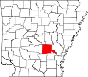
 Location of Jefferson County in Arkansas
This is a list of the National Register of Historic Places listings in Jefferson County, Arkansas.
This is intended to be a complete list of the properties and districts on the National Register of Historic Places in Jefferson County, Arkansas, United States. The locations of National Register properties and districts for which the latitude and longitude coordinates are included below, may be seen in a Google map.[1]
There are 71 properties and districts listed on the National Register in the county. Another 3 properties were once listed but have been removed.
Contents: Counties in Arkansas Arkansas - Ashley - Baxter - Benton - Boone - Bradley - Calhoun - Carroll - Chicot - Clark - Clay - Cleburne - Cleveland - Columbia - Conway - Craighead - Crawford - Crittenden - Cross - Dallas - Desha - Drew - Faulkner - Franklin - Fulton - Garland - Grant - Greene - Hempstead - Hot Spring - Howard - Independence - Izard - Jackson - Jefferson - Johnson - Lafayette - Lawrence - Lee - Lincoln - Little River - Logan - Lonoke - Madison - Marion - Miller - Mississippi - Monroe - Montgomery - Nevada - Newton - Ouachita - Perry - Phillips - Pike - Poinsett - Polk - Pope - Prairie - Pulaski (Little Rock) - Randolph - St. Francis - Saline - Scott - Searcy - Sebastian - Sevier - Sharp - Stone - Union - Van Buren - Washington - White - Woodruff - Yell
-
- This National Park Service list is complete through NPS recent listings posted November 10, 2011.[2]
Current listings
[3] Landmark name [4] Image Date listed Location City or town Summary 1 Antioch Missionary Baptist Church Cemetery July 8, 2010 500 N. McKinney Rd.
34°23′29″N 91°59′08″W / 34.391389°N 91.985556°WSherrill 2 Arkansas Louisiana Gas Company Building May 10, 2001 116 W. 6th
34°13′25″N 92°00′14″W / 34.223611°N 92.003889°WPine Bluff 3 Bellingrath House December 1, 1994 7520 Dollarway Rd.
34°15′54″N 92°05′15″W / 34.265°N 92.0875°WWhite Hall 4 Boone-Murphy House February 18, 1979 714 W. 4th Ave.
34°13′32″N 92°00′39″W / 34.225556°N 92.010833°WPine Bluff 5 Floyd B. Brown House January 19, 2006 1401 S. Georgia St.
34°13′02″N 92°00′00″W / 34.217222°N 92.0°WPine Bluff 6 Caldwell Hall December 22, 1982 University Drive
34°14′32″N 92°01′10″W / 34.242222°N 92.019444°WPine Bluff 7 Camp White Sulphur Springs Confederate Cemetery January 19, 2005 Luckwood Rd. about one block north of Highway 54
34°11′00″N 92°07′12″W / 34.183333°N 92.12°WSulphur Springs 8 Central Texas Gravel Locomotive #210 May 24, 2007 1700 Port Rd.
34°13′46″N 91°59′06″W / 34.229444°N 91.985°WPine Bluff At the Arkansas Railroad Museum 9 Community Theatre May 26, 2004 207 W. 2nd Ave.
34°13′49″N 92°00′17″W / 34.230278°N 92.004722°WPine Bluff 10 Dilley House August 3, 1977 656 Laurel St.
34°13′24″N 92°00′30″W / 34.223333°N 92.008333°WPine Bluff 11 DODX Guard Car #G-56 June 28, 2007 1700 Port Rd.
34°13′47″N 91°59′06″W / 34.229722°N 91.985°WPine Bluff At the Arkansas Railroad Museum 12 Dollarway Road May 17, 1974 South of Redfield off U.S. Route 65; also Highway 365
34°26′17″N 92°10′49″W / 34.438056°N 92.180278°WRedfield Highway 365 represents a boundary increase of July 15, 1999 13 Du Bocage June 24, 1974 1115 W. 4th St.
34°13′34″N 92°00′42″W / 34.226111°N 92.011667°WPine Bluff 14 The Elms July 7, 1978 South of Altheimer
34°18′15″N 91°50′33″W / 34.304167°N 91.8425°WAltheimer 15 Ferguson House January 18, 1978 902 E. 4th Ave.
34°13′33″N 92°00′42″W / 34.225833°N 92.011667°WPine Bluff 16 Fox House December 22, 1982 1303 S. Olive St.
34°12′58″N 92°00′25″W / 34.216111°N 92.006944°WPine Bluff 17 Gibson-Burnham House June 5, 1991 1326 Cherry St.
34°12′56″N 92°00′49″W / 34.215556°N 92.013611°WPine Bluff 18 Gracie House December 22, 1982 Off Highway 88
34°13′36″N 91°46′33″W / 34.226667°N 91.775833°WNew Gascony 19 Hotel Pines August 10, 1979 Main St. and W. 5th Ave.
34°13′30″N 92°00′13″W / 34.225°N 92.003611°WPine Bluff 20 Howson House December 22, 1982 1700 S. Olive St.
34°12′41″N 92°00′25″W / 34.211389°N 92.006944°WPine Bluff 21 Hudson House December 22, 1982 304 W. 5th St.
34°12′51″N 92°00′20″W / 34.214167°N 92.005556°WPine Bluff 22 Hudson-Grace-Borreson House June 24, 1971 716 W. Barraque
34°13′44″N 92°00′30″W / 34.228889°N 92.008333°WPine Bluff 23 Johnson House December 22, 1982 315 Martin St.
34°13′06″N 92°00′21″W / 34.218333°N 92.005833°WPine Bluff 24 Katzenstein House December 22, 1982 902 W. 5th St.
34°13′30″N 92°00′46″W / 34.225°N 92.012778°WPine Bluff 25 R.M. Knox House June 5, 1975 1504 W. 6th St.
34°13′24″N 92°01′04″W / 34.223333°N 92.017778°WPine Bluff 26 Lake Dick July 3, 1975 4 miles south of Altheimer off Highway 88
34°15′13″N 91°50′30″W / 34.253611°N 91.841667°WAltheimer 27 R.E. Lee House June 8, 1982 1302 W. 2nd Ave.
34°13′41″N 92°00′59″W / 34.228056°N 92.016389°WPine Bluff 28 Lone Star Baptist Church September 28, 2005 620 Sheridan Rd.
34°26′38″N 92°11′17″W / 34.443889°N 92.188056°WRedfield 29 MacMillan-Dilley House December 12, 1976 407 Martin Ave.
34°13′05″N 92°00′22″W / 34.218056°N 92.006111°WPine Bluff 30 Masonic Temple November 30, 1978 4th and State St.
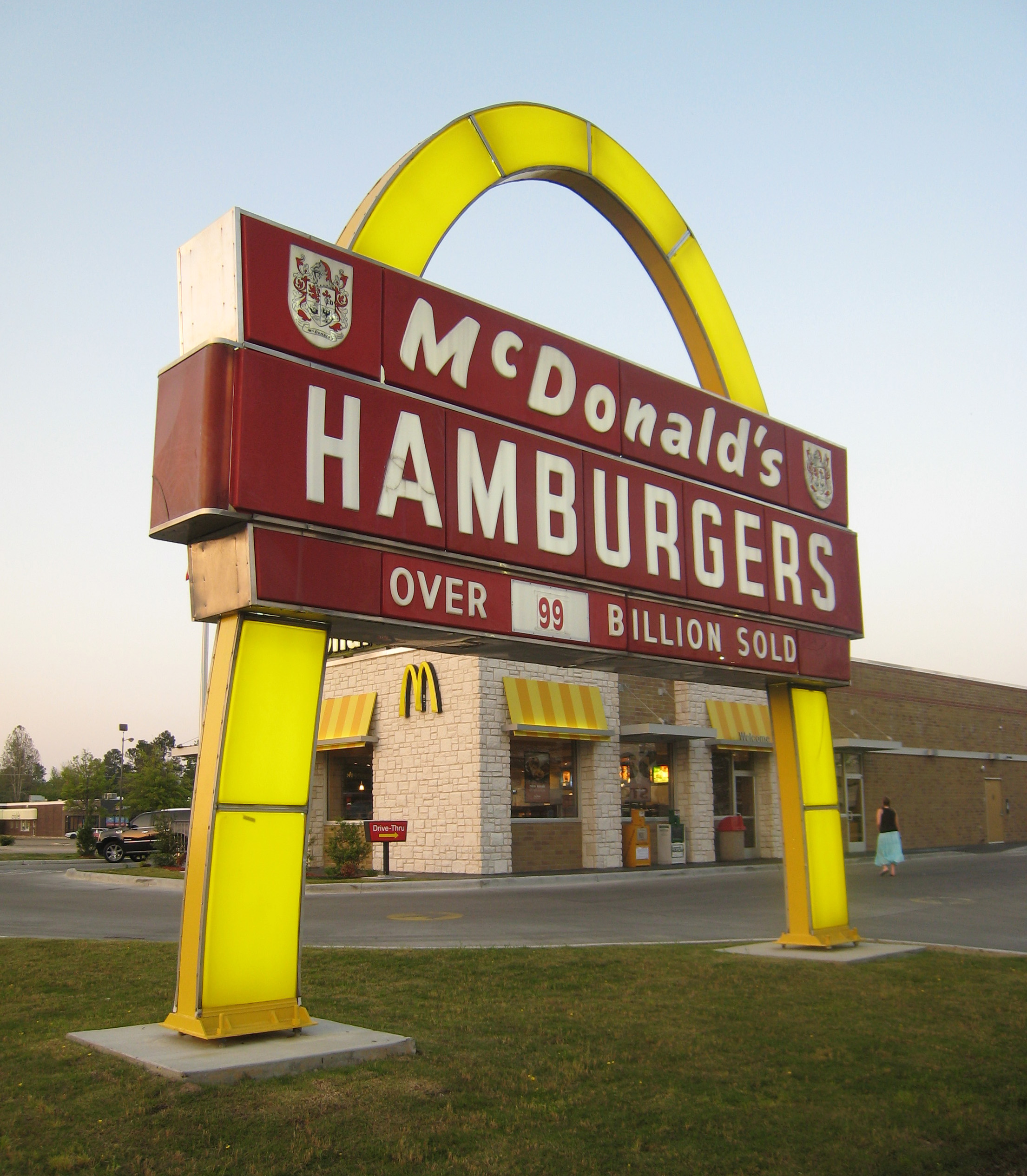
34°13′35″N 92°00′09″W / 34.226389°N 92.0025°WPine Bluff 31 McDonald's Store #433 Sign 
August 21, 2006 2801 S. Olive St.
34°12′07″N 92°00′24″W / 34.201944°N 92.006667°WPine Bluff 32 Merchants and Planters Bank Building August 1, 1978 100 Main St.
34°13′45″N 92°00′13″W / 34.229167°N 92.003611°WPine Bluff 33 Mills House May 29, 1998 715 W. Barraque
34°13′15″N 92°00′36″W / 34.220833°N 92.01°WPine Bluff 34 National Guard Armory-Pine Bluff February 16, 2001 623 W. 2nd Ave.
34°13′44″N 92°00′32″W / 34.228889°N 92.008889°WPine Bluff 35 Nichol House November 12, 1993 205 Park Pl.
34°12′39″N 92°00′02″W / 34.210833°N 92.000556°WPine Bluff 36 W.E. O'Bryant Bell Tower June 3, 1998 1200 N. University Dr. on the campus of the University of Pine Bluff
34°14′35″N 92°01′08″W / 34.243056°N 92.018889°WPine Bluff 37 Dr. John Walter Parker Sr. House September 25, 2003 1405 S. Alabama St.
34°12′54″N 92°00′03″W / 34.215°N 92.000833°WPine Bluff 38 Parkview Apartments May 1, 1989 300 W. 13th Ave.
34°12′58″N 92°00′20″W / 34.216111°N 92.005556°WPine Bluff 39 Pine Bluff Civic Center June 1, 2005 200 E. 8th Ave.
34°13′19″N 92°00′04″W / 34.221944°N 92.001111°WPine Bluff 40 Pine Bluff Commercial Historic District 
May 20, 2008 Roughly bounded by U.S. Route 65 Business, Walnut St., 10th Ave., and S. Alabama St.
34°13′18″N 92°00′11″W / 34.221714°N 92.003103°WPine Bluff 41 Pine Bluff Confederate Monument April 26, 1996 Northern side of the Jefferson County Courthouse at the junction of Barraque and Main Sts.
34°13′49″N 92°00′11″W / 34.230278°N 92.003056°WPine Bluff 42 Pine Bluff Fifth Avenue Historic District October 29, 1980 5th Ave.
34°13′30″N 92°00′27″W / 34.225°N 92.0075°WPine Bluff 43 Plum Bayou Homesteads June 5, 1975 North of Pine Bluff, east of the Arkansas River, includes the community of Wright and its environs
34°25′52″N 92°03′21″W / 34.431111°N 92.055833°WPine Bluff 44 Prigmore House April 10, 1986 1104 W. 5th Ave.
34°13′29″N 92°00′38″W / 34.224722°N 92.010556°WPine Bluff 45 Puddephatt House December 22, 1982 1820 S. Olive St.
34°12′37″N 92°00′26″W / 34.210278°N 92.007222°WPine Bluff 46 Roselawn May 23, 1978 Southwest of Altheimer off Highway 88
34°18′26″N 91°51′34″W / 34.307222°N 91.859444°WAltheimer 47 Roth-Rosenzweig House December 12, 1976 717 W. 2nd Ave.
34°13′43″N 92°00′34″W / 34.228611°N 92.009444°WPine Bluff 48 Saenger Theater March 23, 1995 Southeastern corner of the junction of W. 2nd Ave. and Pine St.
34°13′41″N 92°00′14″W / 34.228056°N 92.003889°WPine Bluff 49 St. Louis San Francisco (Frisco) Railway Coach #661 May 19, 2006 2815 Dixie Woods Dr.
34°16′04″N 92°03′35″W / 34.267778°N 92.059722°WPine Bluff At the Arkansas Railroad Museum 50 St. Louis Southwestern Railway (Cotton Belt Route) Caboose #2325 March 2, 2006 2815 Dixie Woods Dr.
34°16′04″N 92°03′34″W / 34.267778°N 92.059444°WPine Bluff At the Arkansas Railroad Museum 51 St. Louis Southwestern Railway (Cotton Belt Route) Relief Train May 25, 2007 1700 Port Rd.
34°13′45″N 91°59′09″W / 34.229167°N 91.985833°WPine Bluff At the Arkansas Railroad Museum 52 St. Louis Southwestern Railway (Cotton Belt Route) Steam Locomotive #336 January 24, 2007 1700 Port Rd.
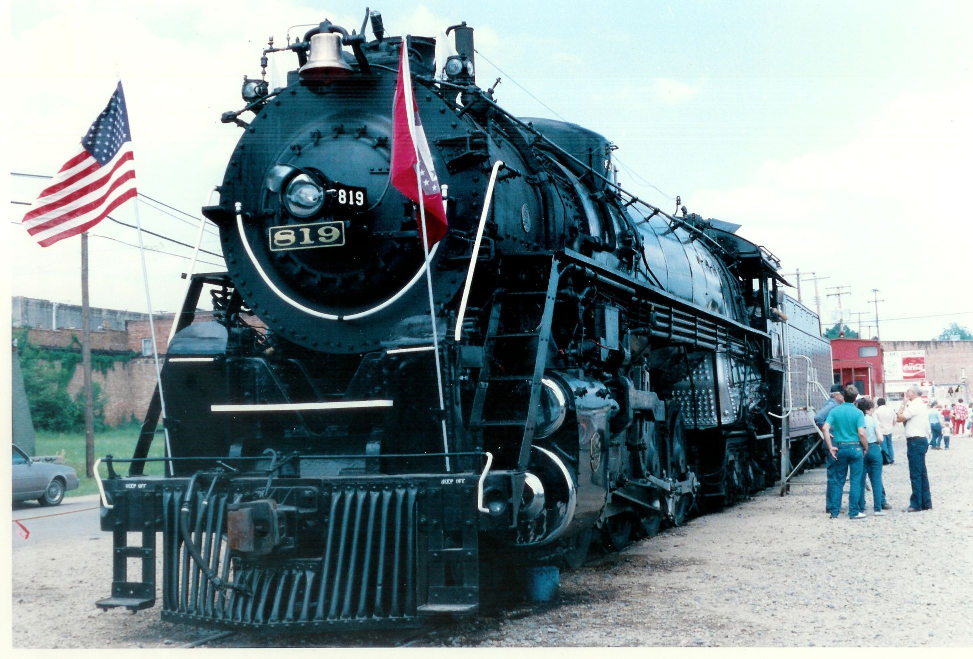
34°13′37″N 91°59′04″W / 34.226944°N 91.984444°WPine Bluff At the Arkansas Railroad Museum 53 St. Louis Southwestern Railway Steam Locomotive #819 
May 18, 2003 1720 Port Rd.
34°13′37″N 91°59′05″W / 34.226944°N 91.984722°WPine Bluff At the Arkansas Railroad Museum 54 St. Peter's Cemetery June 4, 1998 Morgan Rd., south of New Gascony
34°13′50″N 91°46′47″W / 34.230556°N 91.779722°WPine Bluff 55 Sherrill Methodist Episcopal Church, South May 16, 2002 301 Main St.
34°23′15″N 91°57′08″W / 34.3875°N 91.952222°WSherrill 56 Walter B. Sorrells Cottage August 4, 1986 Off Highway 104
34°13′03″N 92°05′16″W / 34.2175°N 92.087778°WPine Bluff 57 Strengthen the Arm of Liberty Monument-Pine Bluff November 1, 2000 10th Ave. between Georgia and State Sts.
34°13′11″N 92°00′03″W / 34.219722°N 92.000833°WPine Bluff 58 Taylor Field January 21, 2010 1201 E. 16th St.
34°12′50″N 91°59′29″W / 34.213906°N 91.991519°WPine Bluff 59 Temple House December 22, 1982 1702 S. Oak St.
34°12′41″N 92°00′38″W / 34.211389°N 92.010556°WPine Bluff 60 Trinity Episcopal Church July 30, 1974 3rd and Oak Sts.
34°13′40″N 92°00′36″W / 34.227778°N 92.01°WPine Bluff 61 Trulock-Cook House February 21, 1979 703 W. 2nd Ave.
34°13′43″N 92°00′38″W / 34.228611°N 92.010556°WPine Bluff 62 Trulock-Gould-Mullis House January 3, 1978 704 W. Barraque St.
34°13′46″N 92°00′35″W / 34.229444°N 92.009722°WPine Bluff 63 Tucker School June 10, 2005 Vandalsen Dr.
34°26′08″N 91°57′21″W / 34.435556°N 91.955833°WTucker 64 Union Station December 14, 1978 E. 4th Ave. and State St.
34°13′34″N 92°00′06″W / 34.226111°N 92.001667°WPine Bluff 65 United States Army Snow Plow #SN-87 January 24, 2007 1700 Port Rd.
34°13′47″N 91°59′07″W / 34.229722°N 91.985278°WPine Bluff At the Arkansas Railroad Museum 66 Wabash Alloys Locomotive May 22, 2007 1700 Port Rd.
34°13′45″N 91°59′06″W / 34.229167°N 91.985°WPine Bluff At Arkansas Railroad Museum 67 Wabbaseka Methodist Episcopal Church, South October 4, 2002 U.S. Route 79
34°21′36″N 91°47′52″W / 34.36°N 91.797778°WWabbeseka 68 John Brown Watson Memorial Library Building January 13, 2006 1200 N. University Dr.
34°14′42″N 92°01′13″W / 34.245°N 92.020278°WPine Bluff 69 West James Street Overpass May 18, 1995 W. James St. over Union Pacific railroad tracks
34°26′44″N 92°11′06″W / 34.445556°N 92.185°WRedfield 70 Williams Building November 16, 2010 418-420 N. University
34°13′59″N 92°01′10″W / 34.233056°N 92.019444°WPine Bluff 71 Yauch-Ragar House January 20, 1978 625 State St.
34°13′28″N 92°00′07″W / 34.224444°N 92.001944°WPine Bluff Former listings
Landmark name Image Dates Location City or Town Summary 1 Collier House December 22, 1982 (listed)
January 23, 2008 (delisted)1227 W. 5th St. Pine Bluff A Bungalow/Craftsman 2 Hospital and Benevolent Association None 11th and Cherry
34°13′04″N 92°00′50″W / 34.217778°N 92.013889°WPine Bluff 3 Russell House December 22, 1982 (listed)
September 20, 2006 (delisted)1617 S. Olive St.
34°12′44″N 92°0′24″W / 34.21222°N 92.00667°WPine Bluff See also
- List of National Historic Landmarks in Arkansas
- National Register of Historic Places listings in Arkansas
References
- ^ The latitude and longitude information provided in this table was derived originally from the National Register Information System, which has been found to be fairly accurate for about 99% of listings. For about 1% of NRIS original coordinates, experience has shown that one or both coordinates are typos or otherwise extremely far off; some corrections may have been made. A more subtle problem causes many locations to be off by up to 150 yards, depending on location in the country: most NRIS coordinates were derived from tracing out latitude and longitudes off of USGS topographical quadrant maps created under North American Datum of 1927, which differs from the current, highly accurate GPS system used by Google maps. Chicago is about right, but NRIS longitudes in Washington are higher by about 4.5 seconds, and are lower by about 2.0 seconds in Maine. Latitudes differ by about 1.0 second in Florida. Some locations in this table may have been corrected to current GPS standards.
- ^ "National Register of Historic Places: Weekly List Actions". National Park Service, United States Department of the Interior. Retrieved on November 10, 2011.
- ^ Numbers represent an ordering by significant words. Various colorings, defined here, differentiate National Historic Landmark sites and National Register of Historic Places Districts from other NRHP buildings, structures, sites or objects.
- ^ "National Register Information System". National Register of Historic Places. National Park Service. . http://nrhp.focus.nps.gov/natreg/docs/All_Data.html.
U.S. National Register of Historic Places Topics Lists by states Alabama • Alaska • Arizona • Arkansas • California • Colorado • Connecticut • Delaware • Florida • Georgia • Hawaii • Idaho • Illinois • Indiana • Iowa • Kansas • Kentucky • Louisiana • Maine • Maryland • Massachusetts • Michigan • Minnesota • Mississippi • Missouri • Montana • Nebraska • Nevada • New Hampshire • New Jersey • New Mexico • New York • North Carolina • North Dakota • Ohio • Oklahoma • Oregon • Pennsylvania • Rhode Island • South Carolina • South Dakota • Tennessee • Texas • Utah • Vermont • Virginia • Washington • West Virginia • Wisconsin • WyomingLists by territories Lists by associated states Other  Category:National Register of Historic Places •
  Portal:National Register of Historic Places
Municipalities and communities of Jefferson County, Arkansas County seat: Pine Bluff Cities Altheimer | Humphrey‡ | Pine Bluff | Redfield | Wabbaseka | White Hall
Town CDP Sulphur Springs
Unincorporated
communitiesJefferson | Moscow | Lake Dick | Reydell | Tucker | Wright
Footnotes ‡This populated place also has portions in an adjacent county or counties
Categories:- Jefferson County, Arkansas
- National Register of Historic Places in Arkansas by county
-

Wikimedia Foundation. 2010.