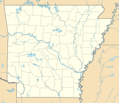
- Dollarway Road
-
Dollarway Road
Nearest city: Redfield, Arkansas Coordinates: 34°26′17″N 92°10′49″W / 34.43806°N 92.18028°WCoordinates: 34°26′17″N 92°10′49″W / 34.43806°N 92.18028°W Area: 12.5 acres (5.1 ha) (after increase) Built: 1913 Architect: Shelby, Isaac Prather Governing body: State (original) and Local (increase) NRHP Reference#: 74000480 and 99000822[1] Added to NRHP: May 17, 1974 (original)
July 15, 1999 (increase)Dollarway Road is a road near Redfield, Arkansas that was built in 1913. It was listed on the National Register of Historic Places (NRHP) in 1974. The boundary of the NRHP-listed area was increased in 1999.[1]
Contents
History
The nation began to focus on good roads at the start of the 20th century. Arkansas did not yet have a state highway commission and instead left the task of building and maintaining good roads to individual road districts, which consisted of area farmers and residents without central leadership and in many cases engineering experience.[2] One district, Jefferson County Road Improvement District No. 4, decided to construct a concrete road from Pine Bluff, Arkansas, north to the Pine Bluff – Little Rock wagon road at the Jefferson County line.
Dollarway pavement
The roadway was paved in 9 feet (2.7 m) wide concrete slabs, poured in a 1-2½-5 mixture.[3] At the edges were 45 degree slopes, which means only 8.5 miles (13.7 km) of the width was level, with the slopes acting as curbs. Further out from the center was 18 inches (0.46 m) of gravel and 3 feet (0.91 m) of earthwork. The gravel shoulder allowed vehicles to continue on the road without stopping for oncoming traffic, which was common at the time.
Tradition holds that the road was called Dollarway because it cost one dollar per linear foot to construct. The final cost was closer to $1.36 per foot. In July 1913, Little Rock, Arkansas contractors Shelby and Bateman were chosen to construct the approximately twenty-three-mile road. Construction began in November 1913, and the road was finished in October 1914. The Dollarway Road was the longest continuous concrete pavement in the United States when complete.[4]
Today
The original NRHP boundary placed the Dollarway within a park near Redfield. The extended boundary added a portion of the Dollarway still used today as Reynolds Road. This segment also contains two original Dollarway concrete bridges.
See also
References
- ^ a b "National Register Information System". National Register of Historic Places. National Park Service. 2009-03-13. http://nrhp.focus.nps.gov/natreg/docs/All_Data.html.
- ^ "Arkansas Highway History and Architecture, 1910–1965". National Register of Historic Places Multiple Property Documentation Form. p. 8. http://pdfhost.focus.nps.gov/docs/NRHP/Text/64500014.pdf. Retrieved July 2, 2011.
- ^ "Arkansas Highway History and Architecture, 1910–1965". National Register of Historic Places Multiple Property Documentation Form. p. 9. http://pdfhost.focus.nps.gov/docs/NRHP/Text/64500014.pdf. Retrieved July 2, 2011.
- ^ "Dollarway Road". The Encyclopedia of Arkansas History and Culture. http://www.encyclopediaofarkansas.net/encyclopedia/entry-detail.aspx?entryID=5237. Retrieved 2010-04-16.
U.S. National Register of Historic Places Topics Lists by states Alabama • Alaska • Arizona • Arkansas • California • Colorado • Connecticut • Delaware • Florida • Georgia • Hawaii • Idaho • Illinois • Indiana • Iowa • Kansas • Kentucky • Louisiana • Maine • Maryland • Massachusetts • Michigan • Minnesota • Mississippi • Missouri • Montana • Nebraska • Nevada • New Hampshire • New Jersey • New Mexico • New York • North Carolina • North Dakota • Ohio • Oklahoma • Oregon • Pennsylvania • Rhode Island • South Carolina • South Dakota • Tennessee • Texas • Utah • Vermont • Virginia • Washington • West Virginia • Wisconsin • WyomingLists by territories Lists by associated states Other Categories:- National Register of Historic Places in Arkansas
- Roads opened in 1913
- Transportation in Jefferson County, Arkansas
Wikimedia Foundation. 2010.

