- National Register of Historic Places listings in Craighead County, Arkansas
-
 Location of Craighead County in Arkansas
This is a list of the National Register of Historic Places listings in Craighead County, Arkansas.
This is intended to be a complete list of the properties and districts on the National Register of Historic Places in Craighead County, Arkansas, United States. The locations of National Register properties and districts for which the latitude and longitude coordinates are included below, may be seen in a Google map.[1]
There are 17 properties and districts listed on the National Register in the county.
Contents: Counties in Arkansas Arkansas - Ashley - Baxter - Benton - Boone - Bradley - Calhoun - Carroll - Chicot - Clark - Clay - Cleburne - Cleveland - Columbia - Conway - Craighead - Crawford - Crittenden - Cross - Dallas - Desha - Drew - Faulkner - Franklin - Fulton - Garland - Grant - Greene - Hempstead - Hot Spring - Howard - Independence - Izard - Jackson - Jefferson - Johnson - Lafayette - Lawrence - Lee - Lincoln - Little River - Logan - Lonoke - Madison - Marion - Miller - Mississippi - Monroe - Montgomery - Nevada - Newton - Ouachita - Perry - Phillips - Pike - Poinsett - Polk - Pope - Prairie - Pulaski (Little Rock) - Randolph - St. Francis - Saline - Scott - Searcy - Sebastian - Sevier - Sharp - Stone - Union - Van Buren - Washington - White - Woodruff - Yell
-
- This National Park Service list is complete through NPS recent listings posted November 10, 2011.[2]
Current listings
[3] Landmark name [4] Image Date listed Location City or town Summary 1 Bay Mounds February 14, 1978 Address Restricted Bay 2 Bell House November 7, 1976 303 W. Cherry St.
35°50′02″N 90°42′26″W / 35.833889°N 90.707222°WJonesboro 3 Berger House November 7, 1996 1120 S. Main St.
35°49′55″N 90°42′17″W / 35.831944°N 90.704722°WJonesboro 4 Berger-Graham House October 10, 1985 1327 S. Main St.
35°49′43″N 90°42′19″W / 35.828611°N 90.705278°WJonesboro 5 US Sen. Hattie Caraway, Gravesite September 20, 2007 Oaklawn Cemetery, 2349 W. Matthews Avenue Ln.
35°50′15″N 90°44′20″W / 35.8375°N 90.738889°WJonesboro Gravesite of Hattie Caraway 6 Community Center No. 1 January 23, 2008 1212 S. Church St.
35°50′00″N 90°42′10″W / 35.833333°N 90.702778°WJonesboro 7 Craighead County Courthouse September 11, 1998 511 Main St.
35°50′14″N 90°42′18″W / 35.837222°N 90.705°WJonesboro 8 Craighead County Road 513C Bridge May 18, 1995 County Road 513C over an unnamed ditch, approximately 1.5 miles east of Dixie, just east of its junction with County Road 669
35°55′12″N 90°25′23″W / 35.92°N 90.423056°WDixie 9 First National Bank Building January 24, 2008 207 W. Drew Ave.
35°53′31″N 90°20′34″W / 35.891944°N 90.342778°WMonette 10 Frierson House April 24, 1973 1112 S. Main St.
35°49′56″N 90°42′17″W / 35.832222°N 90.704722°WJonesboro 11 Mercantile Bank Building January 20, 2005 249 S. Main St.
33°24′34″N 90°46′16″W / 33.409444°N 90.771111°WJonesboro 12 Monette Water Tower January 24, 2008 Southwestern corner of the junction of Highway 139 and Texie Ave.
35°53′38″N 90°20′35″W / 35.893889°N 90.343056°WMonette 13 Nash-Reid-Hill House August 16, 1994 418 W. Matthews Ave.
35°50′09″N 90°42′31″W / 35.835833°N 90.708611°WJonesboro 14 St. Francis River Bridge 
April 9, 1990 Highway 18 over the St. Francis River
35°49′14″N 90°25′58″W / 35.820556°N 90.432778°WLake City 15 C.A. Stuck and Sons Lumber December 27, 2002 215 Union St.
35°50′29″N 90°42′21″W / 35.841389°N 90.705833°WJonesboro 16 West Washington Avenue Historic District October 22, 1982 500-626 W. Washington Ave.
35°50′13″N 90°42′39″W / 35.836944°N 90.710833°WJonesboro 17 Edward L. Westbrooke Building January 8, 2003 505 Union St.
35°50′16″N 90°42′21″W / 35.837778°N 90.705833°WJonesboro See also
- List of National Historic Landmarks in Arkansas
- National Register of Historic Places listings in Arkansas
References
- ^ The latitude and longitude information provided in this table was derived originally from the National Register Information System, which has been found to be fairly accurate for about 99% of listings. For about 1% of NRIS original coordinates, experience has shown that one or both coordinates are typos or otherwise extremely far off; some corrections may have been made. A more subtle problem causes many locations to be off by up to 150 yards, depending on location in the country: most NRIS coordinates were derived from tracing out latitude and longitudes off of USGS topographical quadrant maps created under North American Datum of 1927, which differs from the current, highly accurate GPS system used by Google maps. Chicago is about right, but NRIS longitudes in Washington are higher by about 4.5 seconds, and are lower by about 2.0 seconds in Maine. Latitudes differ by about 1.0 second in Florida. Some locations in this table may have been corrected to current GPS standards.
- ^ "National Register of Historic Places: Weekly List Actions". National Park Service, United States Department of the Interior. Retrieved on November 10, 2011.
- ^ Numbers represent an ordering by significant words. Various colorings, defined here, differentiate National Historic Landmark sites and National Register of Historic Places Districts from other NRHP buildings, structures, sites or objects.
- ^ "National Register Information System". National Register of Historic Places. National Park Service. . http://nrhp.focus.nps.gov/natreg/docs/All_Data.html.
U.S. National Register of Historic Places Topics Lists by states Alabama • Alaska • Arizona • Arkansas • California • Colorado • Connecticut • Delaware • Florida • Georgia • Hawaii • Idaho • Illinois • Indiana • Iowa • Kansas • Kentucky • Louisiana • Maine • Maryland • Massachusetts • Michigan • Minnesota • Mississippi • Missouri • Montana • Nebraska • Nevada • New Hampshire • New Jersey • New Mexico • New York • North Carolina • North Dakota • Ohio • Oklahoma • Oregon • Pennsylvania • Rhode Island • South Carolina • South Dakota • Tennessee • Texas • Utah • Vermont • Virginia • Washington • West Virginia • Wisconsin • WyomingLists by territories Lists by associated states Other  Category:National Register of Historic Places •
  Portal:National Register of Historic Places
Municipalities and communities of Craighead County, Arkansas County seats: Jonesboro and Lake City Cities 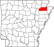
Towns Unincorporated
communitiesAetna | Antioch | Apt | Bowman | Buck Snort | Bunney | Burnt Hill | Cary | Childress | Chilson | Claunch | Cottonwood Corner | Davis Spur | Deep Landing | Degelow | Delfore | Denton Island | Dixie | Dorothy | Dryden | Elm Grove | Fallis | Farrville | Fiftysix | Fisher | Gibson | Gilkerson | Glendale | Goobertown | Greensboro | Gum Point | Hancock | Hancock Junction | Hergett | Herman | Herndon | Jonesboro Junction | Lake View | Lepanto Junction | Lester | Longwill | Lunsford | Macey | Mangrum | Nalle | Needham | Nemo Nettleton | Oak Ridge | Otwell | Pauls Switch | Philadelphia | Phillips | Pleasant Grove | Poplar Ridge | Ridge | Riggs | Risher | Sandy | Southland | Sterling Springs | Stier | Upper Poplar Ridge | Valley View | Winesburg |
Categories:- Craighead County, Arkansas
- National Register of Historic Places in Arkansas by county
-


Wikimedia Foundation. 2010.