- Brookland, Arkansas
Infobox Settlement
official_name = Brookland, Arkansas
settlement_type =Town
imagesize =
image_caption =
image_
imagesize =
image_caption =
image_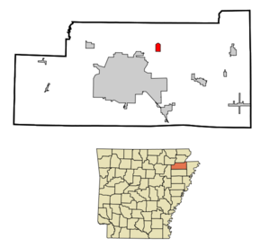
mapsize = 250px
map_caption = Location in Craighead County and the state ofArkansas
mapsize1 =
map_caption1 =
subdivision_type = Country
subdivision_type1 = State
subdivision_type2 = County
subdivision_name =United States
subdivision_name1 =Arkansas
subdivision_name2 = Craighead
government_type =
leader_title =
leader_name =
established_date =
area_magnitude =
area_total_km2 = 2.8
area_total_sq_mi = 1.1
area_land_km2 = 2.8
area_land_sq_mi = 1.1
area_water_km2 = 0
area_water_sq_mi = 0
elevation_ft = 262
elevation_m = 80
population_as_of = 2000
population_footnotes =
population_total = 1332
population_metro =
population_density_km2 = 475.7
population_density_sq_mi = 1210.9
timezone = Central (CST)
utc_offset = -6
latd = 35 |latm = 54 |lats = 9 |latNS = N
longd = 90 |longm = 34 |longs = 54 |longEW = W
timezone_DST = CDT
utc_offset_DST = -5
postal_code_type =ZIP code
postal_code = 72417
area_code = 870
blank_name = FIPS code
blank_info = 05-09100
blank1_name = GNIS feature ID
blank1_info = 0076423
footnotes =
website =Brookland is a town in Craighead County,
Arkansas ,United States . The population was 1,332 at the 2000 census. It is included in theJonesboro, Arkansas Metropolitan Statistical Area . It is often disparagingly referred to as "Goobertown South," being situated 3.7 miles south of the hamlet of Goobertown.Geography
Brookland is located at coor dms|35|54|9|N|90|34|54|W|city (35.902386, -90.581591)GR|1.
According to the
United States Census Bureau , the town has a total area of 2.8km² (1.1 mi²), all land.Demographics
As of the
census GR|2 of 2000, there were 1,332 people, 499 households, and 384 families residing in the town. Thepopulation density was 471.8/km² (1,220.1/mi²). There were 537 housing units at an average density of 190.2/km² (491.9/mi²). The racial makeup of the town was 97.52% White, 0.68% Black or African American, 0.38% Native American, 0.68% from other races, and 0.75% from two or more races. 1.05% of the population were Hispanic or Latino of any race.There were 499 households out of which 43.7% had children under the age of 18 living with them, 59.3% were married couples living together, 14.4% had a female householder with no husband present, and 23.0% were non-families. 19.6% of all households were made up of individuals and 11.0% had someone living alone who was 65 years of age or older. The average household size was 2.67 and the average family size was 3.07.
In the town the population was spread out with 29.7% under the age of 18, 9.2% from 18 to 24, 31.8% from 25 to 44, 17.6% from 45 to 64, and 11.6% who were 65 years of age or older. The median age was 31 years. For every 100 females there were 95.0 males. For every 100 females age 18 and over, there were 87.2 males.
The median income for a household in the town was $33,125, and the median income for a family was $37,500. Males had a median income of $27,471 versus $18,864 for females. The
per capita income for the town was $13,744. About 7.0% of families and 11.1% of the population were below thepoverty line , including 17.4% of those under age 18 and 18.7% of those age 65 or over.References
External links
Wikimedia Foundation. 2010.