- National Register of Historic Places listings in Boone County, Arkansas
-
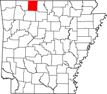 Location of Boone County in Arkansas
This is a list of the National Register of Historic Places listings in Boone County, Arkansas.
This is intended to be a complete list of the properties and districts on the National Register of Historic Places in Boone County, Arkansas, United States. The locations of National Register properties and districts for which the latitude and longitude coordinates are included below, may be seen in a Google map.[1]
There are 20 properties and districts listed on the National Register in the county.
Contents: Counties in Arkansas Arkansas - Ashley - Baxter - Benton - Boone - Bradley - Calhoun - Carroll - Chicot - Clark - Clay - Cleburne - Cleveland - Columbia - Conway - Craighead - Crawford - Crittenden - Cross - Dallas - Desha - Drew - Faulkner - Franklin - Fulton - Garland - Grant - Greene - Hempstead - Hot Spring - Howard - Independence - Izard - Jackson - Jefferson - Johnson - Lafayette - Lawrence - Lee - Lincoln - Little River - Logan - Lonoke - Madison - Marion - Miller - Mississippi - Monroe - Montgomery - Nevada - Newton - Ouachita - Perry - Phillips - Pike - Poinsett - Polk - Pope - Prairie - Pulaski (Little Rock) - Randolph - St. Francis - Saline - Scott - Searcy - Sebastian - Sevier - Sharp - Stone - Union - Van Buren - Washington - White - Woodruff - Yell
-
- This National Park Service list is complete through NPS recent listings posted November 10, 2011.[2]
Current listings
[3] Landmark name [4] Image Date listed Location City or town Summary 1 Elliott and Anna Barham House January 21, 2004 4085 West St.
36°17′02″N 92°54′58″W / 36.283889°N 92.916111°WZinc 2 Bear Creek Motel March 13, 2001 U.S. Route 65
36°17′30″N 93°10′55″W / 36.291667°N 93.181944°WBear Creek Springs 3 Bergman High School September 10, 1992 County Road 48
36°18′48″N 93°01′02″W / 36.313333°N 93.017222°WBergman 4 Boone County Courthouse July 21, 1976 Courthouse Sq.
36°13′49″N 93°06′29″W / 36.230278°N 93.108056°WHarrison 5 Boone County Jail December 12, 1976 Central Ave. and Willow St.
36°13′45″N 93°06′30″W / 36.229167°N 93.108333°WHarrison 6 Carrollton Road-Carrollton Segment May 20, 2008 County Road 917, Terrapin Creek Rd., and Dunkard Rd. between U.S. Route 412 and Green Hill Rd.
36°16′05″N 93°17′13″W / 36.268097°N 93.287067°WCarrollton 7 Cottonwood School #45 October 4, 2002 Cottonwood and Dubuque Rd.
36°24′19″N 93°06′08″W / 36.405278°N 93.102222°WSelf 8 Cricket and Crest Tunnels Historic District September 19, 2007 Under and west of Old U.S. Route 65 Omaha 9 Duncan House September 28, 2005 610 W. Central Ave.
36°13′52″N 93°06′53″W / 36.231111°N 93.114722°WHarrison 10 Evans-Kirby House January 20, 2005 611 S. Pine St.
36°13′33″N 93°06′40″W / 36.225833°N 93.111111°WHarrison 11 Everton School September 10, 1992 Main St.
36°09′12″N 92°54′25″W / 36.153333°N 92.906944°WEverton 12 Grubb Springs School March 29, 1996 Northeastern corner of the junction of Highways 43 and 397
36°13′12″N 93°08′59″W / 36.22°N 93.149722°WHarrison 13 Haggard Ford Swinging Bridge June 30, 1995 Over Bear Creek at Cottonwood Rd., 8 miles north of Harrison
36°20′45″N 93°07′50″W / 36.345833°N 93.130556°WHarrison 14 Harrison Courthouse Square Historic District 
May 6, 1999 Roughly bounded by N. Walnut, W. Ridge, N. Willow, and W. Stephenson Sts.
36°13′51″N 93°06′28″W / 36.230833°N 93.107778°WHarrison 15 Harrison High School January 24, 2007 124 S. Cherry St.
36°13′30″N 93°06′38″W / 36.225°N 93.110556°WHarrison 16 Hotel Seville May 19, 1994 Northwestern corner of the junction of Vine and Ridge Sts.
36°13′56″N 93°06′27″W / 36.232222°N 93.1075°WHarrison 17 Missouri and North Arkansas Depot-Bellefonte June 11, 1992 Southeastern corner of the junction of Center St. and Keeter Dr.
36°12′10″N 93°02′47″W / 36.202778°N 93.046389°WBellefonte 18 Twelve Oaks January 20, 2010 7210 Highway 7 South
36°10′00″N 93°07′23″W / 36.166572°N 93.123103°WHarrison 19 Valley Springs School September 10, 1992 1 School St.
36°09′28″N 92°59′36″W / 36.157778°N 92.993333°WValley Springs 20 Zinc Swinging Bridge-BO0162 January 24, 2007 8039 Washington St.
36°17′05″N 92°54′55″W / 36.284722°N 92.915278°WZinc See also
- List of National Historic Landmarks in Arkansas
- National Register of Historic Places listings in Arkansas
References
- ^ The latitude and longitude information provided in this table was derived originally from the National Register Information System, which has been found to be fairly accurate for about 99% of listings. For about 1% of NRIS original coordinates, experience has shown that one or both coordinates are typos or otherwise extremely far off; some corrections may have been made. A more subtle problem causes many locations to be off by up to 150 yards, depending on location in the country: most NRIS coordinates were derived from tracing out latitude and longitudes off of USGS topographical quadrant maps created under the North American Datum of 1927, which differs from the current, highly accurate WGS84 GPS system used by Google maps. Chicago is about right, but NRIS longitudes in Washington are higher by about 4.5 seconds, and are lower by about 2.0 seconds in Maine. Latitudes differ by about 1.0 second in Florida. Some locations in this table may have been corrected to current GPS standards.
- ^ "National Register of Historic Places: Weekly List Actions". National Park Service, United States Department of the Interior. Retrieved on November 10, 2011.
- ^ Numbers represent an ordering by significant words. Various colorings, defined here, differentiate National Historic Landmark sites and National Register of Historic Places Districts from other NRHP buildings, structures, sites or objects.
- ^ "National Register Information System". National Register of Historic Places. National Park Service. . http://nrhp.focus.nps.gov/natreg/docs/All_Data.html.
U.S. National Register of Historic Places Topics Lists by states Alabama • Alaska • Arizona • Arkansas • California • Colorado • Connecticut • Delaware • Florida • Georgia • Hawaii • Idaho • Illinois • Indiana • Iowa • Kansas • Kentucky • Louisiana • Maine • Maryland • Massachusetts • Michigan • Minnesota • Mississippi • Missouri • Montana • Nebraska • Nevada • New Hampshire • New Jersey • New Mexico • New York • North Carolina • North Dakota • Ohio • Oklahoma • Oregon • Pennsylvania • Rhode Island • South Carolina • South Dakota • Tennessee • Texas • Utah • Vermont • Virginia • Washington • West Virginia • Wisconsin • WyomingLists by territories Lists by associated states Other Municipalities and communities of Boone County, Arkansas Cities 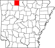
Towns Alpena‡ | Bellefonte | Bergman | Everton | Lead Hill | Omaha | South Lead Hill | Valley Springs | Zinc
Unincorporated
communitiesBear Creek Springs | Hopewell | Self
Footnotes ‡This populated place also has portions in an adjacent county or counties
Categories:- Boone County, Arkansas
- National Register of Historic Places in Arkansas by county
-


Wikimedia Foundation. 2010.