- National Register of Historic Places listings in Cleburne County, Arkansas
-
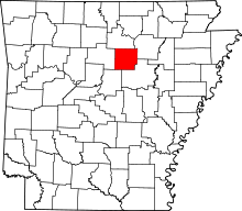 Location of Cleburne County in Arkansas
This is a list of the National Register of Historic Places listings in Cleburne County, Arkansas.
This is intended to be a complete list of the properties and districts on the National Register of Historic Places in Cleburne County, Arkansas, United States. The locations of National Register properties and districts for which the latitude and longitude coordinates are included below, may be seen in a Google map.[1]
There are 16 properties and districts listed on the National Register in the county.
Contents: Counties in Arkansas Arkansas - Ashley - Baxter - Benton - Boone - Bradley - Calhoun - Carroll - Chicot - Clark - Clay - Cleburne - Cleveland - Columbia - Conway - Craighead - Crawford - Crittenden - Cross - Dallas - Desha - Drew - Faulkner - Franklin - Fulton - Garland - Grant - Greene - Hempstead - Hot Spring - Howard - Independence - Izard - Jackson - Jefferson - Johnson - Lafayette - Lawrence - Lee - Lincoln - Little River - Logan - Lonoke - Madison - Marion - Miller - Mississippi - Monroe - Montgomery - Nevada - Newton - Ouachita - Perry - Phillips - Pike - Poinsett - Polk - Pope - Prairie - Pulaski (Little Rock) - Randolph - St. Francis - Saline - Scott - Searcy - Sebastian - Sevier - Sharp - Stone - Union - Van Buren - Washington - White - Woodruff - Yell
-
- This National Park Service list is complete through NPS recent listings posted November 10, 2011.[2]
Current listings
[3] Landmark name [4] Image Date listed Location City or town Summary 1 Brewer School May 26, 2004 Brewer Rd.
35°40′09″N 92°10′57″W / 35.669167°N 92.1825°WBrewer 2 Cleburne County Courthouse July 12, 1976 Courthouse Sq.
35°29′27″N 92°01′55″W / 35.490833°N 92.031944°WHeber Springs 3 Cleburne County Farm Cemetery September 28, 2005 Southeastern corner of the junction of Plantation Dr., E., and Deer Run
35°27′20″N 92°02′15″W / 35.455556°N 92.0375°WHeber Springs 4 Dr. Cyrus F. Crosby House November 19, 1993 202 N. Broadway St.
35°29′33″N 92°01′40″W / 35.4925°N 92.027778°WHeber Springs 5 Dill School August 16, 1994 Western side of Highways 5 and 25, north of Ida
35°35′39″N 91°55′59″W / 35.594167°N 91.933056°WIda 6 Mike Meyer Disfarmer Gravesite January 21, 2009 In the Heber Springs Cemetery at the northeastern corner of Oak St. and S. 4th St.
35°29′00″N 92°02′01″W / 35.483333°N 92.033611°WHeber Springs 7 Clarence Frauenthal House November 19, 1993 210 N. Broadway St.
35°29′36″N 92°01′40″W / 35.493333°N 92.027778°WHeber Springs 8 Heber Springs Commercial Historic District May 1, 2009 100 and 200 blocks of E. Main St., 100-500 blocks of W. Main St., 100 block of N. and S. 3rd, and N. and S. 4th Sts.
35°29′29″N 92°01′46″W / 35.491461°N 92.029567°WHeber Springs 9 Hugh L. King House September 8, 1992 110 W. Spring St.
35°29′34″N 92°01′47″W / 35.492778°N 92.029722°WHeber Springs 10 Old Highway 16 Bridge May 11, 2011 Lakefront Resort Rd.
35°36′09″N 92°11′18″W / 35.6025°N 92.188333°WEdgemont vicinity 11 T.E. Olmstead & Son Funeral Home December 13, 1995 108 S. 4th St.
35°29′29″N 92°01′58″W / 35.491389°N 92.032778°WHeber Springs 12 Quitman Home Economics Building September 4, 1992 2nd Ave.
35°22′47″N 92°13′17″W / 35.379722°N 92.221389°WQuitman 13 Rector House October 17, 2008 603 W. Quitman St.
35°29′23″N 92°02′07″W / 35.489722°N 92.035278°WHeber Springs 14 Shaheen-Goodfellow Weekend Cottage October 30, 2002 704 Stony Ridge
35°30′00″N 92°06′30″W / 35.5°N 92.108333°WEden Isle 15 Woman's Community Club Band Shell August 16, 1994 Northeastern corner of Spring Park
35°29′34″N 92°01′33″W / 35.492778°N 92.025833°WHeber Springs 16 Woodrow Store January 4, 2001 Highway 263
35°39′47″N 92°04′48″W / 35.663056°N 92.08°WWoodrow See also
- List of National Historic Landmarks in Arkansas
- National Register of Historic Places listings in Arkansas
References
- ^ The latitude and longitude information provided in this table was derived originally from the National Register Information System, which has been found to be fairly accurate for about 99% of listings. For about 1% of NRIS original coordinates, experience has shown that one or both coordinates are typos or otherwise extremely far off; some corrections may have been made. A more subtle problem causes many locations to be off by up to 150 yards, depending on location in the country: most NRIS coordinates were derived from tracing out latitude and longitudes off of USGS topographical quadrant maps created under the North American Datum of 1927, which differs from the current, highly accurate WGS84 GPS system used by Google maps. Chicago is about right, but NRIS longitudes in Washington are higher by about 4.5 seconds, and are lower by about 2.0 seconds in Maine. Latitudes differ by about 1.0 second in Florida. Some locations in this table may have been corrected to current GPS standards.
- ^ "National Register of Historic Places: Weekly List Actions". National Park Service, United States Department of the Interior. Retrieved on November 10, 2011.
- ^ Numbers represent an ordering by significant words. Various colorings, defined here, differentiate National Historic Landmark sites and National Register of Historic Places Districts from other NRHP buildings, structures, sites or objects.
- ^ "National Register Information System". National Register of Historic Places. National Park Service. . http://nrhp.focus.nps.gov/natreg/docs/All_Data.html.
U.S. National Register of Historic Places Topics Lists by states Alabama • Alaska • Arizona • Arkansas • California • Colorado • Connecticut • Delaware • Florida • Georgia • Hawaii • Idaho • Illinois • Indiana • Iowa • Kansas • Kentucky • Louisiana • Maine • Maryland • Massachusetts • Michigan • Minnesota • Mississippi • Missouri • Montana • Nebraska • Nevada • New Hampshire • New Jersey • New Mexico • New York • North Carolina • North Dakota • Ohio • Oklahoma • Oregon • Pennsylvania • Rhode Island • South Carolina • South Dakota • Tennessee • Texas • Utah • Vermont • Virginia • Washington • West Virginia • Wisconsin • WyomingLists by territories Lists by associated states Other Municipalities and communities of Cleburne County, Arkansas Cities 
Towns CDP Tumbling Shoals
Unincorporated
communitiesDrasco | Edgemont | Hopewell | Ida | Prim | Tannenbaum | Wilburn
Footnotes ‡This populated place also has portions in an adjacent county or counties
Categories:- Cleburne County, Arkansas
- National Register of Historic Places in Arkansas by county
-

Wikimedia Foundation. 2010.