- Heber Springs, Arkansas
Infobox Settlement
official_name = Heber Springs, Arkansas
settlement_type =City
imagesize =
image_caption =
image_
imagesize =
image_caption =
image_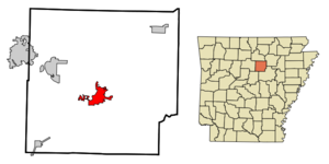
mapsize = 250px
map_caption = Location in Cleburne County and the state ofArkansas
mapsize1 =
map_caption1 =
subdivision_type = Country
subdivision_type1 = State
subdivision_type2 = County
subdivision_name =United States
subdivision_name1 =Arkansas
subdivision_name2 = Cleburne
government_type =
leader_title =
leader_name =
established_date =
area_magnitude =
area_total_km2 = 18
area_total_sq_mi = 124.37
area_land_km2 = 18
area_land_sq_mi = 7
area_water_km2 = 0
area_water_sq_mi = 0.59
elevation_ft = 341
elevation_m = 104
population_as_of = 2000
population_footnotes =
population_total = 6432
population_metro =
population_density_km2 = 357.3
population_density_sq_mi = 918.9
timezone = Central (CST)
utc_offset = -6
latd = 35 |latm = 29 |lats = 40 |latNS = N
longd = 92 |longm = 2 |longs = 21 |longEW = W
timezone_DST = CDT
utc_offset_DST = -5
postal_code_type =ZIP code s
postal_code = 72543, 72545
area_code = 501
blank_name = FIPS code
blank_info = 05-31090
blank1_name = GNIS feature ID
blank1_info = 0077155
footnotes =
website =Heber Springs is a city in Cleburne County,
Arkansas ,United States . The population was 6,432 at the 2000 census. The city is thecounty seat of Cleburne CountyGR|6.Geography
Heber Springs is located at coor dms|35|29|40|N|92|2|21|W|city (35.494329, -92.039168)GR|1.
According to the
United States Census Bureau , the city has a total area of 7.0square mile s (18.0km² ), all of it land. The city was named for a series of natural springs that are located on the east side of town on Main Street.Greers Ferry Lake and The Little Red River are located just north of the city, whererainbow trout are stocked in The Little Red and can be fished below the dam. The lake is also a major tourism draw for swimming, boating and personal watercraft, complemented by the Little Red River along the eastern portion of the city.Demographics
As of the
census GR|2 of 2000, there were 6,432 people, 2,793 households, and 1,851 families residing in the city. Thepopulation density was 923.7 people per square mile (356.8/km²). There were 3,159 housing units at an average density of 453.7/sq mi (175.2/km²). The racial makeup of the city was 97.90% White, 0.23% Black or African American, 0.44% Native American, 0.39% Asian, 0.03% Pacific Islander, 0.22% from other races, and 0.79% from two or more races. 1.80% of the population were Hispanic or Latino of any race.There were 2,793 households out of which 26.9% had children under the age of 18 living with them, 50.7% were married couples living together, 12.5% had a female householder with no husband present, and 33.7% were non-families. 30.5% of all households were made up of individuals and 16.7% had someone living alone who was 65 years of age or older. The average household size was 2.21 and the average family size was 2.72.
In the city the population was spread out with 21.5% under the age of 18, 6.7% from 18 to 24, 23.4% from 25 to 44, 23.1% from 45 to 64, and 25.3% who were 65 years of age or older. The median age was 44 years. For every 100 females there were 83.9 males. For every 100 females age 18 and over, there were 80.3 males.
The median income for a household in the city was $29,599, and the median income for a family was $37,228. Males had a median income of $30,772 versus $19,720 for females. The
per capita income for the city was $19,656. About 8.6% of families and 13.3% of the population were below thepoverty line , including 17.6% of those under age 18 and 12.8% of those age 65 or over.Notable natives
*
Everett G. Burkhalter -Represented the27th district ofCalifornia in the US House of Representatives.
*Mike Disfarmer , photographer
*Laurell K. Hamilton -Author of the and Meredith Gentry series.
*Fred Williams- FormerNFL football player, died in 2000.References
[Brian Hubmann] External links
Wikimedia Foundation. 2010.