- National Register of Historic Places listings in Hempstead County, Arkansas
-
 Location of Hempstead County in Arkansas
This is a list of the National Register of Historic Places listings in Hempstead County, Arkansas.
This is intended to be a complete list of the properties and districts on the National Register of Historic Places in Hempstead County, Arkansas, United States. The locations of National Register properties and districts for which the latitude and longitude coordinates are included below, may be seen in a Google map.[1]
There are 29 properties and districts listed on the National Register in the county, including 1 National Historic Landmark. Another property was once listed but has been removed.
Contents: Counties in Arkansas Arkansas - Ashley - Baxter - Benton - Boone - Bradley - Calhoun - Carroll - Chicot - Clark - Clay - Cleburne - Cleveland - Columbia - Conway - Craighead - Crawford - Crittenden - Cross - Dallas - Desha - Drew - Faulkner - Franklin - Fulton - Garland - Grant - Greene - Hempstead - Hot Spring - Howard - Independence - Izard - Jackson - Jefferson - Johnson - Lafayette - Lawrence - Lee - Lincoln - Little River - Logan - Lonoke - Madison - Marion - Miller - Mississippi - Monroe - Montgomery - Nevada - Newton - Ouachita - Perry - Phillips - Pike - Poinsett - Polk - Pope - Prairie - Pulaski (Little Rock) - Randolph - St. Francis - Saline - Scott - Searcy - Sebastian - Sevier - Sharp - Stone - Union - Van Buren - Washington - White - Woodruff - Yell
-
- This National Park Service list is complete through NPS recent listings posted November 10, 2011.[2]
Current listings
[3] Landmark name [4] Image Date listed Location City or town Summary 1 Brundidge Building March 27, 1990 W. 2nd St.
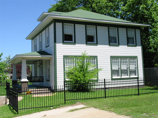
33°40′03″N 93°35′32″W / 33.6675°N 93.592222°WHope 2 Bill Clinton Birthplace 
May 19, 1994 117 S. Hervey St.
33°40′02″N 93°35′47″W / 33.667222°N 93.596389°WHope 3 Columbus Presbyterian Church November 17, 1982 Highway 73
33°46′42″N 93°49′03″W / 33.778333°N 93.8175°WColumbus 4 Confederate State Capitol 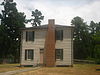
May 19, 1972 Main St.
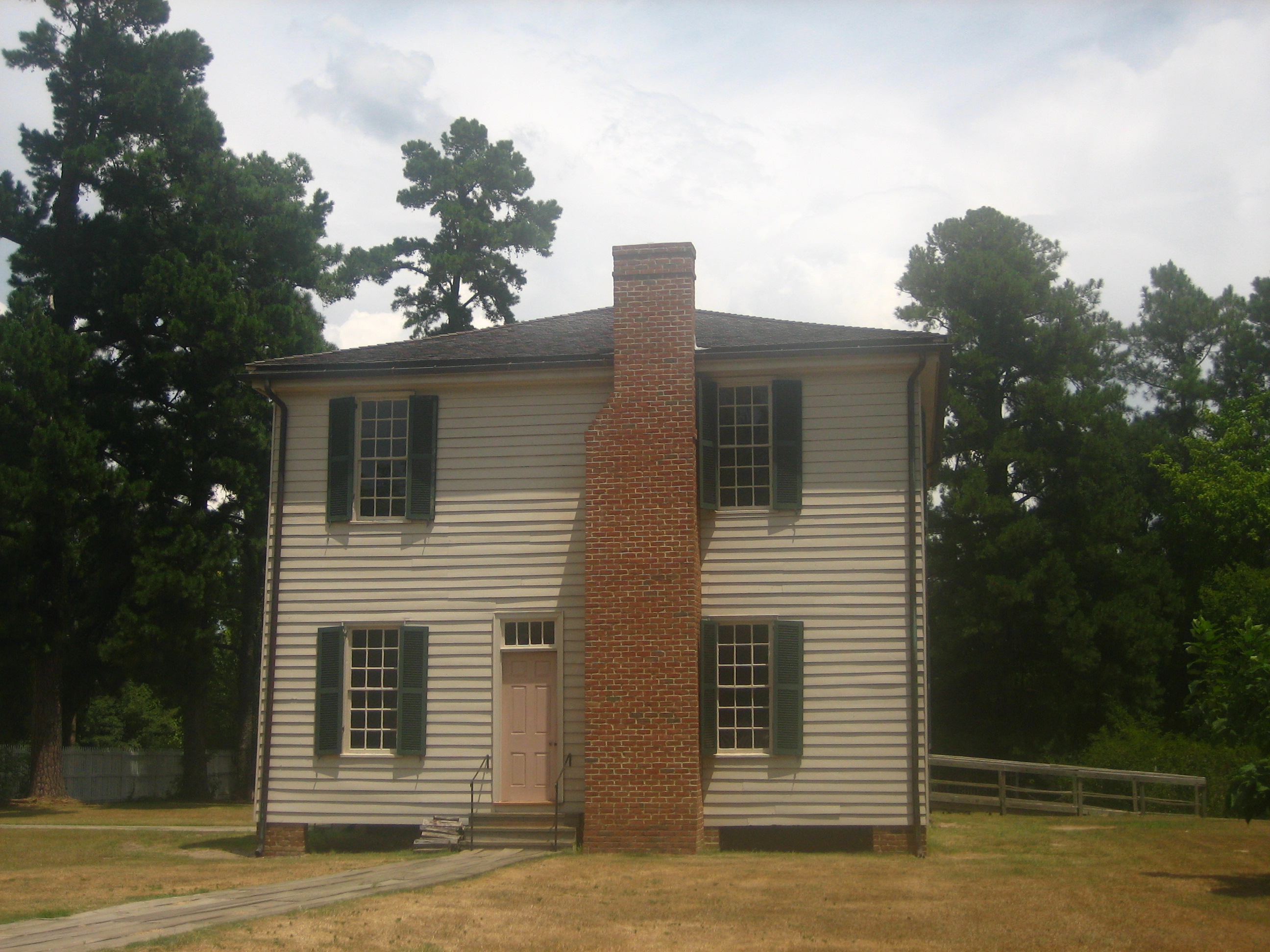
33°46′43″N 93°40′41″W / 33.778611°N 93.678056°WWashington One of the Camden Expedition Sites, a National Historic Landmark consisting of sites in several counties 5 Dooley's Ferry Fortifications Historic District September 22, 2004 On the bluffs above Dooley's Ferry
33°30′47″N 93°44′32″W / 33.51306°N 93.74222°W[5]Spring Hill 6 Ethridge House December 1, 1993 511 N. Main St.
33°40′25″N 93°35′37″W / 33.673611°N 93.593611°WHope 7 Foster House June 5, 1991 420 S. Spruce St.
33°40′00″N 93°35′04″W / 33.666667°N 93.584444°WHope 8 Foster House December 22, 1982 303 N. Hervey St.
33°40′10″N 93°35′49″W / 33.669444°N 93.596944°WHope 9 Goodlett Gin January 17, 1975 799 Franklin St.
33°46′48″N 93°40′41″W / 33.78°N 93.678056°WWashington 10 E.S. Greening House July 9, 1987 707 E. Division St.
33°40′16″N 93°34′52″W / 33.671111°N 93.581111°WHope 11 Hempstead County Courthouse May 19, 1994 Northwestern corner of the junction of 5th and Washington Sts.
33°39′52″N 93°35′55″W / 33.664444°N 93.598611°WHope 12 Hope Historic Commercial District 
July 28, 1995 Roughly bounded by the Union Pacific railroad tracks, Louisiana St., 3rd St. and Walnut St.
33°40′04″N 93°35′32″W / 33.667778°N 93.592222°WHope 13 Dr. Thomas S. Jacques House November 3, 1989 Northwest of McCaskill
33°56′26″N 93°40′02″W / 33.940556°N 93.667222°WMcCaskill 14 McRae House December 22, 1982 1113 E. 3rd St.
33°40′04″N 93°34′45″W / 33.667778°N 93.579167°WHope 15 Missouri-Pacific Railroad Depot-Hope June 11, 1992 North of the junction of E. Division and Main Sts.
33°40′08″N 93°35′32″W / 33.668889°N 93.592222°WHope 16 North Elm Street Historic District July 28, 1995 Roughly bounded by the Union Pacific railroad tracks, Hervey St., G Ave. and Hazel St.
33°40′17″N 93°35′39″W / 33.671389°N 93.594167°WHope 17 North Washington Street Historic District July 28, 1995 Eastern side of N. Washington St. between B and E Sts.
33°40′12″N 93°35′58″W / 33.67°N 93.599444°WHope 18 Oak Grove Missionary Baptist Church May 29, 2003 County Road 16
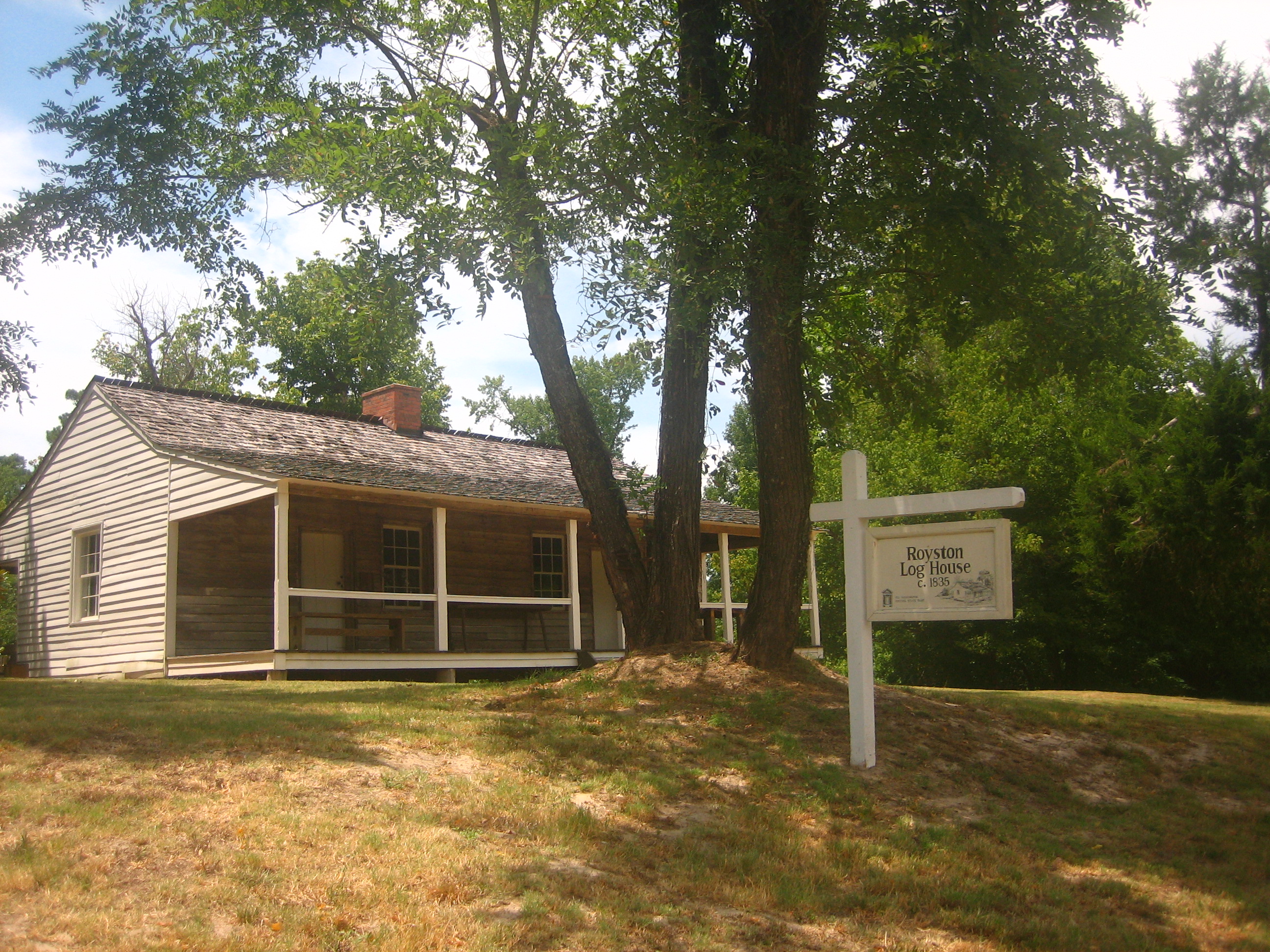
33°49′57″N 93°36′39″W / 33.8325°N 93.610833°WBlevins 19 Grandison D. Royston House 
June 21, 1971 Alexander St., southwest of Columbus St.
33°46′18″N 93°46′45″W / 33.771667°N 93.779167°WWashington 20 Nesburt T. Ruggles House December 9, 1994 Eastern side of Highway 32, southeast of Shover Springs
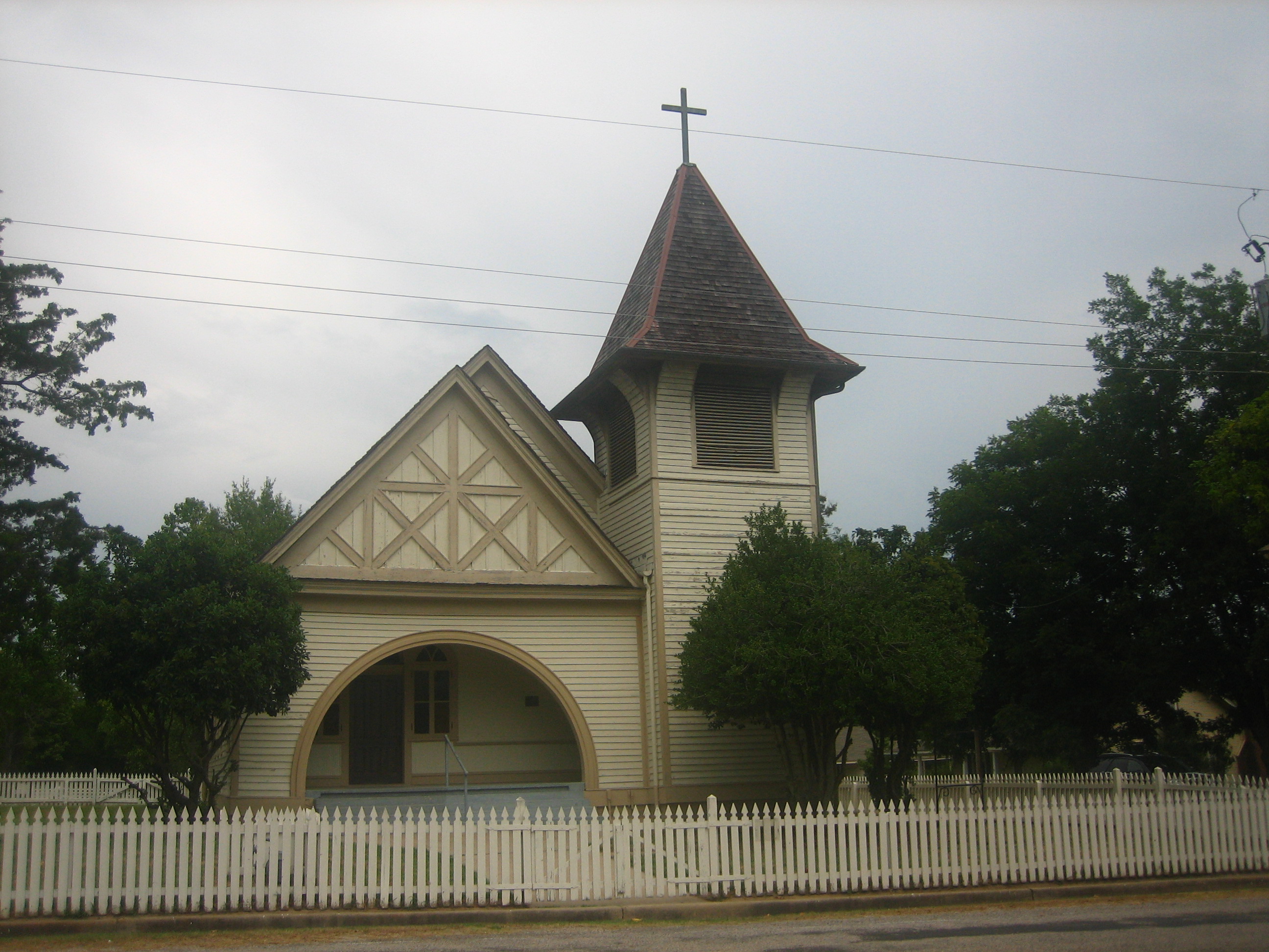
33°36′59″N 93°31′33″W / 33.616389°N 93.525833°WShover Springs 21 St. Mark's Episcopal Church May 6, 1976 3rd and Elm Sts.
33°39′59″N 93°35′33″W / 33.666389°N 93.5925°WHope 22 Southwestern Proving Ground Airport Historic District June 10, 1999 Hope Municipal Airport, Airport Rd.
33°43′17″N 93°39′03″W / 33.721389°N 93.650833°WHope 23 Southwestern Proving Ground Building No. 4 January 22, 2009 259 County Road 279
33°44′28″N 93°36′38″W / 33.740978°N 93.610492°WHope 24 Southwestern Proving Ground Building No. 5 January 22, 2009 259 County Road 279
33°44′28″N 93°36′38″W / 33.740978°N 93.610492°WHope 25 Southwestern Proving Ground Building No. 129 January 29, 2009 195 County Road 279
33°44′23″N 93°36′35″W / 33.739594°N 93.609808°WHope 26 Southwestern Proving Ground Officers Quarters Historic District July 8, 2008 359-383 Oakhaven
33°43′44″N 93°37′10″W / 33.728889°N 93.619347°WOakhaven 27 Ward-Jackson House September 14, 1989 122 N. Louisiana
33°40′10″N 93°35′43″W / 33.669444°N 93.595278°WHope 28 Washington Confederate Monument December 6, 1996 Highway 4, northwest of its junction with Highway 32
33°46′30″N 93°41′28″W / 33.775°N 93.691111°WWashington 29 Washington Historic District 
June 20, 1972 Boundaries correspond to original 1824 plat of city
33°40′51″N 93°38′53″W / 33.680833°N 93.648056°WWashington Former listing
Landmark name Image Date listed Location City or Town Summary 1 Carrigan House January 23, 2008 (delisted) 704 W. Avenue B Hope See also
- List of National Historic Landmarks in Arkansas
- National Register of Historic Places listings in Arkansas
References
- ^ The latitude and longitude information provided in this table was derived originally from the National Register Information System, which has been found to be fairly accurate for about 99% of listings. For about 1% of NRIS original coordinates, experience has shown that one or both coordinates are typos or otherwise extremely far off; some corrections may have been made. A more subtle problem causes many locations to be off by up to 150 yards, depending on location in the country: most NRIS coordinates were derived from tracing out latitude and longitudes off of USGS topographical quadrant maps created under the North American Datum of 1927, which differs from the current, highly accurate WGS84 GPS system used by Google maps. Chicago is about right, but NRIS longitudes in Washington are higher by about 4.5 seconds, and are lower by about 2.0 seconds in Maine. Latitudes differ by about 1.0 second in Florida. Some locations in this table may have been corrected to current GPS standards.
- ^ "National Register of Historic Places: Weekly List Actions". National Park Service, United States Department of the Interior. Retrieved on November 10, 2011.
- ^ Numbers represent an ordering by significant words. Various colorings, defined here, differentiate National Historic Landmark sites and National Register of Historic Places Districts from other NRHP buildings, structures, sites or objects.
- ^ "National Register Information System". National Register of Historic Places. National Park Service. . http://nrhp.focus.nps.gov/natreg/docs/All_Data.html.
- ^ Location derived from "August Fieldwork at Dooley's Ferry", Kadohadacho Chapter of the Arkansas Archeological Society, September 2008, accessed 2009-12-15; and coordinates derived from the GNIS feature record for Dooley's Ferry. The NRIS lists the site as "Address Restricted".
U.S. National Register of Historic Places Topics Lists by states Alabama • Alaska • Arizona • Arkansas • California • Colorado • Connecticut • Delaware • Florida • Georgia • Hawaii • Idaho • Illinois • Indiana • Iowa • Kansas • Kentucky • Louisiana • Maine • Maryland • Massachusetts • Michigan • Minnesota • Mississippi • Missouri • Montana • Nebraska • Nevada • New Hampshire • New Jersey • New Mexico • New York • North Carolina • North Dakota • Ohio • Oklahoma • Oregon • Pennsylvania • Rhode Island • South Carolina • South Dakota • Tennessee • Texas • Utah • Vermont • Virginia • Washington • West Virginia • Wisconsin • WyomingLists by territories Lists by associated states Other Municipalities and communities of Hempstead County, Arkansas Cities 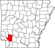
Towns Unincorporated
communitiesFootnotes ‡This populated place also has portions in an adjacent county or counties
Categories:- Hempstead County, Arkansas
- National Register of Historic Places in Arkansas by county
-


Wikimedia Foundation. 2010.