- National Register of Historic Places listings in Hempstead (town), New York
-
This is a list of all National Register of Historic Places listings in the Town of Hempstead in Nassau County, New York. The locations of National Register properties for which the latitude and longitude coordinates are included below, may be seen in a Google map.[1]
Listings
Landmark name Image Date listed Location City or Town Summary 1 Bellerose Village Municipal Complex September 28, 2006 50 Superior Road and Magee Plaza
40°43′21″N 73°43′1″W / 40.7225°N 73.71694°WBellerose 2 Pauline Felix House 
February 24, 2005 151 West Penn Street
40°35′8″N 73°40′20″W / 40.58556°N 73.67222°WLong Beach 3 Granada Towers 
May 31, 1984 310 Riverside Boulevard
40°35′17″N 73°39′40″W / 40.58806°N 73.66111°WLong Beach 4 Haviland-Davison Grist Mill April 21, 1998 Jct. of Wood and Denton Avenues
40°38′47″N 73°39′49″W / 40.64639°N 73.66361°WEast Rockaway 5 House at 226 West Penn Street 
September 24, 2008 226 West Penn Street
40°35′6.93″N 73°40′15.39″W / 40.5852583°N 73.6709417°WLong Beach new listing; refnum 08000932. Also the headquarters for the Long Beach Historical Society. 6 House at 251 Rocklyn Avenue November 7, 2008 251 Rocklyn Avenue
40°39′6.54″N 73°39′54.33″W / 40.6518167°N 73.6650917°WLynbrook New listing: refnum 07001454 7 House at 474 Ocean Avenue November 7, 2008 474 Ocean Avenue
40°39′14.9″N 73°39′29.5″W / 40.654139°N 73.658194°WLynbrook New listing: refnum 07001455 8 House at 73 Grove Street January 23, 2008 73 Grove Street
40°39′54″N 73°40′2″W / 40.665°N 73.66722°WLynbrook 9 Samuel and Elbert Jackson House July 14, 2006 1542 Wantagh Avenue
40°41′4″N 73°30′39″W / 40.68444°N 73.51083°WWantagh 10 Jerusalem District No. 5 Schoolhouse March 1, 1996 Old Jerusalem Road
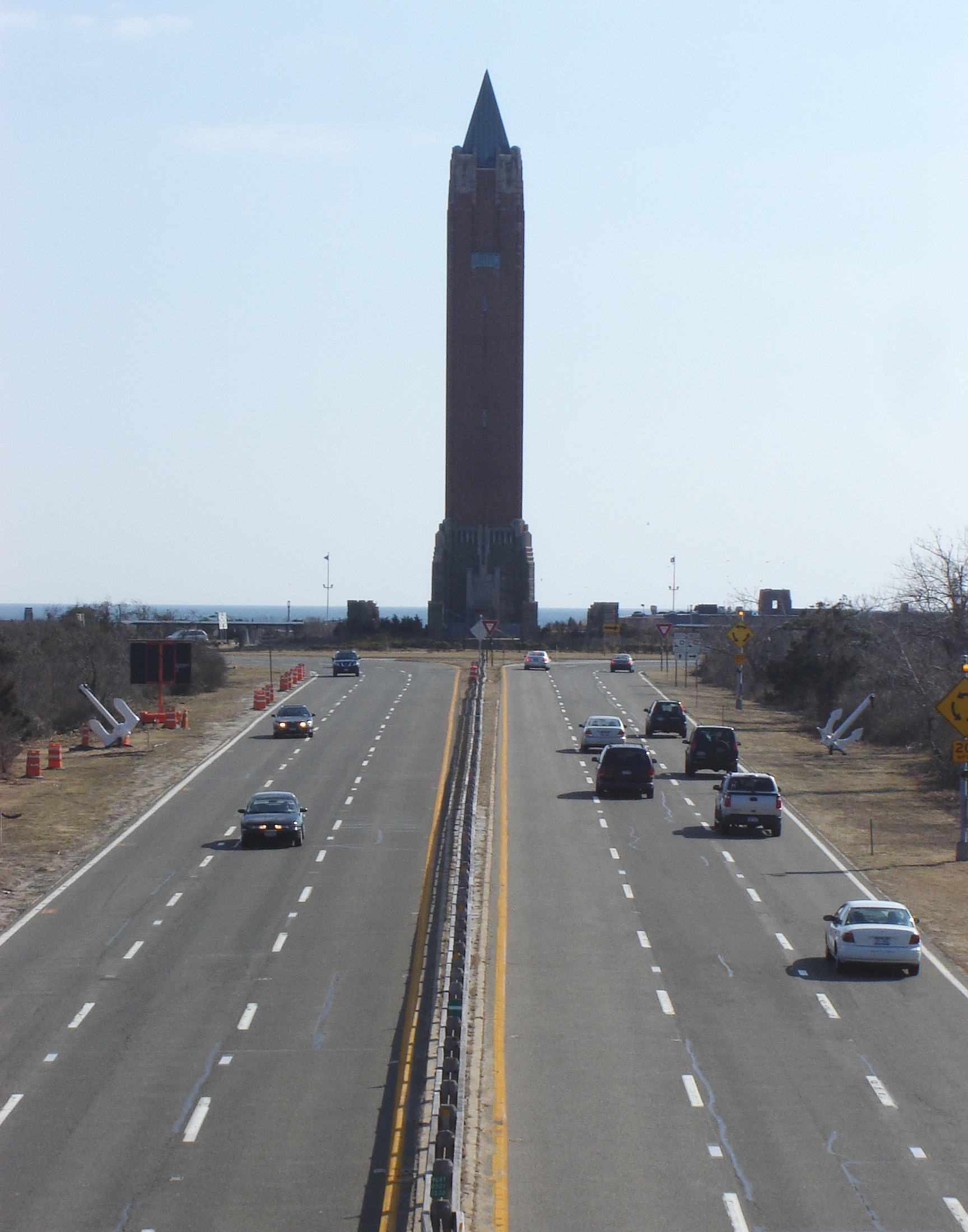
40°42′8″N 73°30′27″W / 40.70222°N 73.5075°WLevittown 11 Jones Beach State Park, Causeway and Parkway System 
April 28, 2005 Ocean, Wantagh, Meadowbrook and Loop State Parkways
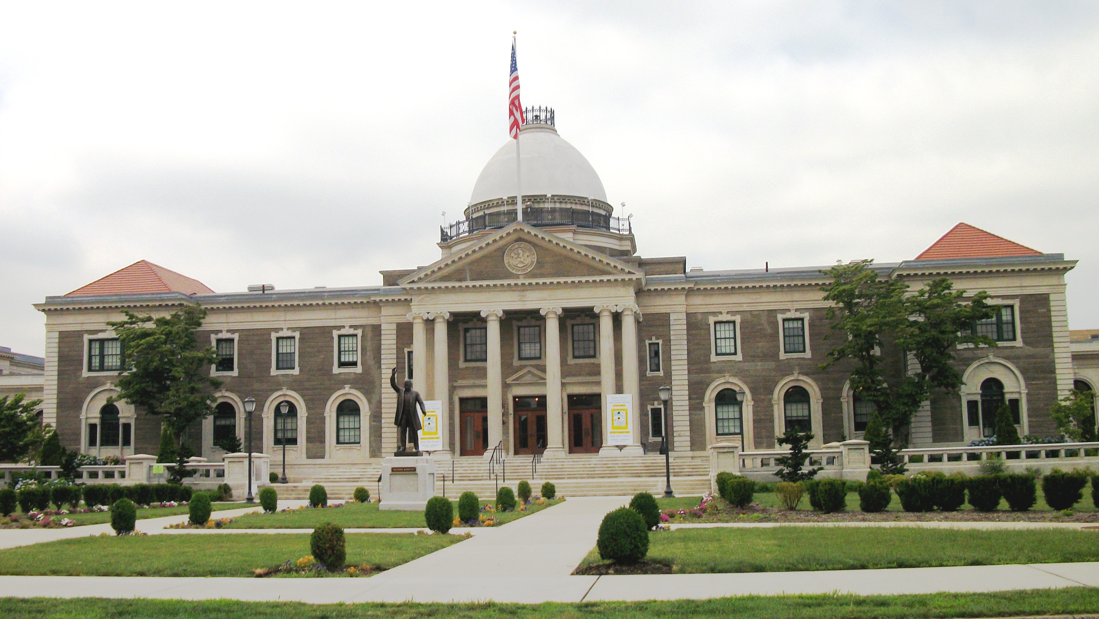
40°36′51″N 73°32′10″W / 40.61417°N 73.53611°WWantagh Groundbreaking Robert Moses project built in late 1920s opened up Long Island beaches to public and led to many more of Long Island's state parks and its parkway system 12 Old Nassau County Courthouse 
February 17, 1978 1550 Franklin Avenue
40°44′16″N 73°38′24″W / 40.73778°N 73.64°WGarden City 13 Pagan-Fletcher House September 8, 1983 143 Hendrickson Avenue
40°41′4″N 73°41′52″W / 40.68444°N 73.69778°WValley Stream 14 Rectory of St. George's Episcopal Church 
May 3, 1988 217 Peninsula Boulevard
40°42′18″N 73°37′18″W / 40.705°N 73.62167°WHempstead 15 Rock Hall 
November 21, 1976 199 Broadway
40°36′32″N 73°44′5″W / 40.60889°N 73.73472°WLawrence 16 St. George's Church 
March 7, 1973 319 Front Street
40°42′24″N 73°37′23″W / 40.70667°N 73.62306°WHempstead 17 St. Paul's German Presbyterian Church and Cemetery September 26, 2008 525 Elmont Rd.
40°41′47.2″N 73°42′56.66″W / 40.696444°N 73.7157389°WElmont 18 A. T. Stewart Era Buildings November 14, 1978 4th, 5th, and 6th Streets, Cathedral and Cherry Valley Avenues
40°43′21″N 73°38′27″W / 40.7225°N 73.64083°WGarden City 19 US Post Office-Freeport 
May 11, 1989 132 Merrick Road
40°39′13″N 73°35′10″W / 40.65361°N 73.58611°WFreeport 20 US Post Office-Garden City 
May 11, 1989 600 Franklin Street
40°43′29″N 73°38′4″W / 40.72472°N 73.63444°WGarden City 21 US Post Office-Hempstead 
November 17, 1988 200 Fulton Avenue
40°42′26″N 73°37′43″W / 40.70722°N 73.62861°WHempstead 22 US Post Office-Long Beach 
May 11, 1989 101 East Park Avenue
40°35′19″N 73°39′39″W / 40.58861°N 73.66083°WLong Beach 23 US Post Office-Rockville Centre May 11, 1989 250 Merrick Road
40°39′22″N 73°38′48″W / 40.65611°N 73.64667°WRockville Centre 24 Samuel Vaisberg House 
October 5, 2005 257 West Olive Street
40°35′13″N 73°40′22″W / 40.58694°N 73.67278°WLong Beach 25 Wantagh Railroad Complex 
June 30, 1983 1700 Wantagh Avenue
40°40′49″N 73°30′38″W / 40.68028°N 73.51056°WWantagh See also
- National Register of Historic Places listings in New York
- National Register of Historic Places listings in Nassau County, New York
References
- ^ The latitude and longitude information provided is primarily from the National Register Information System, and has been found to be fairly accurate for about 99% of listings. For 1%, the location info may be way off. We seek to correct the coordinate information wherever it is found to be erroneous. Please leave a note in the Discussion page for this article if you believe any specific location is incorrect.
Town of Hempstead, New York County 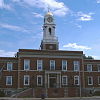
Villages Atlantic Beach · Bellerose · Cedarhurst · East Rockaway · Floral Park · Freeport · Garden City · Hempstead · Hewlett Bay Park · Hewlett Harbor · Hewlett Neck · Island Park · Lawrence · Lynbrook · Malverne · Mineola · New Hyde Park · Rockville Centre · South Floral Park · Stewart Manor · Valley Stream · Woodsburgh
Hamlets Baldwin · Baldwin Harbor · Barnum Island · Bay Park · Bellerose Terrace · Bellmore · Bethpage · East Atlantic Beach · East Garden City · East Meadow · Elmont · Franklin Square · Garden City South · Harbor Isle · Hewlett · Inwood · Lakeview · Levittown · Lido Beach · Malverne Park/Malverne Oaks · Merrick · North Bellmore · North Lynbrook · North Merrick · North Valley Stream · North Wantagh · Oceanside · Point Lookout · Roosevelt · Salisbury (South Westbury) · Seaford · South Hempstead · South Valley Stream · Uniondale · Wantagh · West Hempstead · Woodmere
State Parks Website: toh.liCategories:- Town of Hempstead, New York
- National Register of Historic Places in Hempstead (town), New York


Wikimedia Foundation. 2010.