- The Bellmores, New York
-
Bellmore — Hamlet — Location within the state of New York
 Bellmore
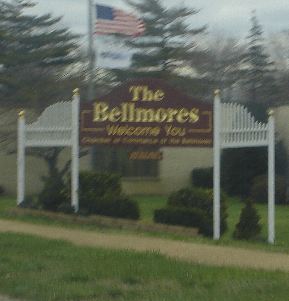
Coordinates: 40°39′40″N 73°32′16″W / 40.66111°N 73.53778°WCoordinates: 40°39′40″N 73°32′16″W / 40.66111°N 73.53778°W Country United States State New York County Nassau Area – Total 3.0 sq mi (7.8 km2) – Land 2.5 sq mi (6.5 km2) – Water 0.5 sq mi (1.3 km2) Population (2010) – Total 16,218 – Density 5,406/sq mi (2,087.3/km2) Time zone Eastern (EST) (UTC-5) – Summer (DST) EDT (UTC-4) ZIP codes FIPS code GNIS feature ID  Welcome to the Bellmores sign on Sunrise Highway.
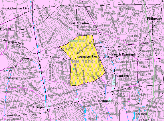
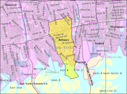 Bellmore Map from U.S. Census
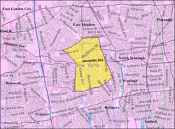 North Bellmore Map from U.S. Census
Bellmore is a hamlet (and census-designated place) in Nassau County, New York, United States. The population according to the 2010 census was 16,218. Bellmore is located on the south shore of Long Island, approximately 27 miles (43 km) east of Manhattan, and 10 miles (16 km) east of the Nassau-Queens (New York City) Line. North Bellmore is a census-designated place (CDP) in Nassau County, New York, United States. The population was 19,941 at the 2010 census.
Bellmore serves as a suburb of New York City on Long Island. The city is easily accessible through a station on the Long Island Rail Road's Babylon Branch. Also, John F. Kennedy Int'l Airport is located within 15 miles (24 km) of Bellmore, making it easy for travelers. Major thoroughfares that wind through the suburb include Sunrise Highway, Southern State Parkway, Merrick Road, Bellmore Avenue, Jerusalem Avenue, and Newbridge Road.
"The Bellmores" are subdivided into Bellmore (population 16,000) and N. Bellmore (population 21,000). The Bellmore area has an approximate population of 37,000 at this time. Also, some residents call the area south of Merrick Road (or sometimes Sunrise Highway) "South Bellmore".
Contents
Geography
Bellmore is located at 40°39′40″N 73°31′44″W / 40.66111°N 73.52889°W (40.661188, -73.529005)[1].
According to the United States Census Bureau, the CDP has a total area of 3.0 square miles (7.8 km2), of which, 2.5 square miles (6.5 km2) of it is land and 0.5 square miles (1.3 km2) of it (17.67%) is water.
North Bellmore is located at 40°41′22″N, 73°32′16″W (40.689490, -73.537910)GR1.
According to the United States Census Bureau, the CDP has a total area of 6.8 km² (2.6 mi²), all land.
Demographics
Bellmore
As of the census[2] of 2000, Bellmore has 16,441 people, 5,643 households, and 4,604 families residing in the CDP. The population density was 6,640.5 per square mile (2,559.6/km²). There were 5,724 housing units at an average density of 2,311.9/sq mi (891.1/km²). The racial makeup of the CDP was 95.4% White, .2% African American, 0.1% Native American, 2.5% Asian, 0.0% Pacific Islander, 0.8% from other races, and 1.1% from two or more races. Hispanic or Latino of any race were 4.0% of the population.
There were 5,643 households out of which 37.5% had children under the age of 18 living with them, 69.2% were married couples living together, 9.1% had a female householder with no husband present, and 18.4% were non-families. 15.8% of all households were made up of individuals and 8.2% had someone living alone who was 65 years of age or older. The average household size was 2.91 and the average family size was 3.26.
In the CDP the population was spread out with 25.3% under the age of 18, 5.9% from 18 to 24, 29.7% from 25 to 44, 25.8% from 45 to 64, and 13.3% who were 65 years of age or older. The median age was 39 years. For every 100 females there were 95.7 males. For every 100 females age 18 and over, there were 92.1 males.
The median income for a household in the CDP was $105,976, and the median income for a family was $86,236. Males had a median income of $66,639 versus $39,241 for females. The per capita income for the CDP was $32,034. About 1.8% of families and 2.4% of the population were below the poverty line, including 2.3% of those under age 18 and 4.3% of those age 65 or over.
North Bellmore
As of the census[2] of 2000, North Bellmore has 20,079 people, 6,555 households, and 5,407 families residing in the CDP. The population density was 7,696.6 per square mile (2,970.3/km²). There were 6,634 housing units at an average density of 2,542.9/sq mi (981.4/km²). The racial makeup of the CDP was 94.18% White, .2% African American, 0.06% Native American, 3.16% Asian, 0.03% Pacific Islander, 1.02% from other races, and 3.31% from two or more races. Hispanic or Latino of any race were 2.55% of the population.
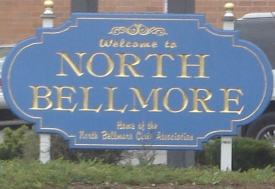
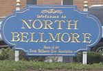 Welcome to North Bellmore sign on Newbridge Rd.
There were 6,555 households out of which 39.0% had children under the age of 18 living with them, 70.1% were married couples living together, 9.2% had a female householder with no husband present, and 17.5% were non-families. 14.2% of all households were made up of individuals and 7.3% had someone living alone who was 65 years of age or older. The average household size was 3.04 and the average family size was 3.36.
In the CDP the population was spread out with 25.5% under the age of 18, 6.5% from 18 to 24, 29.8% from 25 to 44, 23.6% from 45 to 64, and 14.7% who were 65 years of age or older. The median age was 39 years. For every 100 females there were 94.4 males. For every 100 females age 18 and over, there were 91.1 males.
The median income for a household in the CDP was $72,325, and the median income for a family was $80,067. Males had a median income of $55,384 versus $38,079 for females. The per capita income for the CDP was $27,174. About 3.4% of families and 4.0% of the population were below the poverty line, including 4.3% of those under age 18 and 4.0% of those age 65 or over.
North Bellmore is served by the North Bellmore Fire Department.
History
Bellmore was settled primarily by Englishmen who crossed the Long Island Sound from Connecticut in the middle of the seventeenth century. Christian Sorto purchased a 214-acre (0.9 km2) farm in what is now North Bellmore in 1655. Further south, near the bay, John Smith deeded 100 acres (0.4 km2) to his son, Jeremiah in 1676. John Bedell married Sarah Southard and moved into their new home on Merrick Road in about 1689. Two communities grew out of these beginnings. Smithville (later Smithville South) was named for the many Smith families which joined the New Bridge, named for the peninsula on which it stood was along Merrick Road.
When the railroad was built through the area in 1867 they arbitrarily named their station Bellmore. Development followed as both communities grew towards the railroad and adopted the name Bellmore. By 1920, the Bellmores had a population of 3000 as well as stores along Bedford Avenue.[3]
Schools
The city is home to the annual Mathematical Olympiads for Elementary and Middle Schools, a prestigious school math competition in the United States.
General
The school districts of Bellmore are the Bellmore School District, North Bellmore School District, and the Bellmore-Merrick Central High School District. The Bellmorites go to school for K-6 in their respective district (North Bellmore or Bellmore) and then go on to the Bellmore-Merrick Central High School District for grades 7-12. This is one of the four central districts of New York. For two years, North Bellmore and Bellmore students are combined in Grand Avenue. After, Bellmore students go to Kennedy, and North Bellmore students to Mepham. However, this may vary depending on zoning. The administrative offices for the Bellmore Public Schools are located in Winthrop Avenue, while the administrative offices for North Bellmore are in Martin Avenue. Brookside School, in North Merrick, is the home of the Bellmore-Merrick Central-High School District's offices, as well as the alternative school.
Education
The North Bellmore students go to the schools that they are zoned for. However, Bellmore students in the same grade all go to the same school, as each grade level is in one of the three schools and not all. All Bellmore and North Bellmore Students go to Grand Avenue along with a few North Merrick Students who attended Park Avenue Elementary School, and then they split and go to their zoned school in the Central High School District. However, students not zoned for Calhoun may go to that school if they have a special interest in the arts.
Below are the schools, their grade levels and the town or towns that go to them.
School Grades Town(s)That Go To School Park Avenue School K-6 North Bellmore/ North Merrick Martin Avenue School K-6 North Bellmore Jacob Gunther School K-6 North Bellmore Dinklemeyer School K-6 North Bellmore/North Merrick Saw Mill Road School K-6 North Bellmore Newbridge Road School K-6 North Bellmore Reinhard Early Childhood Center K-2 Bellmore Winthrop Avenue Primary Center 3-4 Bellmore Shore Road Intermediate Center 5-6 Bellmore Grand Avenue Middle School* 7-8 Bellmore/North Bellmore John F. Kennedy High School* 9-12 Bellmore/Merrick Wellington C. Mepham High School* 9-12 North Bellmore An asterisk (*) means that the school is part of the Bellmore Merrick Central High School District. All other schools are in the district of town that attends them.
Notable Bellmore/North Bellmore natives
- Tatyana Marisol Ali, graduate of Saw Mill Road School and Harvard; actress and singer, notably in The Fresh Prince of Bel-Air
- Tina Ann, singer
- Lenny Bruce, comedian
- Michael Dweck, Artist/Photographer
- William Casey, former CIA director, from Bellmore
- George Kennedy, actor
- Adam Lazzara, musician/lead singer of Taking Back Sunday; lived in Bellmore when he first moved to Long Island
- Daryl Palumbo, born and raised in Bellmore, lead singer in the rock groups Glassjaw and Head Automatica
- Kurt Ralske, artist and musician/composer
- Fred Travalena, comedian, 1960 graduate of Mepham High School
- Amos Zereoue, Former NFL running back
- Amy Fisher, the "Long Island Lolita"
- Matt Gilroy, NHL player for New York Rangers
- Mark Belger, Former American Middle Distance Runner record holder
- Donny Brady, Former NFL and CFL corner back
- Laurence Traiger, Composer
References
- ^ "US Gazetteer files: 2010, 2000, and 1990". United States Census Bureau. 2011-02-12. http://www.census.gov/geo/www/gazetteer/gazette.html. Retrieved 2011-04-23.
- ^ a b "American FactFinder". United States Census Bureau. http://factfinder.census.gov. Retrieved 2008-01-31.
- ^ History of Bellmore
Town of Hempstead, New York County 
Villages Atlantic Beach · Bellerose · Cedarhurst · East Rockaway · Floral Park · Freeport · Garden City · Hempstead · Hewlett Bay Park · Hewlett Harbor · Hewlett Neck · Island Park · Lawrence · Lynbrook · Malverne · Mineola · New Hyde Park · Rockville Centre · South Floral Park · Stewart Manor · Valley Stream · Woodsburgh
Hamlets Baldwin · Baldwin Harbor · Barnum Island · Bay Park · Bellerose Terrace · Bellmore · Bethpage · East Atlantic Beach · East Garden City · East Meadow · Elmont · Franklin Square · Garden City South · Harbor Isle · Hewlett · Inwood · Lakeview · Levittown · Lido Beach · Malverne Park/Malverne Oaks · Merrick · North Bellmore · North Lynbrook · North Merrick · North Valley Stream · North Wantagh · Oceanside · Point Lookout · Roosevelt · Salisbury (South Westbury) · Seaford · South Hempstead · South Valley Stream · Uniondale · Wantagh · West Hempstead · Woodmere
State Parks Website: toh.liCategories:- Town of Hempstead, New York
- Census-designated places in New York
- Hamlets in New York
- Populated places in Nassau County, New York


Wikimedia Foundation. 2010.