- Oceanside, New York
-
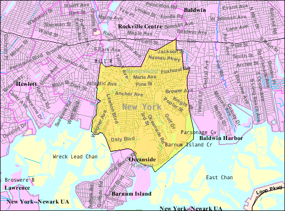
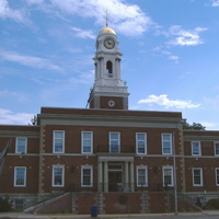
Oceanside, New York — CDP — U.S. Census Map Location within the state of New York

Coordinates: 40°38′11″N 73°38′15″W / 40.63639°N 73.6375°WCoordinates: 40°38′11″N 73°38′15″W / 40.63639°N 73.6375°W Country United States State New York County Nassau Area – Total 5.4 sq mi (14.0 km2) – Land 5.0 sq mi (13.0 km2) – Water 0.4 sq mi (1.0 km2) Elevation 10 ft (3 m) Population (2010) – Total 32,109 – Density 5,940.1/sq mi (2,293.5/km2) Time zone Eastern (EST) (UTC-5) – Summer (DST) EDT (UTC-4) ZIP code 11572 Area code(s) 516 FIPS code 36-54441 GNIS feature ID 0959214 Oceanside is a hamlet (and census-designated place) located in the south part of the town of Hempstead, Nassau County, New York. The population was 32,109 at the 2010 census.[1]
Contents
History
Walter S. Boardman, who wrote of the history of Oceanside, came to the Oceanside School District in September 1927 as high school principal. He served as Superintendent of Schools from 1940-1960. In 2000, the Oceanside Educational Foundation published a work he wrote on the history of Oceanside from the geological "birth" of Long Island to Oceanside in 1960. Oceanside High School teacher Richie Woods continued this history in his recent book, Images of America: Oceanside, New York.
In Boardman's book, he starts at the founding — The English government established a township in 1674 and land development came rapidly. Before that, this territory was called "South Bay," as a region in the Town of Hempstead. "Christian Hook" came about from the religious connections in the young town. Very quickly did oyster sales rise in the nearby area and "Mott's Landing" (name for Mott Street,) was the favored place to buy oysters. A new name had to be found for the town. "Oceanville" sounded better than "Christian Hook" when it came to selling oysters. It was "Oceanville Oysters" that sold, so in 1864, the new name became official. However, there was already an Oceanville in New York, so "Ocean Side" as two words was proposed and in 1890, it became official. The word was condensed to "Oceanside" in 1918, as it is used today.
Oceanside's first school was built around 1838 on the northwest corner of Oceanside and Foxhurst Roads. It only had one room and an attic. The structure still stood as of 1960, but was moved and stands today as a private dwelling. The land where the school was is now known as the Schoolhouse Green, where many school events are held. The school district was actually established as "Hempstead District #11 at Christian Hook" in 1833 and expanded from there. Schools adopted numerical names, 1 through 9. Today, schools #2-5, 8 and 9E are elementary schools, school #6 is a kindergarten center, school 7 is the high school and 9M serves as the middle school. School 9 bears the name of Walter Boardman, while various other schools bear names of significant figures in Oceanside history. School #1 was razed in 1981. It stood where it is now the Schoolhouse Green, after the initial school was moved. Boardman served as principal of what is now school 6, when it was the junior and senior high school. Boardman was principal until June 1940, when Mr. S. Taylor Johnson retired from the Board of Education and Boardman succeeded him. Mr. Charles R. Mosback became the new high school principal.
"There is also a great need for some place or agency whereby the many significant records now scattered about and eventually lots may be preserved…There is also a great need for community action in the preservation of its historic markers." –Walter S. Boardman, 1960.
The Schoolhouse Green was created to remember scattered documents and the words of Boardman.
Excerpts were used for this page from The Story of Oceanside by Walter S. Boardman and Oceanside, New York by Richard Woods.
The Oceanside Fire Department was established in 1902. The last farm in the community, which was on Mann Place, was destroyed in a fire. Technically, the last farm held its position for years until its demolition in 1997. An old firehouse of Columbia Engine Co #1 still sits at the southwest corner of the triangle where Lincoln Avenue meets Long Beach Road.
Nathan's Famous opened its second restaurant on June 4, 1959, on Long Beach Road in Oceanside. (Many sites incorrectly date this event as 1955.) There was a large Nathan's building with play areas and a big open dining room that had a stage. Shows were great family events. The building was razed and a strip mall was built. A modern Nathan's franchise opened on the corner of Long Beach Road and Windsor Parkway. Every Wednesday there is a car night at Nathan's.
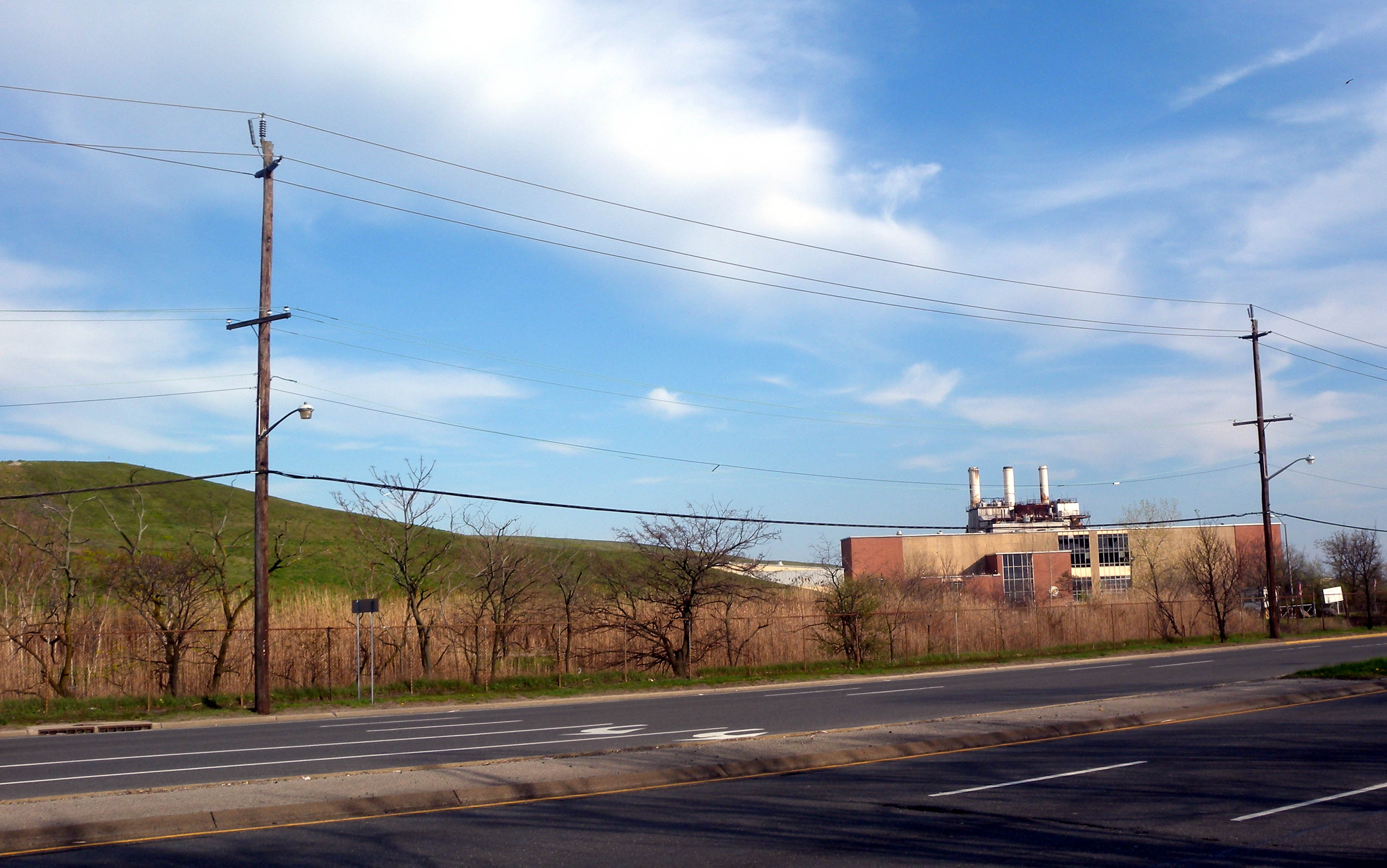
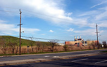 Former dump
Geography
Oceanside is located at 40°38′11″N 73°38′15″W / 40.63639°N 73.6375°W (40.636286, -73.637404)[2].
According to the United States Census Bureau, the community has a total area of 5.4 square miles (14 km2), of which 5.0 square miles (13 km2) is land and 0.4 square miles (1.0 km2), or 7.38%, is water.
Transportation
Long Beach Road, Oceanside Road, Lawson Boulevard, Waukena Avenue, and Merrick Road are some of the main roads in Oceanside. Other roads such as Brower Avenue and Atlantic Avenue also serve as important traffic arteries.
The Long Beach Branch of the Long Island Railroad passes through the west side of Oceanside, with the Oceanside station being at Weidner Avenue and Lawson Boulevard.
Demographics
As of the census[3] of 2000, there were 32,733 people, 11,224 households, and 9,125 families residing in the area. The population density was 6,523.6 per square mile (2,517.6/km2). There were 11,396 housing units at an average density of 2,271.2/sq mi (876.5/km2). The racial makeup of the CDP was 94.95% White, 0.56% African American, 0.07% Native American, 1.83% Asian, 0.01% Pacific Islander, 1.58% from other races, and 1.00% from two or more races. Hispanic or Latino of any race were 5.90% of the population.
There were 11,224 households out of which 36.9% had children under the age of 18 living with them, 69.5% were married couples living together, 8.8% had a female householder with no husband present, and 18.7% were non-families. 16.1% of all households were made up of individuals and 9.1% had someone living alone who was 65 years of age or older. The average household size was 2.90 and the average family size was 3.25.
In the community the population was spread out with 25.0% under the age of 18, 6.1% from 18 to 24, 27.6% from 25 to 44, 25.7% from 45 to 64, and 15.6% who were 65 years of age or older. The median age was 40 years. For every 100 females there were 93.7 males. For every 100 females age 18 and over, there were 89.5 males.
According to a 2007 estimate,[4] the median income for a household in the community was $100,167, and the median income for a family was $109,937. Males had a median income of $55,652 versus $40,163 for females. The per capita income for the CDP was $30,245. About 2.8% of families and 3.5% of the population were below the poverty line, including 3.8% of those under age 18 and 3.9% of those age 65 or over.
Education
The Oceanside School District is made up of nine schools, including one kindergarten, six elementary schools, one middle school, one high school, and one alternative high school. Herb Brown is the superintendent of the school district and has held that position since 1997, when he replaced Elliot Garfinkel.
Nearby colleges include Adelphi University, Nassau Community College, Molloy College, Hofstra University, New York Institute of Technology, and C.W. Post College.
Noted residents, past and present
- Wendy Aron, author (Hide & Seek: How I Laughed at Depression, Conquered My Fears and Found Happiness), sitcom writer (Family Ties)[5]
- Michael Bernstein, composer, and musician
- Glenn Gordon Caron, writer, director, and producer
- Samantha Cesario, figure skater
- Steve Cohen, current General Manager of the Brooklyn Cyclones and recipient of the 2007 NYPL Executive of the Year Award as well as the Mets 2009 Sterling Minor League Executive of the Year
- Thomas H. Cormen, computer scientist
- John Costello, former major league baseball player
- Diane Farr, actress (Rescue Me, Numb3rs), writer
- Leon Feingold, currently a pitcher in the Israel Baseball League, former minor league pitcher for the Cleveland Indians, and internationally ranked (top ranking #12) in the IFOCE (International Federation of Competitive Eating)
- Jay Fiedler, a former NFL quarterback for the Minnesota Vikings, Jacksonville Jaguars, Tampa Bay Buccaneers, Philadelphia Eagles, Miami Dolphins, and New York Jets
- Susie Fishbein, best-selling Orthodox Jewish kosher cookbook author
- John Frascatore, former professional baseball pitcher
- Stephen Friedman, chairman of the President's Foreign Intelligence Advisory Board
- Gilda Gray, "flapper", 1920s-'30s, known as the "Shimmy Queen" and Florenz Ziegfeld's "golden girl"
- Art Heyman, college basketball AP Player of the Year (1963) and professional basketball player
- Robert Iger, CEO of The Walt Disney Company
- Leon Johnson (American football), former professional football player
- Timothy Johnson, former pedicurist, known for his role in the 1988 film Hairspray
- Norman F. Lent, former member of the U.S. House of Representatives
- Dennis Leonard, member of the Kansas City Royals Hall of Fame, started Game 5 of the 1976 and 1977 ALCS vs. the New York Yankees, won Game 4 of the 1980 World Series vs. the Philadelphia Phillies
- Elliott Levine, playwright of the 2003 premiere The Remembered[6]
- Lori Loughlin, actress on the hit television family-comedy series Full House, played the role of Rebecca Donaldson, 1988–1995
- Tomas Masaryk, the "Father of the Czech Nation"; lived in Oceanside for a time during his exile of 1918
- Michael James Massimino, NASA astronaut
- David Paymer, actor (Carpool)
- Frank Pellegrino, actor (GoodFellas, Law & Order, The Sopranos)
- Forbes Riley, actress
- Michael Rosenbaum, actor (Smallville)
- Howard Stelzer, experimental music composer, record producer
- Al Trautwig, sportscaster, 2000 NYC Sportscaster of the Year
- Ernie Vandeweghe, former Knicks star and father of NBA player and executive Kiki Vandeweghe
- Harold E. Varmus, co-recipient of the 1989 Nobel Prize in Physiology or Medicine[7]
- Reginald VelJohnson, actor (Family Matters, Die Hard)
- Joan Walsh, editor-in-chief, Salon.com, MSNBC regular
- Robert Yarchoan, researcher in AIDS and AIDS malignancies; codeveloper of several AIDS drugs including AZT
Politics
Much of Oceanside is in New York's 4th congressional district, which is represented by Congresswoman Carolyn McCarthy. Other parts of Oceanside are located in New York's 3rd congressional district, which is represented by Congressman Peter T. King.
References
- ^ "Race, Hispanic or Latino, Age, and Housing Occupancy: 2010 Census Redistricting Data (Public Law 94-171) Summary File (QT-PL), Oceanside CDP, New York". U.S. Census Bureau, American FactFinder 2. http://factfinder2.census.gov. Retrieved October 4, 2011.
- ^ "US Gazetteer files: 2010, 2000, and 1990". United States Census Bureau. 2011-02-12. http://www.census.gov/geo/www/gazetteer/gazette.html. Retrieved 2011-04-23.
- ^ "American FactFinder". United States Census Bureau. http://factfinder.census.gov. Retrieved 2008-01-31.
- ^ http://factfinder.census.gov/servlet/ACSSAFFFacts?_event=Search&geo_id=16000US3650100&_geoContext=01000US%7C04000US36%7C16000US3650100&_street=&_county=oceanside&_cityTown=oceanside&_state=04000US36&_zip=&_lang=en&_sse=on&ActiveGeoDiv=geoSelect&_useEV=&pctxt=fph&pgsl=160&_submenuId=factsheet_1&ds_name=ACS_2007_3YR_SAFF&_ci_nbr=null&qr_name=null®=null%3Anull&_keyword=&_industry=
- ^ "Hide & Seek: How I Laughed at Depression, Conquered My Fears and Found Happiness (author biography)". Amazon.com. http://search.barnesandnoble.com/Hide-Seek/Wendy-Aron/e/9781601641588/?itm=1. Retrieved January 22, 2010.
- ^ Greenberg, Ginny (August 9, 2007). "Highlighting Powerful Messages to Loved Ones on the Vietnam Memorial's Web Site, "The Remembered" Has Its World Premiere at Hofstra, October 13 and 14, 2007". [press release]. Hofstra University. http://www.lettersonthewall.com/PRESS_RELEASE_TheRemebered_80907.pdf. Retrieved January 22, 2010.
- ^ Kerr, Kathleen. "They Began Here: Around the country, leading thinkers in health and science can trace their roots to Long Island", Newsday, July 16, 2008. Accessed September 17, 2008.
External links
Town of Hempstead, New York County 
Villages Atlantic Beach · Bellerose · Cedarhurst · East Rockaway · Floral Park · Freeport · Garden City · Hempstead · Hewlett Bay Park · Hewlett Harbor · Hewlett Neck · Island Park · Lawrence · Lynbrook · Malverne · Mineola · New Hyde Park · Rockville Centre · South Floral Park · Stewart Manor · Valley Stream · Woodsburgh
Hamlets Baldwin · Baldwin Harbor · Barnum Island · Bay Park · Bellerose Terrace · Bellmore · Bethpage · East Atlantic Beach · East Garden City · East Meadow · Elmont · Franklin Square · Garden City South · Harbor Isle · Hewlett · Inwood · Lakeview · Levittown · Lido Beach · Malverne Park/Malverne Oaks · Merrick · North Bellmore · North Lynbrook · North Merrick · North Valley Stream · North Wantagh · Oceanside · Point Lookout · Roosevelt · Salisbury (South Westbury) · Seaford · South Hempstead · South Valley Stream · Uniondale · Wantagh · West Hempstead · Woodmere
State Parks Website: toh.liCategories:- Town of Hempstead, New York
- Census-designated places in New York
- Hamlets in New York
- Populated places in Nassau County, New York

Wikimedia Foundation. 2010.