- Seaford, New York
Infobox Settlement
official_name = Seaford, New York
settlement_type = CDP
nickname =
motto =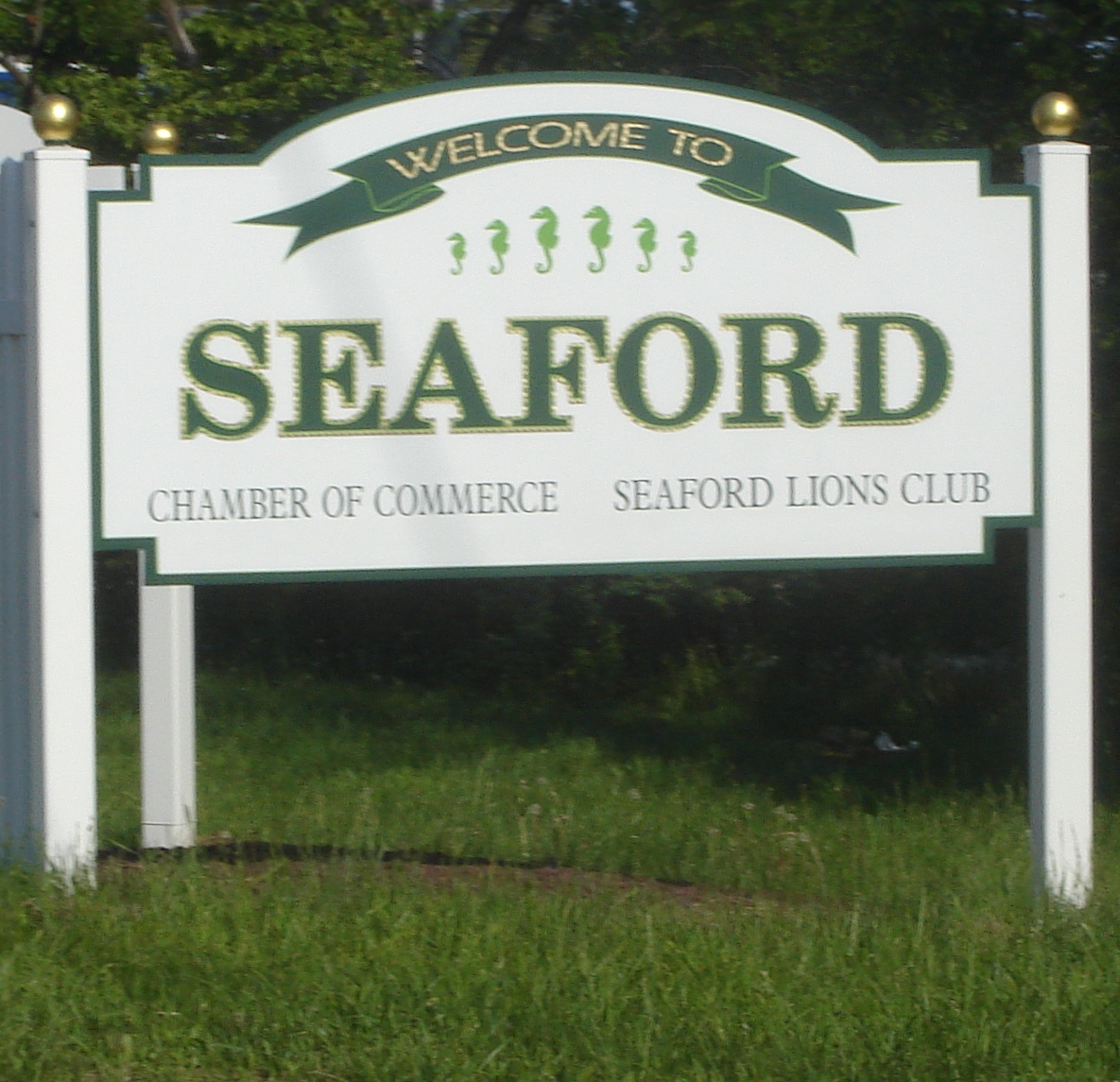
imagesize =
image_caption =
image_pushpin_
pushpin_label_position =
pushpin_map_caption =Location within the state of New York
pushpin_mapsize =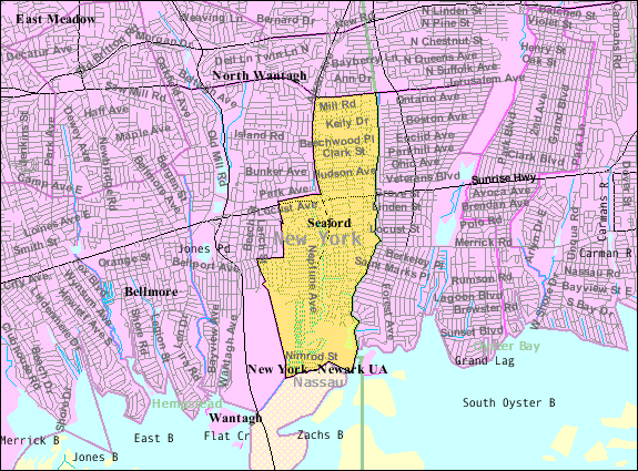
mapsize = 250px
map_caption = U.S. Census Map
mapsize1 =
map_caption1 =subdivision_type = Country
subdivision_name =United States
subdivision_type1 = State
subdivision_name1 =New York
subdivision_type2 = County
subdivision_name2 = Nassau
government_footnotes =
government_type =
leader_title =
leader_name =
leader_title1 =
leader_name1 =
established_title =
established_date =area_footnotes =
area_magnitude =
area_total_km2 = 6.8
area_land_km2 = 6.7
area_water_km2 = 0.0
area_total_sq_mi = 2.6
area_land_sq_mi = 2.6
area_water_sq_mi = 0.0population_as_of = 2000
population_footnotes =
population_total = 15791
population_density_km2 = 2344.8
population_density_sq_mi = 6072.9timezone = Eastern (EST)
utc_offset = -5
timezone_DST = EDT
utc_offset_DST = -4
elevation_footnotes =
elevation_m = 3
elevation_ft = 10
latd = 40 |latm = 40 |lats = 7 |latNS = N
longd = 73 |longm = 29 |longs = 33 |longEW = Wpostal_code_type =
ZIP code
postal_code = 11783
area_code = 516
blank_name = FIPS code
blank_info = 36-66058
blank1_name = GNIS feature ID
blank1_info = 0964724
website =
footnotes =Seaford is a
census-designated place (CDP) in Nassau County,New York ,United States . The population was 15,791 at the 2000 census.Geography
Seaford is located at coor dms|40|40|7|N|73|29|33|W|city (40.668702, -73.492459)GR|1.
According to the
United States Census Bureau , the CDP has a total area of 2.6square mile s (6.8km² ), of which, 2.6 square miles (6.7 km²) of it is land and 0.38% is water.History
The vast land development began with the arrival of Captain John Seaman, a native of Seaford, England. After obtaining the patent for the area, Smith oversaw the creation of Jerusalem South, the first European name given to the town which was to become Seaford. It was also widely referred to as Seaman's Neck.
During the 19th century, as villages across Long Island started to grow (due to the creation of the
Long Island Rail Road ), the town of Jerusalem South seemed to be unaffected. In 1868 the town was then renamed to the current name of "Seaford," to honor Captain Seaman's home town in England. During this time, Seaford remained an agriculturally developed area. Over time, the town gained a post office, a church and a one-roomschool house (established in what would many years later become the firstSeaford Fire Department building). Although the town itself was practically unchanged, many New York City residents had discovered that the area was attractive as a summer retreat. This was a trend in the region; many Long Island towns popular as summer residences, including Oyster Bay and others along the North and South shores.With the creation of
Sunrise Highway in 1929, Seaford started to see a large influx of inhabitants. Before 1929 Seaford had approximately 1,200 citizens. Within 25 years this number would triple [ [http://www.newsday.com/community/guide/lihistory/ny-historytown-hist008y,0,293727.story?coll=ny-lihistory-navigation Newsday Seaford - Eastward Ho! on Sunrise Highway] ] .Economy
Cash crops such as corn and wheat were some of the earliest farmed within the Seaford area. Due to easy access to various waterfronts the attempts to fish and recover oysters were widely seen. At first this was a hard task considering the layers of land beneath the water. In the mid 1800s, baymen from the Seaford area created a type of small, round-bottomed boat, called the "Seaford Skiff", that was used for fishing and market gunning (commercial waterfowl hunting) [http://www.newsday.com/community/guide/lihistory/ny-historytown-hist008y,0,293727.story?coll=ny-lihistory-navigation New York Newsday] ] .
With the popularity of hunting and fishing came the development of two hotels along Merrick Road, the Sportsman's Hotel, where Verity Moving is now located new Route 135, and The Powell Hotel at Jackson Avenue. Many celebrities came to these hotels to go duck hunting in South Oyster Bay, including New York Yankees, Babe Ruth and Lou Gehrig as well as brewery owner Jake Rupert. Local guides including Nelson Verity and Garner Paine, the Sheriff (and one of Long Island's first black officials), would take them to the bay for sport.
The Powell Hotel was torn down in 1977 to make room for the Long Island Savings Bank. Ironically, missing historical documents that would have saved the building by proving landmark status were said to only have been discovered in an eave during actual demolition.
Demographics
As of the
census GR|2 of 2000, there were 15,791 people, 5,257 households, and 4,200 families residing in the CDP. Thepopulation density was 6,072.9 per square mile (2,345.0/km²). There were 5,358 housing units at an average density of 2,060.6/sq mi (795.7/km²). The racial makeup of the CDP was 96.80% White, 0.15% African American, 0.06% Native American, 1.68% Asian, 0.02% Pacific Islander, 0.54% from other races, and 0.59% from two or more races. Hispanic or Latino of any race were 3.71% of the population.There were 5,257 households out of which 37.2% had children under the age of 18 living with them, 68.4% were married couples living together, 8.6% had a female householder with no husband present, and 20.1% were non-families. 16.3% of all households were made up of individuals and 8.3% had someone living alone who was 65 years of age or older. The average household size was 3.00 and the average family size was 3.38.
In the CDP the population was spread out with 25.2% under the age of 18, 6.9% from 18 to 24, 30.2% from 25 to 44, 23.9% from 45 to 64, and 13.7% who were 65 years of age or older. The median age was 38 years. For every 100 females there were 95.5 males. For every 100 females age 18 and over, there were 93.0 males.
The median income for a household in the CDP was $78,572, and the median income for a family was $85,751. Males had a median income of $60,092 versus $39,083 for females. The
per capita income for the CDP was $29,244. About 2.8% of families and 3.6% of the population were below thepoverty line , including 2.9% of those under age 18 and 3.9% of those age 65 or over.Education
In the year 2000, 4,211 people aged 3 and over were enrolled in school in Seaford. [http://www.seaford.li/1603666058.pdf]
The Seaford Union Free School District includes Seaford Manor Elementary, Seaford Harbor Elementary, Seaford Middle School, and Seaford High School. Private schools located in Seaford are Maria Regina and St. William the Abbott, both Roman Catholic.
Activities
Seaford has the Police Athletic Leagues for several sports, and the local Roman Catholic parish, St. William the Abbott, offers CYO baseball, basketball, volleyball, and swimming. Seaford is also home to the Long Island Broncos. Established in 1966, the Long Island Broncos is one of the oldest Youth Football and Cheer organizations on Long Island.
Maria Regina also offers a wide variety of CYO sports.
References
External links
* http://www.Seaford.LI
* http://www.seaford.li/chamber - Seaford Chamber of Commerce
* http://www.Seafordschools.net - Seaford Schools official website
* http://www.libroncos.com - The Long Island Broncos (Seaford Youth Football/Cheer Organization)

Wikimedia Foundation. 2010.