- New York State Route 135
-
This article is about the current alignment of NY 135. For previous alignments of NY 135, see New York State Route 135 (disambiguation).
NYS Route 135
Seaford – Oyster Bay Expressway 
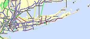
Map of Nassau and western Suffolk Counties with NY 135 highlighted in redRoute information Maintained by NYSDOT Length: 10.66 mi[3] (17.16 km) Existed: by 1964[1] – present History: Completed in 1969[2] Major junctions South end: Merrick Road in Seaford  Southern State Parkway in Seaford
 I-495 in Syosset
North end:  NY 25 in Syosset
Location Counties: Nassau Highway system Numbered highways in New York
Interstate • U.S. • N.Y. (former) • Reference • County←  NY 134
NY 136  →
→← CR 190 
CR 192 → New York State Route 135 (NY 135) is a 10.66-mile (17.16 km) state highway in eastern Nassau County, New York, United States. The route is a limited-access highway that connects Seaford with Syosset. The highway runs from Merrick Road (former County Route 27A or CR 27A) in Seaford to NY 25 in Syosset. In between, NY 135 passes through Bethpage and Plainview and serves Bethpage State Park. The highway is ceremoniously designated as the Ralph J. Marino Expressway; however, it is more commonly known as the Seaford – Oyster Bay Expressway.
The origins of the expressway date back to 1954 when engineering pioneer Robert Moses proposed that a highway be built between Wantagh and Oyster Bay. Although communities along the proposed path of the highway opposed its construction, Moses eventually won the grant. Right-of-way was taken in 1958, and construction began in 1959. In 1967, the name of the expressway was renamed from the Wantagh – Oyster Bay Expressway to its current name. The expressway was completed to its current length in 1969; however, a stub exists at each end of the highway. The freeway was designated was NY 135 by 1964.
Around 1970, Robert Moses returned his focus to the expressway, proposing that the highway be extended north from Syosset. This extension would include a long bridge to Rye in Westchester County across the Long Island Sound. The plan received support until it was brought to the federal government, at which point towns began opposing his plans. Governor Nelson Rockefeller canceled the proposed extension in 1973. In 2007, a developer proposed building a 16-mile (26 km) tunnel to Rye instead. There have also been plans for a southern extension to Jones Beach, but none have been acted on.
Contents
History
Early plans
In 1954, the New York State Department of Public Works (NYSDPW) unveiled plans for a six-lane expressway that would go from the Wantagh State Parkway in Wantagh to NY 106 in Oyster Bay. Unlike the Western Nassau Expressway, a highway proposed two years earlier that would go through densely populated areas in western Nassau County, this roadway would go through lightly populated areas, meaning that acquiring the necessary right-of-way would be easier.[4] Under Robert Moses' original plans for the highway, the northern terminus of the expressway would be placed near brand new local ferry terminals in Oyster Bay. From there, commuters could connect to the city of Stamford, Connecticut, 12 miles (19 km) to the north by way of ferries across Long Island Sound.[5] The proposed highway was added to the New York State Highway Law as follows, with annotations in brackets:[6]
... Seaford – Oyster Bay expressway, beginning at a point on the Wantagh parkway in the vicinity of the hamlet of Wantagh, thence running generally through or near the hamlets of Seaford, Bethpage and Plainview to a point on state highway nine thousand twenty-one [NY 106] south of the village of Oyster Bay; ...[6]
One of the major problems with the proposed alignment of the expressway was that it divided each community that it passed through. This was met by protests from all of the communities. To remedy the concerns, Lewis Waters, the Oyster Bay Town Supervisor, proposed a new alignment for the expressway. Under his plan, it would now begin at the Ocean Parkway in Tobay Beach, cross Great South Bay and enter West Amityville at Clocks Boulevard. From West Amityville, the expressway was to turn to the northeast near the current-day Sunrise Mall, and progress its way through Massapequa and Farmingdale into Bethpage State Park. The highway was to cross through Bethpage State Park using the old right-of-way for the Bethpage State Parkway through the communities of Old Bethpage and Plainview. From there, it would veer to the northwest, approaching and intersecting with the Jericho Turnpike (NY 25) about 0.75-mile (1.21 km) from its current northern terminus. At the Long Island Rail Road's Port Jefferson Branch, it would follow the originally planned alignment, but would end at NY 25A instead of NY 106.[7]
This plan, supported by the residents of Oyster Bay, would require the acquisition of 185 residential homes. In comparison, the alignment planned by Moses would result in the elimination of 450 homes. However, Moses' plan won out, to much of their dismay.[7]
Construction
 CR 191 (1958–1959)
In 1958, NYSDPW acquired the right-of-way for the highway. From Seaford north to the Southern State Parkway near Plainedge, the right-of-way followed the alignment of Seamans Neck Road, then an uninterrupted local road extending from Merrick Road in Seaford north to NY 107 and Union Avenue in Levittown. Also in 1958, the Nassau County Department of Public Works signed over 100 county highways around the county. According to the 1959 Master Plan for the county by the public works department, Seamans Neck Road was initially designated as CR 191, but only from Merrick Road to the proposed interchange between the expressway and NY 105, where Seamans Neck Road would meet the new highway.[5] The CR 191 designation was eventually eliminated.[8]
Construction commenced on the expressway a year later, with the section from Old Country Road (exit 10) to Jericho Turnpike (exits 14E and 14W) opening in June 1962.[9] Construction continued rapidly, with the section from Old Country Road down to the Southern State Parkway (exit 4) being completed only a year later.[10][11][12] The incomplete expressway was designated as NY 135 by 1964.[1]
From there, the construction slowed, with the final piece from Merrick Road (CR 27A) to the Southern State Parkway opening to traffic in late 1969. The resulting highway extended for 10.66 miles (17.16 km) from Seaford to Syosset, but not to Oyster Bay as its name implied.[2]
Bridge to Rye
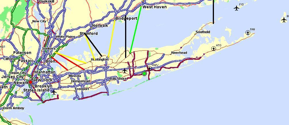
 The proposed bridges or tunnels crossing the LI sound
In 1957, a plan for a bridge to Westchester County across Long Island Sound was first proposed by Charles H. Sells, a former commissioner for the New York State Department of Public Works. His proposal for the Oyster Bay – Rye Bridge, along with the eastern Orient Point – Watch Hill Bridge were two proposed bridge routes off Long Island. Sells, however, suggested that the bridges not be constructed until Long Island's traffic and commuting began to increase.[5]
In seven years, Long Island underwent the transformation that Sells had expected, and the east–west arterials between Long Island and New York City, such as the Northern State Parkway and the Long Island Expressway, were congested with commuters. Motorists bound for New England or upstate regions of New York had to take either the Throgs Neck Bridge or the Bronx–Whitestone Bridge, and both bridges were already reaching their designed capacities. Robert Moses, chairman of the Triborough Bridge and Tunnel Authority, worked with the Department of Public Works to commission a $150,000 (1964 USD) study by the firm Madigan-Hyland to study the feasibility of a bridge across the sound.[13]
Moses revealed the results of the study to the Nassau and Suffolk Regional Planning Board in February 1966. The Oyster Bay – Rye Bridge (originally the Bayville – Rye Bridge) was proposed to complete the Interstate 287 (I-287) beltway around the New York Metropolitan Area. This was to be done by constructing a 6.1-mile (9.8 km) long cable-stayed suspension bridge bridge from the Cross Westchester Expressway (I-287) in Rye to the Seaford – Oyster Bay Expressway (NY 135) in Nassau County. The proposed bridge was to cost $150 million (1966 USD) and had the support of Governor Nelson Rockefeller and many officials on Long Island.[14]
However, Moses ran into a problem once the proposal was brought to the Federal Highway Administration. At this point, opposition to the bridge began to form on both sides of the Long Island Sound. In addition, plans to turn the Oyster Bay area into a bird sanctuary and a protected park made working on the highway harder as building on such protected places is forbidden by law. Faced with growing opposition, Governor Rockefeller canceled the plans for the bridge on June 20, 1973, nine years after the first proposal by Moses.[15]
Nine ideas were discussed in the 1950s, 1960s, and 1970s, but all were canceled. Some were reconsidered during the 1990s, but the New York State Department of Transportation (NYSDOT) backed away from the idea in belief that it would not relieve congestion. Long Islanders seem to favor a bridge but New Englanders are not very supportive of the idea, claiming that it would benefit Long Island at their expense.
Northward extension proposals
Since the demise of the proposed bridge across Long Island Sound, several proposed northward extensions of NY 135 have arisen, none of which have been acted on. In 1973, the Tri-State Transportation Commission proposed restudying the idea of extending the expressway northward back to its originally-planned northern terminus, the hamlet of Oyster Bay, even through the bridge project was shelved. The commission stated, "With the abandonment of the Oyster Bay – Rye Bridge proposal, the need to extend the Seaford-Oyster Bay Expressway northward to NY 25A or NY 106 should be restudied." They added that the study would be probable, even with the abandonment of working on the NY 135 corridor.[16][17]
In 1990, the Long Island Regional Planning Board came up with a proposed multi-billion dollar plan to expand the capacities of state and county highways and to improve all major roads to "satisfactory" levels by 2010. The proposal also revisited the idea of extending the Seaford – Oyster Bay Expressway to NY 25A in Oyster Bay via the right-of-way bought in the 1960s.[18][19] NYSDOT reconsidered the idea a decade later in 2000, saying it would relieve congestion in the area. They indicated that the extension may be built as either a "full-build" expressway or a four-lane arterial boulevard to NY 25A. However, there are no plans to do either at this time.[20]
In 2007, a developer proposed the idea of crossing the Long Island Sound by way of a tunnel instead of a bridge. The tunnel would be 17 miles (27 km) long and run from Bayville to Rye, just as the original bridge would have. To prevent the noticeable tunnel, the developer proposed building a park atop the entrance with ball fields, tennis courts, and several other amenities.[21][22]
 South stub end of the expressway
Part of the proposed northern right-of-way is now slated to be used for an extension of a multi-use bicycle path from Bethpage State Park to the Long Island Rail Road station in Syosset. The path would be extended north to I-495, where it would progress to the northern right-of-way that was once meant for use of the NY 135 extension and continue from there to the Syosset station. There would also be improvements to the hiking and biking trails, pedestrian improvements at crosswalks, the replacing of eroded areas and better parking and signage. Development of the project began in late 1993 and early 1994; however, construction has still not yet begun. Work on the project is expected to start in late 2009 and early 2010 and finish in late 2011. The projected cost for the project is $8.7 million, which will be paid for through state and federal funds.[23]
Southward extension
When the first proposals for a southern extension of NY 135 came out in 1967, around 25 families were relocated to clear a 7.3 acres (30,000 m2) right-of-way for the highway. By 1975, the Tri-State Transportation Commission proposed a plan to extend the highway south to the Wantagh State Parkway, which was NY 135's originally-planned southern terminus. This would have provided another connection to Jones Beach via the Wantagh Parkway. However, the idea was not acted upon and was shelved by NYSDOT in 1980. The right-of-way for the extension was held onto by the state until 2004 when they sold it to Nassau County. Nassau County plans to build a county recreational trail along that right-of-way.[20]
Effects on other highways
Between the Powell Avenue and Broadway / Plainview Road interchanges along the expressway, the highway is divided with a large median. The lane alignment was set up so that the proposed extension of the Bethpage State Parkway would have run within the median of NY 135. The parkway would have followed the highway for a short distance before turning to the southeast and away from NY 135. By making this possible, the Bethpage Parkway would likely have to have been upgraded from its current super-two configuration into a four-lane highway.[20]
NYSDOT had created a project page for the Bethpage Parkway extension, which was viewed by the department as a long-term project. As part of the project, the parkway would have been extended north from the traffic circle with Plainview Road to NY 135. The project was tentatively scheduled to start in mid-2025 and wrap up in early 2027 and cost $27.9 million. The page was taken down by November 2010.[24]
Active and planned construction
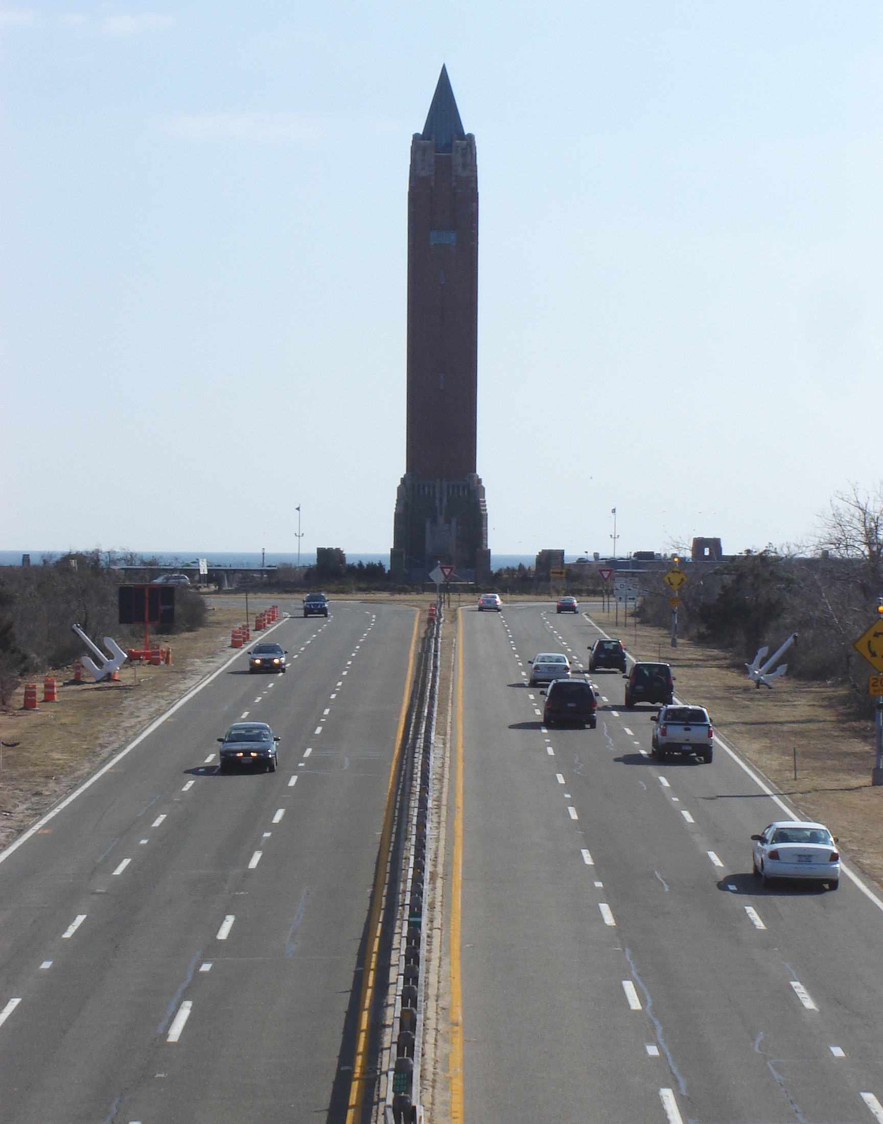
 Wantagh State Parkway approaching Jones Beach. This point is roughly where the Seaford – Oyster Bay Expressway would have ended
There are a number of projects either in progress or in development for NY 135. The one with active construction, however, is work by NYSDOT to repair segments of NY 135, along with many other highways in Nassau and nearby Suffolk Counties, that have concrete beginning to wear out. The project was projected to end in mid-2008, but the department has not updated of their project site with the construction.[25] In late 2006, development began on a project to construct a 100 parking space Park & Ride at the interchange of NY 135 and NY 25. Work on the project is to expected to begin in mid-2015 and end in the middle of the following year. Funds would come from the federal government and the state of New York.[26]
Another planned NYSDOT project is the replacement of the steel barrier for the median of NY 135 from Merrick Road to NY 24. The department will replace it with a normal concrete barrier and will also resurface the entire stretch of highway. The project is to cost $41.6 million of state and federal funding and begin in late 2010 and early 2011. It is expected to be completed by early 2012.[27]
Other history
At 9:30 a.m. on May 24, 1988, a tanker truck loaded with as much as 3,000 imperial gallons (14,000 l) of propane fuel overturned and exploded into flames along the expressway. This caused major traffic delays and congestion as police had to shut down three of the major transportation routes in the area. Nassau County police ordered the evacuation of 1,000 residents in the immediate area, along with nearby commuter routes, the Sunrise Highway and Long Island Railroad's Montauk Branch. With the possibility of an explosion, emergency personnel could not approach the tanker. Since the fire was close to the LIRR station in Seaford, a spokesman said that they had shut all service down from Wantagh to Massapequa. The Long Island Railroad attempted using buses, but with the congestion becoming worse, they routed the buses to Hicksville, where the passengers would take a diesel train to Bethpage and nearby Babylon to continue progress eastward. The Seaford – Oyster Bay Expressway was shut down from Merrick Road to the Southern State Parkway. Police reported that the tanker broke a rear axle, and skidded, causing it to overturn. The tank ruptured, starting the blaze. The driver, a middle-aged man from Westbury, escaped with few injuries.[28]
When the Seaford – Oyster Bay Expressway was first built, the highway was known as the Wantagh – Oyster Bay Expressway.[29] The route was changed to its current name in 1967. The change was made to both avoid confusion with the Wantagh Parkway and to accommodate a request from the community of Seaford to popularize their town. There have also been attempts to rename the expressway with dedications to various Presidents of the United States such as Theodore Roosevelt and Ronald Reagan.[20] However, in March 2002, the New York State Legislature officially dedicated the expressway after Ralph J. Marino, a New York State Senator from Long Island.[30] At the time, the designation was a tribute to Marino; however, he died just two weeks later.[31]
Route description

The Seaford – Oyster Bay Expressway northbound lanes begins at the onramp from Merrick Road (former CR 27A) near the outer limits of downtown Seaford in southeastern Nassau County. There is an aging sign at the southern terminus, depicting the highway as "NY 135" and showing the nearest control city as Oyster Bay. The offramp begins at a commercial building and turns to the northeast, heading through some trees. After a short distance, the onramp merges into the northbound lanes of the expressway.[32]
The expressway progresses northward from the onramp, crossing over Waverly Avenue and passing the first guide sign for exit 2 (NY 27), about 0.5 miles (0.8 km) ahead from this point. The highway widens to three lanes in each direction as it comes upon the interchange with NY 27. The highway progresses its way northward through the interchange and passes by the first NY 135 northbound shield in the middle of the exit. Trees mainly separate the expressway from the nearby highways and communities. After a short distance, the onramp from NY 27 merges into the northbound lanes, and the highway continues northward.[32]
On the southbound side, across from the onramp, the southbound lanes split for exit 2E, set specifically for the eastbound alignment of NY 27. Shortly afterward the expressway crosses under both directions of NY 27 on separate bridges. After that, Seamans Neck Road becomes the service road to the expressway, running parallel to the east. There is a bridge over Clark Street in the nearby community of Massapequa, where West Seamans Neck Road, the southbound service road, ends. After a short distance, Seamans Neck Road ends at exit 3 for NY 105.[32]
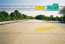
 Signs for exits 14E and 14W, the final ones on the expressway
After a while, the expressway passes the North Wantagh Park, and connects to the Southern State Parkway at exit 4. There, the expressway makes a curve to the northeast, crossing over Cordwood Lane on an overpass. The direction of the expressway begins to straighten, until exit 5, where it encounters NY 107. Soon after, the expressway comes upon exit 6, which is for Boundary Avenue, a connector to the nearby Bethpage State Parkway. From there, the expressway turns to the north and begins to parallel the Bethpage Parkway as it meets NY 24 (Hempstead Turnpike).[32]
North of NY 24 in Bethpage, NY 135 has an exit leading to Powell Avenue and Plainview Road, the latter serving as a local continuation of the Bethpage Parkway. At this point, the median of the expressway widens as the route heads northward.[32] The wide median was originally constructed to allow the Bethpage Parkway to be extended north to the Caumsett State Parkway and Caumsett State Park.[33][34][35] The wide median ends just before exit 9 as the lanes of NY 135 come back together for the exit with Cherry Avenue and Broadway. After interchange 9, the expressway enters Plainview as it crosses over Haypath Road.[32]
As the expressway passes through Plainview it passes beneath Old Country Road at exit 10. Seven interchanges north of the Southern State Parkway, NY 135 comes upon the Northern State Parkway at exit 12. Just after, there is a partial cloverleaf interchange (exit 13) with the Long Island Expressway (I-495) in Locust Grove. The expressway continues north of I-495, heading through Locust Grove to interchanges 14E and 14W. Here, NY 135 ends and merges into NY 25 (the Jericho Turnpike). A stub built for the possible extension of the expressway sits nearby. All traffic merges onto NY 25 west from there.[32]
Exit list
The entire route is in Nassau County.
Location Mile[3] Exit Destinations Notes Seaford 0.00 1E-W Merrick Road – Amityville, Wantagh Southbound exit and northbound entrance 2  NY 27 (Sunrise Highway)
Northbound exit only 0.80 2E-W NY 27 (Sunrise Highway) – Montauk, New York CityNo exit northbound 1.98 3  NY 105 (Jerusalem Avenue) – Massapequa, North Bellmore
Access via Seamans Neck Road northbound 2.70 4E-W Southern State Parkway – East Islip, New York City3.50 5  NY 107 (Massapequa–Hicksville Road) – Massapequa, Hicksville
Bethpage 4.02 6 Boundary Avenue – North Massapequa, Plainedge 4.67 7E-W  NY 24 (Hempstead Turnpike) – Farmingdale, Hempstead
5.85 8 Powell Avenue, Plainview Road – Bethpage, Farmingdale, Bethpage State Park 6.50 9 Broadway, Plainview Road – Plainview, Bethpage Plainview 7.99 10 Old Country Road – Plainview, Hicksville 11 Wallace Drive – Plainview Southbound exit only 9.45 12E-W  Northern Parkway – Hauppauge, New York City
No access to Northern Pkwy west from NY 135 south Syosset 9.77 13E-W I-495 (Long Island Expressway) – Riverhead, New York City10.66 14E-W NY 25 (Jericho Turnpike) – Woodbury, JerichoNorthbound exit and southbound entrance; exit 14E is unsigned southbound 1.000 mi = 1.609 km; 1.000 km = 0.621 mi See also
References
- ^ a b Sinclair (1964). New York and Metropolitan New York (Map). Cartography by Rand McNally and Company.
- ^ a b Report on the Status of the Federal-Aid Highway Program. Committee on Public Works, U.S. Senate. 1970.
- ^ a b "2008 Traffic Data Report for New York State" (PDF). New York State Department of Transportation. June 16, 2009. p. 249. https://www.nysdot.gov/divisions/engineering/technical-services/hds-respository/NYSDOT_Traffic_Data_Report_2008.pdf. Retrieved December 8, 2009.
- ^ "New Route Urged for Expressway". The New York Times: p. 36. March 12, 1955. http://select.nytimes.com/gst/abstract.html?res=F4071EFC3E5C1B7B93C0A81788D85F418585F9. Retrieved July 18, 2010.
- ^ a b c Master Plan for Nassau County. Nassau County Department of Public Works. 1959.
- ^ a b New York State Legislature. "New York State Highway Law § 341". http://public.leginfo.state.ny.us/menugetf.cgi?COMMONQUERY=LAWS. Retrieved December 11, 2009.
- ^ a b Silver, Roy R. (December 11, 1957). "Expressway Plan Stirs Oyster Bay". The New York Times: p. 33. http://select.nytimes.com/gst/abstract.html?res=FA0B11FD3554177B93C3A81789D95F438585F9. Retrieved July 18, 2010.
- ^ Anderson, Steve (2009). "County Roads on Long Island". NYCRoads. http://www.nycroads.com/roads/county-history/. Retrieved January 8, 2009.
- ^ Regional Highways: Status Report. Tri-State Transportation Commission. October 1962. pp. 5–62.
- ^ "Barnes Backs Ballard on New Expressway". New York World-Telegram. July 8, 1965.
- ^ Arterial Progress (1959–1965). Triborough Bridge and Tunnel Authority. 1965.
- ^ Transportation 1985: A Regional Plan. Tri-State Transportation Commission. 1966.
- ^ Traffic, Earnings and Feasibility of the Long Island Sound Crossing. Madigan-Hyland, Incorporated. 1965.
- ^ Proposed Bayville-Rye Bridge. Nassau-Suffolk Regional Planning Board. 1966.
- ^ Clines, Francis X. (June 21, 1973). "Rockefeller Halts Efforts to Build L.I. Sound Bridge". The New York Times: p. 1. http://select.nytimes.com/gst/abstract.html?res=F70917FC3959147A93C3AB178DD85F478785F9. Retrieved July 18, 2010.
- ^ Long, Irving (June 21, 1973). "Veto or No, Route 135 Extension Is in Works". Long Island Press.
- ^ Statewide Master Plan for Transportation. New York State Department of Transportation. 1973.
- ^ Young, Monte R. (February 22, 1990). "Extension of Three Expressways Urged". Newsday (New York City).
- ^ Leavens, Peter Austin (March 25, 1990). "Route 135: Dead End at Both Ends". The New York Times.
- ^ a b c d Anderson, Steve (2009). "Seaford-Oyster Bay Expressway". NYCRoads. http://www.nycroads.com/roads/NY-135/. Retrieved January 9, 2009.
- ^ Clary, Greg (November 21, 2007). "Sound Tunnel Would Link Rye, Long Island". The Journal News (White Plains, New York).
- ^ Enriquez, Susana (January 24, 2008). "Developer: Study Could Sink Long Island Tunnel". Newsday (New York City).
- ^ "Bethpage State Parkway Shared Use Path Extension". New York State Department of Transportation. 2009. pp. 1. https://www.nysdot.gov/portal/pls/portal/MEXIS_APP.WEPIDYNPAGEMULTI.show?p_arg_names=p_pin&p_arg_values=053457. Retrieved April 10, 2009.
- ^ "Bethpage State Parkway Extension to NY 135". New York State Department of Transportation. 2009. https://www.nysdot.gov/portal/pls/portal/MEXIS_APP.WEPIDYNPAGEMULTI.show?p_arg_names=p_pin&p_arg_values=053455. Retrieved April 10, 2009. Re-retrieved November 29, 2010.
- ^ "Concrete Pavement Repair Contract". New York State Department of Transportation. 2009. pp. 1. https://www.nysdot.gov/portal/pls/portal/MEXIS_APP.WEPIDYNPAGEMULTI.show?p_arg_names=p_pin&p_arg_values=080738. Retrieved April 10, 2009.
- ^ "Woodbury Park & Ride Construction". New York State Department of Transportation. 2009. pp. 1. https://www.nysdot.gov/portal/pls/portal/MEXIS_APP.WEPIDYNPAGEMULTI.show?p_arg_names=p_pin&p_arg_values=080807. Retrieved April 10, 2009.
- ^ "NY 135 Resurfacing/Median Replacement - Merrick to NY 24". New York State Department of Transportation. 2009. pp. 1. https://www.nysdot.gov/portal/pls/portal/MEXIS_APP.WEPIDYNPAGEMULTI.show?p_arg_names=p_pin&p_arg_values=005027. Retrieved April 10, 2009.
- ^ Uhlig, Mark A. (May 25, 1988). "Propane Truck Fire Disrupts L.I. Traffic". The New York Times. http://query.nytimes.com/gst/fullpage.html?res=940DE4DD1039F936A15756C0A96E948260. Retrieved January 9, 2009.
- ^ Mobil (1965). New York (Map). Cartography by Rand McNally.
- ^ D'Alessandro, Denise (March 22, 2002). "Seaford-Oyster Bay Expressway Renamed "Ralph J. Marino Expressway"". The Plainview-Old Bethpage Herald.
- ^ McFadden, Robert D. (April 7, 2002). "Ralph J. Marino, Former State Senate Leader, Dies at 74". The New York Times. http://query.nytimes.com/gst/fullpage.html?res=9C0DEFDA153DF934A35757C0A9649C8B63. Retrieved January 13, 2009.
- ^ a b c d e f g Yahoo! Inc. Yahoo! Maps – overview map of NY 135 (Map). Cartography by NAVTEQ. http://maps.yahoo.com/#mvt=h&lat=40.682217&lon=-73.493563&zoom=18&q1=40.665394%2C-73.492206&q2=40.812418%2C-73.491197&q3=40.812125%2C-73.49036. Retrieved January 9, 2009.
- ^ Caro, Robert A. (1974). The Power Broker. Vintage Books-Random House. ISBN 0394720245.
- ^ "New Highways Across Long Island To Link North and South Shores". The New York Times: p. N1. November 15, 1936. http://select.nytimes.com/gst/abstract.html?res=F00D15FA3E59167B93C7A8178AD95F428385F9. Retrieved July 18, 2010.
- ^ History of the Long Island State Parkway System. New York State Department of Transportation. 1985.
External links
- Alps' Roads – New York State Route 135
- New York Routes – New York State Route 135
- New York State Highway Termini – New York State Route 135
- The unfinished northern end of the Seaford Oyster Bay Expressway on Google Maps
- The unfinished southern end of the Seaford Oyster Bay Expressway on Google Maps
- NY 135 (Greater New York Roads)
Categories:- State highways in New York
- Long Island highways
- Transportation in Nassau County, New York
- Limited-access roads in New York
- Robert Moses projects
- Unfinished buildings and structures in the United States


Wikimedia Foundation. 2010.