- Bellmore, Indiana
-
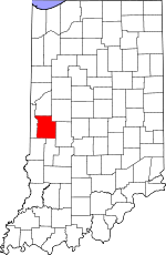
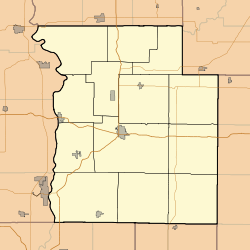
Bellmore — Unincorporated town — Parke County's location in Indiana Location in Park County Coordinates: 39°45′33″N 87°06′19″W / 39.75917°N 87.10528°WCoordinates: 39°45′33″N 87°06′19″W / 39.75917°N 87.10528°W Country  United States
State  Indiana
County Parke County Township Union Township Elevation 226 m (741 ft) ZIP code 47830 GNIS feature ID 430781[1] Bellmore (also known as Belle Moore, North Hampton or Northampton) is an unincorporated town in Union Township, Parke County, Indiana, USA. U.S. Route 36 and State Road 59 intersect in Bellmore.
Geography
Bellmore is located at 39°45′33″N 87°06′19″W / 39.75917°N 87.10528°W at an elevation of 741 feet.
References
- ^ "Bellmore". Geographic Names Information System, U.S. Geological Survey. http://geonames.usgs.gov/pls/gnispublic/f?p=gnispq:3:::NO::P3_FID:0430781. Retrieved 2010-11-01.
Municipalities and communities of Parke County, Indiana Towns Townships Unincorporated
communitiesAlma Lake | Annapolis | Armiesburg | Bellmore | Bethany | Bradfield Corner | Bridgeton | Byron | Catlin | Coloma | Coxville | Diamond | Ferndale | Grange Corner | Guion | Hollandsburg | Howard | Hudnut | Jessup | Judson | Klondyke | Lena | Lodi | Lyford | Mansfield | Midway | Milligan | Minshall | Numa | Nyesville | Smockville | Snow Hill | Sylvania | Tangier | West Atherton | West Melcher | West Union
Categories:- Indiana geography stubs
- Unincorporated communities in Indiana
- Populated places in Parke County, Indiana
Wikimedia Foundation. 2010.


