- Rockville, Indiana
Infobox Settlement
official_name = Rockville
other_name =
nickname = Covered Bridge Capital of the World
settlement_type = Town
motto =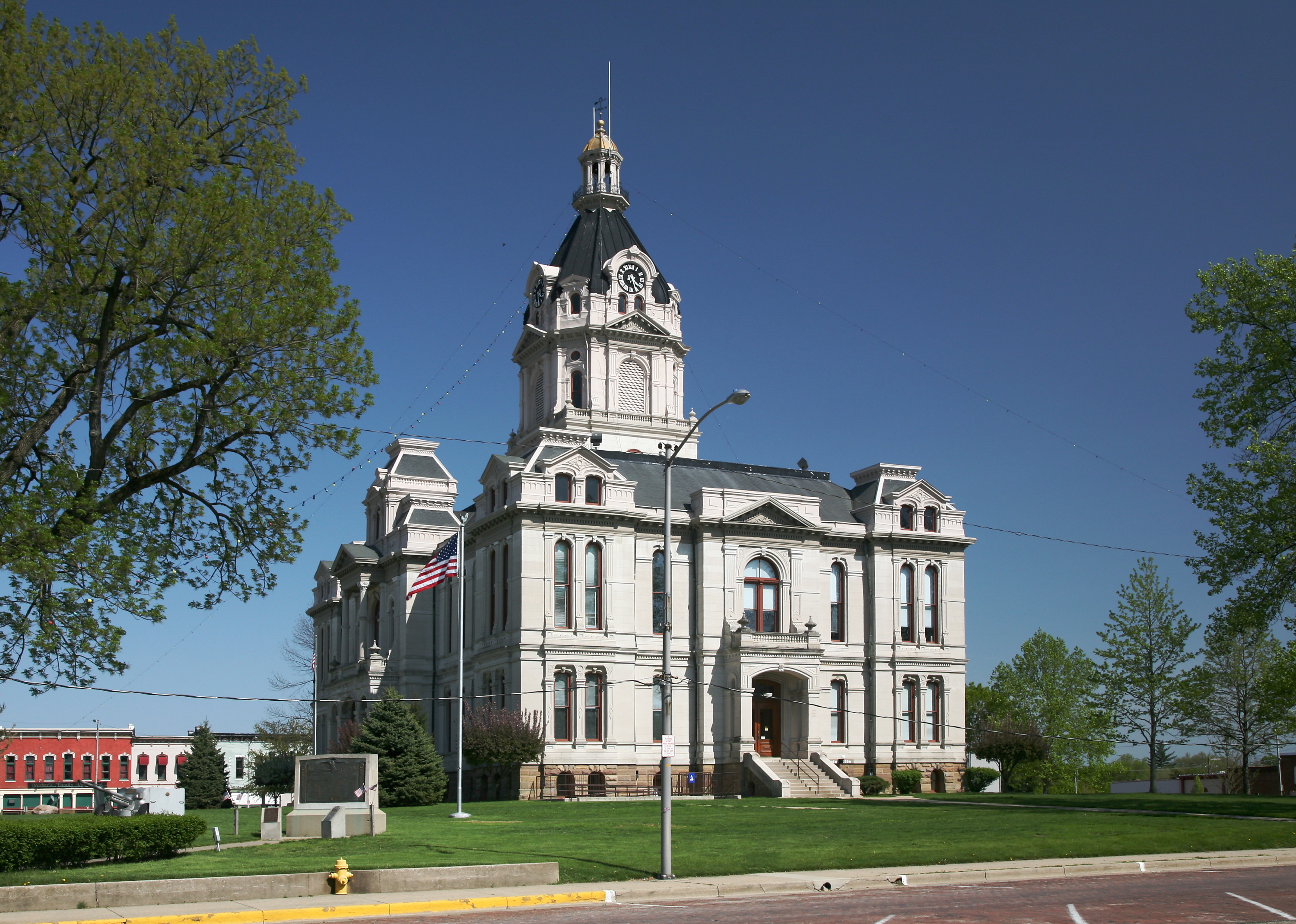
imagesize = 240px
image_caption =
flag_size =
image_
seal_size =
image_shield =
shield_size =
image_blank_emblem =
blank_emblem_type =
blank_emblem_size =
flag_size =
image_
seal_size =
image_shield =
shield_size =
image_blank_emblem =
blank_emblem_type =
blank_emblem_size =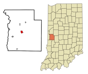
mapsize =
map_caption =
mapsize1 =
map_caption1 =
image_dot_
dot_mapsize =
dot_map_caption =
dot_x =
dot_y =
pushpin_
pushpin_label_position = right
pushpin_map_caption =
pushpin_mapsize =
subdivision_type = Country
subdivision_name =United States
subdivision_type1 = State
subdivision_name1 =Indiana
subdivision_type2 = County
subdivision_name2 = Parke
subdivision_type3 = Township
subdivision_name3 = Adams
government_footnotes =
government_type =
leader_title =
leader_name =
leader_title1 =
leader_name1 =
leader_title2 =
leader_name2 =
leader_title3 =
leader_name3 =
leader_title4 =
leader_name4 =
established_title =
established_date =
established_title2 =
established_date2 =
established_title3 =
established_date3 =
area_magnitude =
unit_pref =
area_footnotes =
unit_pref = Imperial
area_total_km2 = 3.7
area_land_km2 = 3.7
area_water_km2 = 0.0
area_total_sq_mi = 1.4
area_land_sq_mi = 1.4
area_water_sq_mi = 0.0
area_water_percent =
area_urban_km2 =
area_urban_sq_mi =
area_metro_km2 =
area_metro_sq_mi =
area_blank1_title =
area_blank1_km2 =
area_blank1_sq_mi =
population_as_of = 2000
population_footnotes =
population_note =
population_total = 2765
population_density_km2 = 743.0
population_density_sq_mi = 1924.4
population_metro =
population_density_metro_km2 =
population_density_metro_sq_mi =
population_urban =
population_density_urban_km2 =
population_density_urban_sq_mi =
population_blank1_title =
population_blank1 =
population_density_blank1_km2 =
population_density_blank1_sq_mi =
timezone = EST
utc_offset = -5
timezone_DST = EDT
utc_offset_DST = -4
latd = 39 |latm = 45 |lats = 55 |latNS = N
longd = 87 |longm = 13 |longs = 44 |longEW = W
elevation_footnotes = cite web|url=Gnis3|442226|title=USGS detail on Rockville|accessdate=2007-10-04]
elevation_m = 217
elevation_ft = 712
postal_code_type = ZIP code
postal_code = 47872
area_code = 765
blank_name = FIPS code
blank_info = 18-65520GR|2
blank1_name = GNIS feature ID
blank1_info = 0442226GR|3
website =
footnotes =Rockville is a town in Adams Township, Parke County,
Indiana ,United States . The population was 2,765 at the 2000 census. The city is thecounty seat of Parke CountyGR|6. It is known as "The Covered Bridge Capital of the World".Geography
Rockville is located at the intersection of
U.S. Route 36 andU.S. Route 41 , about 30 miles southwest of Crawfordsville. Its coordinates are coor dms|39|45|55|N|87|13|44|W|city (39.765183, -87.228810)GR|1.According to the
United States Census Bureau , the town has a total area of 1.4square mile s (3.7km² ), all of it land.Demographics
As of the
census GR|2 of 2000, there were 2,765 people, 1,286 households, and 735 families residing in the town. Thepopulation density was 1,924.4 people per square mile (741.4/km²). There were 1,390 housing units at an average density of 967.4/sq mi (372.7/km²). The racial makeup of the town was 98.16% White, 0.14% African American, 0.47% Native American, 0.29% Asian, 0.22% from other races, and 0.72% from two or more races. Hispanic or Latino of any race were 0.83% of the population.There were 1,286 households out of which 24.4% had children under the age of 18 living with them, 43.5% were married couples living together, 10.8% had a female householder with no husband present, and 42.8% were non-families. 39.4% of all households were made up of individuals and 23.0% had someone living alone who was 65 years of age or older. The average household size was 2.11 and the average family size was 2.82.
In the town the population was spread out with 21.5% under the age of 18, 6.9% from 18 to 24, 27.0% from 25 to 44, 20.9% from 45 to 64, and 23.7% who were 65 years of age or older. The median age was 42 years. For every 100 females there were 81.1 males. For every 100 females age 18 and over, there were 77.0 males.
The median income for a household in the town was $27,813, and the median income for a family was $36,066. Males had a median income of $30,909 versus $21,745 for females. The
per capita income for the town was $18,431. About 14.8% of families and 15.4% of the population were below thepoverty line , including 28.0% of those under age 18 and 9.7% of those age 65 or over.References
External links

Wikimedia Foundation. 2010.