- National Register of Historic Places listings in Texas, Counties T-Z
-
The following is a list of places within the state of Texas that are listed in the National Register of Historic Places. The names on the list are as they were entered in the register; some place names are inaccurate or have changed since being added.
This is intended to be a complete list of properties and districts listed on the National Register of Historic Places in the Texas counties covered. The locations of National Register properties and districts (at least for all showing latitude and longitude coordinates below) may be seen in a Google map by clicking on "Map of all coordinates".[1]
Contents: Counties A-C · Counties D-G · Counties H-J · Counties K-S · Counties T-Z
(links in italic lead to a new page)Tarrant - Taylor - Terrell - Throckmorton - Titus - Tom Green - Travis - Trinity - Tyler - Upshur - Uvalde - Val Verde - Van Zandt - Victoria - Walker - Waller - Washington - Webb - Wharton - Wheeler - Wichita - Wilbarger - Willacy - Williamson - Wilson - Winkler - Wise - Wood - Young - Zapata
-
- This National Park Service list is complete through NPS recent listings posted November 10, 2011.[2]
Tarrant County
Taylor County
Terrell County
[3] Landmark name [4] Image Date listed Location City or town Summary 1 Bullis' Camp Site August 2, 1978 Address Restricted Dryden 2 Geddis Canyon Rock Art Site May 22, 1978 Address Restricted Dryden 3 Meyers Springs Pictograph Site September 14, 1972 Address Restricted Dryden 4 Wroe Ranch Shelter No. 1 January 4, 1990 Address Restricted Sheffield Throckmorton County
[3] Landmark name Image Date listed Location City or town Summary 1 Throckmorton County Courthouse and Jail None Public Sq. and Chestnut St.
33°10′44″N 99°10′40″W / 33.178889°N 99.177778°WThrockmorton Titus County
[3] Landmark name Image Date listed Location City or town Summary 1 Hale Mound Site July 7, 1990 Address Restricted Winfield Tom Green County
Travis County
Trinity County
[3] Landmark name Image Date listed Location City or town Summary 1 Old Red Schoolhouse 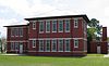
August 10, 2005 100 W. San Jacinto
30°56′34″N 95°22′31″W / 30.942708°N 95.375278°WTrinity 2 Riverside Swinging Bridge September 12, 1979 NE of Riverside
30°51′26″N 95°23′46″W / 30.857222°N 95.396111°WRiverside 3 State Highway 19 Bridge at Trinity River December 1, 2004 TX 19, on the Trinity/Walker county line
30°51′35″N 95°23′55″W / 30.859722°N 95.398611°WRiverside 4 Trinity County Courthouse Square September 10, 2004 162 W. First St., US 287 at TX 94
31°03′21″N 95°07′33″W / 31.055833°N 95.125833°WGroveton Tyler County
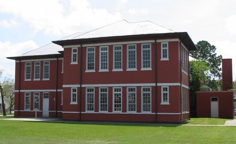
[3] Landmark name Image Date listed Location City or town Summary 1 US 190 Bridge at the Neches River October 10, 1996 US 190 at the Jasper and Tyler County line
30°51′12″N 94°11′55″W / 30.853333°N 94.198611°WJasper 2 Warren School September 12, 2008 312 Co. Rd. 1515 Warren Upshur County
[3] Landmark name Image Date listed Location City or town Summary 1 John and Eva O'Bryne House May 6, 2005 FM 1844, 0.7 mi (1.1 km). E of US 271
32°35′03″N 94°54′36″W / 32.584167°N 94.91°WUnion Grove Uvalde County
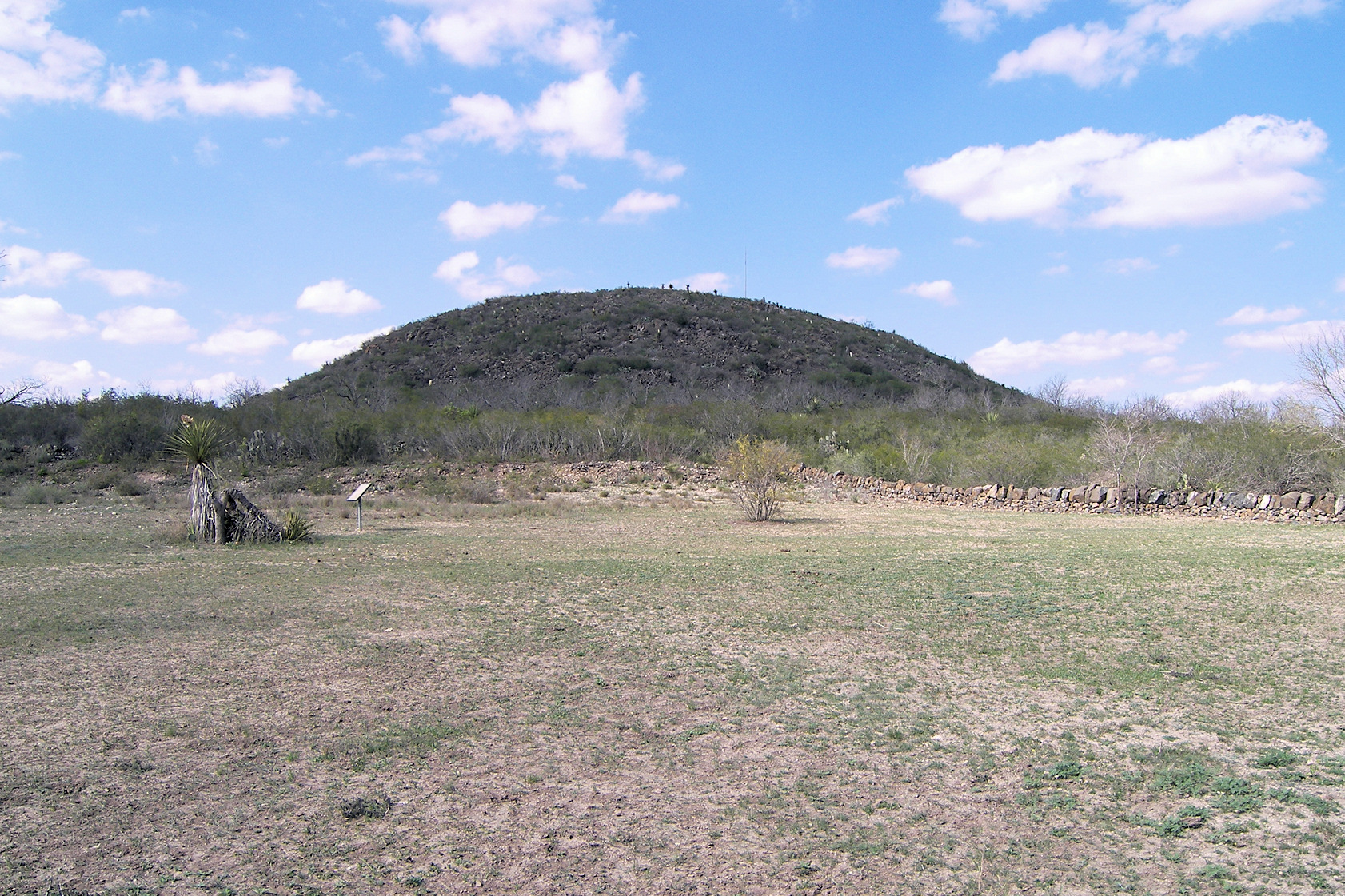
[3] Landmark name Image Date listed Location City or town Summary 1 Fort Inge Archeological Site 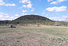
September 12, 1985 Southeast of Uvalde off Ranch Road 140
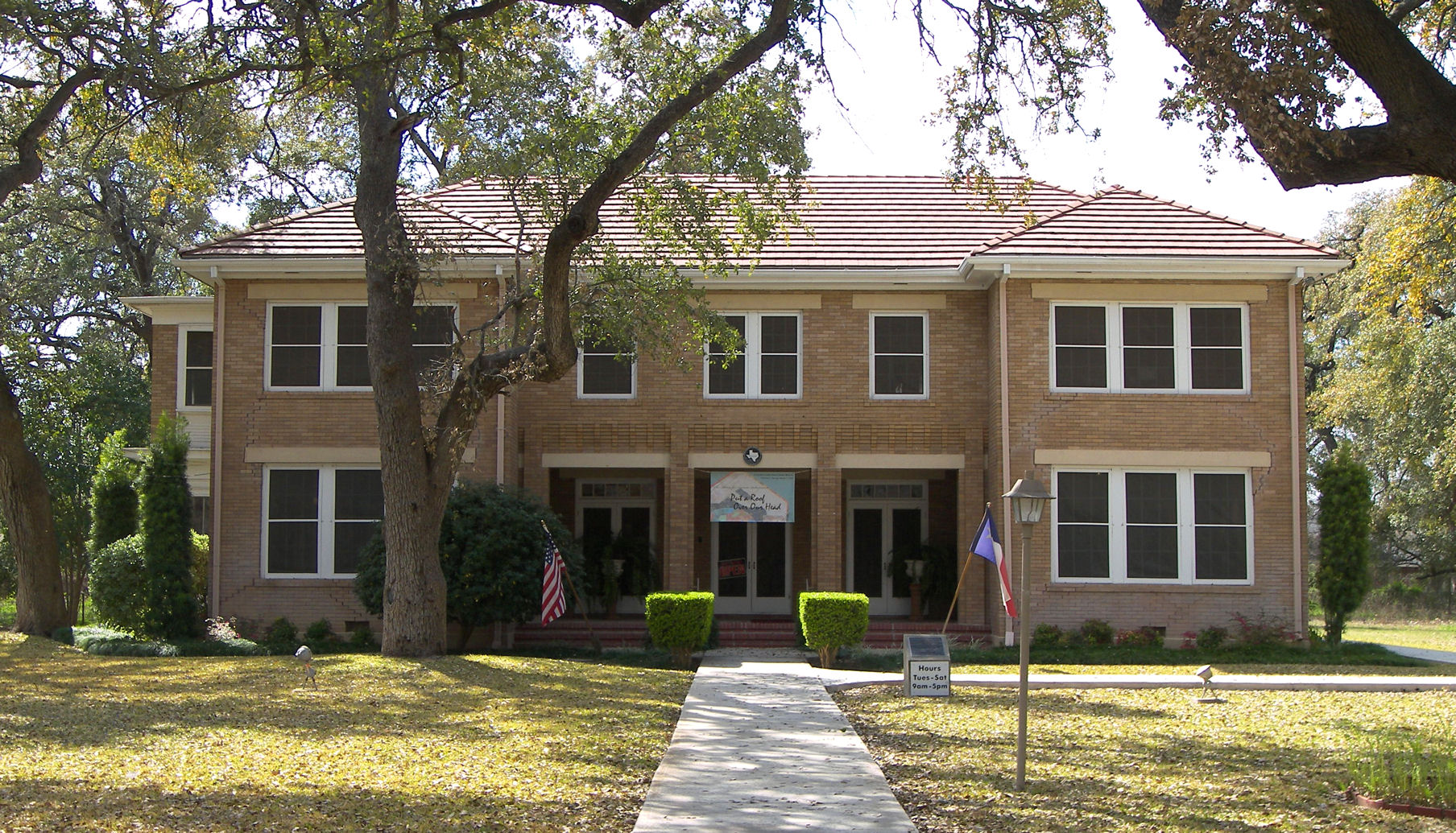
29°10′45″N 99°45′57″W / 29.179167°N 99.765833°WUvalde Remnants of a frontier fort established in 1849. Now a county park. 2 John Nance Garner House 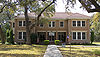
December 8, 1976 333 N. Park St.
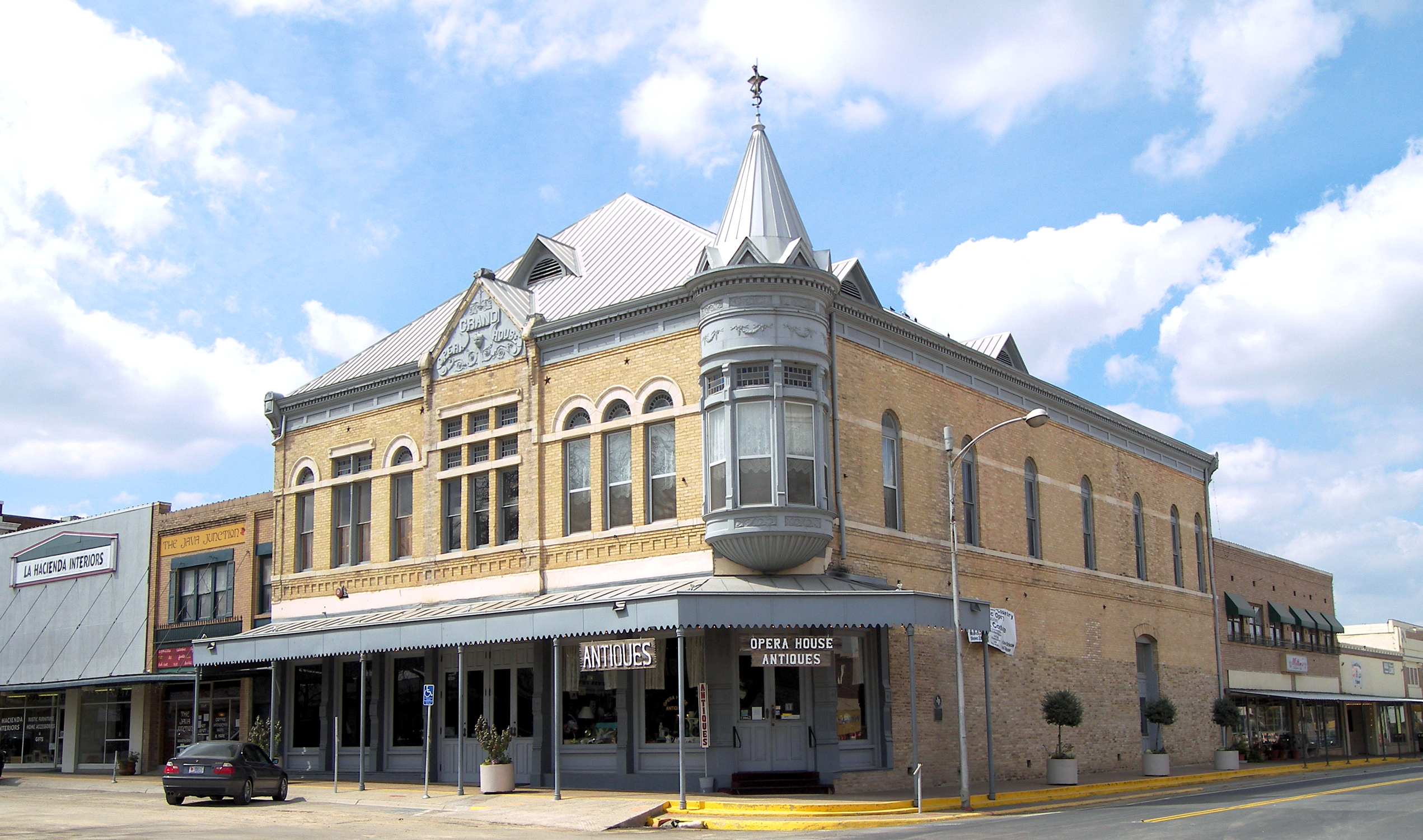
29°12′45″N 99°47′33″W / 29.212569°N 99.792431°WUvalde Former home of John Nance Garner, 32nd Vice-President of the United States. Now a museum about his life and times. 3 Grand Opera House 
May 22, 1978 E. North and N. Getty Sts.
29°12′37″N 99°47′12″W / 29.210278°N 99.786667°WUvalde Built in 1891 for plays, musicals, and cultural performances. It still serves the same function today making it the oldest functioning theater in the state of Texas. 4 Leona River Archeological Site May 6, 1976 Address Restricted Uvalde 5 Nicolas Street School November 27, 2010 332 Nicolas Street
29°12′08″N 99°47′35″W / 29.202222°N 99.793056°WUvalde 6 State Highway 3 Bridge at the Nueces River October 10, 1996 US 90, 13 mi (21 km). E of jct. with Kinney Cnty.
29°12′20″N 99°54′07″W / 29.205556°N 99.901944°WUvalde 7 Taylor Slough Archeological Site May 4, 1976 Address Restricted Uvalde 8 Uvalde Flint Quarry June 3, 1976 Address Restricted Uvalde 9 Willingham Site April 26, 1976 Address Restricted Uvalde Val Verde County
Van Zandt County
[3] Landmark name Image Date listed Location City or town Summary 1 William H. and Molly P. Humphries House August 20, 2004 201 S. Main St.
32°41′47″N 95°53′11″W / 32.696389°N 95.886458°WEdgewood Victoria County
Walker County
[3] Landmark name Image Date listed Location City or town Summary 1 Sam Houston House May 30, 1974 Ave. L, Sam Houston State University
30°42′53″N 95°33′10″W / 30.714722°N 95.552778°WHuntsville Also known as Woodland 2 Riverside Swinging Bridge September 12, 1979 NE of Riverside
30°51′26″N 95°23′46″W / 30.857222°N 95.396111°WRiverside 3 State Highway 19 Bridge at Trinity River December 1, 2004 TX 19, on the Trinity/Walker county line
30°51′35″N 95°23′55″W / 30.859722°N 95.398611°WRiverside 4 John W. Thomason House August 11, 1982 1207 Ave. J
30°43′21″N 95°32′54″W / 30.7225°N 95.548333°WHuntsville Waller County
[3] Landmark name Image Date listed Location City or town Summary 1 Anderson, L.C., Hall June 3, 1999 L.W. Minor St., building #0541
30°05′38″N 95°59′26″W / 30.093889°N 95.990625°WPrairie View 2 Banks, W.R., Library June 3, 1999 L.W. Minor St., building #0508
30°05′36″N 95°59′21″W / 30.093403°N 95.989236°WPrairie View 3 Evans, Annie Laurie, Hall June 3, 1999 L.W. Minor St., building #0544
30°05′37″N 95°59′25″W / 30.093542°N 95.990208°WPrairie View 4 Liendo Plantation June 21, 1971 2 mi (3.2 km). NE of Hempstead off FM 1488
30°05′47″N 96°01′47″W / 30.096389°N 96.029722°WHempstead 5 Veterninary Hospital June 3, 1999 E.M. Norris St., building #0517
30°05′36″N 95°59′02″W / 30.093333°N 95.983889°WPrairie View 6 Woolfolk, G.R., Social and Political Science Building June 3, 1999 A.G. Cleaver St., building #0503
30°05′41″N 95°59′20″W / 30.094722°N 95.988958°WPrairie View Washington County
Webb County
[3] Landmark name Image Date listed Location City or town Summary 1 Barrio Azteca Historic District May 21, 2003 Roughly bounded by I-35, Matamoros St., Arroyo Zacate, and the Rio Grande
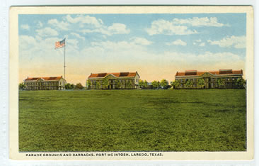
27°30′09″N 99°29′54″W / 27.5025°N 99.498333°WLaredo 2 Fort McIntosh 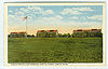
June 25, 1975 Laredo Junior College campus
27°30′28″N 99°31′17″W / 27.507778°N 99.521389°WLaredo 3 Hamilton Hotel April 14, 1992 815 Salinas St.
27°30′25″N 99°30′30″W / 27.506806°N 99.508333°WLaredo 4 Laredo U.S. Post Office, Court House and Custom House 
May 18, 2001 1300 Matamoros
27°30′24″N 99°30′32″W / 27.506736°N 99.508958°WLaredo 5 Los Ojuelos December 22, 1976 2.5 mi (4.0 km). S of Mirando City on SR 649
27°24′12″N 98°59′42″W / 27.403333°N 98.995°WMirando City 6 San Augustin de Laredo Historic District 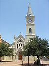
September 19, 1973 Roughly bounded by Grant and Water Sts., Convent and San Bernardino Aves.
27°30′07″N 99°30′19″W / 27.501944°N 99.505278°WLaredo 7 San Jose de Palafox Historic/Archeological District July 24, 1973 Address Restricted Laredo 8 Webb County Courthouse 
May 4, 1981 1000 Houston St.
27°30′27″N 99°30′21″W / 27.5075°N 99.505833°WLaredo Wharton County
Wheeler County
[3] Landmark name Image Date listed Location City or town Summary 1 Battle of Sweetwater Creek August 13, 2001 Address Restricted Mobeetie 2 Route 66 Bridge over the Chicago, Rock Island and Gulf Railroad April 3, 2007 I-40 south frontage road over the former CRI&G RR ROW
35°13′35″N 100°06′20″W / 35.226389°N 100.105556°WShamrock 3 U-Drop Inn 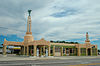
September 18, 1997 101 E. 12th St.
35°13′36″N 100°14′55″W / 35.226667°N 100.248611°WShamrock Also called Tower Station Wichita County
[3] Landmark name Image Date listed Location City or town Summary 1 Beaver Creek Bridge October 10, 1996 FM 2326, 1 mi (1.6 km) W of jct. with TX 25
33°54′21″N 98°54′17″W / 33.905833°N 98.904722°WElectra 2 Depot Square Historic District February 4, 2004 Roughly bounded by 8th St., Indiana St., 5th St. and MKT Railroad tracks
33°54′58″N 98°29′26″W / 33.916111°N 98.490556°WWichita Falls 3 William Benjamin Hamilton House October 28, 1983 1106 Brook Ave.
33°54′02″N 98°30′13″W / 33.900556°N 98.503611°WWichita Falls 4 Hodges-Hardy-Chambers House May 2, 1985 1100 Travis St.
33°54′26″N 98°28′12″W / 33.907222°N 98.47°WWichita Falls 5 Frank Kell House November 28, 1978 900 Bluff St.
33°54′27″N 98°29′49″W / 33.9075°N 98.496944°WWichita Falls 1909 Neoclassical Revival-style home of one of Wichita Falls' founding fathers[5] 6 Morningside Historic District May 16, 1985 Roughly bounded by 9th St., Morningside Dr., Pembroke Lane and Buchanan St.
33°54′21″N 98°31′23″W / 33.905833°N 98.523056°WWichita Falls 7 Weeks House December 3, 1980 2112 Kell Blvd.
33°53′27″N 98°30′51″W / 33.890833°N 98.514236°WWichita Falls 8 Wichita Falls Route Building November 29, 1978 503 8th St.
33°54′48″N 98°29′20″W / 33.913403°N 98.488889°WWichita Falls Wilbarger County
[3] Landmark name Image Date listed Location City or town Summary 1 Doan's Adobe House February 8, 1979 E of Odell off U.S. 283
34°20′38″N 99°15′20″W / 34.343889°N 99.255556°WDoans Willacy County
[3] Landmark name Image Date listed Location City or town Summary 1 King Ranch October 15, 1966 Kingsville and its environs Kingsville 2 Mansfield Cut Underwater Archeological District January 21, 1974 Address Restricted Port Isabel 3 Old Lyford High School November 7, 1985 High School Circle
26°24′37″N 97°47′48″W / 26.410208°N 97.796736°WLyford Williamson County
Wilson County
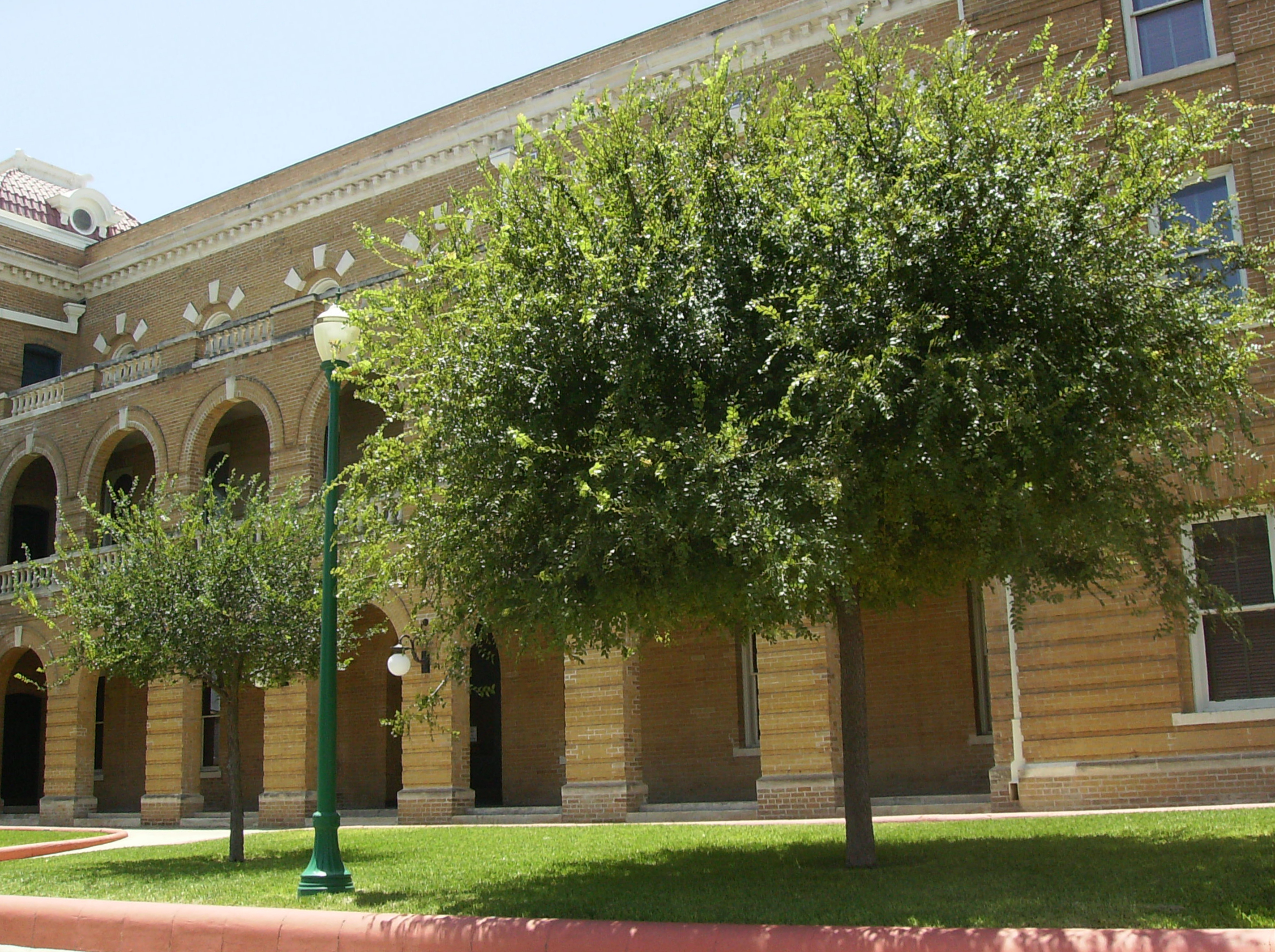
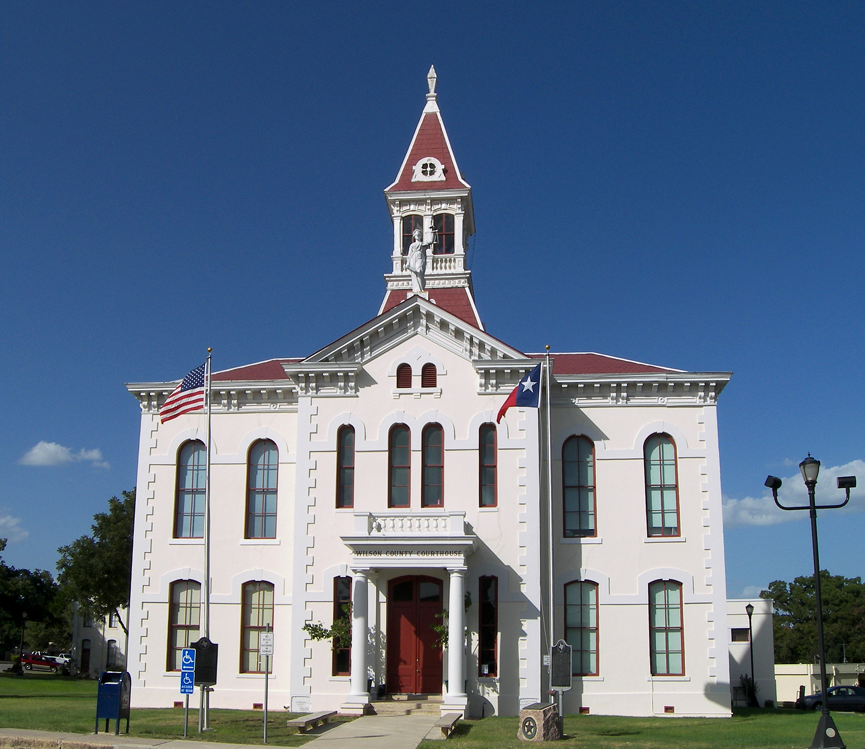
[3] Landmark name Image Date listed Location City or town Summary 1 Mueller Bridge None CR 337 over Cibolo Cr.
29°21′05″N 98°04′28″W / 29.351389°N 98.074444°WLa Vernia 2 Rancho de las Cabras None Address Restricted Floresville 3 Whitehall None N of Sutherland Springs on SR 539
29°19′02″N 98°03′28″W / 29.317222°N 98.057778°WSutherland Springs 4 Wilson County Courthouse and Jail 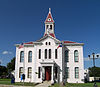
None Public Sq.
29°08′00″N 98°09′27″W / 29.133333°N 98.1575°WFloresville Winkler County
[3] Landmark name Image Date listed Location City or town Summary 1 Rig Theater None 213-215 E. Hendricks Blvd.
31°45′21″N 103°09′25″W / 31.755833°N 103.157083°WWink Wise County
[3] Landmark name Image Date listed Location City or town Summary 1 Administration Building, Decatur Baptist College None 1602 S. Trinity St.
33°13′22″N 97°35′11″W / 33.222778°N 97.586389°WDecatur 2 Brown, J. T., Hotel 
None E. Decatur St
33°17′38″N 97°47′44″W / 33.293889°N 97.795556°WChico 3 Texas Tourist Camp None 900-904 S US 81/287
33°13′42″N 97°34′44″W / 33.228333°N 97.57875°WDecatur 4 Waggoner Mansion None 1003 E. Main
33°14′03″N 97°34′37″W / 33.234167°N 97.576944°WDecatur 5 Wise County Courthouse 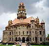
None Public Sq.
33°14′03″N 97°35′13″W / 33.234167°N 97.586944°WDecatur Wood County
[3] Landmark name Image Date listed Location City or town Summary 1 George W. Haines Site May 10, 1990 Address Restricted Hainesville 2 Howle Site April 13, 1977 Address Restricted Quitman 3 Howard L. and Vivian W. Lott House October 9, 1998 311 E. Kilpatrick St.
32°39′50″N 95°29′09″W / 32.663889°N 95.485833°WMineola 4 Joseph and Martha Moody Farmstead May 10, 1990 Address Restricted Hainesville 5 Ned Moody Site May 4, 1990 Address Restricted Hainesville 6 Osborn Site December 15, 1976 Address Restricted Quitman 7 Florence Robinson Cottage May 5, 2000 Washington Place at Emma B. Smith Blvd., Jarvis Christian Colleg
32°35′13″N 95°10′46″W / 32.586944°N 95.179444°WHawkins 8 Sadler Site April 13, 1977 Address Restricted Alba Young County
[3] Landmark name Image Date listed Location City or town Summary 1 Fort Belknap 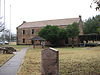
October 15, 1966 1 mi (1.6 km). S of jct. of TX 24 and 251
32°52′26″N 98°44′30″W / 32.873889°N 98.741667°WNewcastle 2 Graham Post Office June 25, 1999 429 Third St.
33°06′21″N 98°35′33″W / 33.105833°N 98.5925°WGraham 3 Harrell Site October 15, 1966 Address Restricted South Bend 4 National Theater June 24, 1993 522 Oak St.
33°06′21″N 98°35′28″W / 33.105833°N 98.591111°WGraham 5 Spencer Boyd Street Houses August 16, 1984 800 and 804 3rd St.
33°06′20″N 98°35′07″W / 33.105556°N 98.585278°WGraham Zapata County
[3] Landmark name Image Date listed Location City or town Summary 1 Corralitos Ranch August 2, 1977 2 mi (3.2 km). N of San Ygnacio off U.S. 83
27°07′10″N 99°25′50″W / 27.119444°N 99.430556°WSan Ygnacio 2 Dolores Nuevo November 27, 1973 Address Restricted Laredo 3 Dolores Viejo August 17, 1973 Address Restricted San Ygnacio 4 San Francisco Ranch March 25, 1977 1 mi (1.6 km). N of San Ygnacio San Ygnacio 5 San Ygnacio Historic District 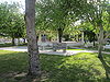
July 16, 1973 Town of San Ygnacio
27°02′44″N 99°26′34″W / 27.045556°N 99.442778°WSan Ygnacio 6 Trevino-Uribe Rancho 
July 16, 1973 Jct. of Uribe and Trevino Sts.
27°02′42″N 99°26′36″W / 27.045°N 99.443333°WSan Ygnacio See also
References
- ^ The latitude and longitude information provided in this table was derived originally from the National Register Information System, which has been found to be fairly accurate for about 99% of listings. For about 1% of NRIS original coordinates, experience has shown that one or both coordinates are typos or otherwise extremely far off; some corrections may have been made. A more subtle problem causes many locations to be off by up to 150 yards, depending on location in the country: most NRIS coordinates were derived from tracing out latitude and longitudes off of USGS topographical quadrant maps created under North American Datum of 1927, which differs from the current, highly accurate GPS system used by Google maps. Chicago is about right, but NRIS longitudes in Washington are higher by about 4.5 seconds, and are lower by about 2.0 seconds in Maine. Latitudes differ by about 1.0 second in Florida. Some locations in this table may have been corrected to current GPS standards.
- ^ "National Register of Historic Places: Weekly List Actions". National Park Service, United States Department of the Interior. Retrieved on November 10, 2011.
- ^ a b Numbers represent an ordering by significant words. Various colorings, defined here, differentiate National Historic Landmark sites and National Register of Historic Places Districts from other NRHP buildings, structures, sites or objects.
- ^ "National Register Information System". National Register of Historic Places. National Park Service. . http://nrhp.focus.nps.gov/natreg/docs/All_Data.html.
- ^ Sweeten-Shults, Lana (January 22, 2011). "Historic Kell House beginning to show its age". Times Record News. Wichita Falls, Texas. http://www.timesrecordnews.com/news/2011/jan/22/historic-kell-house-beginning-to-show-its-age/. Retrieved January 27, 2011.
U.S. National Register of Historic Places Topics Lists by states Alabama • Alaska • Arizona • Arkansas • California • Colorado • Connecticut • Delaware • Florida • Georgia • Hawaii • Idaho • Illinois • Indiana • Iowa • Kansas • Kentucky • Louisiana • Maine • Maryland • Massachusetts • Michigan • Minnesota • Mississippi • Missouri • Montana • Nebraska • Nevada • New Hampshire • New Jersey • New Mexico • New York • North Carolina • North Dakota • Ohio • Oklahoma • Oregon • Pennsylvania • Rhode Island • South Carolina • South Dakota • Tennessee • Texas • Utah • Vermont • Virginia • Washington • West Virginia • Wisconsin • WyomingLists by territories Lists by associated states Other  Category:National Register of Historic Places •
  Portal:National Register of Historic PlacesCategories:
- National Register of Historic Places in Texas
-


Wikimedia Foundation. 2010.