- Port Isabel, Texas
Infobox Settlement
official_name = Port Isabel, Texas
settlement_type =City
nickname =
motto =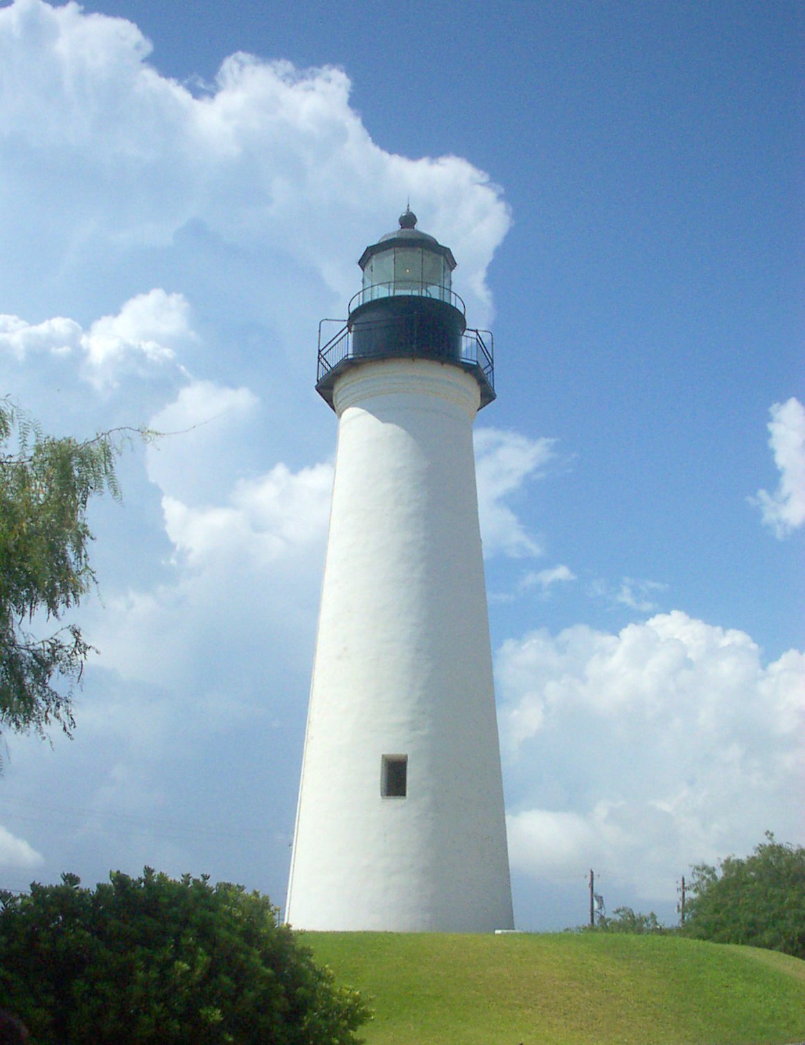
imagesize = 250px
image_caption = Port Isabel Lighthouse [ [http://www.tshaonline.org/handbook/online/articles/PP/ggp1.html "Handbook of Texas Online" article for the Port Isabel lighthouse state historic structure] ]
image_
mapsize = 250px
map_caption = Location of Port Isabel, Texas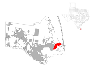
mapsize1 = 250px
map_caption1 =subdivision_type = Country
subdivision_name =United States
subdivision_type1 = State
subdivision_name1 =Texas
subdivision_type2 = County
subdivision_name2 = Camerongovernment_footnotes =
government_type =
leader_title =
leader_name =
leader_title1 =
leader_name1 =
established_title =
established_date =unit_pref = Imperial
area_footnotes =area_magnitude =
area_total_km2 = 7.5
area_land_km2 = 5.7
area_water_km2 = 1.8
area_total_sq_mi = 2.9
area_land_sq_mi = 2.2
area_water_sq_mi = 0.7population_as_of = 2000
population_footnotes =
population_total = 4865
population_density_km2 = 855.4
population_density_sq_mi = 2215.5timezone = Central (CST)
utc_offset = -6
timezone_DST = CDT
utc_offset_DST = -5
elevation_footnotes =
elevation_m = 2
elevation_ft = 7
latd = 26 |latm = 4 |lats = 25 |latNS = N
longd = 97 |longm = 12 |longs = 48 |longEW = Wpostal_code_type =
ZIP code s
postal_code = 78578, 78597
area_code = 956
blank_name = FIPS code
blank_info = 48-58892GR|2
blank1_name = GNIS feature ID
blank1_info = 1375530GR|3
website =
footnotes =Port Isabel is a city located in
Cameron County, Texas . [ [http://www.tsha.utexas.edu/handbook/online/articles/PP/hgp9.html "Handbook of Texas Online" article for Port Isabel] Accessed May 17, 2007.] It is part of the Brownsville–Harlingen Metropolitan Statistical Area. As of the 2000 census, the city had a total population of 4,865.History
Port Isabel is one of the oldest continually inhabited areas founded by Europeans in North America as it was settled in 1554.
In September 1967,
Hurricane Beulah caused extensive damage to much of the city of Port Isabel. [ [http://www.tshaonline.org/handbook/online/articles/HH/ybh1.html "Handbook of Texas Online" article on hurricanes in Texas] Accessed May 16, 2007.] On July 23, 2008, Hurricane Dolly, a category 2 storm, also caused extensive damage to the city.Geography
Port Isabel is located at 26°4'25" North, 97°12'48" West (26.073675, -97.213234)GR|1.
According to the
United States Census Bureau , the city has a total area of 2.9square mile s (7.5km² ), of which, 2.2 square miles (5.7 km²) of it is land and 0.7 square miles (1.8 km²) of it is water.Demographics
As of the
census GR|2 of 2000, there were 4,865 people, 1,649 households, and 1,225 families residing in the city. Thepopulation density was 2,215.5 people per square mile (853.8/km²). There were 2,055 housing units at an average density of 935.8/sq mi (360.7/km²). The racial makeup of the city was 79.67% White, 1.03% African American, 0.33% Native American, 0.25% Asian, 0.10% Pacific Islander, 15.54% from other races, and 3.08% from two or more races. 74.39% of the population were Hispanic or Latino of any race.There were 1,649 households out of which 36.0% had children under the age of 18 living with them, 53.1% were married couples living together, 16.6% had a female householder with no husband present, and 25.7% were non-families. 22.1% of all households were made up of individuals and 7.8% had someone living alone who was 65 years of age or older. The average household size was 2.95 and the average family size was 3.46.
In the city the population was spread out with 30.4% under the age of 18, 9.9% from 18 to 24, 25.6% from 25 to 44, 21.8% from 45 to 64, and 12.2% who were 65 years of age or older. The median age was 32 years. For every 100 females there were 94.1 males. For every 100 females age 18 and over, there were 93.5 males.
The median income for a household in the city was $25,323, and the median income for a family was $26,077. Males had a median income of $17,105 versus $16,316 for females. The
per capita income for the city was $11,239. 27.3% of the population and 21.7% of families were below thepoverty line . 34.7% of those under the age of 18 and 14.3% of those 65 and older were living below the poverty line.Education
Children living in Port Isabel are zoned to schools in
Point Isabel Independent School District . Children go to Garriga Elementary School (Grades K-2), Derry Elementary School, (3-5), Port Isabel Junior High School (6-8), and Port Isabel High School (9-12). All of the schools are located in Port Isabel. [ [http://www.pi-isd.net/ Port Isabel ISD] Accessed May 16, 2007.]In addition, children may apply to schools in
South Texas Independent School District . [ [http://www.stisd.net/about.html South Texas Independent School District] Accessed May 16, 2007.]References
External links
* [http://www.portisabel-texas.com/ Port Isabel Official Tourism & Information Website]
* [http://www.portisabelmuseums.com/ Museums of Port Isabel]
* [http://www.portisabel.org/ Port Isabel Chamber of Commerce]

Wikimedia Foundation. 2010.