- National Register of Historic Places listings in Texas, Counties D-G
-
The following is a list of places within the state of Texas that are listed in the National Register of Historic Places. The names on the list are as they were entered in the register; some place names are inaccurate or have changed since being added.
This is intended to be a complete list of properties and districts listed on the National Register of Historic Places in the Texas counties covered. The locations of National Register properties and districts (at least for all showing latitude and longitude coordinates below) may be seen in a Google map by clicking on "Map of all coordinates".[1]
Contents: Counties A-C · Counties D-G · Counties H-J · Counties K-S · Counties T-Z
(links in italic lead to a new page)Dallam - Dallas - Dawson - DeWitt - Deaf Smith - Denton - Dickens - Dimmit - Donley - Eastland - Ector - Edwards - El Paso - Ellis - Erath - Falls - Fannin - Fayette - Fisher - Floyd - Fort Bend - Franklin - Freestone - Frio - Galveston - Garza - Gillespie - Glasscock - Goliad - Gonzales - Gray - Grayson - Gregg - Grimes - Guadalupe
-
- This National Park Service list is complete through NPS recent listings posted November 10, 2011.[2]
Dallam County
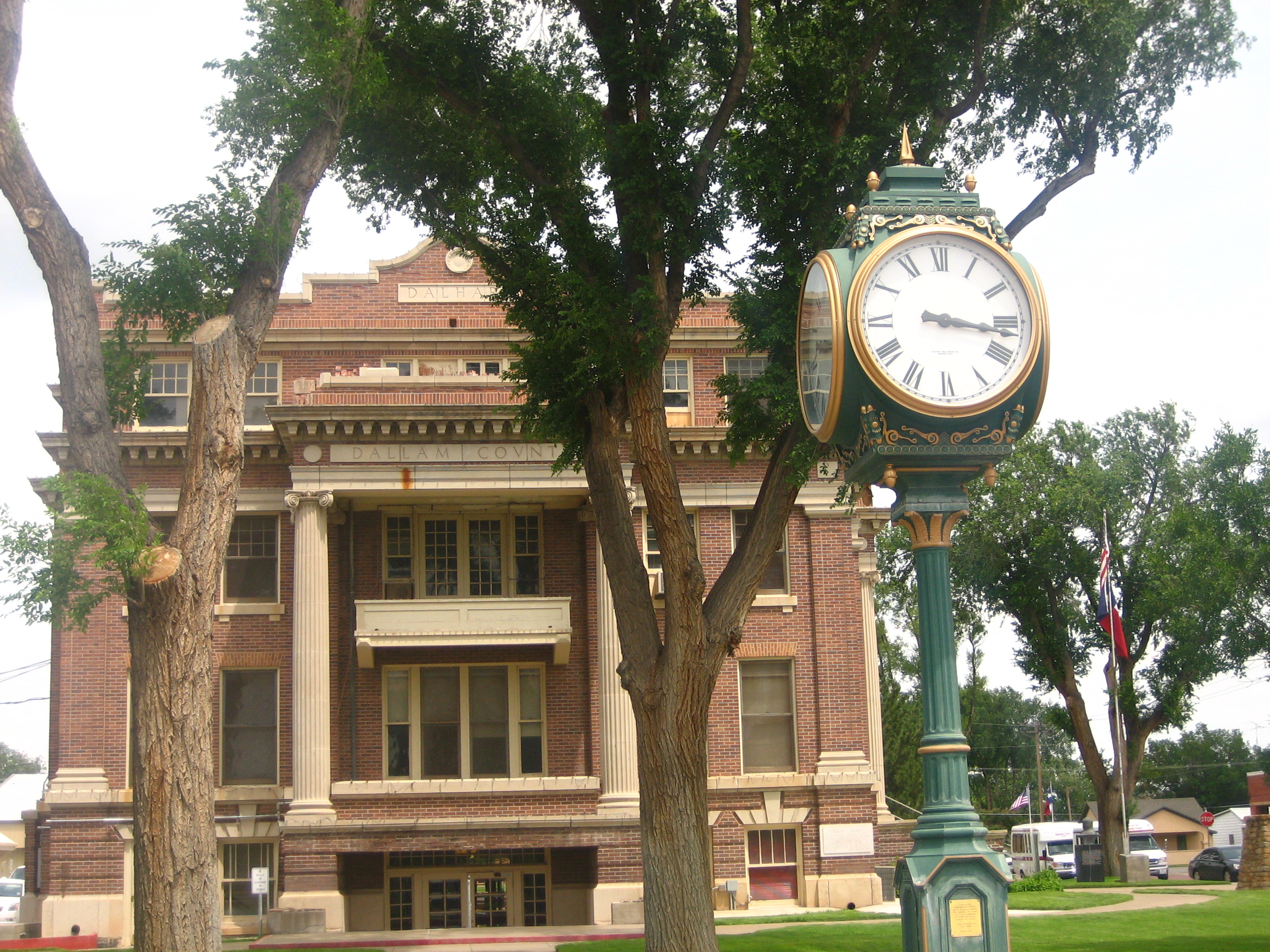
[3] Landmark name [4] Image Date listed Location City or town Summary 1 Dallam County Courthouse 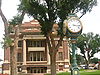
October 15, 1992 Jct. of Fifth and Denrock Sts.
36°03′42″N 102°31′21″W / 36.061667°N 102.5225°WDalhart Dallas County
Dawson County
[3] Landmark name Image Date listed Location City or town Summary 1 Lamesa Farm Workers Community Historic District August 9, 1993 Jct. of US 87 and US 180 Los Ybanez DeWitt County
Deaf Smith County
[3] Landmark name Image Date listed Location City or town Summary 1 E. B. Black House July 17, 1978 508 W. 3rd St.
34°48′52″N 102°24′14″W / 34.814444°N 102.403889°WHereford 2 Glenrio Historic District January 17, 2007 Texas State Highway Loop 504/New Mexico State Road 1578 Glenrio Extends into Quay County, New Mexico Denton County
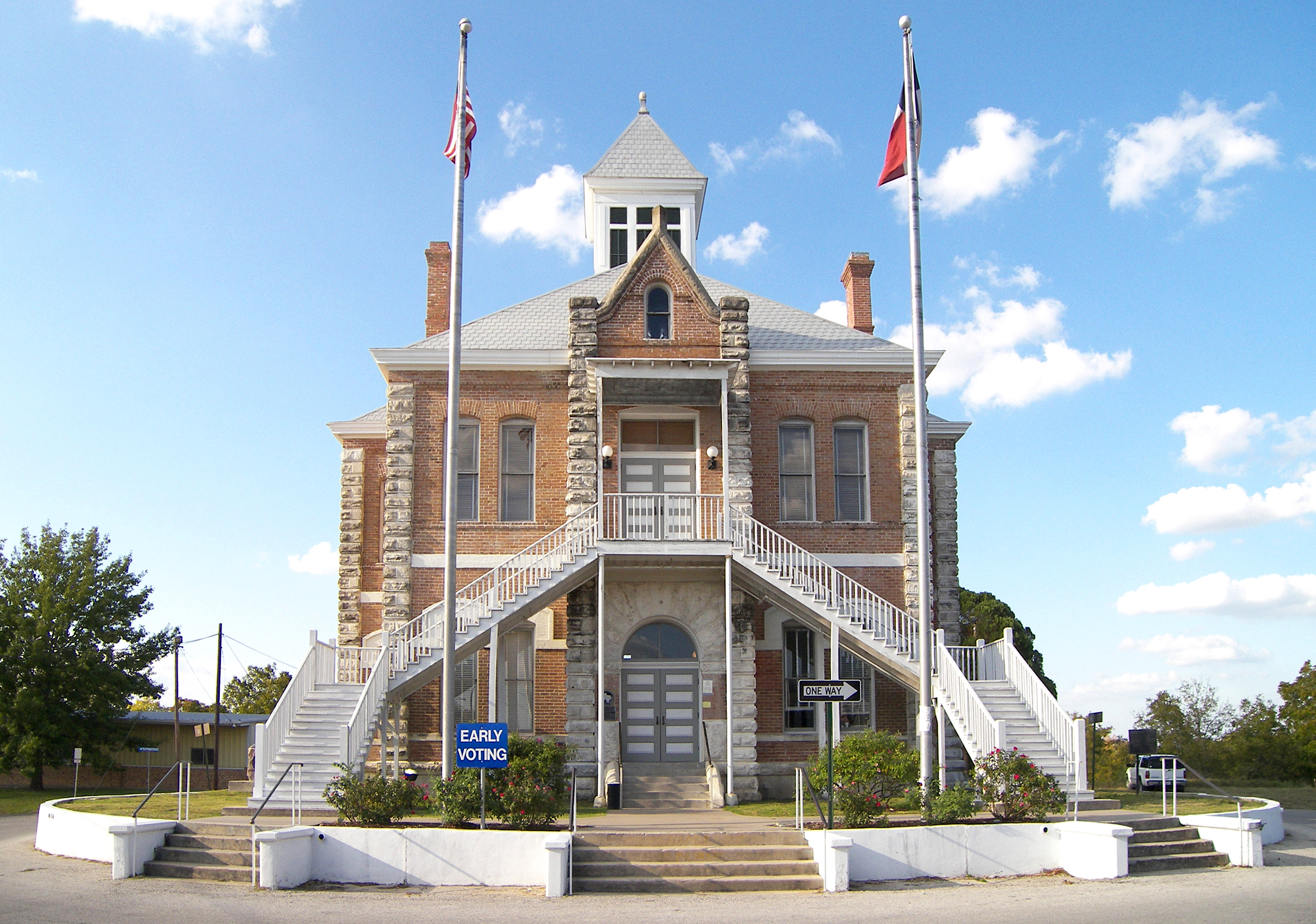
Dickens County
[3] Landmark name Image Date listed Location City or town Summary 1 Dickens County Courthouse and Jail 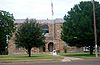
September 4, 1980 Bounded by 4th, 5th, Montgomery and Crow Sts.
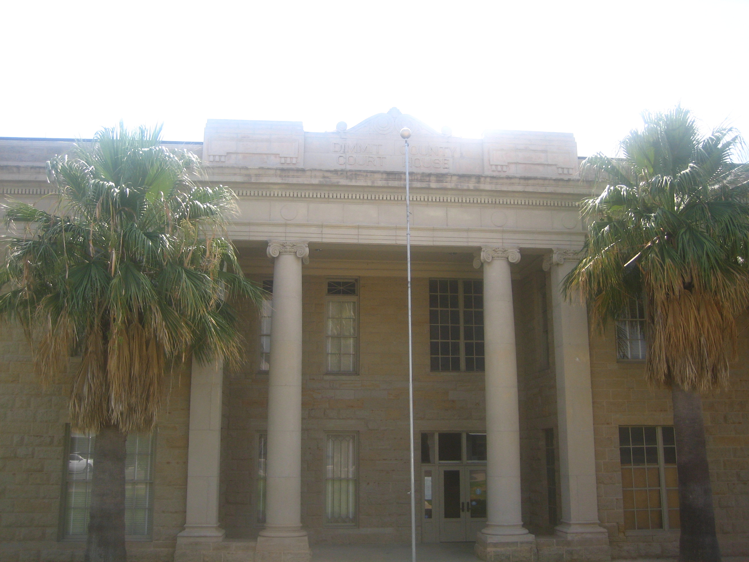
33°37′16″N 100°50′10″W / 33.621111°N 100.836111°WDickens Dimmit County
[3] Landmark name Image Date listed Location City or town Summary 1 Dimmit County Courthouse 
August 14, 1984 Public Square
28°31′19″N 99°51′35″W / 28.521944°N 99.859722°WCarrizo Springs 2 Asher and Mary Isabelle Richardson House 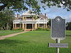
November 22, 1988 US 83
28°26′31″N 99°45′44″W / 28.441944°N 99.762222°WAsherton 3 Valenzuela Ranch Headquarters July 18, 1985 Valenzuela Creek
28°13′52″N 99°40′39″W / 28.231111°N 99.6775°WCatarina Donley County
[3] Landmark name Image Date listed Location City or town Summary 1 Clarendon Motor Company Building November 10, 1994 221 S. Sully St.
34°56′16″N 100°53′20″W / 34.937778°N 100.888889°WClarendon 2 Donley County Courthouse and Jail February 17, 1978 Public Sq.
34°56′14″N 100°53′26″W / 34.937222°N 100.890556°WClarendon 3 Martin-Lowe House November 21, 1985 507 W. Fifth
34°56′13″N 100°53′38″W / 34.936944°N 100.893889°WClarendon Eastland County
[3] Landmark name Image Date listed Location City or town Summary 1 Cisco Historic District November 20, 1984 Roughly bounded by Conrad Hilton Ave., W. 3rd St., Ave. K, W. 8th and 9th Sts.
32°23′19″N 98°59′01″W / 32.388611°N 98.983611°WCisco 2 Mobley Hotel May 13, 1981 4th St. and Conrad Hilton Ave.
32°23′30″N 98°58′51″W / 32.391667°N 98.980833°WCisco Ector County
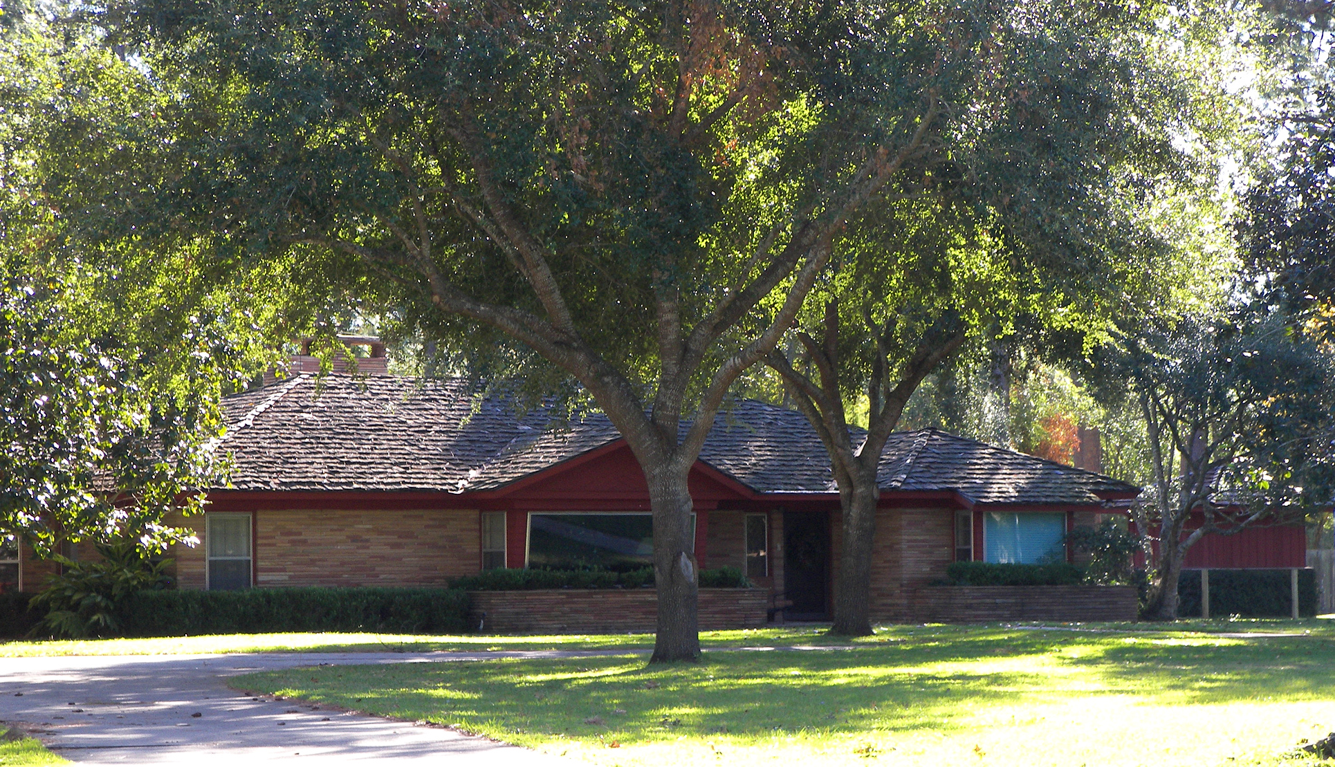
[3] Landmark name Image Date listed Location City or town Summary 1 White-Pool House January 8, 1980 112 E. Murphy St.
31°50′31″N 102°21′52″W / 31.842083°N 102.364444°WOdessa Edwards County
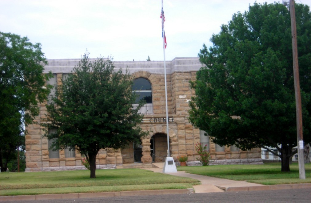
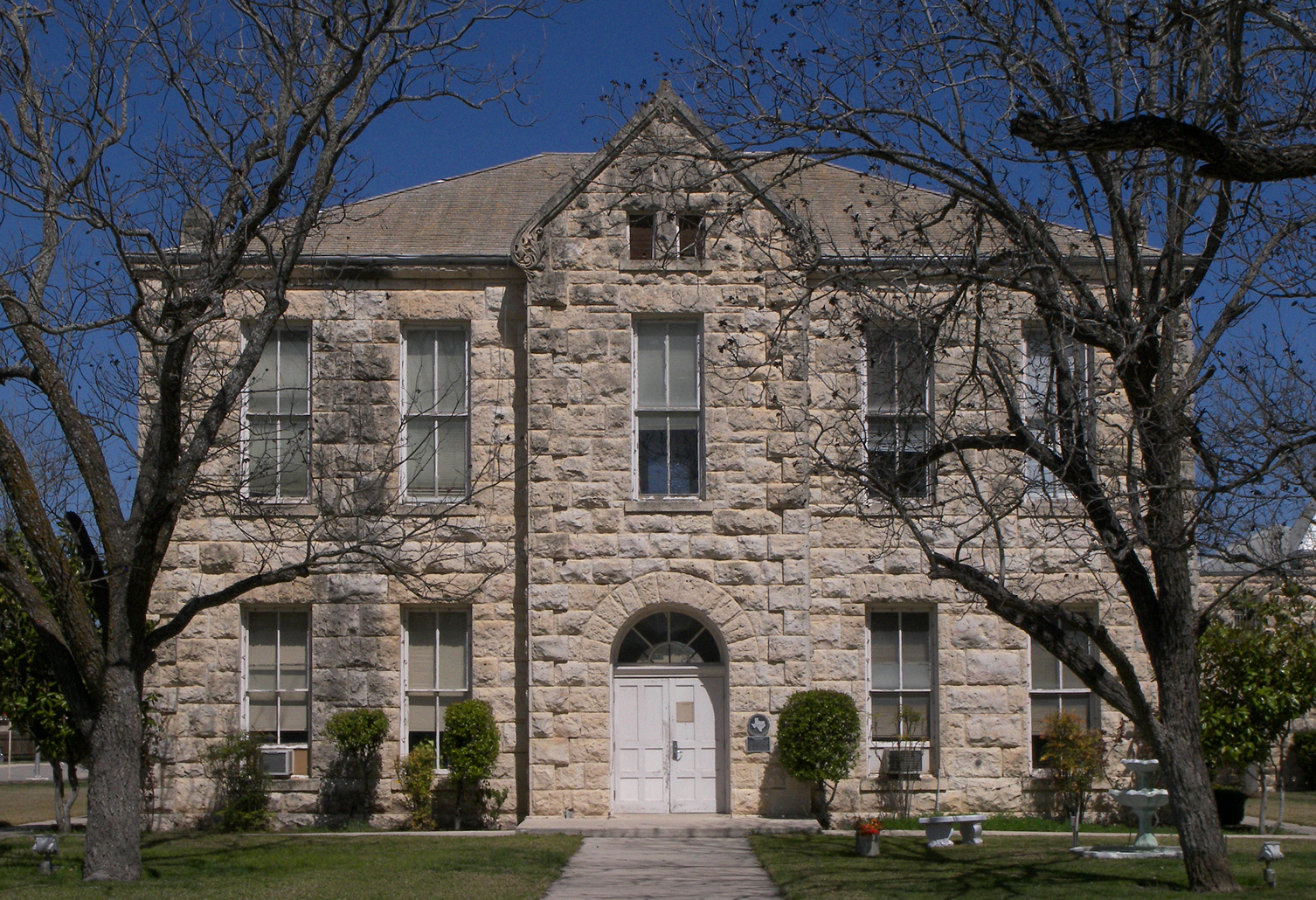
[3] Landmark name Image Date listed Location City or town Summary 1 Edwards County Courthouse and Jail 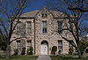
November 7, 1979 Bounded by Austin, Sweeten, Well, and Main Sts.
30°00′58″N 100°12′30″W / 30.016111°N 100.208333°WRocksprings El Paso County
Ellis County
Erath County
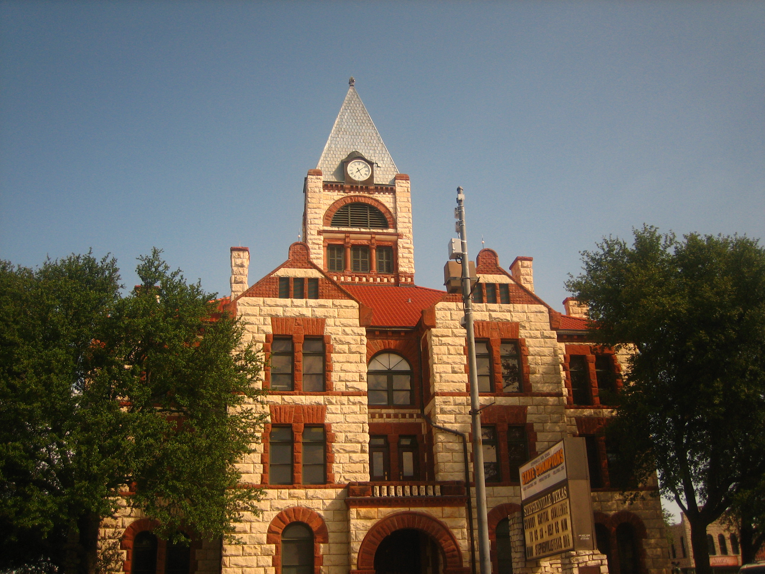
[3] Landmark name Image Date listed Location City or town Summary 1 Berry House May 15, 1980 525 E. Washington St.
32°13′19″N 98°11′57″W / 32.221944°N 98.199167°WStephenville 2 Bluff Dale Suspension Bridge 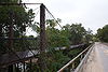
December 20, 1977 Berry's Creek Rd.
32°21′14″N 98°01′34″W / 32.353889°N 98.026111°WBluff Dale 3 Erath County Courthouse 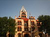
August 18, 1977 Public Sq.
32°13′12″N 98°12′07″W / 32.22°N 98.201944°WStephenville 4 Thurber Historic District August 17, 1979 S of Thurber
32°29′57″N 98°25′54″W / 32.499167°N 98.431667°WThurber 5 Wyatt-Hickie Ranch Complex December 26, 1985 Off US 281 NW of TX 913
32°08′39″N 98°09′08″W / 32.144167°N 98.152222°WStephenville Falls County
[3] Landmark name Image Date listed Location City or town Summary 1 Falls County Courthouse 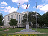
December 13, 2000 1 Courthouse Sq
31°18′25″N 96°53′55″W / 31.306944°N 96.898611°WMarlin 2 Westphalia Rural Historic District 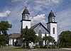
May 15, 1996 Roughly bounded by Co. Rt. 383, Pond Cr., Co. Rts. 377, 368, 372, 373, and the Falls Co. western boundary line
31°07′00″N 97°07′00″W / 31.116667°N 97.116667°WWestphalia Fannin County
[3] Landmark name Image Date listed Location City or town Summary 1 Clendenen-Carleton House May 14, 1979 803 N. Main St.
33°34′52″N 96°10′46″W / 33.581111°N 96.179444°WBonham 2 Haden House January 8, 1980 603 W. Bonham St.
33°25′30″N 95°57′10″W / 33.425°N 95.952778°WLadonia 3 Lake Fannin Organizational Camp June 4, 2001 1 mi (1.6 km). W jct of Cty. Rd. 2025 and State Farm-to-Market Rd. 2554, Caddo National Grasslands
33°46′37″N 96°09′23″W / 33.776944°N 96.156389°WDuplex 4 Sam Rayburn Library and Museum May 6, 2005 800 W. Sam Rayburn Dr.
33°34′42″N 96°11′16″W / 33.578333°N 96.187778°WBonham 5 Samuel T. Rayburn House June 5, 1972 1.5 mi (2.4 km). W of Bonham on U.S. 82
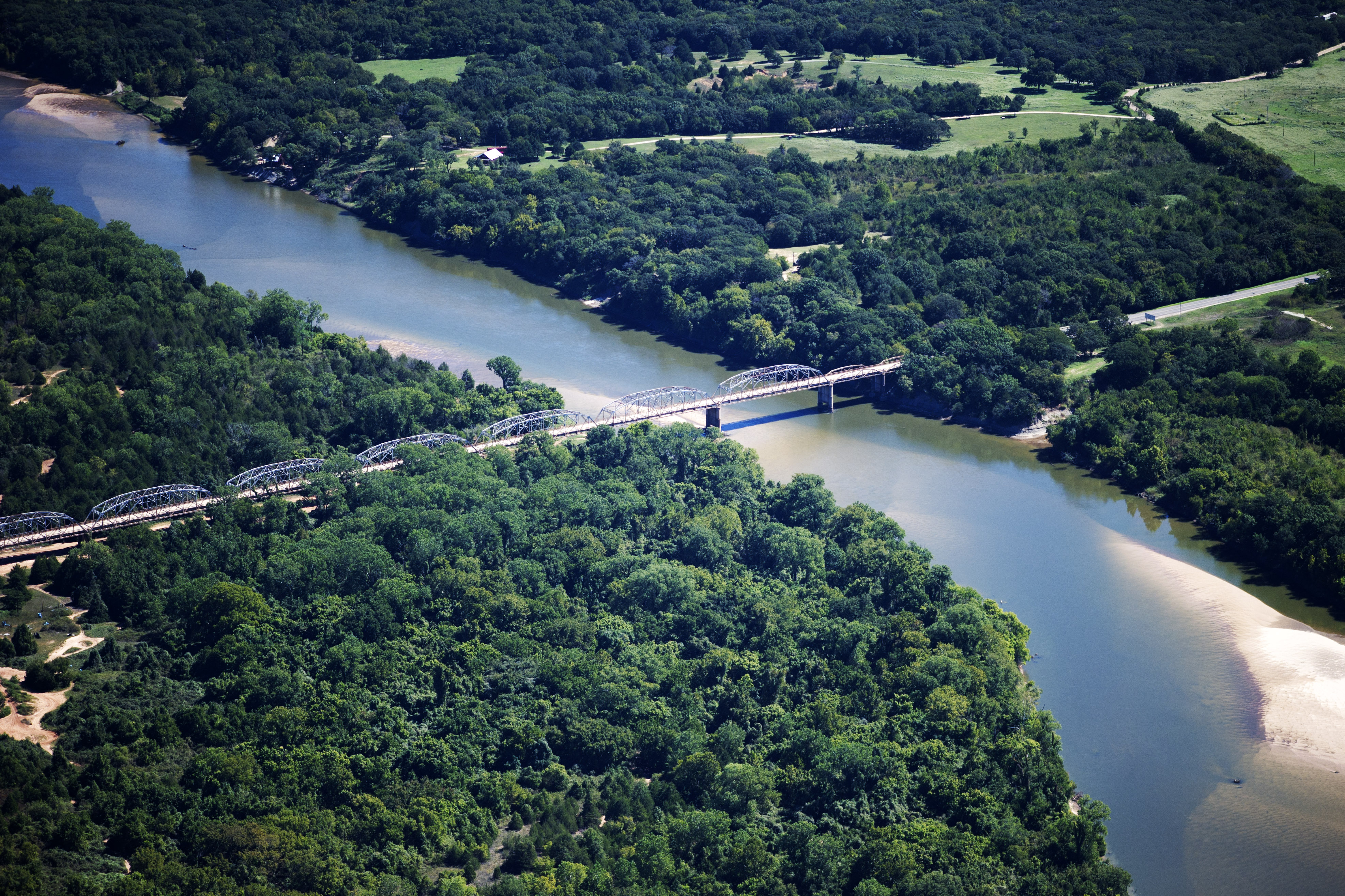
33°34′10″N 96°12′22″W / 33.569444°N 96.206111°WBonham 6 State Highway 78 Bridge at the Red River 
December 20, 1996 OK 78, across the Red River at the OK-TX state line
33°45′10″N 96°11′45″W / 33.752778°N 96.195833°WRavenna 7 Texas and Pacific Railroad Depot January 9, 1997 1 Main St.
33°34′25″N 96°10′45″W / 33.573611°N 96.179167°WBonham 8 Thomas and Katherine Trout House August 23, 1984 705 Poplar St.
33°35′11″N 95°54′16″W / 33.586389°N 95.904444°WHoney Grove Fayette County
Fisher County
[3] Landmark name Image Date listed Location City or town Summary 1 Steadman, Foy, Site March 11, 1971 Address Restricted Noodle Floyd County
[3] Landmark name Image Date listed Location City or town Summary 1 Floyd County Stone Corral September 27, 1984 Address Restricted Floydada 2 Floydada Country Club Site November 7, 1979 Address Restricted Floydada 3 Quitaque Railway Tunnel September 13, 1977 10 mi (16 km). SW of Quitaque
34°14′34″N 101°07′17″W / 34.242778°N 101.121389°WQuitaque Fort Bend County
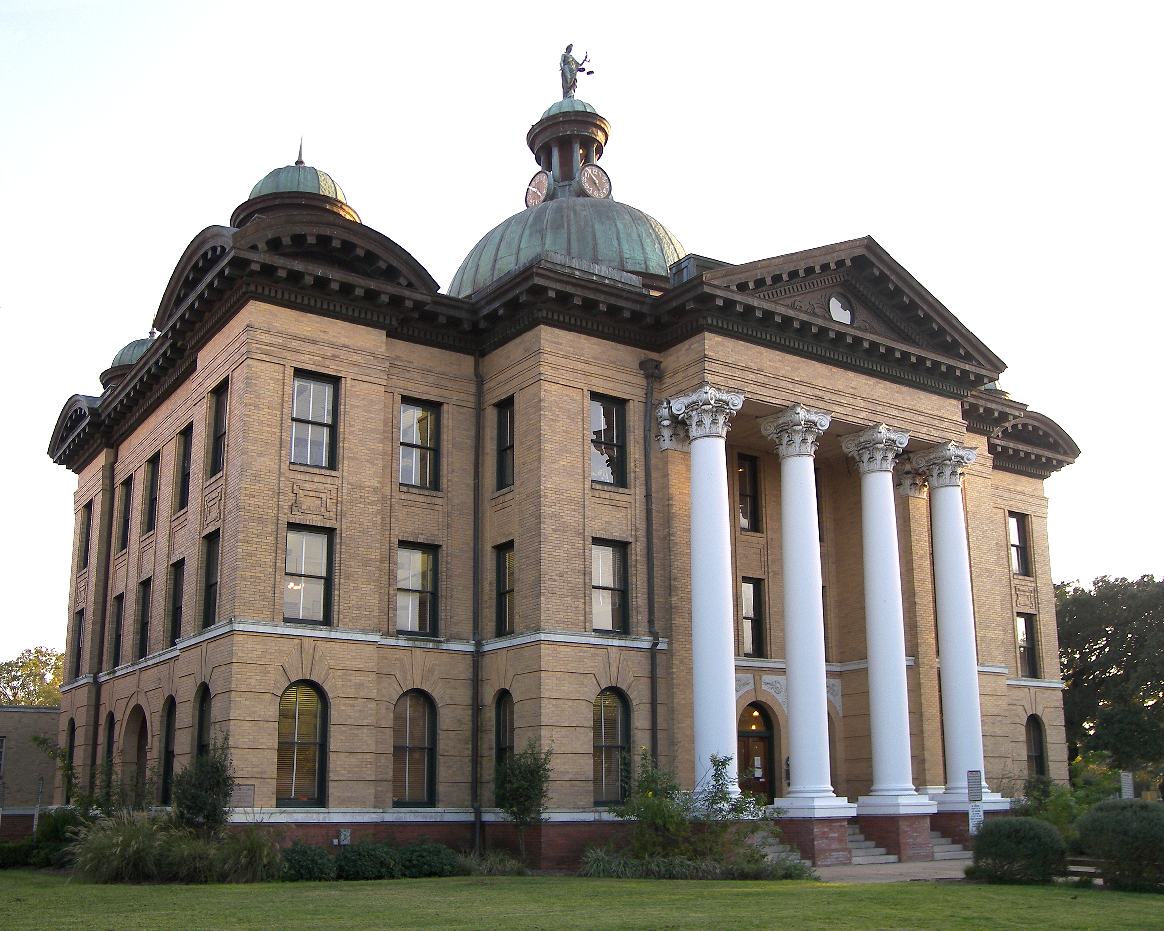
[3] Landmark name Image Date listed Location City or town Summary 1 Fort Bend County Courthouse 
March 13, 1980 400 Jackson St.
29°34′54″N 95°45′42″W / 29.581667°N 95.761667°WRichmond 2 Henry G. and Annie B. Green House September 18, 1996 .5 mi SE of old US 59 and TX 118
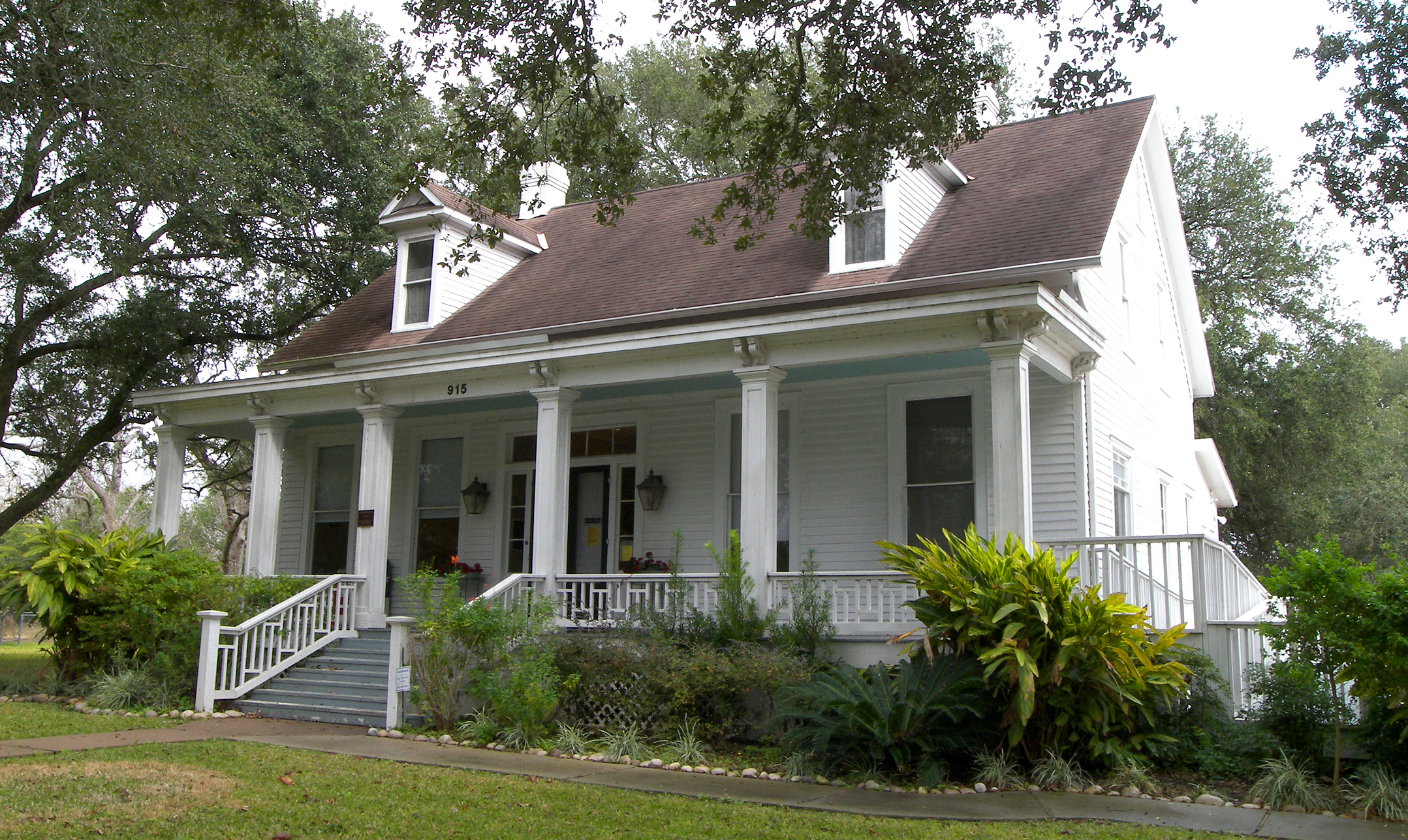
29°26′59″N 95°59′38″W / 29.449722°N 95.993889°WKendleton 3 Lamar-Calder House 
March 30, 2005 915 Front St.
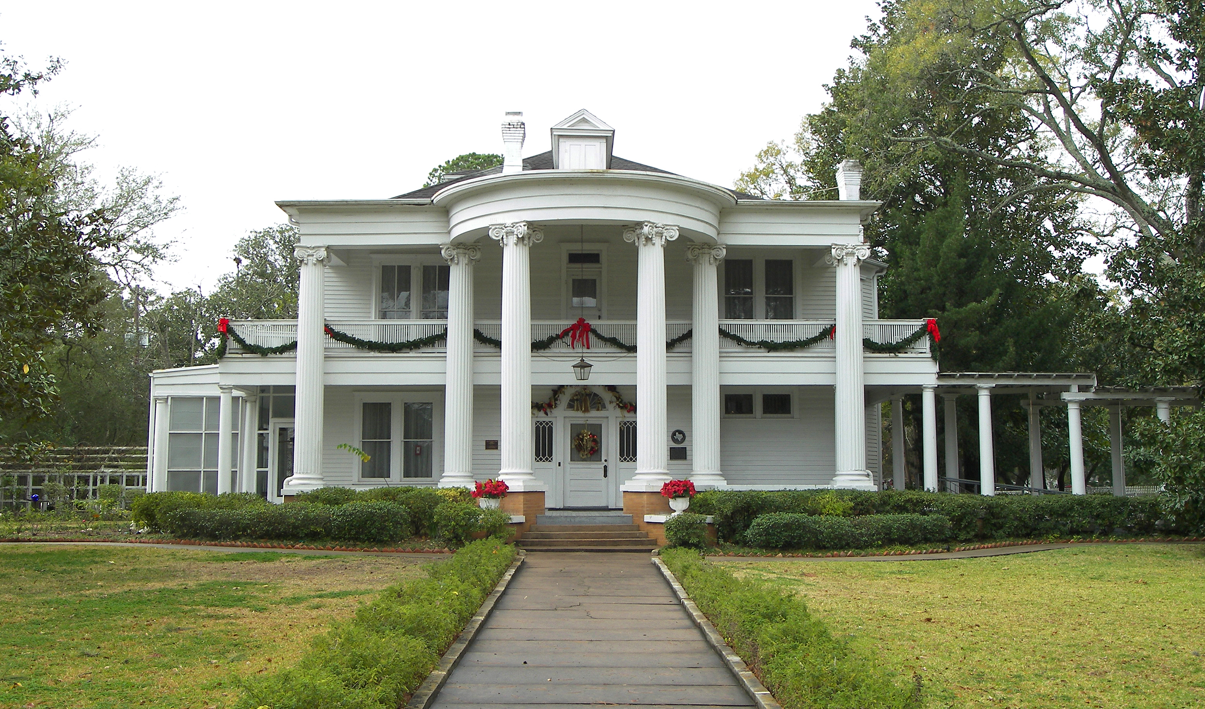
29°34′40″N 95°45′23″W / 29.577778°N 95.756389°WRichmond 4 John M. and Lottie D. Moore House 
September 2001 406 S. Fifth St.
29°34′51″N 95°45′44″W / 29.580833°N 95.762222°WRichmond 5 B. Ray and Charlotte Woods House 
January 6, 2004 610 Woods Ln.
29°47′00″N 95°49′39″W / 29.783333°N 95.8275°WKaty Franklin County
[3] Landmark name Image Date listed Location City or town Summary 1 Franklin County Courthouse and Jail January 18, 2006 200 N Kaufman St.
33°11′21″N 95°13′16″W / 33.189167°N 95.221111°WMount Vernon 2 Rogers-Drummond House September 8, 1980 SE of Mount Vernon
33°07′06″N 95°09′11″W / 33.118333°N 95.153056°WMount Vernon Freestone County
[3] Landmark name Image Date listed Location City or town Summary 1 Trinity and Brazos Valley Railroad Depot and Office Building 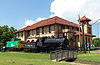
None 208 S. 3rd Ave.
31°37′33″N 96°17′07″W / 31.625833°N 96.285278°WTeague Frio County
[3] Landmark name Image Date listed Location City or town Summary 1 Old Frio County Jail November 19, 1979 E. Medina and S. Pecan Sts.
28°53′16″N 99°05′35″W / 28.887778°N 99.093056°WPearsall AKA Frio Pioneer Jail Museum Galveston County
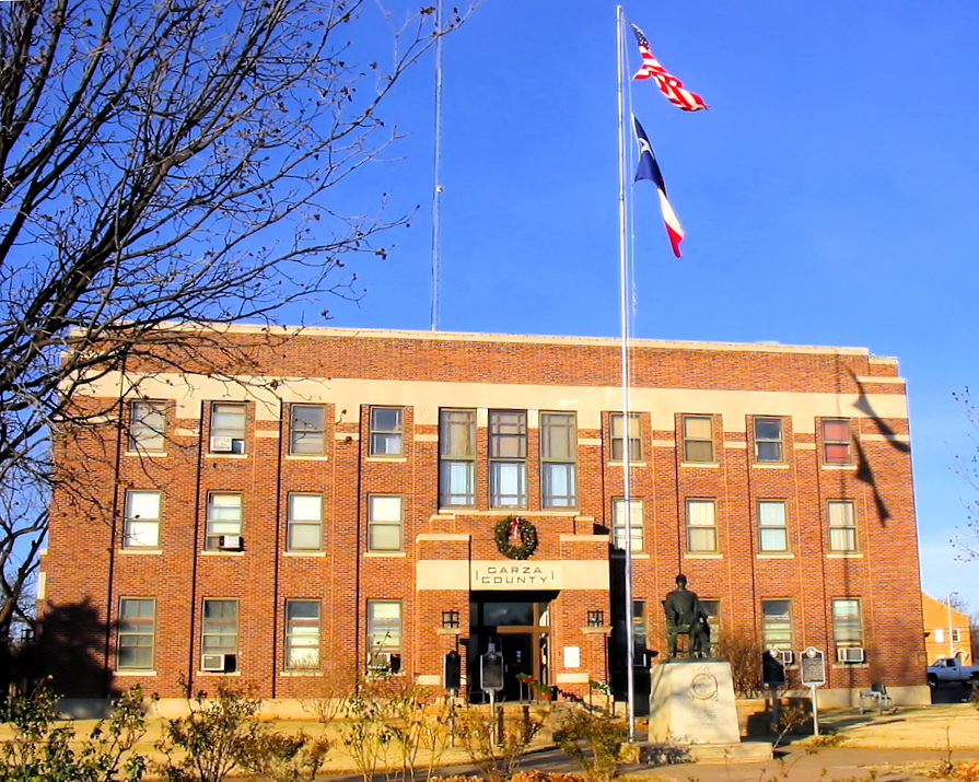
Garza County
[3] Landmark name Image Date listed Location City or town Summary 1 Cooper's Canyon Site 41 GR 25 November 7, 1978 Address Restricted Post 2 Garza County Courthouse 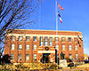
November 21, 2001 300 W. Main St.
33°11′27″N 101°22′53″W / 33.190833°N 101.381389°WPost 3 O.S. Ranch Petroglyphs 41 GR 57 January 31, 1978 Address Restricted Post 4 Old Algerita Hotel April 23, 1975 S corner of Main and Ave. I
33°11′27″N 101°22′37″W / 33.190833°N 101.376944°WPost 5 Old Post Sanitarium May 21, 1975 117 North Ave. N
33°11′31″N 101°23′01″W / 33.191944°N 101.383611°WPost 6 Post West Dugout May 22, 1978 Address Restricted Post 7 Post-Montgomery Site 41 GR 188 November 7, 1978 Address Restricted Post Gillespie County
Glasscock County
[3] Landmark name Image Date listed Location City or town Summary 1 Glasscock County Courthouse and Jail March 21, 2011 117 E Currie St
31°51′49″N 101°28′51″W / 31.863681°N 101.480764°WGarden City Goliad County
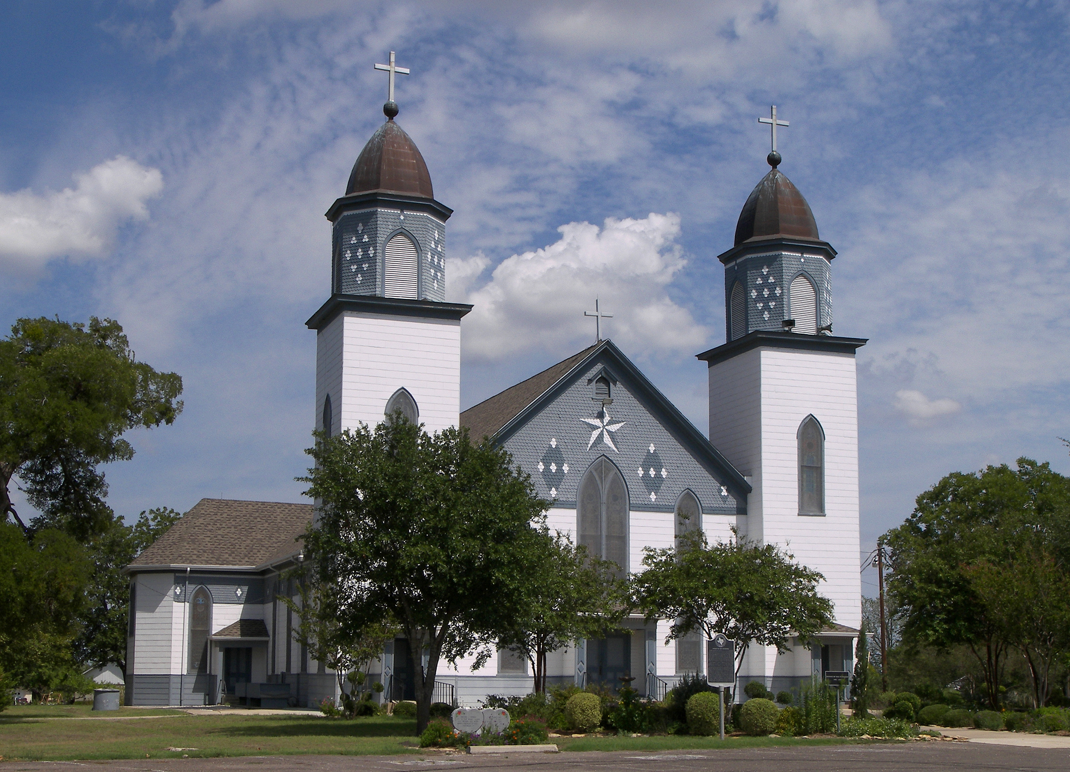
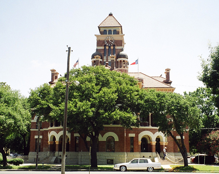
Gonzales County
[3] Landmark name Image Date listed Location City or town Summary 1 Braches House March 11, 1971 12 mi (19 km). SE of Gonzales off U.S. 90A
29°28′33″N 97°18′32″W / 29.475833°N 97.308889°WGonzales 2 Cuero I Archeological District October 9, 1974 Address Restricted Cuero 3 Gonzales Commercial Historic District August 30, 1996 Roughly bounded by Water, Saint Andrew, Saint Peter, and Saint Matthew Sts.
29°30′05″N 97°27′11″W / 29.501389°N 97.453056°WGonzales 4 Gonzales County Courthouse 
June 19, 1972 Bounded by St. Louis, St. Paul. St. Lawrence, and St. Joseph Sts.
29°30′02″N 97°27′07″W / 29.500556°N 97.451944°WGonzales 5 Gonzales County Jail May 21, 1975 Courthouse Sq. on St. Lawrence St.
29°30′05″N 97°27′07″W / 29.501389°N 97.451944°WGonzales 6 Gonzales Memorial Museum and Amphitheater Historic District January 13, 2004 414 Smith St.
29°30′14″N 97°26′37″W / 29.503889°N 97.443611°WGonzales 7 William Buckner and Sue Houston House August 14, 2003 621 E. St. George St.
29°30′12″N 97°26′58″W / 29.503333°N 97.449444°WGonzales 8 Kennard House January 25, 1971 621 St. Louis St.
29°30′21″N 97°28′10″W / 29.505833°N 97.469444°WGonzales 9 Leesville Schoolhouse May 25, 1978 E of Leesville off TX 80
29°24′23″N 97°43′57″W / 29.406389°N 97.7325°WLeesville 10 Thomas Harrison and Mollie Spooner House July 5, 2003 207 St. Francis St.
29°30′10″N 97°27′20″W / 29.502778°N 97.455556°WGonzales Gray County
[3] Landmark name Image Date listed Location City or town Summary 1 Central Fire Station December 30, 1999 203 W. Foster
35°32′06″N 100°57′44″W / 35.535°N 100.962222°WPampa 2 Combs-Worley Building December 30, 1999 120 W. Kingsmille
35°32′12″N 100°57′46″W / 35.536667°N 100.962778°WPampa 3 Gray County Courthouse February 20, 1998 205 N. Russell
35°32′12″N 100°57′50″W / 35.536667°N 100.963889°WPampa 4 McLean Commercial Historic District December 20, 2006 Roughly bounded by Railroad, Rowe, Second and Gray Sts. McLean 5 Pampa City Hall December 30, 1999 200 W. Foster
35°32′08″N 100°57′46″W / 35.535556°N 100.962778°WPampa 6 Schneider Hotel December 19, 1985 120 S. Russell
35°32′04″N 100°57′42″W / 35.534444°N 100.961667°WPampa 7 US Post Office-Pampa Main November 17, 1986 120 E. Foster
35°32′10″N 100°57′36″W / 35.536111°N 100.96°WPampa 8 White Deer Land Company Building January 14, 2000 116 S. Cuyler
35°32′05″N 100°57′38″W / 35.534722°N 100.960556°WPampa Grayson County
[3] Landmark name Image Date listed Location City or town Summary 1 Capt. Noble Allan Birge House September 18, 1986 727 W. Birge
33°38′42″N 96°37′05″W / 33.645°N 96.618056°WSherman 2 George Braun House November 20, 1975 421 N. Austin Ave.
33°45′33″N 96°32′13″W / 33.759167°N 96.536944°WDenison 3 Denison Commercial Historic District November 10, 1983 Roughly Woodard, Main and Chestnut Sts.
33°45′19″N 96°32′22″W / 33.755278°N 96.539444°WDenison 4 Hall Furniture Building September 14, 2002 118 W. Lamar
33°38′08″N 96°36′34″W / 33.635556°N 96.609444°WSherman 5 Ernst Martin Kohl Building July 12, 1976 300 E. Main St.
33°45′17″N 96°31′54″W / 33.754722°N 96.531667°WDenison 6 Old Sherman Public Library October 23, 1986 301 S. Walnut
33°38′05″N 96°36′24″W / 33.634722°N 96.606667°WSherman 7 Sherman US Post Office and Courthouse September 29, 2000 101 E. Pecan St.
33°38′20″N 96°36′33″W / 33.638889°N 96.609167°WSherman 8 Umphress-Taylor House September 12, 1986 301 Paris St.
33°24′57″N 96°34′24″W / 33.415833°N 96.573333°WVan Alstyne Gregg County
[3] Landmark name Image Date listed Location City or town Summary 1 Everett Building November 15, 1979 214-216 Fredonia St.
32°29′43″N 94°44′19″W / 32.495278°N 94.738611°WLongview 2 Northcutt House May 22, 1978 313 S. Fredonia St.
32°29′29″N 94°44′27″W / 32.491389°N 94.740833°WLongview 3 Nuggett Hill Historic District May 1, 1998 Roughly bounded by W. Marshall, N. 6th, Padon, and Teague Sts.
32°30′06″N 94°43′35″W / 32.501667°N 94.726389°WLongview 4 Whaley House May 23, 1980 101 E. Whaley St.
32°29′51″N 94°44′18″W / 32.4975°N 94.738333°WLongview Grimes County
[3] Landmark name Image Date listed Location City or town Summary 1 Anderson Historic District 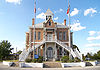
March 15, 1974 Anderson and environs
30°29′02″N 95°59′08″W / 30.483889°N 95.985556°WAnderson 2 Foster House 
September 8, 1980 E of Navasota on TX 90
30°24′33″N 96°03′00″W / 30.409167°N 96.05°WNavasota 3 Navasota Commercial Historic District 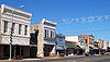
November 30, 1982 Roughly bounded by La Salle, Holland, 9th, and Brule Sts.
30°23′15″N 96°05′23″W / 30.3875°N 96.089722°WNavasota 4 P. A. Smith Hotel 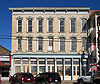
April 16, 1976 111 Railroad St.
30°23′14″N 96°05′22″W / 30.387222°N 96.089444°WNavasota 5 Piedmont Springs Archeological Site July 29, 1982 Address Restricted Anderson 6 Steele House 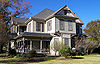
June 13, 1978 217 Brewer St.
30°23′20″N 96°05′03″W / 30.388889°N 96.084167°WNavasota Guadalupe County
See also
References
- ^ The latitude and longitude information provided in this table was derived originally from the National Register Information System, which has been found to be fairly accurate for about 99% of listings. For about 1% of NRIS original coordinates, experience has shown that one or both coordinates are typos or otherwise extremely far off; some corrections may have been made. A more subtle problem causes many locations to be off by up to 150 yards, depending on location in the country: most NRIS coordinates were derived from tracing out latitude and longitudes off of USGS topographical quadrant maps created under the North American Datum of 1927, which differs from the current, highly accurate WGS84 GPS system used by Google maps. Chicago is about right, but NRIS longitudes in Washington are higher by about 4.5 seconds, and are lower by about 2.0 seconds in Maine. Latitudes differ by about 1.0 second in Florida. Some locations in this table may have been corrected to current GPS standards.
- ^ "National Register of Historic Places: Weekly List Actions". National Park Service, United States Department of the Interior. Retrieved on November 10, 2011.
- ^ a b Numbers represent an ordering by significant words. Various colorings, defined here, differentiate National Historic Landmark sites and National Register of Historic Places Districts from other NRHP buildings, structures, sites or objects.
- ^ "National Register Information System". National Register of Historic Places. National Park Service. . http://nrhp.focus.nps.gov/natreg/docs/All_Data.html.
U.S. National Register of Historic Places Topics Lists by states Alabama • Alaska • Arizona • Arkansas • California • Colorado • Connecticut • Delaware • Florida • Georgia • Hawaii • Idaho • Illinois • Indiana • Iowa • Kansas • Kentucky • Louisiana • Maine • Maryland • Massachusetts • Michigan • Minnesota • Mississippi • Missouri • Montana • Nebraska • Nevada • New Hampshire • New Jersey • New Mexico • New York • North Carolina • North Dakota • Ohio • Oklahoma • Oregon • Pennsylvania • Rhode Island • South Carolina • South Dakota • Tennessee • Texas • Utah • Vermont • Virginia • Washington • West Virginia • Wisconsin • WyomingLists by territories Lists by associated states Other Categories:- National Register of Historic Places in Texas
-


Wikimedia Foundation. 2010.