- Asherton, Texas
Infobox Settlement
official_name = Asherton, Texas
settlement_type =City
nickname =
motto =
imagesize =
image_caption =
image_
mapsize = 250px
map_caption = Location of Asherton, Texas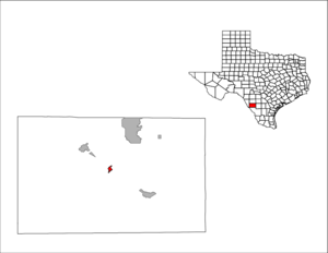
mapsize1 = 250px
map_caption1 =subdivision_type = Country
subdivision_name =United States
subdivision_type1 = State
subdivision_name1 =Texas
subdivision_type2 = County
subdivision_name2 = Dimmitgovernment_footnotes =
government_type =
leader_title =
leader_name =
leader_title1 =
leader_name1 =
established_title =
established_date =unit_pref = Imperial
area_footnotes =area_magnitude =
area_total_km2 = 2.2
area_land_km2 = 2.2
area_water_km2 = 0.0
area_total_sq_mi = 0.8
area_land_sq_mi = 0.8
area_water_sq_mi = 0.0population_as_of = 2000
population_footnotes =
population_total = 1342
population_density_km2 = 621.5
population_density_sq_mi = 1609.6timezone = Central (CST)
utc_offset = -6
timezone_DST = CDT
utc_offset_DST = -5
elevation_footnotes =
elevation_m = 163
elevation_ft = 535
latd = 28 |latm = 26 |lats = 50 |latNS = N
longd = 99 |longm = 45 |longs = 41 |longEW = Wpostal_code_type =
ZIP code
postal_code = 78827
area_code = 830
blank_name = FIPS code
blank_info = 48-04300GR|2
blank1_name = GNIS feature ID
blank1_info = 1377157GR|3
website =
footnotes =Asherton is a city in Dimmit County,
Texas ,United States . The population was 1,342 at the2000 census .U.S. Highway 83 runs through Asherton.Geography
Asherton is located at coor dms|28|26|50|N|99|45|41|W|city (28.447159, -99.761504)GR|1.
According to the
United States Census Bureau , the city has a total area of 0.8square mile s (2.1km² ), all of it land.Demographics
As of the
census GR|2 of 2000, there were 1,342 people, 428 households, and 341 families residing in the city. Thepopulation density was 1,609.6 people per square mile (624.3/km²). There were 535 housing units at an average density of 641.7/sq mi (248.9/km²). The racial makeup of the city was 75.56% White, 0.15% African American, 0.15% Native American, 0.07% Asian, 21.39% from other races, and 2.68% from two or more races. Hispanic or Latino of any race were 94.78% of the population.There were 428 households out of which 42.8% had children under the age of 18 living with them, 56.8% were married couples living together, 18.5% had a female householder with no husband present, and 20.3% were non-families. 18.9% of all households were made up of individuals and 11.2% had someone living alone who was 65 years of age or older. The average household size was 3.13 and the average family size was 3.62.
In the city the population was spread out with 35.2% under the age of 18, 7.6% from 18 to 24, 23.6% from 25 to 44, 20.8% from 45 to 64, and 12.8% who were 65 years of age or older. The median age was 31 years. For every 100 females there were 87.7 males. For every 100 females age 18 and over, there were 83.2 males.
The median income for a household in the city was $20,417, and the median income for a family was $24,107. Males had a median income of $23,281 versus $17,500 for females. The
per capita income for the city was $7,746. About 29.9% of families and 35.8% of the population were below thepoverty line , including 40.8% of those under age 18 and 41.8% of those age 65 or over.Education
The city is served by the
Carrizo Springs Consolidated Independent School District .Schools that serve Asherton include:
* Asherton Elementary School (PreK-6)
* Carrizo Springs Junior High School (7-8)
*Carrizo Springs High School (9-12)Prior to the fall of
1999 , theAsherton Independent School District served Asherton. AISD was forced to close because of concerns about [http://www.wmich.edu/evalctr/rsi/CarrizoSprings.htm] taxation.References
External links
*

Wikimedia Foundation. 2010.