- National Register of Historic Places listings in Missouri, Counties D–I
-
List of properties in Missouri, Counties D-I, on the National Register of Historic Places:
Contents: Counties in Missouri A-B · C · D-I · Jackson · J-K · L-N · O-St. · St. Louis · Ste.-Z Dade - Dallas - Daviess - DeKalb - Dent - Douglas - Dunklin - Franklin - Gasconade - Gentry - Greene - Grundy - Harrison - Henry - Hickory - Holt - Howard - Howell - Iron -
- This National Park Service list is complete through NPS recent listings posted November 10, 2011.[1]
Dade County
[2] Landmark name Image Date listed Location City or town Summary 1 Dilday Mill August 26, 1977 SE of South Greenfield on Turnback Creek
37°19′31″N 93°46′49″W / 37.325278°N 93.780278°WSouth Greenfield Collapsed in 1982.[3] 2 Greenfield Opera House Building December 10, 1998 Jct. of Water and Allison Sts.
37°24′53″N 93°50′27″W / 37.414722°N 93.840833°WGreenfield 3 Washington Hotel October 16, 2002 2 S. Main St.
37°24′56″N 93°50′24″W / 37.415556°N 93.84°WGreenfield Dallas County
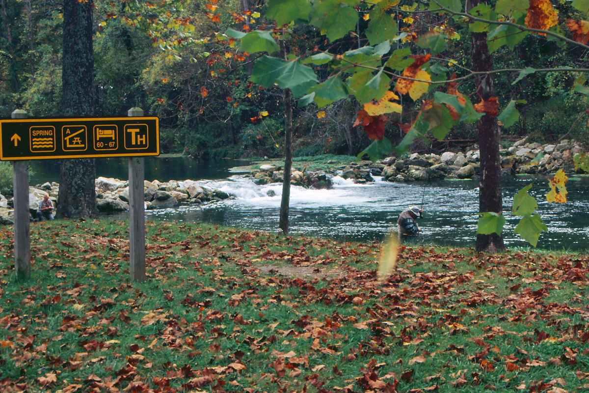
[2] Landmark name Image Date listed Location City or town Summary 1 Bennett Spring State Park Hatchery-Lodge Area Historic District 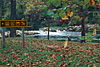
March 4, 1985 MO A64
37°43′31″N 92°51′24″W / 37.725278°N 92.856667°WBennett Spring At Bennett Spring State Park 2 Bennett Spring State Park Shelter House and Water Gauge Station February 28, 1985 Off MO A64
37°43′01″N 92°51′27″W / 37.716944°N 92.8575°WBennett Spring At Bennett Spring State Park Daviess County
[2] Landmark name Image Date listed Location City or town Summary 1 Daviess County Courthouse November 14, 1980 Public Sq.
39°54′55″N 93°57′44″W / 39.915278°N 93.962222°WGallatin 2 Daviess County Rotary Jail and Sheriff's Residence February 23, 1990 310 W. Jackson
39°54′55″N 93°57′50″W / 39.915278°N 93.963889°WGallatin 3 A. Ray Taylor House April 12, 1982 212 W. Van Buren St.
39°54′48″N 93°57′50″W / 39.913333°N 93.963889°WGallatin De Kalb County
[2] Landmark name Image Date listed Location City or town Summary 1 Dalton-Uphoff House April 12, 1982 N of Stewartsville
39°51′12″N 94°29′58″W / 39.853333°N 94.499444°WStewartsville 2 DeKalb County Courthouse February 5, 1998 109 W. Main St.
39°53′24″N 94°21′35″W / 39.89°N 94.359722°WMaysville 3 Absolom Riggs House April 12, 1982 SR 1
39°55′32″N 94°15′12″W / 39.925556°N 94.253333°WWeatherby Dent County
[2] Landmark name Image Date listed Location City or town Summary 1 Dam and Spillway in the Hatchery Area at Montauk State Park February 26, 1985 Off MO 119
37°27′19″N 91°41′05″W / 37.455278°N 91.684722°WSalem 2 Dent County Courthouse February 23, 1972 Main and 4th Sts.
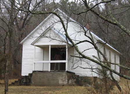
37°38′44″N 91°32′08″W / 37.645556°N 91.535556°WSalem 3 Lower Parker School 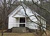
May 31, 1991 E bank of Current R. at Parker Hollow, Ozark National Scenic Riverways
37°26′22″N 91°37′24″W / 37.439444°N 91.623333°WSalem 4 Montauk State Park Open Shelter February 28, 1985 Off MO 119
37°27′01″N 91°41′16″W / 37.450278°N 91.687778°WSalem 5 Nichols Farm District 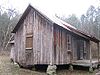
December 27, 1989 W of Co. Rd. V, N of Current River
37°26′31″N 91°37′13″W / 37.441944°N 91.620278°WCedar Grove 6 Nova Scotia Ironworks Historic District August 25, 2003 Mark Twain National Forest
37°30′47″N 91°19′47″W / 37.513056°N 91.329722°WSalem 7 Old Mill at Montauk State Park June 27, 1985 Off MO 119
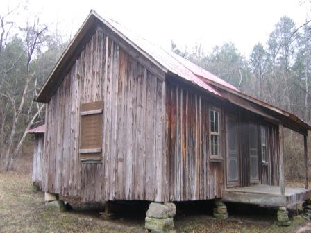
37°27′02″N 91°41′00″W / 37.450556°N 91.683333°WSalem 8 W. A. Young House March 30, 1989 CR 513
37°37′02″N 91°27′25″W / 37.617222°N 91.456944°WSalem Douglas County
[2] Landmark name Image Date listed Location City or town Summary 1 Ava Ranger Station Historic District August 4, 2003 MO 5S
36°56′15″N 92°39′41″W / 36.9375°N 92.661389°WAva 2 Southwest Missouri Prehistoric Rock Shelter and Cave Sites Discontiguous Archeological District 
October 24, 1991 Address Restricted Dogwood Dunklin County
[2] Landmark name Image Date listed Location City or town Summary 1 Charles and Bettie Birthright House October 30, 2009 109 S. Main St.
36°27′02″N 89°58′02″W / 36.450597°N 89.967253°WClarkton 2 Campbell Commercial Historic District October 8, 1991 Roughly bounded by Magnolia St., Martin Ave., Locust St. and the St. Louis & Southwest RR tracks
36°29′35″N 90°04′30″W / 36.493056°N 90.075°WCampbell 3 Ely and Walker Shirt Factory No. 5 March 12, 2008 221 S Main St.
36°14′07″N 90°03′26″W / 36.235278°N 90.057222°WKennett 4 Kennett Archeological Site February 17, 1978 Address Restricted Kennett 5 Kennett City Hall and Masonic Lodge September 17, 1981 122 College St.
36°14′11″N 90°04′08″W / 36.236389°N 90.068889°WKennett 6 Langdon Site January 11, 1974 Address Restricted Hornersville 7 Little River Lake Discontiguous Archeological District December 16, 1998 Address Restricted Kennett 8 Given Owens House March 29, 1983 Off MO 53
36°30′30″N 90°06′25″W / 36.508333°N 90.106944°WCampbell Franklin County
Gasconade County
[2] Landmark name Image Date listed Location City or town Summary 1 Hermann Historic District February 1, 1972 Roughly bounded by E. Wharf, Mozart, E. 5th, and Gellert Sts.; also 214 and 304 Franklin, 301-501 Gellert, and 2202 Route 100; also roughly bounded by Wharf, 1st, Mozart, 5th, Schiller, 4th, Gutenberg, and Reserve Sts.
38°42′19″N 91°26′04″W / 38.705278°N 91.434444°WHermann Second and third sets of boundaries represent boundary increases of November 29, 2006 and October 30, 2009 respectively 2 Kotthoff-Weeks Farm Complex March 28, 1983 Off SR J
38°38′04″N 91°31′50″W / 38.634444°N 91.530556°WHermann 3 Old Stone Hill Historic District May 21, 1969 Bounded roughly by W. 12th, Goethe and Jefferson Sts., and Iron Rd.
38°41′48″N 91°26′45″W / 38.696667°N 91.445833°WHermann 4 Peenie Petroglyph Archeological Site July 29, 1969 Address Restricted Bem 5 William Poeschel House June 21, 1990 W. Tenth St. approximately 2 miles W of Hermann city limits
38°41′43″N 91°28′11″W / 38.695278°N 91.469722°WHermann 6 The Rotunda November 2, 1995 City Park, Washington St.
38°41′57″N 91°26′32″W / 38.699167°N 91.442222°WHermann 7 Ruskaup House March 29, 1983 W of Drake on U.S. 50
38°29′05″N 91°31′53″W / 38.484722°N 91.531389°WDrake 8 Shobe-Morrison House February 10, 1983 W of Morrison off MO 100
38°40′24″N 91°38′16″W / 38.673333°N 91.637778°WMorrison 9 Vallet-Danuser House September 23, 1982 E of Hermann on MO 100
38°42′16″N 91°24′54″W / 38.704444°N 91.415°WHermann Gentry County
[2] Landmark name Image Date listed Location City or town Summary 1 Albany Carnegie Public Library February 23, 1990 101 W. Clay St.
40°14′47″N 94°19′46″W / 40.246389°N 94.329444°WAlbany 2 Gentry County Courthouse September 18, 1980 Public Sq.
40°11′43″N 94°20′01″W / 40.195278°N 94.333611°WAlbany 3 Opera Hall Block May 9, 2002 101-03 W. Vermont/101-03 S. Connecticut
40°03′04″N 94°31′25″W / 40.051111°N 94.523611°WKing City 4 Samuel and Pauline Peery House August 11, 2005 1105 N. Hundley St.
40°15′21″N 94°19′51″W / 40.255833°N 94.330833°WAlbany Greene County
Grundy County
[2] Landmark name Image Date listed Location City or town Summary 1 Crowder State Park Vehicle Bridge March 4, 1985 MO 128
40°05′31″N 93°39′51″W / 40.091944°N 93.664167°WTrenton A bridge in Crowder State Park 2 Jewett Norris Library September 7, 1984 1331 Main St.
40°04′43″N 93°36′22″W / 40.078611°N 93.606111°WTrenton 3 Plaza Hotel July 18, 2001 715 Main St.
40°04′27″N 93°37′08″W / 40.074167°N 93.618889°WTrenton 4 St. Philip's Episcopal Church July 17, 1979 141 E. 9th St.
40°04′25″N 93°37′00″W / 40.073611°N 93.616667°WTrenton 5 Trenton High School April 21, 2010 1312 E. 9th St.
40°04′27″N 93°36′21″W / 40.074283°N 93.605914°WTrenton 6 WPA Stock Barn and Pavilion April 25, 1994 Oklahoma St. at Eastside Park
40°04′41″N 93°35′59″W / 40.078056°N 93.599722°WTrenton Harrison County
[2] Landmark name Image Date listed Location City or town Summary 1 Hamilton House April 11, 1985 1228 W. Main
40°16′06″N 94°02′17″W / 40.268333°N 94.038056°WBethany 2 Slatten House July 9, 1984 MO 4
40°16′24″N 93°56′34″W / 40.273333°N 93.942778°WBethany Henry County
[2] Landmark name Image Date listed Location City or town Summary 1 Anheuser-Busch Brewing Association Building August 9, 1991 203 W. Franklin St.
38°22′15″N 93°46′41″W / 38.370833°N 93.778056°WClinton 2 C. M. and Vina Clark House January 16, 1997 704 California Ave.
38°15′41″N 93°59′09″W / 38.261389°N 93.985833°WMontrose 3 Clinton Square Historic District February 7, 2007 Roughly 100 Blocks on N & S Main; S. Washington; W Franklin; W Jefferson Clinton 4 William F. and Julia Crome House March 25, 1999 305 S. Second St.
38°22′03″N 93°46′27″W / 38.3675°N 93.774167°WClinton 5 Judge Jerubial Gideon Dorman House February 10, 1983 302 W. Franklin St.
38°22′14″N 93°46′47″W / 38.370556°N 93.779722°WClinton 6 Gustave C. Haysler House July 21, 1995 301 S. Second St.
38°22′04″N 93°46′27″W / 38.367778°N 93.774167°WClinton 7 St. Ludger Catholic Church April 13, 1998 Jct. of MO K and High St.
38°17′26″N 94°01′13″W / 38.290556°N 94.020278°WMontrose 8 C. C. Williams House October 21, 1982 303 W. Franklin St.
38°22′16″N 93°46′46″W / 38.371111°N 93.779444°WClinton Hickory County
[2] Landmark name Image Date listed Location City or town Summary 1 Quincy Public Hall April 7, 1995 MO 83
38°00′31″N 93°28′17″W / 38.008611°N 93.471389°WQuincy 2 John Siddle Williams House September 27, 1980 Off U.S. 54
37°56′33″N 93°19′10″W / 37.9425°N 93.319444°WHermitage Holt County
[2] Landmark name Image Date listed Location City or town Summary 1 Carroll Stagecoach Inn August 18, 1983 E of Oregon
39°59′21″N 95°03′27″W / 39.989167°N 95.0575°WOregon 2 Chicago, Burlington and Quincy Depot December 12, 1978 S. State St.
40°07′43″N 95°13′52″W / 40.128611°N 95.231111°WMound City 3 City Hall June 27, 1979 MO 111
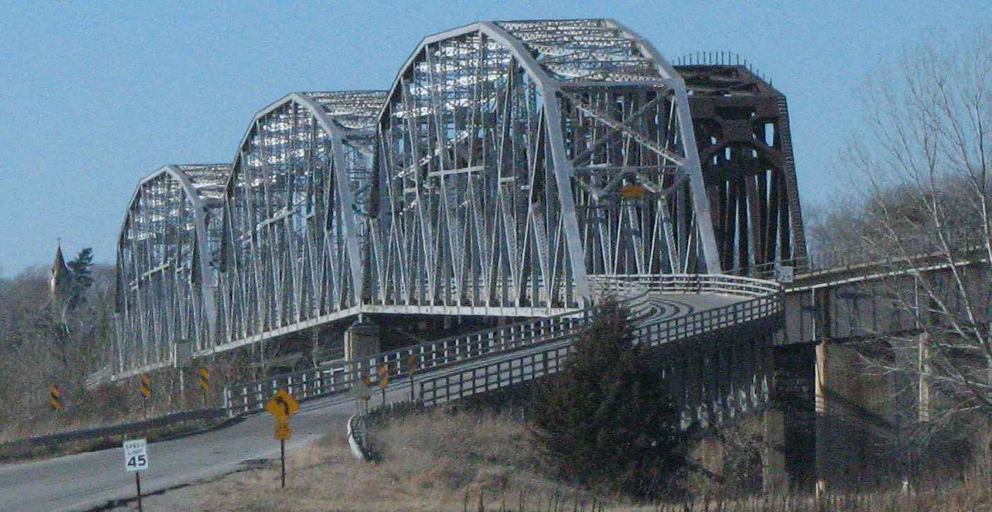
39°58′57″N 95°11′25″W / 39.9825°N 95.190278°WForest City 4 Rulo Bridge 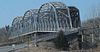
January 4, 1993 US 159 over the Missouri R.
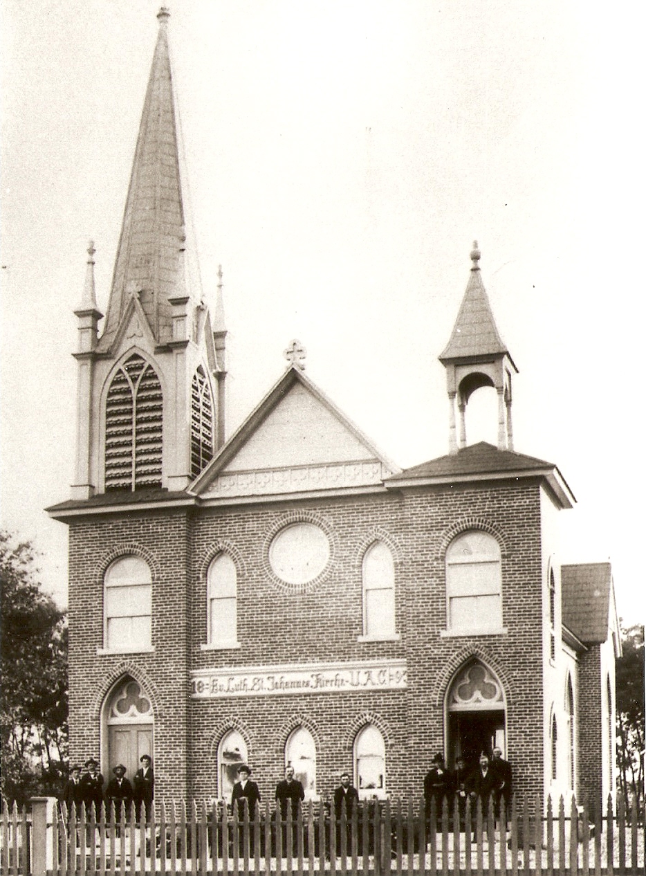
40°03′14″N 95°25′14″W / 40.053889°N 95.420556°WFortescue 5 St. John's Evangelical Lutheran Church and Parochial School 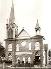
January 4, 2008 112 Walters St.
40°14′52″N 95°27′16″W / 40.247778°N 95.454444°WCorning Howard County
Howell County
[2] Landmark name Image Date listed Location City or town Summary 1 Courthouse Square Historic District July 17, 2003 Roughly bounded by Broadway, Grove St., Court Sq. and Washington Ave.
36°43′43″N 91°51′08″W / 36.728611°N 91.852222°WWest Plains 2 Elledge Arcade Buildings January 26, 2001 28 Court Sq. and 2 Elledge Arcade
36°43′43″N 91°51′10″W / 36.728611°N 91.852778°WWest Plains 3 International Shoe Company Building November 8, 2011 665 Missouri Ave.
36°44′05″N 91°51′31″W / 36.734817°N 91.858728°WWest Plains 4 Mount Zion Lodge Masonic Temple April 15, 2011 304 E. Main St.
36°43′41″N 91°51′01″W / 36.728056°N 91.850278°WWest Plains 5 W. J. and Ed Smith Building January 26, 2001 109-113 Washington Ave.
36°43′44″N 91°51′09″W / 36.728889°N 91.8525°WWest Plains 6 West Plains Bank Building September 7, 2001 107 Washington Ave.
36°43′44″N 91°51′09″W / 36.728889°N 91.8525°WWest Plains Iron County
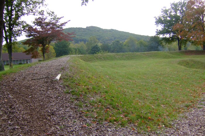
[2] Landmark name Image Date listed Location City or town Summary 1 Fort Davidson 
February 26, 1970 On MO 21, south of its junction with Route V in the Clark National Forest
37°37′45″N 90°38′24″W / 37.629167°N 90.64°WPilot Knob 2 Immanuel Evangelical Lutheran Church January 22, 1979 Palmer and Zeigler Sts.
37°37′34″N 90°38′29″W / 37.626111°N 90.641389°WPilot Knob 3 Iron County Courthouse Buildings June 27, 1979 Courthouse Sq. and 220 S. Shepherd St.
37°35′52″N 90°37′41″W / 37.597778°N 90.628056°WIronton 4 St. Paul's Episcopal Church May 21, 1969 NW corner of Knob and Reynolds Sts.
37°35′59″N 90°37′36″W / 37.599722°N 90.626667°WIronton 5 Ursuline Academy-Arcadia College Historic District July 1, 1998 Jct. of Maine and Maple Sts.
37°34′57″N 90°37′48″W / 37.5825°N 90.63°WArcadia See also
References
- ^ "National Register of Historic Places: Weekly List Actions". National Park Service, United States Department of the Interior. Retrieved on November 10, 2011.
- ^ Numbers represent an ordering by significant words. Various colorings, defined here, differentiate National Historic Landmark sites and National Register of Historic Places Districts from other NRHP buildings, structures, sites or objects.
- ^ http://www.dnr.mo.gov/shpo/Dade.htm
U.S. National Register of Historic Places Topics Lists by states Alabama • Alaska • Arizona • Arkansas • California • Colorado • Connecticut • Delaware • Florida • Georgia • Hawaii • Idaho • Illinois • Indiana • Iowa • Kansas • Kentucky • Louisiana • Maine • Maryland • Massachusetts • Michigan • Minnesota • Mississippi • Missouri • Montana • Nebraska • Nevada • New Hampshire • New Jersey • New Mexico • New York • North Carolina • North Dakota • Ohio • Oklahoma • Oregon • Pennsylvania • Rhode Island • South Carolina • South Dakota • Tennessee • Texas • Utah • Vermont • Virginia • Washington • West Virginia • Wisconsin • WyomingLists by territories Lists by associated states Other Categories:- National Register of Historic Places in Missouri
-
Wikimedia Foundation. 2010.