- National Register of Historic Places listings in Jackson County, Missouri
-
This is a list of properties and historic districts in Jackson County, Missouri (which includes Kansas City, Missouri), that are listed on the National Register of Historic Places. .
Contents: Counties in Missouri A–B · C · D–I · Jackson ·J–K · L–N · O–St. · St. Louis · Ste.–Z -
- This National Park Service list is complete through NPS recent listings posted November 10, 2011.[1]
Jackson County
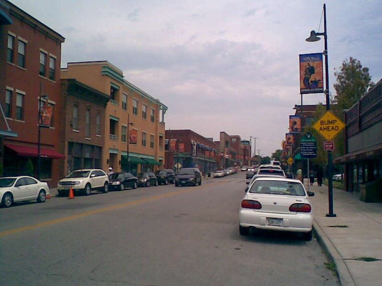
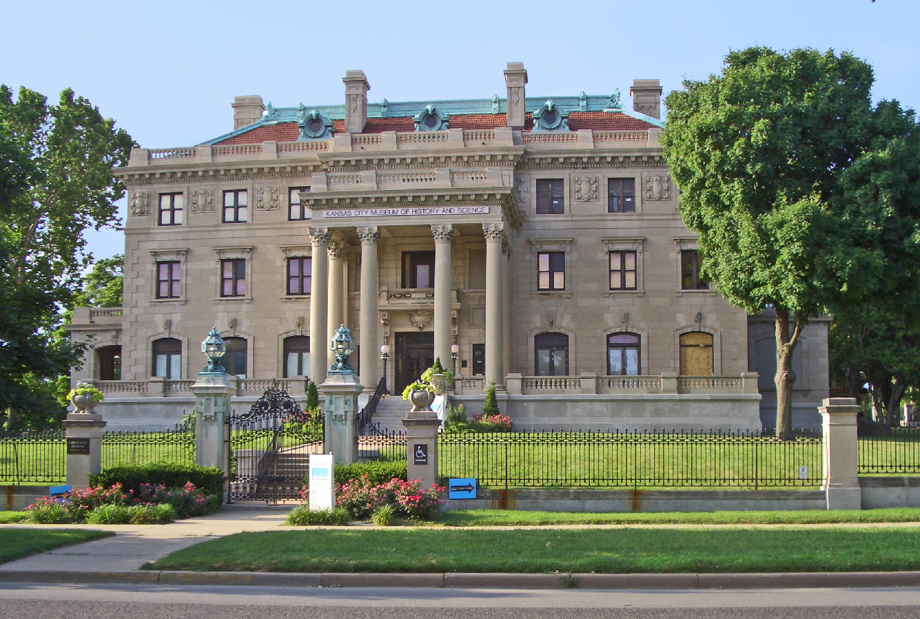
Landmark name Image Date listed Location City or Town Summary 1 1524 Grand Avenue Building April 15, 2004 1524 Grand Boulevard
39°5′49″N 94°34′53″W / 39.09694°N 94.58139°WKansas City 2 18th and Vine Historic District 
September 9, 1991 Roughly bounded by 18th St., Woodland Ave., 19th St. and The Paseo
39°5′20″N 94°33′40″W / 39.08889°N 94.56111°WKansas City 3 1901 McGee Street Automotive Service Building January 22, 2009 1901-1907 McGee St.
39°5′25.08″N 94°34′48.71″W / 39.0903°N 94.5801972°WKansas City 4 A.B.C. Storage and Van Company Building February 1, 2007 1015 E. 8th St.
39°6′21″N 94°34′12″W / 39.10583°N 94.57°WKansas City 5 Acme Brass and Machine Works Building July 14, 2004 609-611 E. 17th St.
39°5′42″N 94°34′34″W / 39.095°N 94.57611°WKansas City 6 Aines Farm Dairy Building October 1, 2008 3110-30 Gillham Rd.
39°4′13.16″N 94°34′44.14″W / 39.0703222°N 94.5789278°WKansas City 7 Alana Apartment Hotel July 5, 2006 2700-2706 Troost Ave. and 1015 E. 27th St.
39°4′46″N 94°34′16″W / 39.07944°N 94.57111°WKansas City 8 Ambassador Hotel Historic District February 17, 1983 3527 and 3600 Broadway and 435 and 441 Knickerbocker Pl.; also 336 W. 36th St. and 3543 Broadway
39°3′45″N 94°35′25″W / 39.0625°N 94.59028°WKansas City Second set of boundaries represents a boundary increase of April 10, 2008 9 Argyle Building August 17, 2005 306 E. 12th St.
39°6′8″N 94°34′45″W / 39.10222°N 94.57917°WKansas City 10 Armour Boulevard Post-World War II Apartment Building Historic District November 7, 2007 640 and 701 E. Armour Boulevard and 3457 Holmes St.
39°3′49″N 94°34′34″W / 39.06361°N 94.57611°WKansas City 11 Attucks School September 9, 1991 1815 Woodland Ave.
39°5′20″N 94°33′33″W / 39.08889°N 94.55917°WKansas City 12 Auto Coach Building April 18, 2007 1730-34 Oak St.
39°5′39″N 94°34′45″W / 39.09417°N 94.57917°WKansas City 13 Bailey Family Farm Historic District July 3, 2006 SW corner of Bailey and Ranson Rds.
38°53′45″N 94°20′29″W / 38.89583°N 94.34139°WLee's Summit 14 Baker-Vawter Building May 5, 2000 915-917 Wyandotte
39°6′21″N 94°35′7″W / 39.10583°N 94.58528°WKansas City 15 Barclay Building February 8, 2007 3613-23 Broadway Boulevard
39°3′50″N 94°35′25″W / 39.06389°N 94.59028°WKansas City 16 Bellefontaine Avenue Historic District February 14, 2011 500-24 Bellefontaine Ave.
39°6′27″N 94°32′50″W / 39.1075°N 94.54722°WKansas City 17 Bellerive Hotel February 28, 1980 214 E. Armour Boulevard
39°3′50″N 94°34′59″W / 39.06389°N 94.58306°WKansas City 18 Thomas Hart Benton House and Studio November 21, 1980 3616 Belleview St.
39°3′38″N 94°35′51″W / 39.06056°N 94.5975°WKansas City 19 Burnette-Berry House February 18, 2011 1030 W. 65th St.
39°0′38″N 94°36′7″W / 39.01056°N 94.60194°WKansas City 20 Beth Shalom Synagogue September 9, 1982 3400 The Paseo
39°3′52″N 94°34′1″W / 39.06444°N 94.56694°WKansas City 21 Bingham-Waggoner House and Estate May 22, 1980 313 W. Pacific Ave.
39°5′7″N 94°25′11″W / 39.08528°N 94.41972°WIndependence 22 Walter E. Bixby House November 21, 1978 6505 State Line Rd.
39°0′38″N 94°36′25″W / 39.01056°N 94.60694°WKansas City 23 Blackstone Hotel October 18, 2003 817 Cherry St.
39°6′20″N 94°34′32″W / 39.10556°N 94.57556°WKansas City 24 Blue Mills April 21, 1994 3101 Lentz Rd.
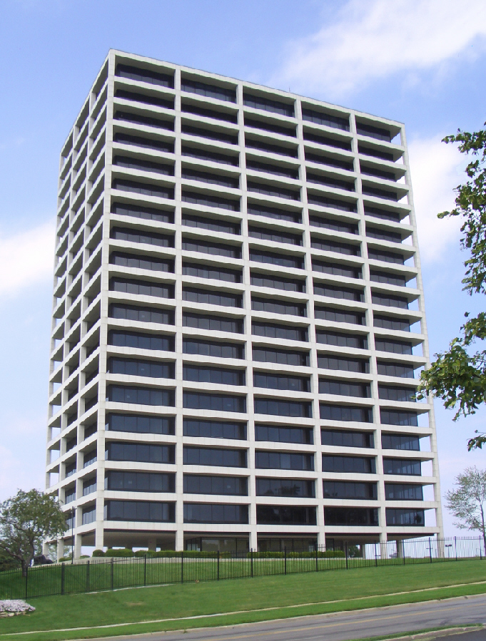
39°9′28″N 94°18′34″W / 39.15778°N 94.30944°WIndependence 25 BMA Tower 
August 21, 2002 700 Karnes Boulevard
39°4′26″N 94°35′35″W / 39.07389°N 94.59306°WKansas City 26 Boley Building 
March 9, 1971 1130 Walnut St.
39°6′0″N 94°34′56″W / 39.1°N 94.58222°WKansas City 27 Bon Air Apartments Building July 30, 2008 4127-4133 Locust St.
39°3′8.34″N 94°34′49.77″W / 39.0523167°N 94.5804917°WKansas City 28 Bonfils Building March 22, 1984 1200 Grand Ave.
39°5′58″N 94°34′52″W / 39.09944°N 94.58111°WKansas City 29 Bryant Building 
April 24, 1989 1102 Grand Ave.
39°6′4″N 94°34′54″W / 39.10111°N 94.58167°WKansas City 30 Dr. John S. Jr. and Harriet Smart Bryant House May 21, 1992 519 S. Main St.
39°5′13″N 94°24′56″W / 39.08694°N 94.41556°WIndependence 31 Buick Automobile Company Building May 5, 2004 216 Admiral Boulevard
39°6′27″N 94°34′47″W / 39.1075°N 94.57972°WKansas City 32 Bunker Building September 5, 1975 820 Baltimore Ave.
39°6′14″N 94°35′3″W / 39.10389°N 94.58417°WKansas City 33 Byram's Ford Historic District October 16, 1989 63rd St. and Manchester Trafficway at Big Blue River
39°1′1″N 94°31′14″W / 39.01694°N 94.52056°WKansas City 34 Cave Spring August 10, 1978 7100 Blue Ridge Extension
38°59′35″N 94°29′5″W / 38.99306°N 94.48472°WKansas City 35 Chambers Building December 28, 2001 25 E. 12th St.
39°6′8″N 94°34′56″W / 39.10222°N 94.58222°WKansas City 36 Philip E. Chappell House August 3, 1990 1836 Pendleton Ave.
39°6′47″N 94°33′30″W / 39.11306°N 94.55833°WKansas City 37 Chatham Hotel June 24, 2008 3701 Broadway
39°3′37.22″N 94°35′25.99″W / 39.0603389°N 94.5905528°WKansas City 38 Cherry Street Colonnades Historic District September 22, 2005 2523,2527,2531,2535,2539,2543,2547,2542, and 2544 Cherry St.
39°4′55″N 94°34′37″W / 39.08194°N 94.57694°WKansas City 39 Chicago Apartments September 11, 1980 1110-1112 E. Armour Boulevard
39°3′52″N 94°34′16″W / 39.06444°N 94.57111°WKansas City 40 Christian Church Hospital October 21, 2004 2524 W. Paseo Boulevard
39°4′50″N 94°33′55″W / 39.08056°N 94.56528°WKansas City 41 Circle Apartments October 22, 2002 1200 Paseo Boulevard
39°6′4″N 94°33′53″W / 39.10111°N 94.56472°WKansas City 42 City Bank Building February 17, 1983 1801 Grand Ave.
39°5′30″N 94°34′51″W / 39.09167°N 94.58083°WKansas City 43 Coates House Hotel February 23, 1972 1005 Broadway
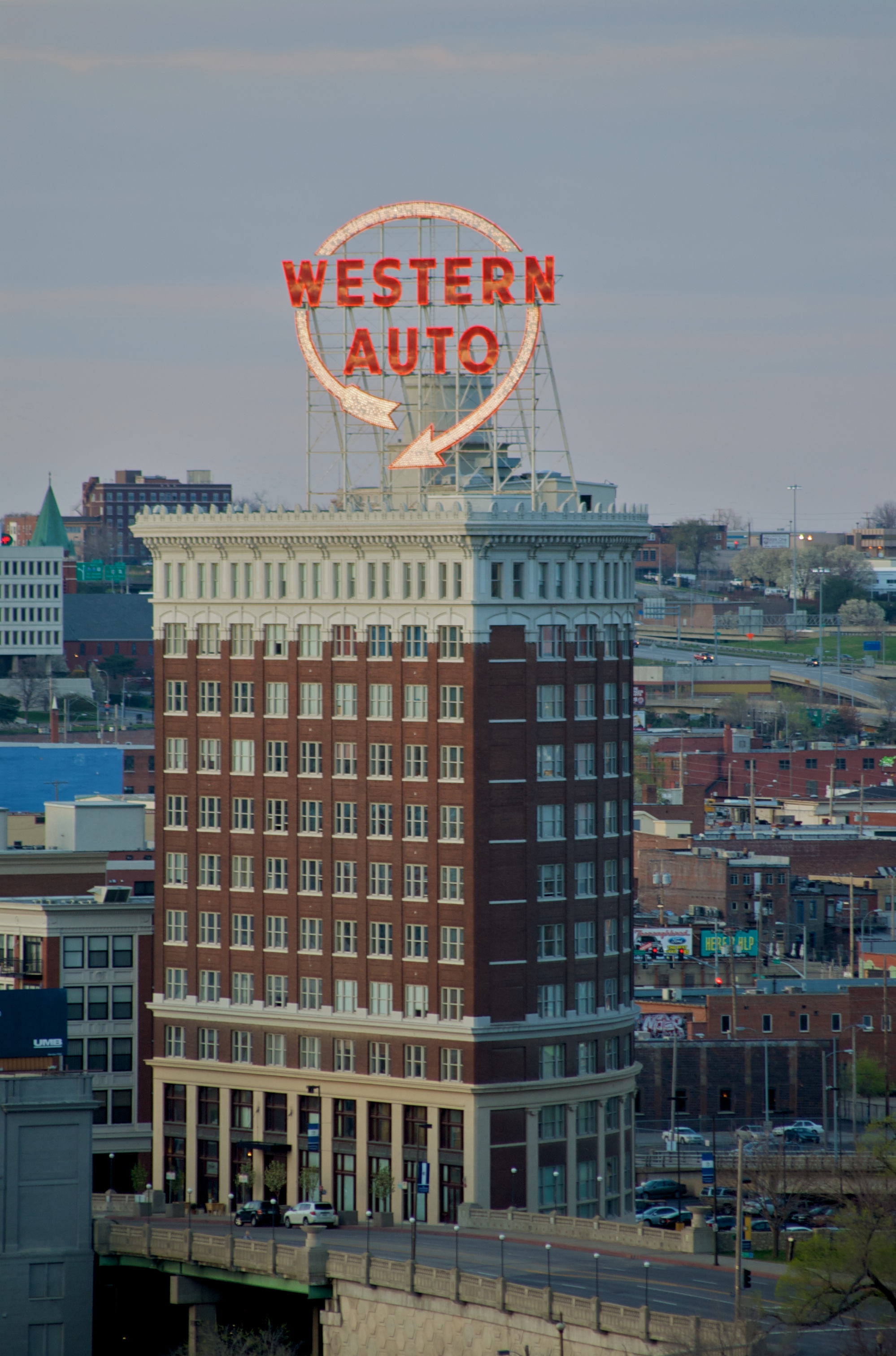
39°6′8″N 94°35′17″W / 39.10222°N 94.58806°WKansas City 44 Coca-Cola Building 
August 18, 1988 2101-2111 Grand Ave.
39°5′16″N 94°34′52″W / 39.08778°N 94.58111°WKansas City Also known as the Western Auto Building 45 Colonnade Apartment Building at 4302 Oak Street September 4, 2008 4302 Oak St.
39°2′57.17″N 94°34′54.76″W / 39.0492139°N 94.5818778°WKansas City 46 Columbia Building May 5, 2000 2006-2012 Wyandotte St.
39°5′19.99″N 94°35′10.02″W / 39.0888861°N 94.5861167°WKansas City 47 Continental Hotel 
August 8, 1983 106 W. 11th St.
39°6′5″N 94°35′4″W / 39.10139°N 94.58444°WKansas City Also known as Mark Twain Tower 48 Bernard Corrigan House 
January 18, 1978 1200 W. 55th St.
39°1′42″N 94°36′13″W / 39.02833°N 94.60361°WKansas City 49 Thos. Corrigan Building September 16, 1982 1828 Walnut St.
39°5′26″N 94°34′58″W / 39.09056°N 94.58278°WKansas City 50 Crestwood Historic District October 8, 1998 Roughly bounded by Oak St., the jct. of Cherry and Locust Sts., Holmes St., and 56th St.
39°1′46″N 94°34′58″W / 39.02944°N 94.58278°WKansas City 51 Crossroads Historic Freight District December 22, 2000 Roughly bounded by Southwest Boulevard, W. 20th St., Baltimore Ave., W. 22nd St., and Broadway
39°5′22″N 94°35′12″W / 39.08944°N 94.58667°WKansas City 52 Louis Curtiss Studio Building June 19, 1972 1116-1120 McGee St.
39°5′48″N 94°34′45″W / 39.09667°N 94.57917°WKansas City 53 O.H. Dean Building September 3, 2009 3625–3635 Main Street
39°3′40.5″N 94°35′10″W / 39.06125°N 94.58611°WKansas City 54 Dierks Building January 29, 2009 1000-1006 Grand Boulevard
39°6′8.15″N 94°34′50.73″W / 39.1022639°N 94.5807583°WKansas City 55 Walt Disney House May 22, 1978 3028 Bellefontaine Ave.
39°4′12″N 94°32′50″W / 39.07°N 94.54722°WKansas City 56 District I July 28, 1983 Armour Boulevard between Broadway and Baltimore Aves.
39°3′51″N 94°35′18″W / 39.06417°N 94.58833°WKansas City 57 District I August 8, 1983 Roughly bounded by Baltimore Ave., W. 12th, W. 13th, and Wyandotte Sts.
39°5′59″N 94°35′4″W / 39.09972°N 94.58444°WKansas City 58 District II July 28, 1983 Armour Boulevard between Warwick and Kenwood Aves.
39°3′49″N 94°34′47″W / 39.06361°N 94.57972°WKansas City 59 District III July 28, 1983 Armour Boulevard between Charlotte St. and The Paseo; also 3424 and 3426 Harrison Boulevard
39°3′48″N 94°34′12″W / 39.06333°N 94.57°WKansas City Second set of boundaries represents a boundary increase of June 13, 2006 60 Dorson Apartment Building May 5, 1987 912-918 Benton Boulevard
39°6′27″N 94°32′37″W / 39.1075°N 94.54361°WKansas City 61 Andrew Drumm Institute November 3, 2006 3210 Lee's Summit Rd.
39°3′48″N 94°23′38″W / 39.06333°N 94.39389°WIndependence 62 East 27th Street Colonnades Historic District June 28, 2006 1300-02, 1312-14, 1320-22 E. 27th St.
39°4′41″N 94°34′3″W / 39.07806°N 94.5675°WKansas City 63 Ellsworth Apartments October 22, 2002 928 Paseo Boulevard
39°6′15″N 94°33′50″W / 39.10417°N 94.56389°WKansas City 64 Elmwood Cemetery 
July 28, 1983 4900 Truman Rd.
39°5′46″N 94°31′33″W / 39.09611°N 94.52583°WKansas City 65 Exchange Building June 13, 2003 1201-1207 Grand Boulevard
39°6′6″N 94°34′49″W / 39.10167°N 94.58028°WKansas City 66 Faultless Starch Company Building May 9, 2002 1025 W. 8th St.
39°6′26″N 94°35′49″W / 39.10722°N 94.59694°WKansas City 67 Federal Reserve Bank of Kansas City 
April 10, 2007 925 Grand Boulevard
39°6′16″N 94°34′50″W / 39.10444°N 94.58056°WKansas City 68 The Fidelity National Bank and Trust Company Building 
August 14, 1997 911 Walnut St.
39°6′8″N 94°34′53″W / 39.10222°N 94.58139°WKansas City 69 Fire Department Headquarters; Fire station No. 2 September 2, 1982 1020 Central Ave.
39°6′11″N 94°35′14″W / 39.10306°N 94.58722°WKansas City 70 Firestone Building January 3, 1986 2001 Grand Ave.
39°5′20″N 94°34′51″W / 39.08889°N 94.58083°WKansas City 71 Jacobs Floyd House September 8, 1983 5050 Sunset Dr.
39°2′10″N 94°35′53″W / 39.03611°N 94.59806°WKansas City 72 Fort Osage 
October 15, 1966 N edge of Sibley on the Missouri River
39°11′13″N 94°11′31″W / 39.18694°N 94.19194°WSibley 73 Fort Osage Archeological District 
March 17, 1972 Address Restricted Sibley 74 Four Gates Farm July 15, 1991 13001 Little Blue Rd.
38°59′53″N 94°25′43″W / 38.99806°N 94.42861°WKansas City 75 Henry T. Fowler House July 28, 1983 3 E. Armour Boulevard
39°3′49″N 94°35′7″W / 39.06361°N 94.58528°WKansas City 76 Hunter Gary House February 13, 2008 1228 W. 56th St.
39°1′37″N 94°36′20″W / 39.02694°N 94.60556°WKansas City 77 Gate City National Bank September 2, 1982 1111 Grand Ave.
39°6′1″N 94°34′49″W / 39.10028°N 94.58028°WKansas City 78 Todd M. George, Sr., House February 12, 2010 408 SE 3rd St.
38°54′50.5″N 94°22′16.6″W / 38.914028°N 94.371278°WLee's Summit 79 John and Adele Georgen House May 11, 2000 933 S. Main St.
39°4′49″N 94°24′54″W / 39.08028°N 94.415°WIndependence 80 German Evangelical Pastors' Home Historic District October 13, 1988 1808-1812 W. Walnut and 300-311 19th Terrace
39°0′57″N 94°17′12″W / 39.01583°N 94.28667°WBlue Springs 81 Gillham Court Apartments Building November 7, 2007 3411 Gillham Rd.
39°3′53″N 94°34′50″W / 39.06472°N 94.58056°WKansas City 82 Globe Storage and Transfer Company Building April 18, 2007 1712 Main St.
39°5′42″N 94°35′1″W / 39.095°N 94.58361°WKansas City 83 Gloyd Building July 25, 1985 921 Walnut
39°6′10″N 94°34′53″W / 39.10278°N 94.58139°WKansas City 84 Goodenow Textiles Company Building April 18, 2003 3710 Main St.
39°3′35.94″N 94°35′9.34″W / 39.0599833°N 94.5859278°WKansas City 85 Grand Avenue Temple and Grand Avenue Temple Building May 8, 1985 205 E. 9th St. and 903 Grand Ave.
39°6′12″N 94°34′50″W / 39.10333°N 94.58056°WKansas City 86 Grandview Residential Historic District November 15, 2005 807-1111 Highgrove Rd., 13016-13020 and 13019 Grandview Rd. and 13006-13018 10th St.
38°53′24″N 94°31′59″W / 38.89°N 94.53306°WGrandview 87 Graphic Arts Building August 4, 2005 934 Wyandotte St.
39°6′16″N 94°35′5″W / 39.10444°N 94.58472°WKansas City 88 Greenlease Cadillac Building June 13, 2003 2900 Gillham Rd.
39°4′33″N 94°34′45″W / 39.07583°N 94.57917°WKansas City 89 Guadalupe Center September 2, 2003 1015 Avenida de Cesar Chavez
39°5′16″N 94°35′49″W / 39.08778°N 94.59694°WKansas City 90 Gumbel Building January 22, 1979 801 Walnut St.
39°6′16″N 94°34′53″W / 39.10444°N 94.58139°WKansas City 91 Col. John Harris House October 18, 1972 4000 Baltimore Ave.
39°3′14″N 94°35′15″W / 39.05389°N 94.5875°WKansas City 92 Helping Hand Institute Building May 5, 2000 523 Grand Boulevard
39°7′5″N 94°34′47″W / 39.11806°N 94.57972°WKansas City 93 Dr. Generous Henderson House 
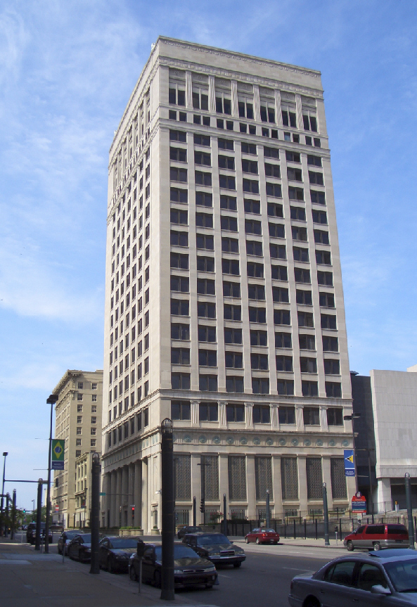
February 26, 1979 1016 The Paseo
39°6′4″N 94°33′51″W / 39.10111°N 94.56417°WKansas City 94 Hesse Carriage Company Building March 21, 2007 1700 Oak St.
39°5′42″N 94°34′45″W / 39.095°N 94.57917°WKansas City 95 Hiland Telephone Exchange Building May 6, 2005 1020 E. 63rd St.
39°00′55″N 94°34′30″W / 39.01528°N 94.575°WKansas City 96 Holy Name Catholic Church September 25, 2003 2800 E. 23rd St.
39°5′5″N 94°32′57″W / 39.08472°N 94.54917°WKansas City 97 Holy Rosary Historic District February 7, 2007 Roughly bounded by 5th and Campbell, 5th and Harrison and 9th E. Missouri Ave.
39°6′33.84″N 94°34′20.93″W / 39.1094°N 94.5724806°WKansas City 98 Mary Rockwell Hook House September 8, 1983 4940 Summit St.
39°2′14″N 94°35′47″W / 39.03722°N 94.59639°WKansas City 99 Hotel Phillips 
June 4, 1979 106 W. 12th St.
39°6′1″N 94°35′3″W / 39.10028°N 94.58417°WKansas City 100 House at 5011 Sunset Drive September 8, 1983 5011 Sunset Dr.
39°1′49″N 94°35′7″W / 39.03028°N 94.58528°WKansas City 101 House at 54 E. 53rd Terrace September 8, 1983 54 E. 53rd Terr.
39°2′14″N 94°35′48″W / 39.03722°N 94.59667°WKansas City 102 Howard Neighborhood Historic District July 3, 2007 Roughly bounded by SE 5th St., SE Green St., SE 7th St., and SE Miller St.
38°54′30.53″N 94°22′22.91″W / 38.9084806°N 94.3730306°WLee's Summit 103 Frank M. Howe Residence April 18, 1985 1707 Jefferson St.
39°5′34″N 94°35′31″W / 39.09278°N 94.59194°WKansas City 104 Mollie and Josephine Hughes House April 7, 1994 801 S. Main St.
39°5′2″N 94°24′54″W / 39.08389°N 94.415°WIndependence 105 Hyde Park Historic District November 21, 1980 Roughly bounded by Armour and Harrison Boulevards, 39th St. and Gillham Rd.
39°3′36″N 94°34′38″W / 39.06°N 94.57722°WKansas City 106 Imperial Brewing Company Brewery February 11, 2011 2825 Southwest Blvd.
39°4′36″N 94°36′8″W / 39.07667°N 94.60222°WKansas City Railroad Related Historic Commercial and Industrial Resources in Kansas City, Missouri MPS 107 Insurance Building-Consumers Cooperative Association Building November 25, 2005 318-320 E. 10th St.
39°6′15″N 94°34′45″W / 39.10417°N 94.57917°WKansas City 108 Inter-State Building June 12, 2008 417 E. 13th St./1300 Locust St.
39°5′54.27″N 94°34′38.85″W / 39.0984083°N 94.5774583°WKansas City 109 Ivanhoe Masonic Temple May 2, 1985 2301 E. Linwood Boulevard and 3201 Park Ave.
39°4′5″N 94°33′22″W / 39.06806°N 94.55611°WKansas City 110 Jackson County Courthouse 
October 18, 1972 Bounded by Lexington and Maple Aves. and Liberty and Main Sts.
39°5′33″N 94°22′58″W / 39.0925°N 94.38278°WIndependence 111 Jackson County Jail and Marshal's House 
June 15, 1970 217 N. Main St.
39°5′36″N 94°24′55″W / 39.09333°N 94.41528°WIndependence 112 Janssen Place Historic District November 7, 1976 Janssen Pl.
39°3′36″N 94°34′41″W / 39.06°N 94.57806°WKansas City 113 Jenkins Music Company Building March 2, 1979 1217-1223 Walnut St.
39°5′58″N 94°34′53″W / 39.09944°N 94.58139°WKansas City 114 Jensen-Salsbery Laboratories July 16, 1985 520 W. 21st St.
39°5′16″N 94°35′27″W / 39.08778°N 94.59083°WKansas City 115 Lewis Jones House April 21, 1994 104 Elizabeth St.
39°6′22″N 94°24′54″W / 39.10611°N 94.415°WIndependence 116 R. Bryson Jones House April 15, 2009 1045 W. 56th St.
39°1′36.4″N 94°36′3.68″W / 39.026778°N 94.6010222°WKansas City 117 Kansas City Athenaeum October 11, 1979 900 E. Linwood Boulevard
39°4′9″N 94°34′26″W / 39.06917°N 94.57389°WKansas City 118 Kansas City Club Building November 19, 2002 1228 Baltimore Ave.
39°6′3″N 94°35′5″W / 39.10083°N 94.58472°WKansas City 119 Kansas City Cold Storage Company Building June 1, 2005 500 E. 3rd St.
39°6′48″N 94°34′44″W / 39.11333°N 94.57889°WKansas City 120 Kansas City Live Stock Exchange 
April 5, 1984 1600 Genessee St.
39°5′40″N 94°36′19″W / 39.09444°N 94.60528°WKansas City 121 Kansas City Masonic Temple November 14, 1980 903 Harrison St.
39°6′11″N 94°34′13″W / 39.10306°N 94.57028°WKansas City 122 Kansas City Police Station Number 4 October 26, 2005 115 W. 19th St.
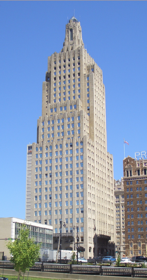
39°5′35″N 94°35′7″W / 39.09306°N 94.58528°WKansas City 123 Kansas City Power and Light Company Building 
January 9, 2002 1330 Baltimore Ave.
39°5′51″N 94°35′4″W / 39.0975°N 94.58444°WKansas City 124 Kansas City Public Library 
May 23, 1977 500 E. 9th St.
39°6′13″N 94°34′35″W / 39.10361°N 94.57639°WKansas City 125 Kansas City Southern Railway Building May 6, 2004 114 W. 11th St.
39°6′12″N 94°35′6″W / 39.10333°N 94.585°WKansas City 126 Kansas City Terminal Railway Company Roundhouse Historic District January 26, 2001 Jct. of 27th St. and Southwest Boulevard
39°4′59″N 94°35′59″W / 39.08306°N 94.59972°WKansas City 127 Kansas City Title and Trust Building June 25, 2005 927 Walnut St.
39°6′16″N 94°34′54″W / 39.10444°N 94.58167°WKansas City 128 Lee's Summit Christian Church Building April 20, 2011 SE Douglas and SE Fourth Sts.
38°54′40″N 94°22′31″W / 38.91111°N 94.37528°WLee's Summit 129 Kansas City Water Department Building April 7, 1994 201 Main St.
39°6′38″N 94°34′59″W / 39.11056°N 94.58306°WKansas City 130 Kansas City, Missouri Western Union Telegraph Building February 12, 2003 100-114 E. 7th St.
39°6′27″N 94°34′53″W / 39.1075°N 94.58139°WKansas City 131 Michael H. and Rose Katz House March 22, 2004 5930 Ward Parkway
39°1′20″N 94°36′10″W / 39.02222°N 94.60278°WKansas City 132 Charles S. Keith House 
March 31, 2000 1214 W. 55th St.
39°1′51″N 94°36′20″W / 39.03083°N 94.60556°WKansas City 133 Kelley-Reppert Motor Company Building November 12, 2004 422 Admiral Boulevard
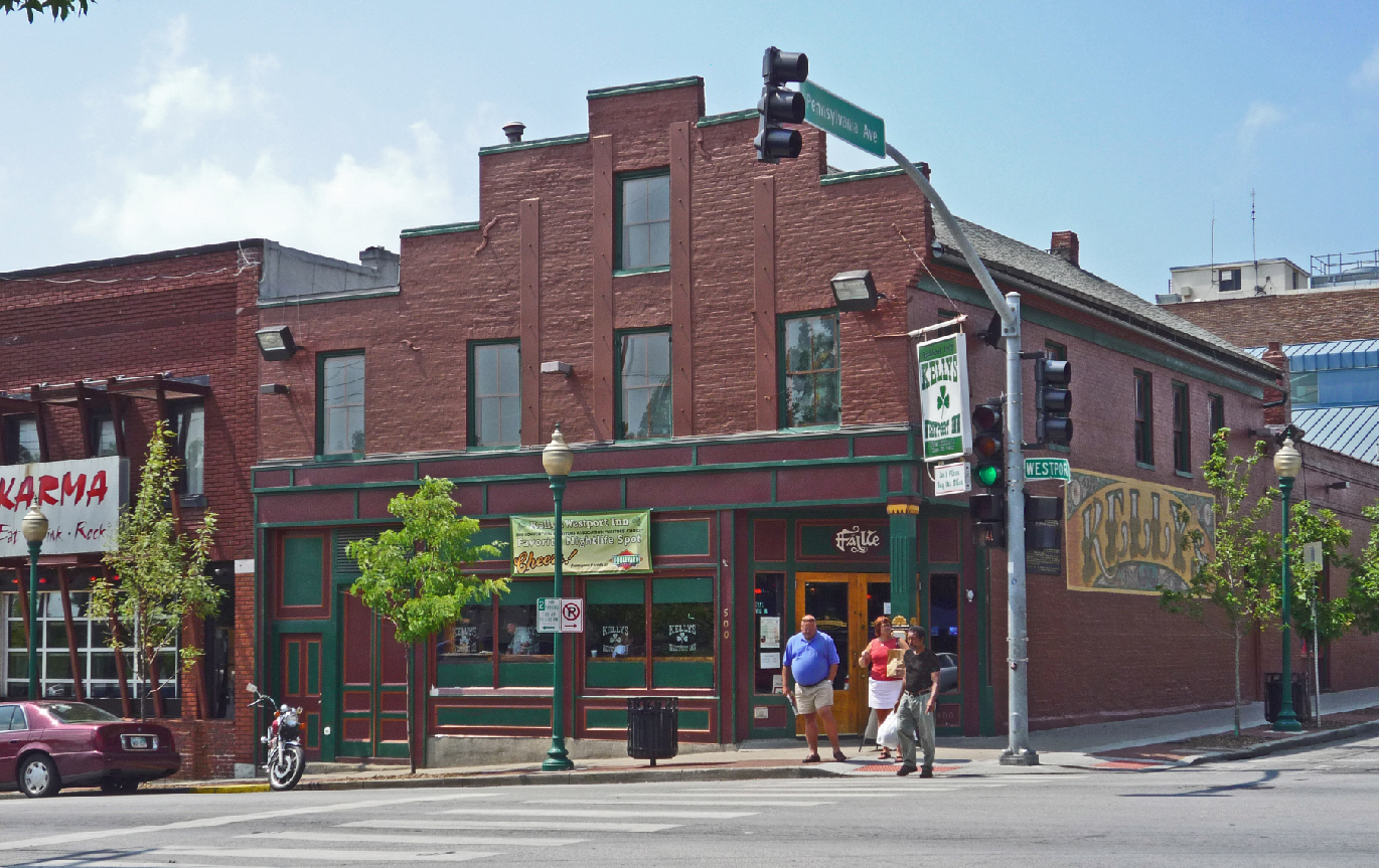
39°6′27″N 94°34′40″W / 39.1075°N 94.57778°WKansas City 134 Kelly's Westport Inn 
September 7, 1972 Westport Rd. and Pennsylvania Ave.
39°3′9″N 94°35′29″W / 39.0525°N 94.59139°WKansas City 135 Kessler Apartments October 22, 2002 924 Paseo Boulevard
39°6′15″N 94°33′49″W / 39.10417°N 94.56361°WKansas City 136 Kirkwood Building July 25, 2001 1737-41 McGee St.
39°5′38″N 94°34′47″W / 39.09389°N 94.57972°WKansas City 137 Knickerbocker Apartments June 13, 2003 501-535 Knickerbocker Place
39°3′53″N 94°35′31″W / 39.06472°N 94.59194°WKansas City 138 William Baker and Mary Knight House October 18, 2003 3534 Walnut St.
39°3′51″N 94°35′5″W / 39.06417°N 94.58472°WKansas City 139 Kritser House April 10, 1985 115 E. Walnut
39°5′22″N 94°24′53″W / 39.08944°N 94.41472°WIndependence 140 Kuehne-Schmidt Apartments February 13, 2007 3737-39 and 3741-43 Main Sts.
39°3′39″N 94°35′8″W / 39.06083°N 94.58556°WKansas City 141 Land Bank Building January 18, 1985 15 W. 10th St.
39°6′7″N 94°35′0″W / 39.10194°N 94.583333°WKansas City 142 Lee's Summit Downtown Historic District August 17, 2005 Roughly bounded by Second St., Douglas St., Fourth St., and Market St.
38°54′48″N 94°22′36″W / 38.91333°N 94.37667°WLee's Summit 143 Lewis-Webb House February 6, 1986 302 W. Mill
39°6′0″N 94°25′6″W / 39.1°N 94.41833°WIndependence 144 Liberty Memorial 
October 6, 2000 100 W. 26th St.
39°4′55″N 94°35′10″W / 39.08194°N 94.58611°WKansas City 145 Liquid Carbonic Company Building April 29, 1994 2000 Baltimore St.
39°5′21″N 94°35′4″W / 39.08917°N 94.58444°WKansas City 146 Locust Street Apartments April 29, 2011 3421 & 3425 Locust St.
39°3′52″N 94°34′46″W / 39.06444°N 94.57944°WKansas City Working-Class and Middle-Income Apartment Buildings in Kansas City, Missouri MPS 147 Loew's Midland Theater-Midland Building September 28, 1977 1232-1234 Main St. and 1221-1233 Baltimore Ave.
39°5′55″N 94°35′2″W / 39.09861°N 94.58389°WKansas City 148 R.A. Long Building January 8, 2003 928 Grand Boulevard
39°6′16″N 94°34′51″W / 39.10444°N 94.58083°WKansas City 149 R.A. Long House 
November 14, 1980 3218 Gladstone Boulevard
39°6′55.3″N 94°32′34.89″W / 39.115361°N 94.543025°WKansas City 150 Longview Farm October 24, 1985 11700 and 850 S.W. Longview Rd.
38°54′20″N 94°26′49″W / 38.90556°N 94.44694°WLee's Summit 151 Jacob Loose House July 28, 1983 101 E. Armour Boulevard
39°3′49″N 94°35′3″W / 39.06361°N 94.58417°WKansas City 152 Loretto Academy July 28, 1983 1111 W. 39th St.
39°3′35″N 94°36′1″W / 39.05972°N 94.60028°WKansas City 153 Emily Rockwell Love House September 8, 1983 5029 Sunset Dr.
39°2′8″N 94°35′51″W / 39.03556°N 94.5975°WKansas City 154 Maine Apartments October 22, 2002 1300 Paseo Boulevard
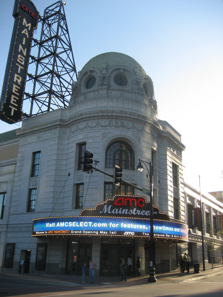
39°5′59″N 94°33′53″W / 39.09972°N 94.56472°WKansas City 155 Mainstreet Theatre 
February 15, 2007 1400 Main St.
39°5′56″N 94°35′1″W / 39.09889°N 94.58361°WKansas City 156 Majestic Apartments October 17, 2003 701-707 Benton Boulevard
39°6′21″N 94°32′38″W / 39.10583°N 94.54389°WKansas City 157 Alexander Majors House April 3, 1970 8145 State Line Rd.
38°58′45″N 94°36′28″W / 38.97917°N 94.60778°WKansas City 158 Maples Apartments October 22, 2002 1401 E. 10th St.
39°6′11″N 94°33′52″W / 39.10306°N 94.56444°WKansas City 159 Marks and Garvey Historic District June 26, 2006 2429,2433,2437 Tracy Ave.
39°5′3″N 94°34′5″W / 39.08417°N 94.56806°WKansas City 160 Maryland Apartments October 22, 2002 930 Paseo Boulevard
39°6′14″N 94°33′51″W / 39.10389°N 94.56417°WKansas City 161 McConahay Building May 22, 1978 1121-1131 E. 31st St.
39°4′13″N 94°34′12″W / 39.07028°N 94.57°WKansas City 162 Levi McIntire House July 28, 1983 710 E. Armour Boulevard
39°3′50″N 94°34′32″W / 39.06389°N 94.57556°WKansas City 163 McMahon Apartments October 22, 2002 1106 Paso Boulevard
39°6′7″N 94°33′52″W / 39.10194°N 94.56444°WKansas City 164 Mercantile Bank & Trust Building December 31, 2009 1101 Walnut St.
39°6′4.03″N 94°34′55.34″W / 39.1011194°N 94.5820389°WKansas City 165 August Meyer House September 9, 1982 4415 Warwick Boulevard
39°2′49″N 94°34′57″W / 39.04694°N 94.5825°WKansas City 166 Midwest Hotel May 6, 2004 1925 Main St.
39°5′29″N 94°35′0″W / 39.09139°N 94.583333°WKansas City 167 Milo Apartments October 25, 2011 1014-1020 W. 44th St.
39°2′54″N 94°35′57″W / 39.04833°N 94.59917°WKansas City Working-Class and Middle-Income Apartment Buildings in Kansas City, Missouri MPS 168 Mineral Hall 
July 12, 1976 4340 Oak St.
39°2′51″N 94°34′55″W / 39.0475°N 94.58194°WKansas City 169 Charles Minor House March 22, 1984 314 N. Spring St.
39°5′40″N 94°25′11″W / 39.09444°N 94.41972°WIndependence 170 Missouri Apartments October 22, 2002 1304 Paseo Boulevard
39°5′59″N 94°33′54″W / 39.09972°N 94.565°WKansas City 171 Missouri Pacific Depot 
January 22, 1979 600 S. Grand
39°5′12″N 94°25′45″W / 39.08667°N 94.42917°WIndependence 172 Monroe Hotel 
May 6, 2004 1904-06 Main St.
39°5′30″N 94°35′2″W / 39.09167°N 94.58389°WKansas City 173 Montgomery Ward and Company General Merchandise Warehouse July 8, 2010 819 East 19th St.
39°5′25″N 94°34′27″W / 39.09028°N 94.57417°WKansas City 174 Mutual Ice Company Building August 4, 2004 4142-4144 Pennsylvania Ave.
39°3′11″N 94°35′26″W / 39.05306°N 94.59056°WKansas City 175 Mutual Musicians' Foundation Building February 7, 1979 1823 Highland Ave.
39°5′25″N 94°33′43″W / 39.09028°N 94.56194°WKansas City 176 George J. Myers House July 28, 1983 633 E. Armour Boulevard
39°3′47″N 94°34′36″W / 39.06306°N 94.57667°WKansas City 177 National Bank of Commerce Building 
May 5, 1999 922-924 Walnut St.
39°6′15″N 94°34′55″W / 39.10417°N 94.58194°WKansas City 178 National Garage May 5, 2000 1100-1110 McGee St.
39°6′12″N 94°34′47″W / 39.10333°N 94.57972°WKansas City 179 Nettleton, George H., Home October 14, 1999 5125 Swope Parkway
39°2′5″N 94°32′23″W / 39.03472°N 94.53972°WKansas City 180 New England Apartments October 22, 2002 1116 Paseo Boulevard
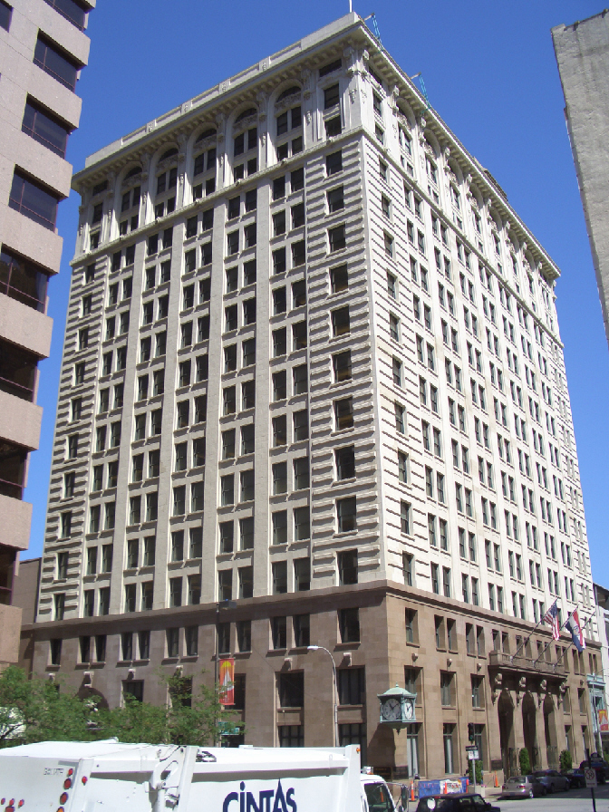
39°6′1″N 94°33′50.43″W / 39.10028°N 94.5640083°WKansas City 181 New York Life Building 
July 8, 1970 20 W. 9th St.
39°6′13″N 94°35′2″W / 39.10361°N 94.58389°WKansas City 182 Newbern Hotel September 23, 1980 525 E. Armour Boulevard
39°3′48″N 94°34′43″W / 39.06333°N 94.57861°WKansas City 183 D.W. Newcomer's Sons Funeral Home August 9, 1983 1331 Brush Creek
39°2′34″N 94°34′7″W / 39.04278°N 94.56861°WKansas City 184 George E. Nicholson House November 25, 2005 1028 W. 58th St.
39°1′28″N 94°36′6″W / 39.02444°N 94.60167°WKansas City 185 Smallwood V. Noland House April 21, 1994 1024 S. Forest St.
39°4′54″N 94°26′13″W / 39.08167°N 94.43694°WIndependence 186 Northeast Douglas Street Residential Historic District August 27, 2008 NE Douglas St. roughly between Elm and Maggie Sts.
38°55′12.27″N 94°22′48.23″W / 38.920075°N 94.3800639°WLee's Summit 187 Northeast Forest Avenue and Northeast Green Street Residential Historic District August 27, 2008 108, 110, 114 NE Forest Ave. and 310, 312 NE Green St.
38°55′11.93″N 94°22′39.64″W / 38.9199806°N 94.3776778°WLee's Summit 188 Northeast Green and 1st Streets Residential Historic District August 27, 2008 Roughly bounded by NE Douglas St., Maple St., 1st St., and NE Johnson St.
38°54′59.94″N 94°22′36.59″W / 38.91665°N 94.3768306°WLee's Summit 189 Old Hyde Park East Historic District May 27, 2004 Roughly bounded by Armour Boulevard, Walnut St., 39th St., and Gillham Rd.
39°3′42″N 94°35′3″W / 39.06167°N 94.58417°WKansas City 190 Old Hyde Park West Historic District May 27, 2004 Roughly bounded by Linwood Boulevard, Central, 39th St., and Baltimore St.
39°3′49″N 94°35′17″W / 39.06361°N 94.58806°WKansas City 191 Old New England Building October 25, 1973 112 W. 9th St.
39°6′13″N 94°35′6″W / 39.10361°N 94.585°WKansas City 192 Old Town Historic District June 7, 1978 Roughly bounded by Independence Ave., 2nd, Delaware and Walnut Sts.; also 119, 207, and 213 Walnut St.; also 136 Main St.; also 140 Walnut St.
39°6′32″N 94°34′59″W / 39.10889°N 94.58306°WKansas City Second, third, and fourth sets of addresses represent boundary increases of July 1, 2005, October 5, 2005, and February 14, 2006 193 Robert Ostertag House September 8, 1983 5030 Summit St.
39°2′10″N 94°35′48″W / 39.03611°N 94.59667°WKansas City 194 Overfelt-Campbell-Johnston House September 5, 1975 305 S. Pleasant St.
39°5′23″N 94°25′15″W / 39.08972°N 94.42083°WIndependence 195 Owens-McCoy House April 21, 1994 410 W. Farmer Ave.
39°5′46″N 94°25′12″W / 39.09611°N 94.42°WIndependence 196 Palace Clothing Company Building January 18, 1985 1126-1128 Grand Ave.
39°6′0″N 94°34′51″W / 39.1°N 94.58083°WKansas City 197 Parade Park Maintenance Building July 24, 2008 1722 Woodland Ave.
39°5′31.06″N 94°33′39.54″W / 39.0919611°N 94.5609833°WKansas City 198 Paris and Weaver Apartment Buildings July 5, 2006 3944-46 and 3948-50 Walnut St.
39°3′24″N 94°35′7″W / 39.05667°N 94.58528°WKansas City 199 Park Lane Apartments May 5, 2004 4600-4606 J.C. Nichols Parkway
39°2′43″N 94°35′19″W / 39.04528°N 94.58861°WKansas City 200 Park Manor Historic District February 1, 2006 910 Ward Parkway, 920 Ward Parkway, and 4826 Roanoke Parkway
39°2′29″N 94°35′54″W / 39.04139°N 94.59833°WKansas City 201 The Parkview October 22, 2002 1000 Paseo Boulevard
39°6′14″N 94°33′52″W / 39.10389°N 94.56444°WKansas City 202 Paseo YMCA September 9, 1991 1824 The Paseo
39°5′26.89″N 94°33′52.18″W / 39.0908028°N 94.5644944°WKansas City 203 George B. Peck Dry Goods Company Building April 30, 1980 1044 Main St.
39°6′4″N 94°35′1″W / 39.10111°N 94.58361°WKansas City 204 Thomas J. Pendergast Headquarters October 25, 2011 1908 Main St.
39°5′24″N 94°35′2″W / 39.09°N 94.58389°WKansas City 205 Pennbroke Apartments April 15, 2009 604 W. 10th St.
39°6′8.96″N 94°35′27.98″W / 39.1024889°N 94.5911056°WKansas City ref number 09000206 (Working-Class and Middle-Income Apartment Buildings in Kansas City, Missouri MPS) 206 Joseph Grear Peppard House March 26, 1985 1704 Jefferson St.
39°5′34″N 94°35′33″W / 39.09278°N 94.5925°WKansas City 207 Nelle E. Peters Troost Avenue Historic District July 23, 2009 2719-37 Troost Ave.; 2730 Troost Ave.
39°4′36.89″N 94°34′16.54″W / 39.0769139°N 94.5712611°WKansas City 208 Pickwick Hotel, Office Building, Parking Garage and Bus Terminal March 29, 2005 901-937 McGee St., 301-311 E. 9th St., 300-310 E. Tenth St., 906-912 Oak St.
39°6′17″N 94°34′57″W / 39.10472°N 94.5825°WKansas City 209 Pilgrim Lutheran Church for the Deaf of Greater Kansas City and Parsonage January 25, 2001 3801-3807 Gilham Rd.
39°3′36″N 94°35′33″W / 39.06°N 94.5925°WKansas City 210 Pink House September 8, 1983 5012 Summit St.
39°2′12″N 94°35′47″W / 39.03667°N 94.59639°WKansas City 211 President Gardens Apartments Historic District December 10, 1998 Roughly along President Ave., 83rd St., and 82nd Terrace bet. Lydia and Troost Aves.
38°58′40″N 94°34′25″W / 38.97778°N 94.57361°WKansas City 212 President Hotel August 8, 1983 1327-1335 Baltimore Ave.
39°5′52″N 94°35′3″W / 39.09778°N 94.58417°WKansas City 213 Professional Building July 17, 1979 1101-1107 Grand Ave.
39°6′3″N 94°34′49″W / 39.10083°N 94.58028°WKansas City 214 Quality Hill 
July 7, 1978 Roughly bounded by Broadway, 10th, 14th, and Jefferson Sts.
39°6′0″N 94°35′26″W / 39.1°N 94.59056°WKansas City 215 William D. Repp House July 28, 1983 3500 Charlotte St.
39°3′42″N 94°34′31″W / 39.06167°N 94.57528°WKansas City 216 Rice-Tremonti House March 2, 1979 8801 E. 66th St.
39°0′14″N 94°28′54″W / 39.00389°N 94.48167°WRaytown 217 Richards and Conover Hardware Company Building January 21, 1999 200 W. 5th St.
39°6′36″N 94°35′8″W / 39.11°N 94.58556°WKansas City 218 Rieger Hotel May 6, 2004 1922 Main St.
39°5′29″N 94°35′3″W / 39.09139°N 94.58417°WKansas City 219 Rockhill Neighborhood July 21, 1975 Both sides of 47th St. from Locust St. (S. Pierce St.) to both sides of Harrison St. (north to Brush Creek Boulevard)
39°2′31″N 94°34′36″W / 39.04194°N 94.57667°WKansas City 220 Bertrand Rockwell House September 8, 1983 1004 W. 52nd St.
39°2′1″N 94°35′58″W / 39.03361°N 94.59944°WKansas City 221 Row House Buildings May 22, 1978 1–7 E. 34th St. and 3401 Main St.; also 9-23 E. 34th St.
39°3′56″N 94°35′6″W / 39.06556°N 94.585°WKansas City 9-23 E. 34th represent a boundary increase of January 15, 1985 222 Sacred Heart Church, School and Rectory November 14, 1978 2540-2544 Madison Ave. and 910 W. 26th St.
39°4′50″N 94°35′44″W / 39.08056°N 94.59556°WKansas City 223 Safeway Stores and Office and Warehouse Building May 5, 2000 2029-2043 Wyandotte St.
39°5′28″N 94°35′6″W / 39.09111°N 94.585°WKansas City 224 St. Mary's Episcopal Church November 7, 1978 1307 Holmes St.
39°5′53″N 94°34′28″W / 39.09806°N 94.57444°WKansas City 225 Saint Paul's Episcopal Church 
October 3, 1985 Fifth and S. Green Sts.
38°54′39″N 94°22′21″W / 38.91083°N 94.3725°WLee's Summit 226 St. Teresa's Academy Music and Arts Building November 15, 2000 5600 Main St.
39°1′40″N 94°35′23″W / 39.02778°N 94.58972°WKansas City 227 Santa Fe Place Historic District May 30, 1986 Roughly bounded by Twenty-seventh St., Indiana Ave., Thirtieth St., and Prospect Ave.
39°4′31″N 94°33′6″W / 39.07528°N 94.55167°WKansas City 228 Santa Fe Trail-Minor Park, Kansas City, Trail Segments June 30, 1994 Red Bridge Rd. E of jct. with Holmes Rd.
38°55′26″N 94°34′30″W / 38.92389°N 94.575°WKansas City 229 Santa Fe Trail-Santa Fe Trail Park, Independence Trail Segments April 21, 1994 Santa Fe Rd.
39°3′56″N 94°25′35″W / 39.06556°N 94.42639°WIndependence 230 Savoy Hotel and Grill December 30, 1974 219 W. 9th St. and 9th and Central Sts.
39°6′13″N 94°35′12″W / 39.10361°N 94.58667°WKansas City 231 Scarritt Building and Arcade March 9, 1971 Corner of 19th and Grand Sts. and 819 Walnut St.
39°6′13″N 94°34′47″W / 39.10361°N 94.57972°WKansas City 232 Scarritt Point North Historic District December 1, 1997 Roughly along Gladstone Boulevard, Windor, Bales, Indiana, and Norledge Aves.
39°6′54″N 94°32′30″W / 39.115°N 94.54167°WKansas City 233 Scarritt Point South Historic District December 1, 1997 Roughly aling Gladstone and Benton Boulevards, and Thompson Ave.
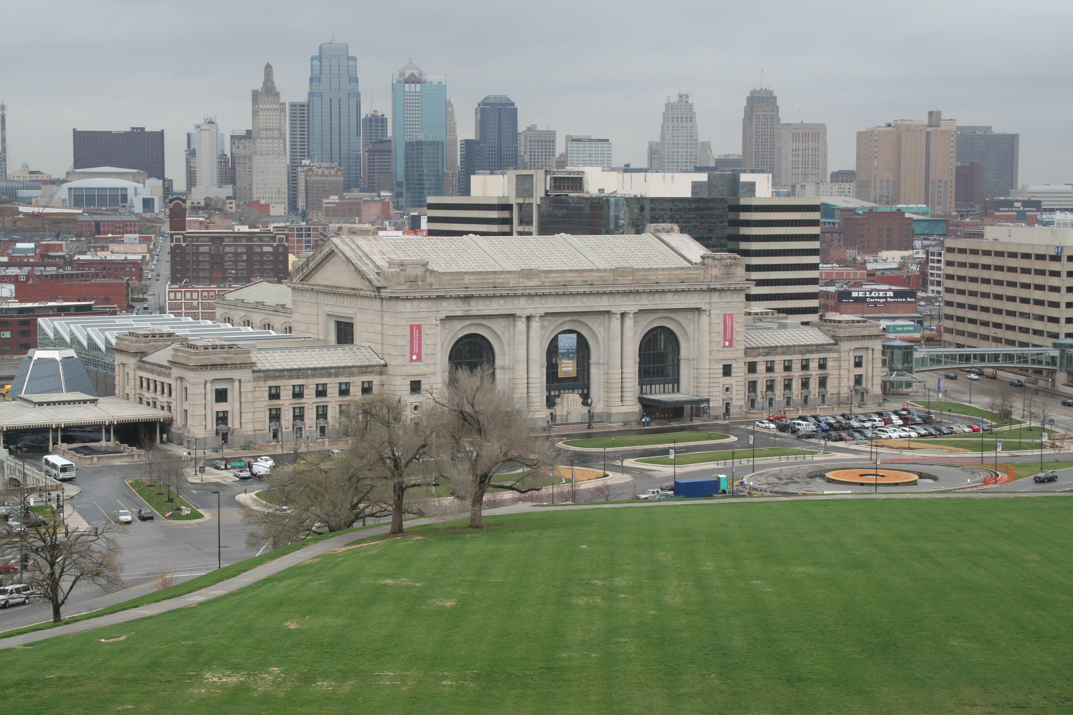
39°6′38″N 94°32′40″W / 39.11056°N 94.54444°WKansas City 234 Edward Lucky Scarritt House May 23, 1977 3500 Gladstone Boulevard
39°6′56″N 94°32′23″W / 39.11556°N 94.53972°WKansas City 235 Rev. Nathan Scarritt House May 8, 1978 4038 Central St.
39°3′8″N 94°35′18″W / 39.05222°N 94.58833°WKansas City 236 William Chick Scarritt House March 21, 1978 3240 Norledge Ave.
39°7′1″N 94°32′32″W / 39.11694°N 94.54222°WKansas City 237 Sewall Paint and Glass Company Building May 9, 2002 1009-1013 W. 8th St.
39°6′26″N 94°35′51″W / 39.10722°N 94.5975°WKansas City 238 William Francis Shelley House March 17, 1978 3601 Baltimore Ave.
39°3′42″N 94°35′11″W / 39.06167°N 94.58639°WKansas City 239 Sherwood Manufacturing Company Building October 28, 2010 123 SE 3rd St.
38°54′46″N 94°22′29″W / 38.91278°N 94.37472°WLee's Summit Lee's Summit, Missouri MPS 240 Simpson-Yeomans-Country Side Historic District September 6, 1984 Roughly bounded by 51st Terr., Wornall Rd., Wyandotte and 54th Sts.
39°1′52″N 94°35′27″W / 39.03111°N 94.59083°W
Boundary increase I (listed May 26, 2000): General vicinity of W. 51st Terrace, Wornall Rd., W. F7, and W. 57th St.
Boundary increase II (listed July 14, 2011): E. 52nd St., Brookside Blvd., Oak St., E. 57th St. & Main St.Kansas City 241 Smith and Sons Manufacturing Company Building December 18, 2007 1400-26 Guinotte Ave.
39°6′56″N 94°33′58″W / 39.11556°N 94.56611°WKansas City 242 Sophian Plaza July 5, 1983 4618 Warwick Boulevard
39°2′33″N 94°35′1″W / 39.0425°N 94.58361°WKansas City 243 South Hyde Park Historic District November 14, 2007 Bounded by E. 39th St., the Gillham Parkway, Brush Creek Boulevard, and Troost Ave.
39°3′6.69″N 94°34′31.22″W / 39.0518583°N 94.5753389°WKansas City 244 South Side Historic District June 9, 1983 Roughly bounded by 38th, 40th, Walnut, and Baltimore Sts.
39°3′23″N 94°35′11″W / 39.05639°N 94.58639°WKansas City 245 Southeast Grand Avenue and Fifth Street Residential Historic District April 20, 2011 Roughly comprised of the east side of SE Grand Ave. between SE 4th St. and SE 5th St. and the north side of SE 5th St. between SE Grand Ave. and SE Howard St.
38°54′38″N 94°22′20″W / 38.91056°N 94.37222°WLee's Summit Lee's Summit, Missouri Multiple Property Submission 246 Southeast Green Street Historic Cottage District October 14, 2010 311-330, and 400 and 401 SE Green St.
38°54′44″N 94°22′26″W / 38.91222°N 94.37389°WLee's Summit Lee's Summit, Missouri Multiple Property Submission 247 Southeast Third Street and Southeast Corder Avenue Ranch House Historic District September 15, 2011 Roughly the south side of Southeast 3rd. St. east of Independence Ave.; along Southeast Corder Ave. north of Southeast 4th St.; and five lots on the east side of Southeast Corder Ave. south of 4th St.
38°54′43″N 94°22′5″W / 38.91194°N 94.36806°WLee's Summit Lee's Summit, Missouri Multiple Property Submission 248 Southeast Third Street Residential Historic District October 14, 2010 Roughly comprised of the 400 block of SE Third St. between SE Grand and SE Howard Sts.
38°54′50″N 94°22′17″W / 38.91389°N 94.37139°WLee's Summit Lee's Summit, Missouri Multiple Property Submission 249 E. R. Squibb and Sons Building December 7, 2010 2500 W. Pennyway St.
39°4′55″N 94°35′32″W / 39.08194°N 94.59222°WKansas City 250 Standard Theatre 
June 5, 1974 300 W. 12th St.
39°6′7″N 94°35′13″W / 39.10194°N 94.58694°WKansas City 251 R.O. Stenzel & Company, Warehouse July 18, 2007 1811 Walnut
39°5′35″N 94°34′56″W / 39.09306°N 94.58222°WKansas City 252 Stine and McClure Undertaking Company Building July 19, 1990 924-926 Oak St.
39°6′10″N 94°34′42″W / 39.10278°N 94.57833°WKansas City 253 Studna Garage Building July 5, 2006 415 Oak St.
39°6′41″N 94°34′46″W / 39.11139°N 94.57944°WKansas City 254 Switzer School Buildings December 18, 2009 Generally bounded by Madison Ave. and Summit St., 18th to 20th Sts.
39°5′25.07″N 94°35′38.56″W / 39.0902972°N 94.5940444°WKansas City 255 Temple Block Building June 19, 1985 531 Walnut
39°6′33″N 94°34′55″W / 39.10917°N 94.58194°WKansas City 256 Temple Site 
September 22, 1970 Lexington Ave. and River Boulevard
39°5′29″N 94°25′31″W / 39.09139°N 94.42528°WIndependence 257 The Tocoma November 24, 1979 3835 Main St.
39°3′25″N 94°35′8″W / 39.05694°N 94.58556°WKansas City 258 Alfred Toll House July 28, 1983 3502 Warwick Boulevard
39°3′17″N 94°35′0″W / 39.05472°N 94.583333°WKansas City 259 Town of Kansas Site June 28, 2011 Address Restricted Kansas City Railroad Related Historic Commercial and Industrial Resources in Kansas City, Missouri MPS 260 Townley Metal & Hardware Company Building April 14, 1994 200-210 Walnut St.
39°6′39″N 94°34′56″W / 39.11083°N 94.58222°WKansas City 261 Triangle Battery and Service Company Building October 17, 2003 3001-03 Gillham Rd.
39°4′28″N 94°34′43″W / 39.07444°N 94.57861°WKansas City 262 Trinity Episcopal Church April 27, 1979 409 N. Liberty St.
39°5′41″N 94°24′59″W / 39.09472°N 94.41639°WIndependence 263 Norman Tromanhauser House January 26, 2001 3603 W. Roanoke Dr.
39°3′49″N 94°35′54″W / 39.06361°N 94.59833°WKansas City 264 Harry S. Truman Historic District November 11, 1971 N. Delaware St. area
39°5′47″N 94°25′22″W / 39.09639°N 94.42278°WIndependence 265 Harry S Truman National Historic Site 
May 31, 1985 219 N. Delaware St.; also 601 and 605 W. Truman Rd. and 216 N. Delaware St.
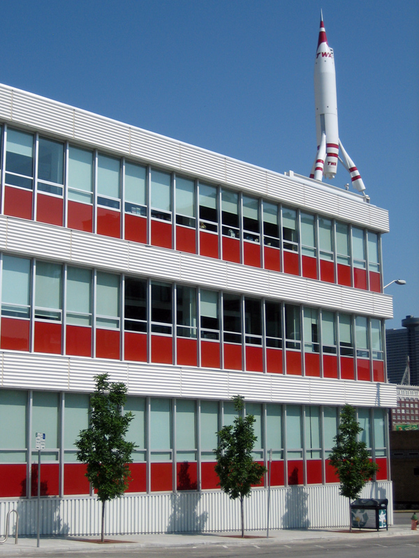
39°5′36″N 94°25′23″W / 39.09333°N 94.42306°WIndependence Second set of boundaries represents a boundary increase of February 23, 2005 266 TWA Corporate Headquarters' Building 
November 20, 2002 1735-1741 Baltimore Ave.-1740 Main St.
39°5′42″N 94°35′3″W / 39.095°N 94.58417°WKansas City 267 Twenty-Ninth Street Colonnaded Apartments Historic District February 7, 2007 900-906 E. 29th St. and 2843 N. Campbell; 910-912 E. 29th St.; 914 E. 29th St.
39°4′35″N 94°34′26″W / 39.07639°N 94.57389°WKansas City 268 U.S. Courthouse and Post Office--Kansas City, MO 
November 20, 2007 811 Grand Boulevard
39°6′24″N 94°34′47″W / 39.10667°N 94.57972°WKansas City 269 Union Station 
February 1, 1972 Pershing Rd. and Main St.; also generally bounded by the Kansas City Terminal railroad tracks at Pennway, Pershing Rd., and Union Station
39°5′5″N 94°35′8″W / 39.08472°N 94.58556°WKansas City Second set of boundaries represents a boundary increase of May 6, 2004 270 United States Post Office-Kansas City May 26, 2004 315 W. Pershing Rd.
39°5′6″N 94°35′12″W / 39.085°N 94.58667°WKansas City 271 Unity School of Christianity Historic District April 12, 1989 Junction of US 50 and Colborn Rd.
38°56′49″N 94°24′21″W / 38.94694°N 94.40583°WUnity Village 272 Uptown Building and Theatre June 27, 1979 3700-3712 Broadway
39°3′40″N 94°35′27″W / 39.06111°N 94.59083°WKansas City 273 Joe Vaccaro Soda Water Manufacturing Company Building October 18, 2003 918-922 E. 5th St.
39°6′45″N 94°34′21″W / 39.1125°N 94.5725°WKansas City 274 Vaile Mansion October 1, 1969 1500 N. Liberty St.
39°6′29″N 94°25′2″W / 39.10806°N 94.41722°WIndependence 275 Valentine on Broadway Hotel August 1, 2008 3724 Broadway Boulevard
39°3′37.18″N 94°35′26.13″W / 39.0603278°N 94.5905917°WKansas City 276 Ira C. and Charles S. Van Noy Houses July 8, 1987 6700 and 6800 Elmwood
39°0′17″N 94°32′5″W / 39.00472°N 94.53472°WKansas City 277 Villa Serena Apartment Hotel April 15, 2009 325 Ward Parkway
39°2′22.82″N 94°35′28.83″W / 39.0396722°N 94.5913417°WKansas City ref number 09000207 278 Virginia Apartments October 22, 2002 1100 Paseo Boulevard
39°6′8″N 94°33′52″W / 39.10222°N 94.56444°WKansas City 279 Vitagraph Film Exchange Building February 28, 2008 1703 Wyandotte St.
39°5′43″N 94°35′7″W / 39.09528°N 94.58528°WKansas City 280 William Volker House May 20, 1993 3717 Bell St.
39°3′37″N 94°36′20″W / 39.06028°N 94.60556°WKansas City 281 Waldo Water Tower 
April 18, 1977 75th St. and Holmes Rd., Tower Park
38°59′25″N 94°34′55″W / 38.99028°N 94.58194°WKansas City 282 Walnut Street Warehouse and Commercial Historic District September 17, 1999 Roughly bounded by Main St., 15th St., Grand St. and 17th St.; also 1612, 1616, 1620, and 1624 Grand Boulevard and 1705-07 and 1709 Walnut St.
39°5′46″N 94°34′52″W / 39.09611°N 94.58111°WKansas City Second set of boundaries represents a boundary increase of June 13, 2008 283 Waltower Building August 8, 2001 823 Walnut St.
39°6′20″N 94°34′53″W / 39.10556°N 94.58139°WKansas City 284 Seth E. Ward Homestead 
February 17, 1978 1032 W. 55th St.
39°1′42″N 94°36′6″W / 39.02833°N 94.60167°WKansas City 285 Maj. William Warner House May 23, 1977 1021 Pennsylvania Ave.
39°6′6″N 94°35′27″W / 39.10167°N 94.59083°WKansas City 286 Webster School September 2, 1982 1644 Wyandotte St.
39°5′35″N 94°35′10″W / 39.09306°N 94.58611°WKansas City 287 West Eleventh Street Historic District September 9, 1982 Central and W. 11th Sts.
39°6′4″N 94°35′12″W / 39.10111°N 94.58667°WKansas City 288 West Ninth Street-Baltimore Avenue Historic District November 7, 1976 Roughly bounded by Main, 8th, 10th and Central Sts.; also the western side of the 100 block of 10th St. and the 1000 block of Baltimore Ave.; also 807-815 Wyandotte
39°6′12″N 94°35′5″W / 39.10333°N 94.58472°WKansas City Second set of boundaries represents a boundary increase of November 20, 2002; third set of boundaries represents a boundary increase of October 12, 2010 289 Western Newspaper Union Building March 21, 2007 304 W. 10th St.
39°6′16″N 94°35′14″W / 39.10444°N 94.58722°WKansas City 290 Westminister Congregational Church February 28, 1980 3600 Walnut St.
39°3′42″N 94°35′6″W / 39.06167°N 94.585°WKansas City 291 Wholesale District October 25, 1979 Roughly bounded by 6th, Wyandotte, 8th, May, 11th and Washington Sts.
39°6′14″N 94°35′15″W / 39.10389°N 94.5875°WKansas City 292 Kansas City Destroyed in a 1993 flood.[2] 293 Windsor Hall Apartments January 14, 2011 3420 Locust St.
39°3′52″N 94°34′47″W / 39.06444°N 94.57972°WKansas City Working Class Hotels at 19th and Main Streets, Kansas City, Missouri MPS 294 Woodson-Sawyer House March 20, 1986 1604 W. Lexington
39°5′14″N 94°26′4″W / 39.08722°N 94.43444°WIndependence 295 F. W. Woolworth Building May 6, 2005 3120-3122 Troost Ave.
39°4′18″N 94°34′18″W / 39.07167°N 94.57167°WKansas City 296 Wornall House 
May 21, 1969 146 W. 61st St.
39°1′0″N 94°35′32″W / 39.016667°N 94.59222°WKansas City 297 Solomon Young Farm-Harry S. Truman Farm 
May 5, 1978 12121 and 12301 Blue Ridge Extension
38°54′8″N 94°31′51″W / 38.90222°N 94.53083°WGrandview See also
References
- ^ "National Register of Historic Places: Weekly List Actions". National Park Service, United States Department of the Interior. Retrieved on November 10, 2011.
- ^ http://www.dnr.mo.gov/shpo/Jackson.htm
Municipalities and communities of Jackson County, Missouri Cities Blue Springs | Buckner | Grain Valley | Grandview | Greenwood | Independence‡ | Kansas City‡ | Lake Lotawana | Lake Tapawingo | Lee's Summit‡ | Levasy | Lone Jack | Oak Grove‡ | Raytown | Sugar Creek‡

Villages Unincorporated
communityFootnotes ‡This populated place also has portions in an adjacent county or counties
U.S. National Register of Historic Places Topics Lists by states Alabama • Alaska • Arizona • Arkansas • California • Colorado • Connecticut • Delaware • Florida • Georgia • Hawaii • Idaho • Illinois • Indiana • Iowa • Kansas • Kentucky • Louisiana • Maine • Maryland • Massachusetts • Michigan • Minnesota • Mississippi • Missouri • Montana • Nebraska • Nevada • New Hampshire • New Jersey • New Mexico • New York • North Carolina • North Dakota • Ohio • Oklahoma • Oregon • Pennsylvania • Rhode Island • South Carolina • South Dakota • Tennessee • Texas • Utah • Vermont • Virginia • Washington • West Virginia • Wisconsin • WyomingLists by territories Lists by associated states Other Categories:- Jackson County, Missouri
- National Register of Historic Places in Missouri
-


Wikimedia Foundation. 2010.