- Pilot Knob, Missouri
Infobox Settlement
official_name = Pilot Knob, Missouri
settlement_type =City
nickname =
motto =
imagesize =
image_caption =
image_
imagesize =
image_caption =
image_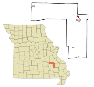
mapsize = 250px
map_caption = Location of Pilot Knob, Missouri
mapsize1 =
map_caption1 =subdivision_type = Country
subdivision_name =United States
subdivision_type1 = State
subdivision_name1 =Missouri
subdivision_type2 = County
subdivision_name2 = Iron
government_footnotes =
government_type =
leader_title =
leader_name =
leader_title1 =
leader_name1 =
established_title =
established_date =unit_pref = Imperial
area_footnotes =area_magnitude =
area_total_km2 = 2.2
area_land_km2 = 2.2
area_water_km2 = 0.0
area_total_sq_mi = 0.9
area_land_sq_mi = 0.9
area_water_sq_mi = 0.0population_as_of = 2000
population_footnotes =
population_total = 697
population_density_km2 = 310.3
population_density_sq_mi = 803.7timezone = Central (CST)
utc_offset = -6
timezone_DST = CDT
utc_offset_DST = -5
elevation_footnotes =
elevation_m = 293
elevation_ft = 961
latd = 37 |latm = 37 |lats = 25 |latNS = N
longd = 90 |longm = 38 |longs = 37 |longEW = Wpostal_code_type =
ZIP code
postal_code = 63663
area_code = 573
blank_name = FIPS code
blank_info = 29-57656GR|2
blank1_name = GNIS feature ID
blank1_info = 0751590GR|3
website =
footnotes =Pilot Knob is a city in Iron County,
Missouri ,United States . The population was 697 at the 2000 census. It lies eight miles south of Belgrade and thirteen miles east of Centerville.History
The
Battle of Pilot Knob in the fall of 1864 was a notable clash in the area.Geography
Pilot Knob is located at coor dms|37|37|25|N|90|38|37|W|city (37.623573, -90.643696)GR|1.
According to the
United States Census Bureau , the city has a total area of 0.9square mile s (2.3km² ), all of it land.Demographics
As of the
census GR|2 of 2000, there were 697 people, 283 households, and 189 families residing in the city. Thepopulation density was 803.7 people per square mile (309.3/km²). There were 326 housing units at an average density of 375.9/sq mi (144.7/km²). The racial makeup of the city was 91.97% White, 5.88% African American, 0.29% Native American, 0.57% Asian, 0.86% from other races, and 0.43% from two or more races. Hispanic or Latino of any race were 1.72% of the population.There were 283 households out of which 31.4% had children under the age of 18 living with them, 48.1% were married couples living together, 12.0% had a female householder with no husband present, and 32.9% were non-families. 28.6% of all households were made up of individuals and 8.8% had someone living alone who was 65 years of age or older. The average household size was 2.40 and the average family size was 2.92.
In the city the population was spread out with 27.3% under the age of 18, 9.8% from 18 to 24, 26.1% from 25 to 44, 22.4% from 45 to 64, and 14.5% who were 65 years of age or older. The median age was 36 years. For every 100 females there were 90.4 males. For every 100 females age 18 and over, there were 87.1 males.
The median income for a household in the city was $19,702, and the median income for a family was $22,794. Males had a median income of $22,344 versus $16,691 for females. The
per capita income for the city was $12,487. About 20.1% of families and 27.0% of the population were below thepoverty line , including 46.3% of those under age 18 and 10.5% of those age 65 or over.References
External links
Wikimedia Foundation. 2010.