- Dunklin County, Missouri
-
Dunklin County, Missouri 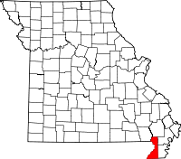
Location in the state of Missouri
Missouri's location in the U.S.Founded February 14, 1845 Named for Former Governor of Missouri Daniel Dunklin Seat Kennett Largest city Kennett Area
- Total
- Land
- Water
547.11 sq mi (1,417 km²)
545.62 sq mi (1,413 km²)
1.49 sq mi (4 km²), 0.27PopulationEst.
- (2008)
- Density
31,454
26/sq mi (10/km²)Time zone Central: UTC-6/-5 Dunklin County is a county located in the Bootheel of Southeast Missouri in the United States. As of the 2000 U.S. Census, the county's population was 33,155. A 2008 estimate, however, showed the population to be 31,454. The largest city and county seat is Kennett[1]. The county was officially organized on February 14, 1845, and is named in honor of Daniel Dunklin, a former Governor of Missouri who died the year before the county was organized.
Contents
Geography
According to the 2000 census, the county has a total area of 547.11 square miles (1,417.0 km2), of which 545.62 square miles (1,413.1 km2) (or 99.73%) is land and 1.49 square miles (3.9 km2) (or 0.27%) is water.[2] The lowest point in the state of Missouri is located on the St. Francis River in Buffalo Township in Dunklin County, where it flows out of Missouri and into Arkansas.
Adjacent counties
- Stoddard County (north)
- New Madrid County (northeast)
- Pemiscot County (east)
- Mississippi County, Arkansas (southeast)
- Craighead County, Arkansas (south)
- Greene County, Arkansas (southwest)
- Clay County, Arkansas (west)
- Butler County (northwest)
Transportation
Major highways
Airports
Kennett Memorial Airport is a public-use airport in Dunklin County. It is located one nautical mile (1.85 km) southeast of the central business district of Kennett, which owns the airport.[3]
Education
Of adults 25 years of age and older in Dunklin County, 63.7% possesses a high school diploma or higher while 9.1% hold a bachelor's degree or higher as their highest educational attainment.
Public Schools
- Campbell R-II School District - Campbell
- Campbell Elementary School (PK-06)
- Campbell High School (07-12)
- Clarkton C-4 School District - Clarkton
- Clarkton Elementary School (PK-06)
- Clarkton High School (07-12)
- Holcomb R-III School District - Holcomb
- Holcomb Elementary School (PK-06)
- Holcomb High School (07-12)
- Kennett School District 39 - Kennett
- Early Childhood Center - (PK) - Primary School
- H. Byron Masterson Elementary School (K-02)
- South Elementary School (03-05)
- Kennett Middle School (06-08)
- Kennett High School (09-12)
- Malden R-I School District - Malden
- Malden Elementary School (PK-06)
- Malden High School (07-12)
- Senath-Hornersville C-8 School District - Senath
- Senath Elementary School (PK-04)
- Hornersville Middle School (05-08)
- Senath-Hornersville High School (09-12)
- Southland C-9 School District - Cardwell
- Southland Elementary School (K-06)
- Southland High School (07-12)
Private Schools
- Kennett Christian Academy - Kennett - (K-12) - Assemblies of God/Pentecostal
- St. Teresa School - Campbell - (PK-08) - Roman Catholic
Alternative & Vocational Schools
- Bootheel State School - Clarkton - (K-12) - A school for handicapped students and/or those with special needs.
- Diagnostic Center - Kennett - (PK-12) - Special Education
- Dreamers High School - Kennett - (08-12)
- Kennett Area Vocational School - Kennett - (09-12) - Vocational/technical
History
Dunklin County was formed on February 14, 1845 from portions of Stoddard County. It was named for Daniel Dunklin, a governor of Missouri.
Demographics
As of the census[4] of 2006, there were 43,154 people, 13,411 households, and 9,159 families residing in the county. The population density was 61 people per square mile (23/km²). There were 14,682 housing units at an average density of 27 per square mile (10/km²). The racial makeup of the county was 88.64% White, 8.68% Black or African American, 0.31% Native American, 0.27% Asian, 0.01% Pacific Islander, 1.03% from other races, and 1.06% from two or more races. Approximately 2.49% of the population were Hispanic or Latino of any race. Among the major first ancestries reported in Dunklin County were 38.8% American, 10.6% Irish, 8.2% German, and 7.5% English, according to Census 2000.
There were 13,411 households, of which 31.30% had children under the age of 18 living with them, 51.60% were married couples living together, 13.20% had a female householder with no husband present, and 31.70% were "non-families." Of all households, 28.10% consisted of individuals and 14.00% had someone living alone who was 65 years of age or older. The average household size was 2.42 and the average family size was 2.94.
Of the county's population, 26.00% were under the age of 18, 8.10% were from 18 to 24, 26.00% were from 25 to 44, 23.50% were from 45 to 64, and 16.50% were 65 years of age or older. The median age was 38 years. For every 100 females there were 89.60 males. For every 100 females age 18 and over, there were 85.10 males.
The median income for a household in the county was $30,927, and the median income for a family was $38,439. Males had a median income of $27,288 versus $18,142 for females. The per capita income for the county was $16,737. About 19.40% of families and 24.50% of the population were below the poverty line, including 33.90% of those under age 18 and 21.30% of those age 65 or over.
Religion
According to the Association of Religion Data Archives County Membership Report (2000), Dunklin County is a part of the Bible Belt with evangelical Protestantism being the majority religion. The most predominant denominations among residents in Dunklin County who adhere to a religion are Southern Baptists (64.11%), Methodists (8.66%), and Churches of Christ (6.74%).
Cities and towns
Notable people
- Sheryl Crow, Grammy-winning singer/songwriter, was born in Kennett and grew up there.
- Trent Tomlinson, country music singer/songwriter, was born and raised in Kennett
- Arlie Metheny (1918-2008), United States Army officer who coordinated Elvis Presley's induction at Fort Chaffee, Arkansas, was born and reared in Dunklin County.
- David Nail, country music singer, was born and raised in Kennett.
Politics
Local
Politics at the local level in Dunklin County is predominantly controlled by the Democratic Party, and all but one of its elected officeholders are Democrats.
Office Incumbent Party Assessor Karen Vandeventer Democratic Circuit Clerk Paula Gargus Democratic Clerk Carol Hinesly Democratic Commissioner – District 1 Jeanie Moore Herbst Democratic Commissioner – District 2 Patrick McHaney Democratic Coroner Jack Adkins Democratic Presiding Commissioner Don Collins Democratic Prosecuting Attorney Stephen P. Sokoloff Democratic Public Administrator Shawnee L. Trowbridge Republican Recorder Susan Luce Democratic Sheriff Bob Holder Democratic Treasurer & Ex Officio Collector Kathy Rasberry Democratic State
Past Gubernatorial Elections Results Year Republican Democratic Third Parties 2008 41.65% 4,792 56.13% 6,458 2.22% 255 2004 52.46% 6,015 46.25% 5,302 1.29% 148 2000 42.70% 4,471 56.11% 5,875 1.19% 125 1996 31.51% 3,232 66.86% 6,858 1.63% 167 Dunklin County is divided into two legislative districts in the Missouri House of Representatives.
- District 162 - Rep. Terry Swinger (D-Caruthersville). Consists of the southern and eastern parts of the county and includes the towns of Arbyrd, Cardwell, Hornersville, Rives, and Senath. In 2010, Swinger ran unopposed and was reelected with 100 percent of the vote.
Missouri House of Representatives - District 162 - Dunklin County (2010) Party Candidate Votes % ±% Democratic Terry Swinger* 723 100.00 0 - District 163 – Currently represented by Tom Todd (D-Campbell) and consists of the northern and western parts of the county and includes the cities of Kennett and Malden as well as the towns of Campbell, Clarkton, and Holcomb. Incumbent Todd was defeated by Republican challenger Kent Hampton in 2010.
Missouri House of Representatives - District 163 - Dunklin County (2010) Party Candidate Votes % ±% Republican Kent Hampton 3,141 52.55 +52.55 Democratic Tom Todd* 2,836 47.45 -30.16 In the Missouri Senate, all of Dunklin County is a part of Missouri's 25th District and is currently represented by State Senator Rob Mayer (R-Dexter). In 2008, Mayer defeated M. Shane Stoelting (D) 65.32-34.68 percent in the district. The 25th Senatorial District consists of Butler, Dunklin, New Madrid, Pemiscot, Ripley, Stoddard, and Wayne counties.
Missouri Senate - District 25 - Dunklin County (2008) Party Candidate Votes % ±% Republican Rob Mayer 6,334 56.51 Democratic M. Shane Stoelting 4,874 43.49 Federal
In the U.S. House of Representatives, Dunklin County is represented by Jo Ann Emerson (R-Cape Girardeau) who represents all of Southeast Missouri as part of Missouri's 8th Congressional District.
U.S. House of Representatives - District 8 - Dunklin County (2010) Party Candidate Votes % ±% Republican Jo Ann Emerson 4,661 66.60 -1.36 Democratic Tommy Sowers 2,157 30.82 +0.43 Independent Larry Bill 111 1.59 +1.59 Libertarian Rick Vandeven 70 1.00 -0.18 Political Culture
Past Presidential Elections Results Year Republican Democratic Third Parties 2008 59.88% 7,044 38.59% 4,540 1.53% 180 2004 57.55% 6,720 41.97% 4,901 0.48% 56 2000 51.55% 5,426 47.00% 4,947 1.45% 152 1996 37.02% 3,766 53.36% 5,428 9.62% 979 At the presidential level, Dunklin County is a fairly independent-leaning or battleground county although, like many counties in the impoverished Bootheel with a significant African American population, it does has a slight tendency to lean Democratic. While George W. Bush carried Dunklin County in 2000 and 2004, Bill Clinton also carried the county both times in 1992 and 1996 by convincing double-digit margins. And like many of the other rural counties in Missouri, Dunklin County favored John McCain over Barack Obama in 2008.
Like most rural areas throughout Missouri, voters in Dunklin County generally adhere to socially and culturally conservative principles but are more moderate or populist on economic issues, typical of the Dixiecrat philosophy. In 2004, Missourians voted on a constitutional amendment to define marriage as the union between a man and a woman—it overwhelmingly passed Dunklin County with 87.57 percent of the vote. The initiative passed the state with 71 percent of support from voters as Missouri became the first state to ban same-sex marriage. In 2006, Missourians voted on a constitutional amendment to fund and legalize embryonic stem cell research in the state—it failed in Dunklin County with 53.70 percent voting against the measure. The initiative narrowly passed the state with 51 percent of support from voters as Missouri became one of the first states in the nation to approve embryonic stem cell research. Despite Dunklin County’s longstanding tradition of supporting socially conservative platforms, voters in the county have a penchant for advancing populist causes like increasing the minimum wage. In 2006, Missourians voted on a proposition (Proposition B) to increase the minimum wage in the state to $6.50 an hour—it passed Dunklin County with 79.42 percent of the vote. The proposition strongly passed every single county in Missouri with 78.99 percent voting in favor as the minimum wage was increased to $6.50 an hour in the state. During the same election, voters in five other states also strongly approved increases in the minimum wage.
Missouri Presidential Preference Primary (2008)
In the 2008 Missouri Presidential Preference Primary, voters in Dunklin County from both political parties supported candidates who finished in second place in the state at large and nationally.
- Former U.S. Senator Hillary Rodham Clinton (D-New York) received more votes, a total of 2,587, than any candidate from either party in Dunklin County during the 2008 Missouri Presidential Preference Primary. She also received more votes altogether than the total number of votes cast in the entire Republican Primary in Dunklin County. Dunklin County was also her strongest county in Missouri.
Dunklin County, Missouri 2008 Republican primary in Missouri John McCain 480 (21.46%) Mike Huckabee 1,309 (58.52%) Mitt Romney 381 (17.03%) Ron Paul 36 (1.61%) Dunklin County, Missouri 2008 Democratic primary in Missouri Hillary Rodham Clinton 2,587 (78.44%) Barack Obama 604 (18.31%) John Edwards (withdrawn) 69 (2.09%) Uncommitted 24 (1.90%) See also
- National Register of Historic Places listings in Dunklin County, Missouri
References
- ^ "Find a County". National Association of Counties. http://www.naco.org/Counties/Pages/FindACounty.aspx. Retrieved 2011-06-07.
- ^ "Census 2000 U.S. Gazetteer Files: Counties". United States Census. http://www.census.gov/tiger/tms/gazetteer/county2k.txt. Retrieved 2011-02-13.
- ^ FAA Airport Master Record for TKX (Form 5010 PDF). Federal Aviation Administration. Effective 11 February 2010.
- ^ "American FactFinder". United States Census Bureau. http://factfinder.census.gov. Retrieved 2008-01-31.
External links
- Digitized 1930 Plat Book of Dunklin County from University of Missouri Division of Special Collections, Archives, and Rare Books
Municipalities and communities of Dunklin County, Missouri County seat: Kennett Cities 
Village Townships Buffalo | Clay | Cotton Hill | Freeborn | Holcomb | Independence | Salem | Union
Unincorporated
communitiesFootnotes ‡This populated place also has portions in an adjacent county or counties
Categories:- Missouri counties
- Dunklin County, Missouri


Wikimedia Foundation. 2010.