- National Register of Historic Places listings in Greene County, Missouri
-
This is a list of properties and historic districts in Greene County, Missouri, that are listed on the National Register of Historic Places. .
Contents: Counties in Missouri A–B · C · D–I · J–K · L–N · O–St. · St. Louis · Ste.–Z -
- This National Park Service list is complete through NPS recent listings posted November 10, 2011.[1]
Current listings
Landmark name Image Date listed Location City or Town Summary 1 Abou Ben Adhem Shrine Mosque 
September 9, 1982 601 E. St. Louis
37°12′34″N 93°17′10″W / 37.20944°N 93.28611°WSpringfield 2 Ambassador Apartments 
October 29, 2008 1235 E. Elm St.
37°12′19.61″N 93°16′28.38″W / 37.2054472°N 93.27455°WSpringfield 3 Elijah Teague Anderson House November 14, 1980 406 N. Pine St.
37°7′22″N 93°28′44″W / 37.12278°N 93.47889°WRepublic 4 Bentley House November 14, 1980 603 E. Calhoun St.
37°13′21″N 93°17′6″W / 37.2225°N 93.285°WSpringfield 5 Benton Avenue AME Church October 14, 2001 830 N. Benton Ave.
37°13′2″N 93°17′14″W / 37.21722°N 93.28722°WSpringfield 6 Berry Cemetery November 13, 2004 1431 W. Farm Rd. 74
37°19′26″N 93°36′0″W / 37.32389°N 93.6°WAsh Grove 7 Boegel and Hine Flour Mill-Wommack Mill November 6, 1986 E side of N. Main St., S of intersection with MO 125
37°22′59″N 93°9′1″W / 37.38306°N 93.15028°WFair Grove 8 Nathan Boone House October 1, 1969 1.75 miles N of Ash Grove on Hwy. V
37°20′46″N 93°34′35″W / 37.34611°N 93.57639°WAsh Grove 9 Camp Manor Apartments December 6, 2005 423 E. Elm St.
37°12′18″N 93°17′21″W / 37.205°N 93.28917°WSpringfield 10 Campbell Avenue Historic District June 25, 1999 200 and 300 blocks of S. Campbell Ave. and 300 block of Park Central West; also 318 and 322-326 S. Campbell Ave.
37°12′30″N 93°17′38″W / 37.20833°N 93.29389°WSpringfield Second set of boundaries represents a boundary increase of December 23, 2005 11 Christ Episcopal Church March 26, 1987 601 E. Walnut St.
37°12′25″N 93°17′11″W / 37.20694°N 93.28639°W[2]Springfield 12 College Apartments May 1, 2003 408 E. Walnut St.
37°12′31″N 93°17′20″W / 37.20861°N 93.28889°WSpringfield 13 Commercial Street Historic District May 24, 1983 Commercial St.
37°13′47″N 93°17′23″W / 37.22972°N 93.28972°WSpringfield 14 Day House November 7, 1976 614 South St.
37°12′12″N 93°17′31″W / 37.20333°N 93.29194°WSpringfield 15 Finkbiner Building May 25, 2005 509-513 W. Oliver St.
37°12′43″N 93°17′46″W / 37.21194°N 93.29611°WSpringfield 16 Franklin Springfield Motor Co. Building November 15, 2006 312-314 E. Olive St.
37°12′40″N 93°17′26″W / 37.21111°N 93.29056°WSpringfield 17 Gillioz Theater 
July 9, 1991 325 Park Central E.
37°12′30″N 93°17′20″W / 37.20833°N 93.28889°WSpringfield 18 Gilmore Barn April 8, 1994 US 160, 3.5 miles E of Ash Grove
37°19′24″N 93°30′43″W / 37.32333°N 93.51194°WAsh Grove 19 Gottfried Furniture Company Building December 18, 2007 326 Boonville Ave.
37°12′45″N 93°17′31″W / 37.2125°N 93.29194°WSpringfield 20 Greene County Courthouse November 14, 2007 940 Boonville Ave.
37°13′12″N 93°17′31″W / 37.22°N 93.29194°WSpringfield 21 Heer's Department Store 
October 24, 2002 138 Park Central Square
37°12′33″N 93°17′34″W / 37.20917°N 93.29278°WSpringfield 22 Holland Building November 15, 2000 205 Park Central East
37°12′33″N 93°17′28″W / 37.20917°N 93.29111°WSpringfield 23 Hotel Sansone May 5, 2000 312 Park Central East
37°12′32″N 93°17′25″W / 37.20889°N 93.29028°WSpringfield 24 Jefferson Street Footbridge 
September 2, 2003 Jefferson Ave., bet. Commercial and Chase Sts.
37°13′58″N 93°17′21″W / 37.23278°N 93.28917°WSpringfield 25 Keet-McElhany House March 22, 1984 435 E. Walnut St.
37°12′24″N 93°17′20″W / 37.20667°N 93.28889°WSpringfield 26 J.E. King Manufacturing Company July 27, 2005 1350 St. Louis St.
37°12′7″N 93°17′57″W / 37.20194°N 93.29917°WSpringfield 27 Robert B. and Vitae A. Kite Apartment Building January 28, 2004 769-771 South Ave.
37°12′9″N 93°17′34″W / 37.2025°N 93.29278°WSpringfield 28 Landers Theater August 12, 1977 311 E. Walnut
37°12′26″N 93°17′27″W / 37.20722°N 93.29083°WSpringfield 29 Lincoln School May 31, 2000 815 N. Sherman Ave.
37°13′0″N 93°16′53″W / 37.216667°N 93.28139°WSpringfield 30 Marquette Hotel May 5, 2000 400 East Walnut
37°12′25″N 93°17′21″W / 37.20694°N 93.28917°WSpringfield 31 Marx-Hurlburt Building September 2, 2003 311-315 E. Park Central Sq.
37°12′40″N 93°17′26″W / 37.21111°N 93.29056°WSpringfield 32 Mid-Town Historic District July 13, 1989 Roughly bounded by Pacific, Clay, Pythian, Summit, Calhoun, Washington, Central, Benton, Division, and Jefferson; also roughly along N. Robberson Ave. and N. Jefferson Ave.
37°13′22″N 93°17′6″W / 37.22278°N 93.285°WSpringfield Second set of boundaries represents a boundary increase of August 9, 2002 33 Netter-Ullman Building April 18, 2003 317 Park Central East
37°12′40″N 93°17′15″W / 37.21111°N 93.2875°WSpringfield 34 D.M. Oberman Manufacturing Co. Building April 18, 2002 600 N. Boonville Ave.
37°12′58″N 93°17′31″W / 37.21611°N 93.29194°WSpringfield 35 Old Calaboose November 14, 1980 409 W. McDaniel St.
37°12′30″N 93°17′40″W / 37.20833°N 93.29444°WSpringfield 36 Palace Hotel November 27, 2002 501 College St.
37°12′40″N 93°17′44″W / 37.21111°N 93.29556°WSpringfield 37 Pearl Apartments and Windsor Apartments December 6, 2005 728 and 722 S. Jefferson St.
37°12′7″N 93°17′21″W / 37.20194°N 93.28917°WSpringfield 38 Pearson Creek Archeological District 
October 11, 1978 Address Restricted Springfield 39 Producers Produce Company Plant April 12, 2010 501 N. Main Ave.
37°7′26.16″N 93°28′49.4″W / 37.1239333°N 93.480389°WSpringfield 40 Pythian Home of Missouri October 7, 2009 1451 E. Pythian St.
37°13′17.16″N 93°16′7.24″W / 37.2214333°N 93.2686778°WSpringfield 41 Rail Haven Motel 
May 10, 2010 203 S. Glenstone Ave.
37°12′30.44″N 93°15′45.59″W / 37.2084556°N 93.2626639°WSpringfield 42 Rock Fountain Court Historic District April 2, 2003 2400 W. College St.
37°12′31″N 93°19′28″W / 37.20861°N 93.32444°WSpringfield 43 St. John's Mercy Hospital Building September 2, 2003 620 W. Scott
37°13′17″N 93°17′49″W / 37.22139°N 93.29694°WSpringfield 44 St. Paul Block January 15, 2009 401 South Ave.
37°12′25.55″N 93°17′32.46″W / 37.2070972°N 93.29235°WSpringfield 45 Henry Schneider Building August 24, 2006 600 College St.-219-231 S. Main Ave.
37°12′38″N 93°17′50″W / 37.21056°N 93.29722°WSpringfield 46 South Avenue Commercial Historic District June 25, 1999 Walnut and Pershing Sts., South and Robberson Aves.
37°12′23″N 93°17′30″W / 37.20639°N 93.29167°WSpringfield 47 South-McDaniel-Patton Commercial Historic District March 7, 2003 Roughlyb bounded by S. Campbell Ave., W. McDaniel St., South Ave., and W. Walnut St.
37°12′34″N 93°17′35″W / 37.20944°N 93.29306°WSpringfield 48 Springfield Furniture Company July 5, 2006 601 N. National
37°12′58″N 93°16′35″W / 37.21611°N 93.27639°WSpringfield 49 Springfield Grocer Company Warehouse July 8, 2010 323 North Patton Ave.
37°12′38″N 93°17′37″W / 37.21056°N 93.29361°WSpringfield 50 Springfield National Cemetery August 27, 1999 1702 E. Seminole St.
37°10′12″N 93°15′51″W / 37.17°N 93.26417°WSpringfield 51 Springfield Public Square Historic District May 5, 2006 149, 138, 137, 134, 127, 132, 124 and 122 Park Central Sq., 219, 221 South Ave.
37°12′40″N 93°17′34″W / 37.21111°N 93.29278°WSpringfield Boundary increase (listed January 13, 2010): East side Public Square, part of the 300 block Park Central E., North side of 200 block of W. Olive 52 Springfield Seed Co. Office and Warehouse September 14, 2006 319 N. Main Ave.
37°12′44″N 93°17′49″W / 37.21222°N 93.29694°WSpringfield 53 Springfield Warehouse and Industrial Historic District June 25, 1999 E. Water, W. Mill and W. Phelps Sts. and Boonville Ave.
37°12′41″N 93°17′30″W / 37.21139°N 93.29167°WSpringfield 54 Stone Chapel October 21, 1982 Benton and Central Sts
37°13′4″N 93°17′13″W / 37.21778°N 93.28694°WSpringfield 55 U.S. Customhouse and Post Office June 27, 1979 830 Boonville Ave.
37°12′57″N 93°17′31″W / 37.21583°N 93.29194°WSpringfield 56 Walnut Street Commercial Historic District June 25, 1999 Walnut St.
37°12′26″N 93°17′27″W / 37.20722°N 93.29083°WSpringfield 57 Walnut Street Historic District March 21, 1985 Roughly bounded by McDaniel, Walnut, and Elm Sts. and the Sherman Parkway; also roughly along E. Walnut St. in the 700 and 800 blocks
37°12′24″N 93°15′59″W / 37.20667°N 93.26639°WSpringfield Second set of boundaries represents a boundary increase of August 5, 2002 58 West Walnut Street Commercial Historic District March 20, 2002 Roughly the 300 and 400 blocks of W. Walnut St., and the 300 and 400 blocks of S. Campbell Ave.
37°12′32″N 93°17′40″W / 37.20889°N 93.29444°WSpringfield 59 E. M. Wilhoit Building January 31, 2005 300-330 E. Pershing St.
37°12′29″N 93°17′25″W / 37.20806°N 93.29028°WSpringfield 60 Edward M. and Della C. Wilhoit House 
December 23, 2004 903 S. Weller Ave.
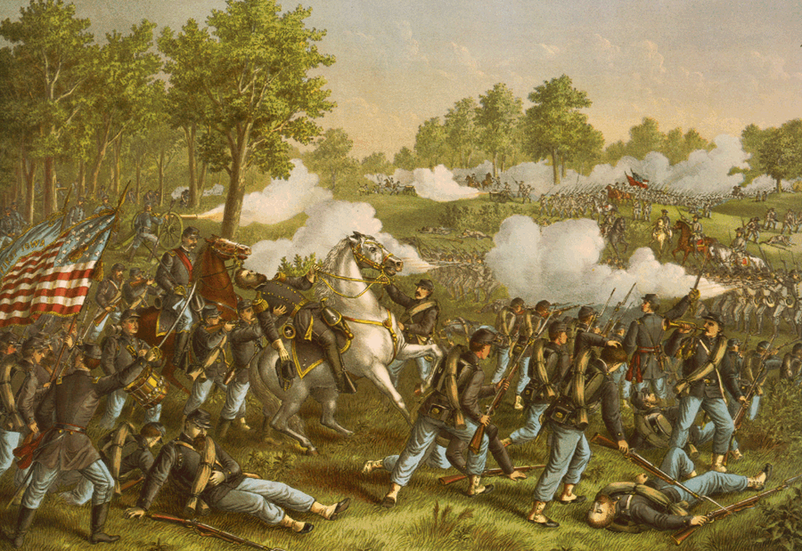
37°12′0″N 93°16′7″W / 37.2°N 93.26861°WSpringfield 61 Wilson's Creek National Battlefield 
October 15, 1966 SW of Springfield on MO 174
37°6′6″N 93°24′31″W / 37.10167°N 93.40861°WSpringfield 62 Wise Feed Company Building January 6, 2003 438-440 S. Campbell Ave.
37°12′20″N 93°17′34″W / 37.20556°N 93.29278°WSpringfield 63 Woods-Evertz Stove Company Historic District October 23, 2003 Area bounded by N. Jefferson Ave., E Phelps St., N. Robberson Ave., and E. Tampa St.
37°12′55″N 93°17′26″W / 37.21528°N 93.29056°WSpringfield Formerly listed properties
Landmark name Image Date delisted Location City or Town Summary 1 Second Baptist Church October 6, 2001 729 North Washington
37°12′57″N 93°17′11″W / 37.21583°N 93.28639°WSpringfield References
- ^ "National Register of Historic Places: Weekly List Actions". National Park Service, United States Department of the Interior. Retrieved on November 10, 2011.
- ^ Location derived from About Us, Christ Episcopal Church, n.d. Accessed 2011-08-05. The NRIS lists the site as "Address Restricted".
Municipalities and communities of Greene County, Missouri Cities Ash Grove | Battlefield | Fair Grove | Republic‡ | Rogersville‡ | Springfield‡ | Strafford | Walnut Grove | Willard

Townships Brookline | Cass | Clay | East Republic | Murray | Pond Creek | Springfield | Taylor | Walnut Grove | Washington | West Republic | Wilson
Unincorporated
communitiesBois D'Arc | Logan | Ebenezer | Oak Grove Heights | Plano | Cave Spring | Turners
Footnotes ‡This populated place also has portions in an adjacent county or counties
U.S. National Register of Historic Places Topics Lists by states Alabama • Alaska • Arizona • Arkansas • California • Colorado • Connecticut • Delaware • Florida • Georgia • Hawaii • Idaho • Illinois • Indiana • Iowa • Kansas • Kentucky • Louisiana • Maine • Maryland • Massachusetts • Michigan • Minnesota • Mississippi • Missouri • Montana • Nebraska • Nevada • New Hampshire • New Jersey • New Mexico • New York • North Carolina • North Dakota • Ohio • Oklahoma • Oregon • Pennsylvania • Rhode Island • South Carolina • South Dakota • Tennessee • Texas • Utah • Vermont • Virginia • Washington • West Virginia • Wisconsin • WyomingLists by territories Lists by associated states Other Categories:- Greene County, Missouri
- National Register of Historic Places in Missouri
-


Wikimedia Foundation. 2010.