- Republic, Missouri
Infobox Settlement
official_name = Republic, Missouri
settlement_type =City
nickname =
motto =
imagesize =
image_caption =
image_
imagesize =
image_caption =
image_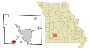
mapsize = 250px
map_caption = Location of Republic, Missouri
mapsize1 =
map_caption1 =subdivision_type = Country
subdivision_name =United States
subdivision_type1 = State
subdivision_name1 =Missouri
subdivision_type2 = County
subdivision_name2 = Greene
government_footnotes =
government_type =
leader_title =
leader_name =
leader_title1 =
leader_name1 =
established_title =
established_date =unit_pref = Imperial
area_footnotes =area_magnitude =
area_total_km2 = 14.5
area_land_km2 = 14.5
area_water_km2 = 0.0
area_total_sq_mi = 5.6
area_land_sq_mi = 5.6
area_water_sq_mi = 0.0population_as_of = 2000
population_footnotes =
population_total = 8438
population_density_km2 = 582.3
population_density_sq_mi = 1508.1timezone = Central (CST)
utc_offset = -6
timezone_DST = CDT
utc_offset_DST = -5
elevation_footnotes =
elevation_m = 399
elevation_ft = 1309
latd = 37 |latm = 7 |lats = 18 |latNS = N
longd = 93 |longm = 28 |longs = 17 |longEW = Wpostal_code_type =
ZIP code
postal_code = 65738
area_code = 417
blank_name = FIPS code
blank_info = 29-61238GR|2
blank1_name = GNIS feature ID
blank1_info = 0725224GR|3
website =
footnotes =Republic is a city in Greene County,
Missouri ,United States . The population was 8,438 at the 2000 census. It is part of theSpringfield, Missouri Metropolitan Statistical Area.History
In 2005, the cities of Republic and Brookline consolidated as Missouri State laws allow after a vote of the residents of both communities approved the consolidation with Republic taking over all aspects of city government. Originally, Brookline was to retain its own identity, but the city limit signs have since been changed to Republic's. However, according to Section I (b) of the Intergovernmental Agreement:
"Name of Consolidated Municipality - The name of the consolidated municipality shall be "City of Republic." To help preserve the identity of the Village, the City will place signs with text “Village of Brookline” at the current corporate limits of the Village. Placement of signage is subject to State sign regulations when placed in State right-of-way. The City of Republic will work with the United States Postal Service to help preserve the history and operation of the Brookline Station Post Office."
Therefore, Brookline has retained its identity per intergovernmental agreement although city limit signs have been placed at the old borders of the village. The Brookline signs are still located to identify the original village area near the post office.Geography
Republic is located at coor dms|37|7|18|N|94|28|17|W|city (37.121652, -93.471440)GR|1.
According to the
United States Census Bureau , the city has a total area of 5.6square mile s (14.5km² ), all of it land.Demographics
As of the
census GR|2 of 2000, there were 8,438 people, 3,148 households, and 2,379 families residing in the city. Thepopulation density was 1,508.1 people per square mile (581.8/km²). There were 3,298 housing units at an average density of 589.4/sq mi (227.4/km²). The racial makeup of the city was 97.43% White, 0.24% African American, 0.56% Native American, 0.49% Asian, 0.02% Pacific Islander, 0.24% from other races, and 1.03% from two or more races. Hispanic or Latino of any race were 1.04% of the population.There were 3,148 households out of which 41.1% had children under the age of 18 living with them, 59.7% were married couples living together, 12.4% had a female householder with no husband present, and 24.4% were non-families. 20.8% of all households were made up of individuals and 8.9% had someone living alone who was 65 years of age or older. The average household size was 2.63 and the average family size was 3.04.
In the city the population was spread out with 28.7% under the age of 18, 8.1% from 18 to 24, 32.0% from 25 to 44, 18.9% from 45 to 64, and 12.3% who were 65 years of age or older. The median age was 33 years. For every 100 females there were 88.2 males. For every 100 females age 18 and over, there were 82.1 males.
The median income for a household in the city was $34,611, and the median income for a family was $37,622. Males had a median income of $30,849 versus $21,725 for females. The
per capita income for the city was $15,212. About 5.8% of families and 6.7% of the population were below thepoverty line , including 7.8% of those under age 18 and 10.2% of those age 65 or over.References
External links
* [http://www.republicmo.com City of Republic Official Website]
Wikimedia Foundation. 2010.