- Fair Grove, Missouri
Infobox Settlement
official_name = Fair Grove, Missouri
settlement_type =City
nickname = "The Old Mill Town"
motto =
imagesize =
image_caption =
image_
imagesize =
image_caption =
image_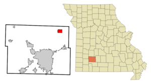
mapsize = 250px
map_caption = Location in the state of Missouri
mapsize1 =
map_caption1 =subdivision_type = Country
subdivision_name =United States
subdivision_type1 = State
subdivision_name1 =Missouri
subdivision_type2 = County
subdivision_name2 = Greene
government_footnotes =
government_type =
leader_title =Mayor
leader_name = Tim Smith
leader_title1 =
leader_name1 =
established_title =
established_date =unit_pref = Imperial
area_footnotes =area_magnitude =
area_total_km2 = 8.0
area_land_km2 = 8.0
area_water_km2 = 0.0
area_total_sq_mi = 3.1
area_land_sq_mi = 3.1
area_water_sq_mi = 0.0population_as_of = 2000
population_footnotes =
population_total = 1107
population_density_km2 = 137.9
population_density_sq_mi = 357.1timezone = Central (CST)
utc_offset = -6
timezone_DST = CDT
utc_offset_DST = -5
elevation_footnotes =
elevation_m = 369
elevation_ft = 1211
latd = 37 |latm = 22 |lats = 52 |latNS = N
longd = 93 |longm = 9 |longs = 4 |longEW = Wpostal_code_type =
ZIP code
postal_code = 65648
area_code = 417
blank_name = FIPS code
blank_info = 29-23338GR|2
blank1_name = GNIS feature ID
blank1_info = 0717724GR|3
website = http://ci.fairgrove.mo.us/
footnotes =Fair Grove is a city in Greene County,
Missouri ,United States . The population was 1,107 at the 2000 census. It is part of theSpringfield, Missouri Metropolitan Statistical Area.Geography
Fair Grove is located at coor dms|37|22|52|N|93|9|4|W|city (37.380992, -93.150996)GR|1.
According to the
United States Census Bureau , the city has a total area of 3.1square mile s (8.0km² ), all of it land.Demographics
Fair Grove is located about 14 miles north of
Springfield, Missouri onHighway 65 . The 2000census counted 1,107 citizens.MODOT is improving four lane Highway 65 south to Springfield, connecting with 4 lanes south toBranson andBuffalo, MO . As of thecensus GR|2 of 2000, there were 1,107 people, 405 households, and 309 families residing in the city. Thepopulation density was 357.1 people per square mile (137.9/km²). There were 421 housing units at an average density of 135.8/sq mi (52.4/km²). The racial makeup of the city was 98.19% White, 0.18% Native American, 0.18% Asian, and 1.45% from two or more races. Hispanic or Latino of any race were 0.36% of the population.There were 405 households out of which 43.7% had children under the age of 18 living with them, 59.5% were married couples living together, 12.1% had a female householder with no husband present, and 23.5% were non-families. 20.7% of all households were made up of individuals and 10.9% had someone living alone who was 65 years of age or older. The average household size was 2.73 and the average family size was 3.18.
In the city the population was spread out with 31.7% under the age of 18, 8.1% from 18 to 24, 32.6% from 25 to 44, 17.4% from 45 to 64, and 10.1% who were 65 years of age or older. The median age was 31 years. For every 100 females there were 93.9 males. For every 100 females age 18 and over, there were 88.1 males.
The median income for a household in the city was $36,761, and the median income for a family was $41,167. Males had a median income of $30,688 versus $21,447 for females. The
per capita income for the city was $16,765. About 6.4% of families and 6.8% of the population were below thepoverty line , including 7.1% of those under age 18 and 11.5% of those age 65 or over.History
Tradition says that the little
log school went by the name of the Duke School House from the fact that Chattam Duke was the teacher of the first term of school in the new district -- this was on or about the year 1851.Later on, the
Methodist andPresbyterian people met to worship in the grove a few yards east of this house (if house it may be called with puncheon floor and grotesque furnishings) and there built an arbor and small house in which to worship.At one of these meetings the question was asked "What shall we name this place?" and Uncle Willis Spence, as he was familiarly called, suggested that it be called Fair Grove after the name of the Methodist church of which he had been a member, in
Randolph County, NC All acquiesced and the name has ever since remained. So the Grove part of the name was not a native part of Missouri, but ofNorth Carolina .In the early years of Fair Grove, the citizens of the place, and community -- mostly Methodists and Presbyterians met to worship under a brush arbor about where a small house of worship was built and afterward a spacious arbor supported by numerous posts and covered with clapboards, served a few years.
On or about the year 1856, one John Ramey, a prosperous farmer, who owned a large farm which at this time is owned by Cal Potter, built a small store house on the lot now (1932) owned and occupied by the Farmers Exchange, became the first merchant of Fair Grove.
The town was noted for numerous
blacksmith s.In 1883, a very good and efficient buhr mill was built to grind both corn and wheat. After a few years they dispensed with the wheat buhr and installed the roller process of making flour which enabled them to turn out a high grade of merchantable flour and the proprietors for years and years had a very lucrative business.
Fair Grove at one time had a
wool carding machine. This machine was housed in a small house immediately west of the Bell Hotel Lot. This factory was built by Paschal McMinn, father of the late Willis McMinn who established the first barbershop in town.Fair Grove had an elegant cafe and a hotel second to none in the country. Mr. Bell proprietor, together with his good wife built through courteousness, an enviable business in their line. Their table filled with delicious viands is seldom surpassed by any hotel in large cities.
Mr. Bell has established a miniature zoo park which featured a pair each of
deer ,peafowl ,white guineas ,ring-tail coon ,black coon , (a very rare animal) a whiteopossum , agroundhog , a pair of foxsquirrels and several gray squirrels; also three exquisite houses for Martins which from their elevation overlooked the town.Fair Grove from its early existence was noted for its commerciality, which increased as the years flitted by. The many customers of the several merchants carried away an immense amount of the necessaries of the home, while the several merchants furnished in such profuse quantities. [cite web |url= http://fghps.org/index.html|title= Fair Grove Historical Society Homepage|accessdate=2007-10-12 |last= Smith |first= Marilyn |authorlink= |coauthors= |date= |year= |month= |format= |publisher=
FGHPS, Inc. |language= ]Fair Grove Today
Consistent growth is the plan for the inhabitants that are proud of 1883
Wommack Mill , school, park, and small town style of living with a sense of community. There are nine subdivisions underway in the city limits. All city streets are paved and the newer subdivisions have curbs, gutters and sidewalks. The citizens passed a revenue bond issue in 2005 to expand the sewer system in planning for future growth. Fair Grove City Water has been established since 1968 and has twowells and two storage tanks. Water ischlorinated and tested as per DNR regulations. There are around 500single-family homes , and several multi family buildings andduplexes . A Senior Citizen's Housing provides 1-bedroom apartments for 20. There are 43 businesses, including the historic district. These businesses consist of 4 banks (O'Bannon Bank;Emprie Bank;Greene County Bank; and Bank Of Bolivar), Family Pharmacy,MFA ,Dollar General , Cody's Convenience Store,O Reilly Auto Parts Store , Subway, Hilltop Pizza and BBQ,The Brick House Diner , Summerfresh Grocery, and the localUSPS . Nine Churches reside within the city limits.The 3.131 square miles of city operates with an alderman-based government. Mayor Tim Smith and 6 aldermen (2 aldermen representing each of the 3 wards) meet twice a month. A 39-acre city park in the center of town was purchased by the Park Department with plans to develop a hiking trail, soccer fields, baseball diamonds and a community building. A rambling creek runs through the center of the parkland. There is a part of the recreational area already established next to City Hall and the library with a sand volleyball court, basketball court, public restrooms, a toddler playground area and another playground for older children. The library was completed in 2000 and holds over 6,000 books.
Fair Grove R-X Public Schools
Fair Grove R-10 School District is a K-12 school district located at 132 N. Main Street in Fair Grove. The school district is again for the ninth year out of 10 and for the last four years Accredited with Distinction in Performance. This is the highest accreditation awarded by the Missouri Department of Elementary and Secondary Education. The school enrollment is 1,140 students in the learning centers: grades K-5, 6-8, and 9-12. In addition to the basic courses, instruction is provided through classes of remediation, special needs, enrichment, college preparatory, advanced, vocational courses, area vocational school, dual credit and distant learning courses with nearby universities. This district far exceeds the educational opportunities required by theMissouri Department of Elementary and Secondary Education . [cite web |url= http://ci.fairgrove.mo.us/index.html|title= City of Fair Grove Homepage|accessdate=2007-10-12 |last= Manning |first= Betty |authorlink= |coauthors=Gene Rice |date= |year= |month= |format= |publisher=City of Fair Grove, Missouri |language= ]In 2007, voters approved a tax bond for new construction projects and for renovation of current space. In the summer of 2008 the construction was completed on the new Middle School that was built in 2007 as a result of the tax bond. The New Middle School was opened for the 2008-2009 school year. Construction of a new baseball field as well as a new football field and track. Expected completion for the construction and renovations as a result of the 2007 tax bond is 2010.
Fair Grove Heritage Reunion
The most notable event that takes place in Fair Grove each year is the Fair Grove Heritage Reunion. This festival has its roots in the Fair Grove Arts and Crafts Festival which started in 1978. Dan and Betty Manning organized a gathering of 12 local craftsmen to sell their wares on the square. [cite web | publisher = Missouri State University | title = Fair Grove Heritage Reunion History | url = http://www.missouristate.edu/rls/fair_grove_heritage_reunion_hist.htm | accessdate= 2006-09-15]
That first year, Granny Poke, in a bedraggled cookshack, fired up her wood stove to cook a batch of brown beans, poke greens, homemade fruit cobbler and
cornbread . A short parade began the two-day event, with a small crowd attending. A few men of the town gathered at the mill to learn log splitting and shingle riving, and Sassafras tea,pawpaw s and hickory nuts were available, just for the asking.Since those early years, the organizers of that first festival have seen many changes and improvements. Today, the crowd estimate during the Fair Grove Heritage Reunion is 40,000 to 50,000 on Saturday and around 30,000 on Sunday. The number of booths have increased to almost 400, with many featuring demonstrations, such as
weaving ,bobbin lace and soap making. The two day event still includes a parade and a church service in front of the historic mill.Activities abound throughout the show area. Some of the favorites include corn grinding in the Wommack Mill, working draft teams, an antique tractor rodeo,
horse andmule obstacle course and wheat threshing. Primitive gasoline engines andsteam-powered engines are furnished through the Early Day Gas Engines and Tractor Association, Branch 16 and The Ozark Steam Engine Association. Demonstrations of corn shredders and acorn shellers also occur throughout the day. [cite web |url= http://fghps.org/reunion_history.html|title= History of Fair Grove Heritage Reunion|accessdate=2007-10-12 |last= Smith |first= Marilyn |authorlink= |coauthors= |date= |year= |month= |format= |publisher=FGHPS, Inc. |language= ]The 2007 the Festival had an estimated 60,000 attendance. Also in 2007, the parade was the longest ever (over 3 hours long) in celebration of the City's 40th Anniversary. Mayor Brian Thompson and the entire Board of Aldermen where featured on the City's own float.
Fair Grove and the Future
In 2007, MoDOT began construction of the new four lane highway 65 from Springfield to Buffalo. The Fair Grove Schools began remodeling and new construction of all the R-X Schools.
In the fall of 2007, Pizza Hut started offering the Pizza Hut Express Trailer in Fair Grove twice a week. But, was later discontinued as a result of funding issues.
Fair Grove is currently constructing the new Public Park. The new Park will feature a volleyball court, basketball court, softball field, soccer field, a baseball field, a water park/pool, hiking trails, and playgrounds.
In December 2007,
at&t started offering their DSL in Fair Grove. Before than, Fair Grove didn't have any High Speed Internet providers - many residents and businesses had to get their Internet via satellite or they had to have Dial-Up service.In February 2008, Verizon Wireless started offering Wireless service in the Springfield Metro Area (including Fair Grove).
In August 2008, the construction of the new Middle School was completed. Construction continues on the new central office and the athletic fields.
References
External links
* [http://ci.fairgrove.mo.us/ City of Fair Grove Homepage]
* [http://fairgrove.org/ Fair Grove Chamber of Commerce Homepage]
* [http://fghps.org/ Fair Grove Historical Society Homepage]
* [http://fairgroveparks,org/ Fair Grove District Parks Department Homepage]
* [http://fairgrovefire.org/ Fair Grove Fire Protection District Homepage]
* [http://fairgrovewater.org/ Fair Grove Public Water Supply District Homepage]
Wikimedia Foundation. 2010.