- National Register of Historic Places listings in Searcy County, Arkansas
-
 Location of Searcy County in Arkansas
This is a list of the National Register of Historic Places listings in Searcy County, Arkansas.
This is intended to be a complete list of the properties and districts on the National Register of Historic Places in Searcy County, Arkansas, United States. The locations of National Register properties and districts for which the latitude and longitude coordinates are included below, may be seen in a Google map.[1]
There are 48 properties and districts listed on the National Register in the county.
Contents: Counties in Arkansas Arkansas - Ashley - Baxter - Benton - Boone - Bradley - Calhoun - Carroll - Chicot - Clark - Clay - Cleburne - Cleveland - Columbia - Conway - Craighead - Crawford - Crittenden - Cross - Dallas - Desha - Drew - Faulkner - Franklin - Fulton - Garland - Grant - Greene - Hempstead - Hot Spring - Howard - Independence - Izard - Jackson - Jefferson - Johnson - Lafayette - Lawrence - Lee - Lincoln - Little River - Logan - Lonoke - Madison - Marion - Miller - Mississippi - Monroe - Montgomery - Nevada - Newton - Ouachita - Perry - Phillips - Pike - Poinsett - Polk - Pope - Prairie - Pulaski (Little Rock) - Randolph - St. Francis - Saline - Scott - Searcy - Sebastian - Sevier - Sharp - Stone - Union - Van Buren - Washington - White - Woodruff - Yell
-
- This National Park Service list is complete through NPS recent listings posted November 10, 2011.[2]
Current listings
[3] Landmark name [4] Image Date listed Location City or town Summary 1 3SE33 June 29, 1976 Address Restricted Silver Hill 2 Aday-Stephenson House December 2, 1993 Pine St.
35°54′22″N 92°37′29″W / 35.906111°N 92.624722°WMarshall 3 American Legion Post No. 131 December 2, 1993 Center St. west of its junction with Walnut St.
35°49′46″N 92°33′36″W / 35.829444°N 92.56°WLeslie 4 Bank of Marshall Building October 4, 1993 Southeastern corner of the junction of Main and Center Sts.
35°54′33″N 92°37′53″W / 35.909167°N 92.631389°WMarshall 5 Guy Bartley House December 2, 1993 Northeastern corner of the junction of Elm and 5th Sts.
35°50′02″N 92°33′25″W / 35.833889°N 92.556944°WLeslie 6 Bates Tourist Court October 4, 1993 Fair St.
35°54′39″N 92°37′56″W / 35.910833°N 92.632222°WMarshall 7 Bromley-Mills-Treece House October 4, 1993 Main St.
35°54′32″N 92°37′43″W / 35.908889°N 92.628611°WMarshall 8 Noah Bryan Store August 18, 1993 Southwestern corner of the junction of Glade and Main Sts.
35°54′33″N 92°37′56″W / 35.909167°N 92.632222°WMarshall 9 Campbell Post Office-Kuykendall General Store December 2, 1993 County Road 73 northwest of Oxley
35°52′19″N 92°28′35″W / 35.871944°N 92.476389°WOxley 10 Dr. Clay House December 2, 1993 Junction of Walnut and Center Sts.
35°49′46″N 92°33′33″W / 35.829444°N 92.559167°WLeslie 11 Cooper's Bluff May 4, 1982 Address Restricted Snowball 12 Dr. J.O. Cotton House December 2, 1993 Southeastern corner of the junction of Highway 66 and High St.
35°49′49″N 92°33′28″W / 35.830278°N 92.557778°WLeslie 13 Dr. Sam G. Daniel House August 18, 1993 Northern side of Nome St., one block west of Courthouse Square
35°54′36″N 92°37′57″W / 35.91°N 92.6325°WMarshall 14 Dugger and Schultz Millinery Store Building October 4, 1993 Southwestern corner of the junction of Glade and Nome Sts.
35°54′35″N 92°37′57″W / 35.909722°N 92.6325°WMarshall 15 Farmers Bank Building August 18, 1993 Junction of Main and Walnut Sts.
35°49′44″N 92°33′35″W / 35.828889°N 92.559722°WLeslie 16 Bud Fendley House August 18, 1993 201 Spring St.
35°54′28″N 92°37′45″W / 35.907778°N 92.629167°WMarshall 17 Ferguson Gas Station October 4, 1993 Southeastern corner of the junction of Center and U.S. Route 65
35°54′37″N 92°37′52″W / 35.910278°N 92.631111°WMarshall 18 T.M. Ferguson House October 4, 1993 Canaan St.
35°54′29″N 92°38′05″W / 35.908056°N 92.634722°WMarshall 19 Zeb Ferguson House October 4, 1993 U.S. Route 65
35°54′39″N 92°37′51″W / 35.910833°N 92.630833°WMarshall 20 Gates-Helm Farm August 18, 1993 County Road 13, approximately 1 mile north of its junction with County Road 250
35°55′16″N 92°50′04″W / 35.921111°N 92.834444°WSnowball 21 Columbus Hatchett House August 18, 1993 Northern side of the junction of Main and Hazel Sts.
35°49′40″N 92°33′26″W / 35.827778°N 92.557222°WLeslie 22 Henley Hotel January 24, 2011 112 U.S. Route 65 North
36°01′47″N 92°48′09″W / 36.029722°N 92.8025°WSt. Joe Searcy County MPS 23 Benjamin Franklin Henley House December 5, 1985 Off U.S. Route 65
36°02′15″N 92°47′09″W / 36.0375°N 92.785833°WSt. Joe 24 Dr. Cleveland Hollabaugh House December 2, 1993 Oak St.
35°49′56″N 92°33′34″W / 35.832222°N 92.559444°WLeslie 25 S.A. Lay House October 4, 1993 Junction of Glade St. and U.S. Route 65
35°54′38″N 92°37′55″W / 35.910556°N 92.631944°WMarshall 26 Leslie-Rolen House August 18, 1993 Junction of Cherry and High Sts.
35°49′48″N 92°33′25″W / 35.83°N 92.556944°WLeslie 27 Anthony Luna House October 4, 1993 Southwestern corner of the junction of Main and Spring Sts.
35°54′33″N 92°37′50″W / 35.909167°N 92.630556°WMarshall 28 Thomas Lynch House August 18, 1993 County Road 52, approximately 2.5 miles north of Morning Star
36°00′18″N 92°35′52″W / 36.005°N 92.597778°WMorning Star 29 Sam Marshall House October 4, 1993 County Road 163
35°58′14″N 92°35′05″W / 35.970556°N 92.584722°WMorning Star 30 William P. and Rosa Lee Martin Farm June 15, 2011 7429 Campbell Rd.
35°56′04″N 92°28′26″W / 35.934444°N 92.473889°WMarshall vicinity 31 Mays General Store September 1, 1983 Front St.
35°59′20″N 92°42′57″W / 35.988889°N 92.715833°WGilbert 32 J.M. McCall House October 4, 1993 Spring St.
35°54′18″N 92°37′46″W / 35.905°N 92.629444°WMarshall 33 Vinie McCall House October 4, 1993 Spring St.
35°54′20″N 92°37′45″W / 35.905556°N 92.629167°WMarshall 34 Meek Building November 15, 2000 Junction of Main and Oak Sts.
35°49′47″N 92°33′36″W / 35.829722°N 92.56°WLeslie 35 J.C. Miller House December 2, 1993 Northwestern corner of the junction of Oak and High Sts.
35°49′56″N 92°33′34″W / 35.832222°N 92.559444°WLeslie 36 Missouri and North Arkansas Depot-Leslie June 11, 1992 Southwestern end of Walnut St.
35°49′38″N 92°33′32″W / 35.827222°N 92.558889°WLeslie 37 Old Searcy County Jail May 28, 2010 Arkansas Highway 27 (Center St.) Marshall 38 Charley Passmore House October 4, 1993 Campus St.
35°54′19″N 92°37′56″W / 35.905278°N 92.632222°WMarshall 39 Oscar Redman Building August 18, 1993 119 E. Main St.
35°54′34″N 92°37′52″W / 35.909444°N 92.631111°WMarshall 40 W.F. Reeves House October 4, 1993 Short St.
35°54′48″N 92°38′02″W / 35.913333°N 92.633889°WMarshall 41 Dr. Robinson House December 2, 1993 Walnut St. east of its junction with Center St.
35°49′46″N 92°33′31″W / 35.829444°N 92.558611°WLeslie 42 St. Joe Missouri and North Arkansas Railroad Depot September 16, 1993 Southern side of U.S. Route 65
36°01′47″N 92°48′09″W / 36.029722°N 92.8025°WSt. Joe 43 Sanders-Hollabaugh House October 4, 1993 Church St.
35°54′39″N 92°37′47″W / 35.910833°N 92.629722°WMarshall 44 Searcy County Courthouse October 21, 1976 Courthouse Sq.
35°54′34″N 92°37′55″W / 35.909444°N 92.631944°WMarshall 45 Greene Thomas House August 18, 1993 West of County Road 55, 0.25 miles south of its junction with County Road 74
35°51′32″N 92°33′58″W / 35.858889°N 92.566111°WLeslie 46 Treat Commercial Building August 18, 1993 Northwestern side of Oak St. between High and 4th Sts.
35°49′49″N 92°33′36″W / 35.830278°N 92.56°WLeslie 47 Jasper E. Treece Building August 18, 1993 West of County Road 55, approximately 0.5 miles south of its junction with Highway 74
35°54′21″N 92°29′05″W / 35.905833°N 92.484722°WBaker 48 Willmering Tourist Cabins Historic District November 15, 2000 Highway 65
35°58′09″N 92°44′52″W / 35.969167°N 92.747778°WSilver Hill See also
- List of National Historic Landmarks in Arkansas
- National Register of Historic Places listings in Arkansas
References
- ^ The latitude and longitude information provided in this table was derived originally from the National Register Information System, which has been found to be fairly accurate for about 99% of listings. For about 1% of NRIS original coordinates, experience has shown that one or both coordinates are typos or otherwise extremely far off; some corrections may have been made. A more subtle problem causes many locations to be off by up to 150 yards, depending on location in the country: most NRIS coordinates were derived from tracing out latitude and longitudes off of USGS topographical quadrant maps created under the North American Datum of 1927, which differs from the current, highly accurate WGS84 GPS system used by Google maps. Chicago is about right, but NRIS longitudes in Washington are higher by about 4.5 seconds, and are lower by about 2.0 seconds in Maine. Latitudes differ by about 1.0 second in Florida. Some locations in this table may have been corrected to current GPS standards.
- ^ "National Register of Historic Places: Weekly List Actions". National Park Service, United States Department of the Interior. Retrieved on November 10, 2011.
- ^ Numbers represent an ordering by significant words. Various colorings, defined here, differentiate National Historic Landmark sites and National Register of Historic Places Districts from other NRHP buildings, structures, sites or objects.
- ^ "National Register Information System". National Register of Historic Places. National Park Service. . http://nrhp.focus.nps.gov/natreg/docs/All_Data.html.
U.S. National Register of Historic Places Topics Lists by states Alabama • Alaska • Arizona • Arkansas • California • Colorado • Connecticut • Delaware • Florida • Georgia • Hawaii • Idaho • Illinois • Indiana • Iowa • Kansas • Kentucky • Louisiana • Maine • Maryland • Massachusetts • Michigan • Minnesota • Mississippi • Missouri • Montana • Nebraska • Nevada • New Hampshire • New Jersey • New Mexico • New York • North Carolina • North Dakota • Ohio • Oklahoma • Oregon • Pennsylvania • Rhode Island • South Carolina • South Dakota • Tennessee • Texas • Utah • Vermont • Virginia • Washington • West Virginia • Wisconsin • WyomingLists by territories Lists by associated states Other Municipalities and communities of Searcy County, Arkansas Cities 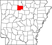
Towns Unincorporated
communitiesCozahome | Harriet | Snowball | Witts Springs
Footnotes ‡This populated place also has portions in an adjacent county or counties
Categories:- Searcy County, Arkansas
- National Register of Historic Places in Arkansas by county
-

Wikimedia Foundation. 2010.