- National Register of Historic Places listings in Randolph County, Arkansas
-
 Location of Randolph County in Arkansas
This is a list of the National Register of Historic Places listings in Randolph County, Arkansas.
This is intended to be a complete list of the properties and districts on the National Register of Historic Places in Randolph County, Arkansas, United States. The locations of National Register properties and districts for which the latitude and longitude coordinates are included below, may be seen in a Google map.[1]
There are 16 properties and districts listed on the National Register in the county. Another property was once listed but has been removed.
Contents: Counties in Arkansas Arkansas - Ashley - Baxter - Benton - Boone - Bradley - Calhoun - Carroll - Chicot - Clark - Clay - Cleburne - Cleveland - Columbia - Conway - Craighead - Crawford - Crittenden - Cross - Dallas - Desha - Drew - Faulkner - Franklin - Fulton - Garland - Grant - Greene - Hempstead - Hot Spring - Howard - Independence - Izard - Jackson - Jefferson - Johnson - Lafayette - Lawrence - Lee - Lincoln - Little River - Logan - Lonoke - Madison - Marion - Miller - Mississippi - Monroe - Montgomery - Nevada - Newton - Ouachita - Perry - Phillips - Pike - Poinsett - Polk - Pope - Prairie - Pulaski (Little Rock) - Randolph - St. Francis - Saline - Scott - Searcy - Sebastian - Sevier - Sharp - Stone - Union - Van Buren - Washington - White - Woodruff - Yell
-
- This National Park Service list is complete through NPS recent listings posted November 10, 2011.[2]
Current listings
[3] Landmark name [4] Image Date listed Location City or town Summary 1 Black River Bridge 
April 9, 1990 U.S. Route 67 over the Black River
36°15′16″N 90°58′15″W / 36.254444°N 90.970833°WPocahontas Swing truss bridge 2 Campbell Cemetery May 25, 2005 Off Muddy Ln., southeast of Imboden
36°10′59″N 91°8′28″W / 36.18306°N 91.14111°W[5]Imboden 3 Cedar Grove School #81 January 21, 2004 Approximately 5 miles north of Pocahontas along Highway 115 in the community of Brockett
36°19′57″N 90°57′06″W / 36.3325°N 90.951667°WPocahontas 4 Hillyard Cabin August 16, 1994 Western side of Old Burr Rd., northeast of Warm Springs
36°29′02″N 91°02′04″W / 36.483889°N 91.034444°WWarm Springs 5 Looney-French House September 23, 2004 1325 Deer Run Trail
36°23′50″N 91°07′22″W / 36.397222°N 91.122778°WDalton 6 Marr's Creek Bridge January 24, 2008 S. Bettis St.
36°15′35″N 90°58′19″W / 36.259722°N 90.971944°WPocahontas 7 Old Davidsonville State Historic Monument January 18, 1974 Northeast of Black Rock on the Black River
36°09′23″N 91°03′23″W / 36.156389°N 91.056389°WBlack Rock 8 Old Randolph County Courthouse 
April 24, 1973 Broadway and Vance St.
36°15′38″N 90°58′10″W / 36.260556°N 90.969444°WPocahontas 9 Old Union School November 12, 1993 504 Old Union Rd.
36°15′41″N 91°06′07″W / 36.261389°N 91.101944°WBirdell 10 Old US 67, Biggers to Datto September 24, 2004 Biggers-Reyno Rd., 1st St., and County Road 111
36°21′35″N 90°46′37″W / 36.359722°N 90.776944°WBiggers 11 Pocahontas Commercial Historic District June 12, 2009 Roughly bounded by Rice, Thomasville, Jordan, and McDonald Sts.
36°15′41″N 90°58′14″W / 36.261508°N 90.970444°WPocahontas 12 Pocahontas Post Office May 16, 2002 109 Van Bibber St.
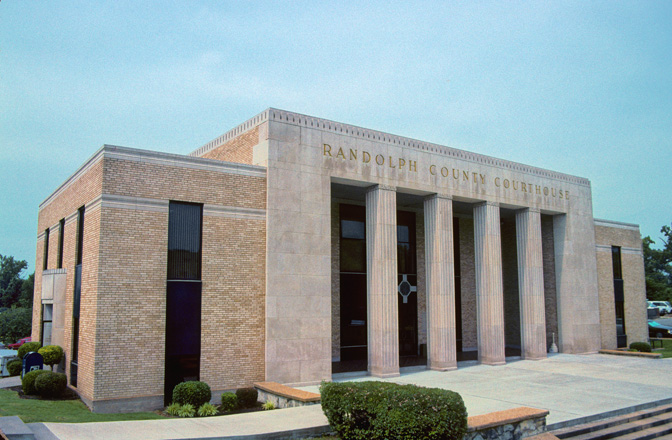
36°15′43″N 90°58′16″W / 36.261944°N 90.971111°WPocahontas 13 Randolph County Courthouse 
August 22, 1996 Southwestern corner of the junction of Broadway and N. Marr Sts.
36°15′39″N 90°58′16″W / 36.260833°N 90.971111°WPocahontas 14 Ravenden Springs School January 14, 2004 Highway 90
36°18′52″N 91°13′26″W / 36.314444°N 91.223889°WRavenden Springs 15 Rice-Upshaw House October 6, 2004 Highway 93, 2 miles south of Dalton
36°25′02″N 91°07′11″W / 36.417222°N 91.119722°WDalton 16 St. Mary's AME Church-Pocahontas Colored School August 5, 2002 1708 Archer St.
36°15′44″N 90°58′53″W / 36.262222°N 90.981389°WPocahontas Former listing
Landmark name Image Date removed Location City or Town Summary 1 Daniel V. Bates House September 14, 2002 U.S. Route 67 Pocahontas See also
- List of National Historic Landmarks in Arkansas
- National Register of Historic Places listings in Arkansas
References
- ^ The latitude and longitude information provided in this table was derived originally from the National Register Information System, which has been found to be fairly accurate for about 99% of listings. For about 1% of NRIS original coordinates, experience has shown that one or both coordinates are typos or otherwise extremely far off; some corrections may have been made. A more subtle problem causes many locations to be off by up to 150 yards, depending on location in the country: most NRIS coordinates were derived from tracing out latitude and longitudes off of USGS topographical quadrant maps created under North American Datum of 1927, which differs from the current, highly accurate GPS system used by Google maps. Chicago is about right, but NRIS longitudes in Washington are higher by about 4.5 seconds, and are lower by about 2.0 seconds in Maine. Latitudes differ by about 1.0 second in Florida. Some locations in this table may have been corrected to current GPS standards.
- ^ "National Register of Historic Places: Weekly List Actions". National Park Service, United States Department of the Interior. Retrieved on November 10, 2011.
- ^ Numbers represent an ordering by significant words. Various colorings, defined here, differentiate National Historic Landmark sites and National Register of Historic Places Districts from other NRHP buildings, structures, sites or objects.
- ^ "National Register Information System". National Register of Historic Places. National Park Service. . http://nrhp.focus.nps.gov/natreg/docs/All_Data.html.
- ^ Location derived from its GNIS feature record; the NRIS lists the site as "Address Restricted"
U.S. National Register of Historic Places Topics Lists by states Alabama • Alaska • Arizona • Arkansas • California • Colorado • Connecticut • Delaware • Florida • Georgia • Hawaii • Idaho • Illinois • Indiana • Iowa • Kansas • Kentucky • Louisiana • Maine • Maryland • Massachusetts • Michigan • Minnesota • Mississippi • Missouri • Montana • Nebraska • Nevada • New Hampshire • New Jersey • New Mexico • New York • North Carolina • North Dakota • Ohio • Oklahoma • Oregon • Pennsylvania • Rhode Island • South Carolina • South Dakota • Tennessee • Texas • Utah • Vermont • Virginia • Washington • West Virginia • Wisconsin • WyomingLists by territories Lists by associated states Other Municipalities and communities of Randolph County, Arkansas City 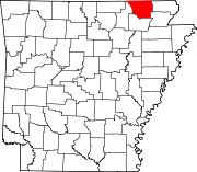
Towns Biggers | Maynard | O'Kean | Ravenden Springs | Reyno
Unincorporated
communityWarm Springs
Categories:- Randolph County, Arkansas
- National Register of Historic Places in Arkansas by county
-


Wikimedia Foundation. 2010.