- National Register of Historic Places listings in Johnson County, Arkansas
-
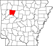
 Location of Johnson County in Arkansas
This is a list of the National Register of Historic Places listings in Johnson County, Arkansas.
This is intended to be a complete list of the properties on the National Register of Historic Places in Johnson County, Arkansas, United States. The locations of National Register properties for which the latitude and longitude coordinates are included below, may be seen in a Google map.[1]
There are 29 properties listed on the National Register in the county.
Contents: Counties in Arkansas Arkansas - Ashley - Baxter - Benton - Boone - Bradley - Calhoun - Carroll - Chicot - Clark - Clay - Cleburne - Cleveland - Columbia - Conway - Craighead - Crawford - Crittenden - Cross - Dallas - Desha - Drew - Faulkner - Franklin - Fulton - Garland - Grant - Greene - Hempstead - Hot Spring - Howard - Independence - Izard - Jackson - Jefferson - Johnson - Lafayette - Lawrence - Lee - Lincoln - Little River - Logan - Lonoke - Madison - Marion - Miller - Mississippi - Monroe - Montgomery - Nevada - Newton - Ouachita - Perry - Phillips - Pike - Poinsett - Polk - Pope - Prairie - Pulaski (Little Rock) - Randolph - St. Francis - Saline - Scott - Searcy - Sebastian - Sevier - Sharp - Stone - Union - Van Buren - Washington - White - Woodruff - Yell
-
- This National Park Service list is complete through NPS recent listings posted November 10, 2011.[2]
Current listings
[3] Landmark name [4] Image Date listed Location City or town Summary 1 Big Piney Creek Bridge 
April 9, 1990 Highway 123 over Big Piney Creek
35°40′37″N 93°14′10″W / 35.676944°N 93.236111°WHagersville 2 Bunch-Walton Post #22 American Legion Hut January 24, 2007 201 Legion St.
35°28′17″N 93°27′29″W / 35.471389°N 93.458056°WClarksville 3 Clarksville Commercial Historic District March 30, 2009 Roughly bounded by McConnell Street on the south, Cherry Street on the north, Johnson Street on the west, and Spadra Creek on the east Clarksville 4 Clarksville Confederate Monument June 25, 1999 Oakland Memorial Cemetery, west of Montgomery Ave.
35°28′04″N 93°28′39″W / 35.467778°N 93.4775°WClarksville 5 Clarksville High School Building No. 1 September 10, 1992 Main St.
35°28′17″N 93°28′20″W / 35.471389°N 93.472222°WClarksville 6 Clarksville National Guard Armory January 24, 2007 309 College St.
35°28′35″N 93°28′00″W / 35.476389°N 93.466667°WClarksville 7 Davis House December 22, 1982 212 Fulton St.
35°28′01″N 93°27′57″W / 35.466944°N 93.465833°WClarksville 8 N.E. Dickerson Store September 22, 1995 East of Highway 215
35°41′21″N 93°34′23″W / 35.689167°N 93.573056°WOark 9 Dover to Clarksville Road-Hickeytown Road Segment May 26, 2005 Hickeytown Rd., east of U.S. Route 64
35°26′06″N 93°22′53″W / 35.435°N 93.381389°WLamar 10 Dunlap House December 22, 1982 101 Grandview
35°28′15″N 93°27′37″W / 35.470833°N 93.460278°WClarksville 11 First Presbyterian Church May 13, 1991 212 College Ave.
35°28′21″N 93°27′57″W / 35.4725°N 93.465833°WClarksville 12 Harmony Presbyterian Church December 1, 1994 Northern side of Highway 103, approximately 8 miles north of Clarksville
35°33′02″N 93°34′13″W / 35.550556°N 93.570278°WHarmony 13 Taylor Hill Hotel October 21, 2008 409 Alabama St.
35°26′11″N 93°40′15″W / 35.436261°N 93.670767°WCoal Hill 14 Johnson County Courthouse June 14, 1991 Junction of Main and Fulton Sts.
35°28′15″N 93°27′53″W / 35.470833°N 93.464722°WClarksville 15 King's Canyon Petroglyphs May 4, 1982 Address Restricted Clarksville 16 Edward Taylor McConnell House May 10, 2001 302 S. Fulton St.
35°28′09″N 93°27′57″W / 35.469167°N 93.465833°WClarksville 17 McKennon House December 22, 1982 115 Grandview
35°28′12″N 93°27′37″W / 35.47°N 93.460278°WClarksville 18 Capt. Archibald S. McKennon House January 2, 1976 215 N. Central
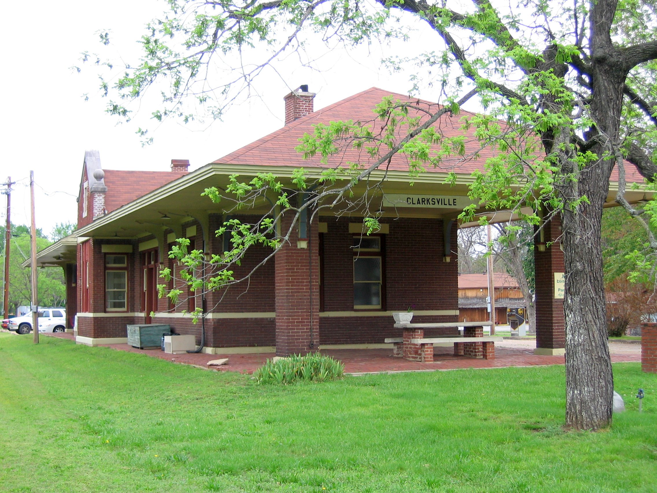
35°28′22″N 93°27′55″W / 35.472778°N 93.465278°WClarksville 19 Missouri-Pacific Depot-Clarksville 
June 11, 1992 West of College St. between Cherry and Main Sts.
35°28′18″N 93°28′07″W / 35.471667°N 93.468611°WClarksville 20 Munger House November 8, 1996 West of County Road 416, approximately ¾ mile north of the Pope County line
35°28′35″N 93°15′02″W / 35.476389°N 93.250556°WLutherville 21 Raymond Munger Memorial Chapel-University of the Ozarks June 8, 1993 West of Highway 103 on the University of the Ozarks campus
35°28′38″N 93°28′03″W / 35.477222°N 93.4675°WClarksville 22 Oark School-Methodist Church September 29, 1995 Junction of Highway 215 and County Road 34
35°41′28″N 93°34′15″W / 35.691111°N 93.570833°WOark 23 Pennington House December 1, 1994 317 Johnson St.
35°28′23″N 93°28′09″W / 35.473056°N 93.469167°WClarksville 24 Pioneer House March 31, 1995 Poplar St. (Highway 64), south of Highway 123 and west of the Johnson County Hospital
35°27′47″N 93°26′47″W / 35.463056°N 93.446389°WClarksville 25 St. Paul Lutheran School March 5, 1999 County Road 418
35°28′44″N 93°16′52″W / 35.478889°N 93.281111°WLamar 26 Serpent Cave May 4, 1982 Address Restricted Clarksville 27 Fremont Stokes House June 4, 2008 319 Grandview Ave.
35°27′58″N 93°27′47″W / 35.46605°N 93.463081°WClarksville 28 Tankersley-Stewart House May 19, 1994 East of County Road 27 and north of Highway 352
35°29′26″N 93°36′36″W / 35.490556°N 93.61°WHunt 29 Union School January 24, 2011 North side of County Road 4670, west of Little Piney Creek
35°38′04″N 93°19′43″W / 35.634444°N 93.328611°WHagarville vicinity Public Schools in the Ozarks MPS; two-room, wood frame schoolhouse erected in 1929; also used as a Masonic Lodge, church and community center[5] See also
- List of National Historic Landmarks in Arkansas
- National Register of Historic Places listings in Arkansas
References
- ^ The latitude and longitude information provided in this table was derived originally from the National Register Information System, which has been found to be fairly accurate for about 99% of listings. For about 1% of NRIS original coordinates, experience has shown that one or both coordinates are typos or otherwise extremely far off; some corrections may have been made. A more subtle problem causes many locations to be off by up to 150 yards, depending on location in the country: most NRIS coordinates were derived from tracing out latitude and longitudes off of USGS topographical quadrant maps created under North American Datum of 1927, which differs from the current, highly accurate GPS system used by Google maps. Chicago is about right, but NRIS longitudes in Washington are higher by about 4.5 seconds, and are lower by about 2.0 seconds in Maine. Latitudes differ by about 1.0 second in Florida. Some locations in this table may have been corrected to current GPS standards.
- ^ "National Register of Historic Places: Weekly List Actions". National Park Service, United States Department of the Interior. Retrieved on November 10, 2011.
- ^ Numbers represent an ordering by significant words. Various colorings, defined here, differentiate National Historic Landmark sites and National Register of Historic Places Districts from other NRHP buildings, structures, sites or objects.
- ^ "National Register Information System". National Register of Historic Places. National Park Service. . http://nrhp.focus.nps.gov/natreg/docs/All_Data.html.
- ^ Lanning, Curt (February 16, 2011). "Johnson County school declared historic property". Couriernews.com. Russellville, Arkansas: Russellville Newspapers, Inc.. http://www.couriernews.com/archived_story.php?ID=27153&Search=Johnson%20County%20school%20declared%20historic%20property. Retrieved February 17, 2011.
U.S. National Register of Historic Places Topics Lists by states Alabama • Alaska • Arizona • Arkansas • California • Colorado • Connecticut • Delaware • Florida • Georgia • Hawaii • Idaho • Illinois • Indiana • Iowa • Kansas • Kentucky • Louisiana • Maine • Maryland • Massachusetts • Michigan • Minnesota • Mississippi • Missouri • Montana • Nebraska • Nevada • New Hampshire • New Jersey • New Mexico • New York • North Carolina • North Dakota • Ohio • Oklahoma • Oregon • Pennsylvania • Rhode Island • South Carolina • South Dakota • Tennessee • Texas • Utah • Vermont • Virginia • Washington • West Virginia • Wisconsin • WyomingLists by territories Lists by associated states Other  Category:National Register of Historic Places •
  Portal:National Register of Historic Places
Municipalities and communities of Johnson County, Arkansas County seat: Clarksville Cities Clarksville | Coal Hill | Hartman | Knoxville | Lamar
CDP Hagarville
Unincorporated
communitiesGillian Settlement | Hickeytown | Oark | Ozone | Pittsburg | Sulphur Springs
Categories:- Johnson County, Arkansas
- National Register of Historic Places in Arkansas by county
-


Wikimedia Foundation. 2010.