- National Register of Historic Places listings in Mississippi County, Arkansas
-
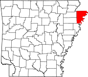
 Location of Mississippi County in Arkansas
This is a list of the National Register of Historic Places listings in Mississippi County, Arkansas.
This is intended to be a complete list of the properties and districts on the National Register of Historic Places in Mississippi County, Arkansas, United States. The locations of National Register properties and districts for which the latitude and longitude coordinates are included below, may be seen in a Google map.[1]
There are 33 properties and districts listed on the National Register in the county, including 2 National Historic Landmarks. Another property was once listed but has been removed.
Contents: Counties in Arkansas Arkansas - Ashley - Baxter - Benton - Boone - Bradley - Calhoun - Carroll - Chicot - Clark - Clay - Cleburne - Cleveland - Columbia - Conway - Craighead - Crawford - Crittenden - Cross - Dallas - Desha - Drew - Faulkner - Franklin - Fulton - Garland - Grant - Greene - Hempstead - Hot Spring - Howard - Independence - Izard - Jackson - Jefferson - Johnson - Lafayette - Lawrence - Lee - Lincoln - Little River - Logan - Lonoke - Madison - Marion - Miller - Mississippi - Monroe - Montgomery - Nevada - Newton - Ouachita - Perry - Phillips - Pike - Poinsett - Polk - Pope - Prairie - Pulaski (Little Rock) - Randolph - St. Francis - Saline - Scott - Searcy - Sebastian - Sevier - Sharp - Stone - Union - Van Buren - Washington - White - Woodruff - Yell
-
- This National Park Service list is complete through NPS recent listings posted November 10, 2011.[2]
Current listings
[3] Landmark name [4] Image Date listed Location City or town Summary 1 Bank of Osceola August 6, 1987 207 E. Hale St.
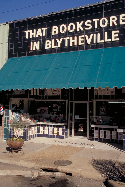
35°42′10″N 89°58′00″W / 35.702778°N 89.966667°WOsceola 2 Blytheville Commercial Historic District 
May 24, 2006 Main St. between 5th and Franklin Sts. and Ash St. between 5th and 2nd Sts.
35°55′44″N 89°54′20″W / 35.928889°N 89.905556°WBlytheville 3 Blytheville Greyhound Bus Station August 17, 1987 109 N. 5th St.
35°55′41″N 89°54′29″W / 35.928056°N 89.908056°WBlytheville 4 Blytheville, Leachville and Arkansas Southern Railroad Depot-Leachville June 11, 1992 Northeastern corner of the junction of 2nd and McNamee Sts.
35°56′15″N 90°15′33″W / 35.9375°N 90.259167°WLeachville 5 Burdette School Complex Historic District October 28, 2001 153 E. Park Ln.
35°48′47″N 89°56′13″W / 35.813056°N 89.936944°WBurdette 6 Chickasawba Mound (3M55) November 16, 1984 Address Restricted Blytheville 7 City Hall August 6, 1987 316 W. Hale St.
35°42′10″N 89°58′15″W / 35.702778°N 89.970833°WOsceola 8 Delta Valley & Southern Railway Locomotive #50 January 24, 2007 U.S. Route 61 at the Delta Valley and Southern Railway crossing
35°33′15″N 90°05′03″W / 35.554167°N 90.084167°WDelpro Last known location Oklahoma City, Oklahoma, May 2009 9 Dyess Colony Center 
January 1, 1976 Highway 297
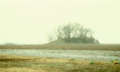
35°35′29″N 90°12′46″W / 35.591389°N 90.212778°WDyess 10 Eaker Site 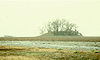
November 25, 1992 Address Restricted Blytheville 11 Florida Brothers Building August 6, 1987 319 W. Hale St.
35°42′09″N 89°58′15″W / 35.7025°N 89.970833°WOsceola 12 Garden Point Cemetery May 24, 2006 4682 W. Highway 140
35°42′08″N 90°14′17″W / 35.702222°N 90.238056°WEtowah 13 Hale Avenue Historic District September 14, 1987 Roughly bounded by Hale Ave., Poplar St., Ford Ave., and Walnut St.; also roughly 107-111 W. Hale Ave. and 101-109 N. Walnut St.
35°42′09″N 89°58′10″W / 35.7025°N 89.969444°WOsceola Second set of addresses represents a boundary of September 2, 2003 14 Herman Davis Memorial April 7, 1995 Northeastern corner of the junction of Baltimore Ave and Highway 18
35°52′23″N 90°09′57″W / 35.873056°N 90.165833°WManila 15 Jonesboro, Lake City & Eastern Railroad Depot March 8, 1997 Northwestern corner of the junction of S. Dewey and Baltimore Ave
35°52′43″N 90°10′00″W / 35.878611°N 90.166667°WManila 16 Keiser School October 8, 1992 Southeastern corner of the junction of Main and School Sts.
35°40′26″N 90°05′42″W / 35.673889°N 90.095°WKeiser 17 Keiser Water Tower January 24, 2007 Junction of Water and E. Main Sts.
35°40′39″N 90°05′50″W / 35.6775°N 90.097222°WKeiser 18 Kress Building June 13, 1997 210 W. Main St.
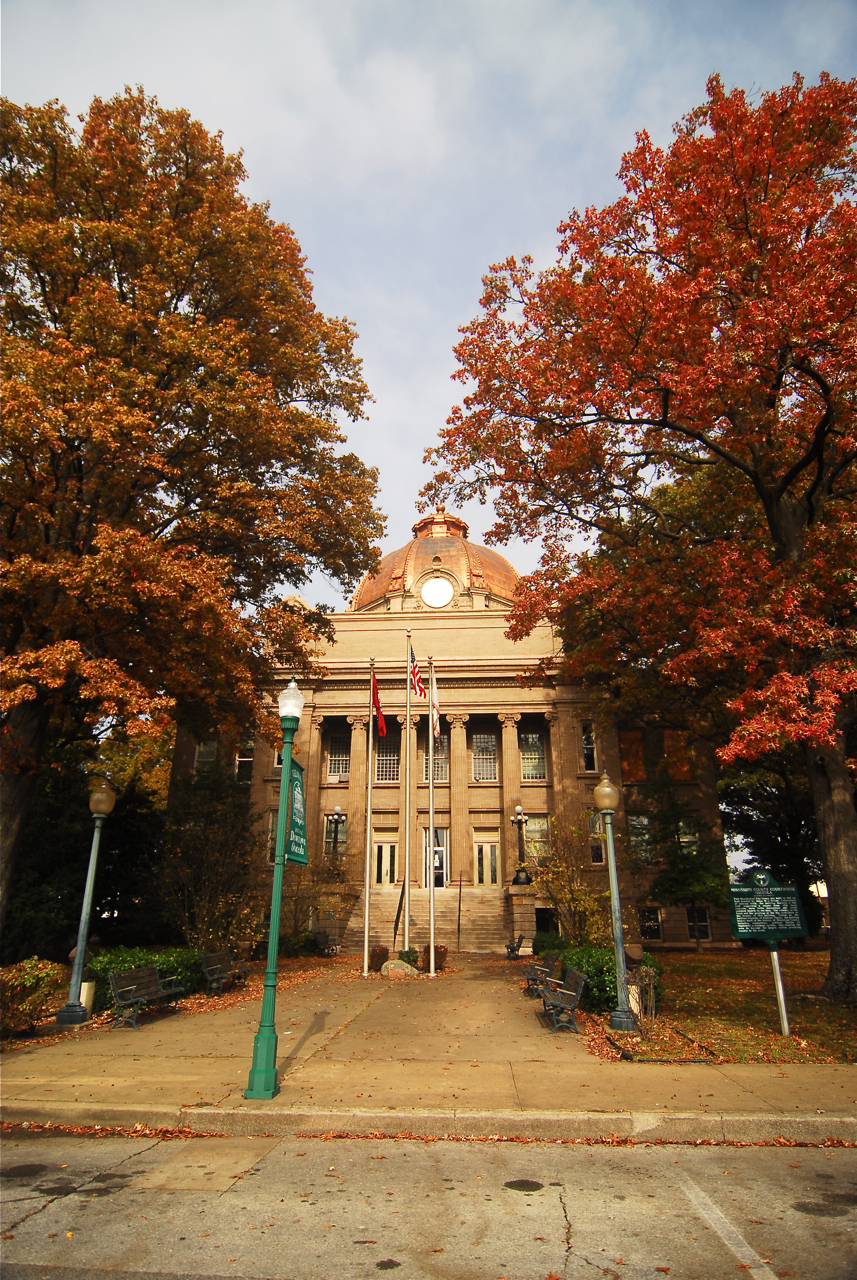
35°55′40″N 89°53′37″W / 35.927778°N 89.893611°WBlytheville 19 Mississippi County Courthouse 
December 13, 1978 Hale and Poplar Aves.
35°42′11″N 89°58′09″W / 35.703056°N 89.969167°WOsceola 20 Mississippi County Courthouse, Chickasawba District December 6, 1996 200 W. Walnut St.
35°55′43″N 89°54′16″W / 35.928611°N 89.904444°WBlytheville 21 Mississippi County Jail August 6, 1987 300 S. Poplar St.
35°42′06″N 89°58′09″W / 35.701667°N 89.969167°WOsceola 22 Nodena Site 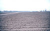
October 15, 1966 Address Restricted Wilson An archeological site which is the type site for the Nodena culture. Possibly visited by Spanish explorer Hernando de Soto in 1542 23 Old Bell Telephone Building August 6, 1987 100 block of Ash St.
35°42′12″N 89°57′59″W / 35.703333°N 89.966389°WOsceola 24 Osceola Times Building August 6, 1987 112 N. Poplar St.
35°42′11″N 89°58′07″W / 35.703056°N 89.968611°WOsceola 25 Planters Bank Building August 6, 1987 200 E. Hale St.
35°42′09″N 89°58′01″W / 35.7025°N 89.966944°WOsceola 26 Three States Lumber Company Mill Powerhouse October 28, 2001 Old Mill Rd.
35°49′00″N 89°56′24″W / 35.816667°N 89.94°WBurdette 27 Chris Tompkins House October 28, 2001 144 South Oak Dr.
35°48′57″N 89°56′19″W / 35.815833°N 89.938611°WBurdette 28 United States Highway 61 Arch October 28, 2001 U.S. Route 61
35°59′57″N 89°54′02″W / 35.999167°N 89.900556°WBlytheville 29 Violet Cemetery October 6, 2004 Area bounded by W. Johnson Ave., Semmes Ave., and Pecan St.
35°42′22″N 89°58′01″W / 35.706111°N 89.966944°WOsceola 30 West Main Street Residential Historic District August 5, 2010 W. Main St. between B and 6th St. and Division
35°55′39″N 89°55′08″W / 35.9275°N 89.918889°WBlytheville 31 Widner-Magers Farm Historic District January 29, 2007 3398 Highway 181
35°52′41″N 90°02′38″W / 35.878056°N 90.043889°WDell 32 Edward Samuel Wildy Barn January 15, 2004 1198 S. Highway 136
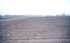
35°43′07″N 90°14′33″W / 35.718611°N 90.2425°WEtowah 33 Zebree Homestead May 2, 1975 Address Restricted Buckeye Former listing
Landmark name Image Date Location City or Town Summary 1 First Baptist Church September 14, 2005 (delisted) 513 S. Pecan St. Osceola, Arkansas See also
- List of National Historic Landmarks in Arkansas
- National Register of Historic Places listings in Arkansas
References
- ^ The latitude and longitude information provided in this table was derived originally from the National Register Information System, which has been found to be fairly accurate for about 99% of listings. For about 1% of NRIS original coordinates, experience has shown that one or both coordinates are typos or otherwise extremely far off; some corrections may have been made. A more subtle problem causes many locations to be off by up to 150 yards, depending on location in the country: most NRIS coordinates were derived from tracing out latitude and longitudes off of USGS topographical quadrant maps created under the North American Datum of 1927, which differs from the current, highly accurate WGS84 GPS system used by Google maps. Chicago is about right, but NRIS longitudes in Washington are higher by about 4.5 seconds, and are lower by about 2.0 seconds in Maine. Latitudes differ by about 1.0 second in Florida. Some locations in this table may have been corrected to current GPS standards.
- ^ "National Register of Historic Places: Weekly List Actions". National Park Service, United States Department of the Interior. Retrieved on November 10, 2011.
- ^ Numbers represent an ordering by significant words. Various colorings, defined here, differentiate National Historic Landmark sites and National Register of Historic Places Districts from other NRHP buildings, structures, sites or objects.
- ^ "National Register Information System". National Register of Historic Places. National Park Service. . http://nrhp.focus.nps.gov/natreg/docs/All_Data.html.
U.S. National Register of Historic Places Topics Lists by states Alabama • Alaska • Arizona • Arkansas • California • Colorado • Connecticut • Delaware • Florida • Georgia • Hawaii • Idaho • Illinois • Indiana • Iowa • Kansas • Kentucky • Louisiana • Maine • Maryland • Massachusetts • Michigan • Minnesota • Mississippi • Missouri • Montana • Nebraska • Nevada • New Hampshire • New Jersey • New Mexico • New York • North Carolina • North Dakota • Ohio • Oklahoma • Oregon • Pennsylvania • Rhode Island • South Carolina • South Dakota • Tennessee • Texas • Utah • Vermont • Virginia • Washington • West Virginia • Wisconsin • WyomingLists by territories Lists by associated states Other Municipalities and communities of Mississippi County, Arkansas Cities Blytheville | Gosnell | Joiner | Keiser | Leachville | Manila | Osceola
Towns Unincorporated
communitiesArkmo‡ | Athelstan | Creamery Package | Denwood | Dimple | Driver | Floodway | Frenchmans Bayou | Poplar Corner | Turner | West Ridge
Footnotes ‡This populated place also has portions in an adjacent county or counties
Categories:- Mississippi County, Arkansas
- National Register of Historic Places in Arkansas by county
-

Wikimedia Foundation. 2010.