- National Register of Historic Places listings in Lee County, Arkansas
-
 Location of Lee County in Arkansas
This is a list of the National Register of Historic Places listings in Lee County, Arkansas.
This is intended to be a complete list of the properties and districts on the National Register of Historic Places in Lee County, Arkansas, United States. The locations of National Register properties and districts for which the latitude and longitude coordinates are included below, may be seen in a Google map.[1]
There are 11 properties and districts listed on the National Register in the county, including 1 National Historic Landmark. Another property was once listed but has been removed.
Contents: Counties in Arkansas Arkansas - Ashley - Baxter - Benton - Boone - Bradley - Calhoun - Carroll - Chicot - Clark - Clay - Cleburne - Cleveland - Columbia - Conway - Craighead - Crawford - Crittenden - Cross - Dallas - Desha - Drew - Faulkner - Franklin - Fulton - Garland - Grant - Greene - Hempstead - Hot Spring - Howard - Independence - Izard - Jackson - Jefferson - Johnson - Lafayette - Lawrence - Lee - Lincoln - Little River - Logan - Lonoke - Madison - Marion - Miller - Mississippi - Monroe - Montgomery - Nevada - Newton - Ouachita - Perry - Phillips - Pike - Poinsett - Polk - Pope - Prairie - Pulaski (Little Rock) - Randolph - St. Francis - Saline - Scott - Searcy - Sebastian - Sevier - Sharp - Stone - Union - Van Buren - Washington - White - Woodruff - Yell
-
- This National Park Service list is complete through NPS recent listings posted November 10, 2011.[2]
Current listings
[3] Landmark name [4] Image Date listed Location City or town Summary 1 Elks Club July 27, 1979 67 W. Main St.
34°46′23″N 90°45′36″W / 34.773056°N 90.76°WMarianna 2 Gen. Robert E. Lee Monument May 10, 1996 City Park, roughly bounded by Court, Chestnut, and Main Sts.
34°46′26″N 90°45′25″W / 34.773889°N 90.756944°WMarianna 3 Lee County Courthouse September 7, 1995 15 E. Chestnut St.
34°46′28″N 90°45′25″W / 34.774444°N 90.756944°WMarianna 4 Louisiana Purchase Survey Marker February 23, 1972 Southeast of Blackton at the corner of Monroe and Phillips counties
34°38′48″N 91°03′05″W / 34.646667°N 91.051389°WBlackton Extends into Monroe and Phillips counties 5 Marianna Commercial Historic District January 4, 2001 Portions of Chestnut, Liberty, East Columbia, Mississippi, Poplar, Main, Court, and Church Sts.
34°46′25″N 90°45′26″W / 34.773611°N 90.757222°WMarianna 6 Marianna Missouri-Pacific Depot August 5, 1994 Carolina St., S.
34°46′14″N 90°45′39″W / 34.770556°N 90.760833°WMarianna 7 Marianna National Guard Armory January 24, 2007 45 W. Mississippi St.
34°46′22″N 90°45′32″W / 34.772778°N 90.758889°WMarianna 8 Marianna Waterworks January 24, 2007 252 U.S. Route 79
34°46′36″N 90°45′56″W / 34.776667°N 90.765556°WMarianna 9 McClintock House December 22, 1982 43 Magnolia
34°46′30″N 90°45′37″W / 34.775°N 90.760278°WMarianna 10 McClintock House December 28, 1977 82 W. Main St.
34°45′55″N 90°45′36″W / 34.765278°N 90.76°WMarianna 11 John A. Plummer House June 16, 1998 269 Pearl St.
34°46′52″N 90°45′43″W / 34.781111°N 90.761944°WMarianna Former listing
Landmark name Image Date Location City or Town Summary 1 Mixon-Evans Barn June 1, 2005 (delisted) 459 S. Alabama St. and U.S. Route 1 Business, S. Marianna See also
- List of National Historic Landmarks in Arkansas
- National Register of Historic Places listings in Arkansas
References
- ^ The latitude and longitude information provided in this table was derived originally from the National Register Information System, which has been found to be fairly accurate for about 99% of listings. For about 1% of NRIS original coordinates, experience has shown that one or both coordinates are typos or otherwise extremely far off; some corrections may have been made. A more subtle problem causes many locations to be off by up to 150 yards, depending on location in the country: most NRIS coordinates were derived from tracing out latitude and longitudes off of USGS topographical quadrant maps created under the North American Datum of 1927, which differs from the current, highly accurate WGS84 GPS system used by Google maps. Chicago is about right, but NRIS longitudes in Washington are higher by about 4.5 seconds, and are lower by about 2.0 seconds in Maine. Latitudes differ by about 1.0 second in Florida. Some locations in this table may have been corrected to current GPS standards.
- ^ "National Register of Historic Places: Weekly List Actions". National Park Service, United States Department of the Interior. Retrieved on November 10, 2011.
- ^ Numbers represent an ordering by significant words. Various colorings, defined here, differentiate National Historic Landmark sites and National Register of Historic Places Districts from other NRHP buildings, structures, sites or objects.
- ^ "National Register Information System". National Register of Historic Places. National Park Service. . http://nrhp.focus.nps.gov/natreg/docs/All_Data.html.
U.S. National Register of Historic Places Topics Lists by states Alabama • Alaska • Arizona • Arkansas • California • Colorado • Connecticut • Delaware • Florida • Georgia • Hawaii • Idaho • Illinois • Indiana • Iowa • Kansas • Kentucky • Louisiana • Maine • Maryland • Massachusetts • Michigan • Minnesota • Mississippi • Missouri • Montana • Nebraska • Nevada • New Hampshire • New Jersey • New Mexico • New York • North Carolina • North Dakota • Ohio • Oklahoma • Oregon • Pennsylvania • Rhode Island • South Carolina • South Dakota • Tennessee • Texas • Utah • Vermont • Virginia • Washington • West Virginia • Wisconsin • WyomingLists by territories Lists by associated states Other Municipalities and communities of Lee County, Arkansas City 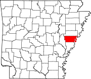
Towns Unincorporated
communitiesBrickeys | Monroe‡
Footnotes ‡This populated place also has portions in an adjacent county or counties
Categories:- Lee County, Arkansas
- National Register of Historic Places in Arkansas by county
-

Wikimedia Foundation. 2010.