- National Register of Historic Places listings in Guadalupe County, Texas
-
List of Registered Historic Places in Guadalupe County, Texas
This is intended to be a complete list of properties and districts listed on the National Register of Historic Places in Guadalupe County, Texas. The locations of National Register properties and districts (at least for all showing latitude and longitude coordinates below) may be seen in a Google map by clicking on "Map of all coordinates".[1]
-
- This National Park Service list is complete through NPS recent listings posted November 10, 2011.[2]
[3] Landmark name [4] Image Date listed Location City or town Summary 1 Erskine House No. 1 August 25, 1970 902 N. Austin St.
29°34′01″N 97°57′51″W / 29.566944°N 97.964167°WSeguin 2 Robert Hall House October 25, 1979 214 S. Travis St.
29°34′03″N 97°58′00″W / 29.5675°N 97.966667°WSeguin 3 Hardscramble July 6, 2011 1806 Tschoepe Rd.
29°38′12″N 97°53′43″W / 29.636667°N 97.895278°WSeguin vicinity 4 Joseph F. Johnson House June 23, 1978 761 Johnson Ave.
29°33′49″N 97°58′26″W / 29.563611°N 97.973889°WSeguin 5 Los Nogales 
March 24, 1972 S. River and E. Live Oak Sts.
29°33′57″N 97°57′47″W / 29.565833°N 97.963056°WSeguin 6 Park Hotel May 23, 1980 217 S. River St.
29°34′02″N 97°57′49″W / 29.567222°N 97.963611°WSeguin 7 Saffold Dam November 15, 1979 Off TX 123
29°33′03″N 97°58′12″W / 29.550833°N 97.97°WSeguin 8 Sebastopol 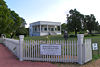
August 25, 1970 NE corner of W. Court and N. Erkel Sts.
29°34′12″N 97°58′21″W / 29.57°N 97.9725°WSeguin 9 Seguin Commercial Historic District December 15, 1983 Roughly bounded by Camp, Myrtle, Washington, and Crockett Sts.
29°34′13″N 97°57′51″W / 29.570278°N 97.964167°WSeguin 70 buildings, 1 structure, 1875-1949 10 Seguin Commercial Historic District (Boundary Increase) August 14, 2003 Roughly bounded by Camp, Myrtle, Washington, and Crockett Sts.
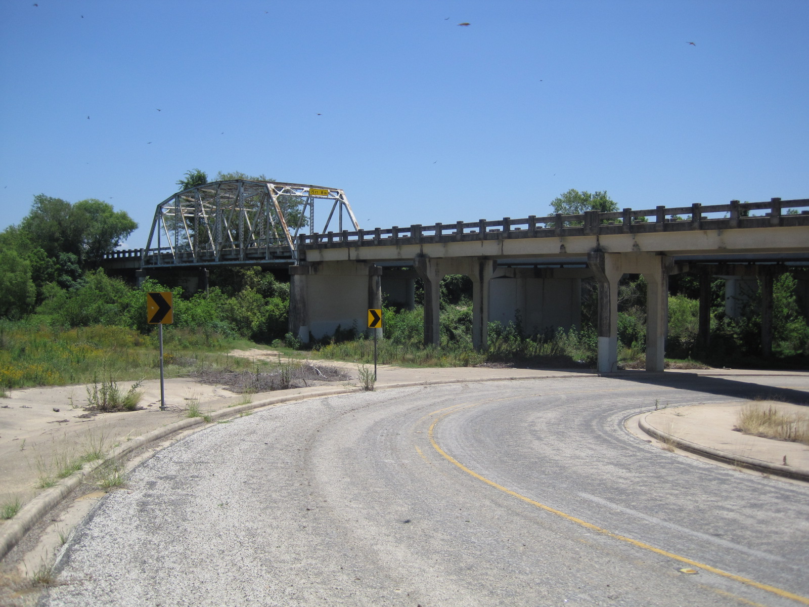
29°34′13″N 97°57′51″W / 29.570278°N 97.964167°WSeguin 9 buildings, 1825-1974 11 State Highway 3-A Bridge at Cibolo Creek 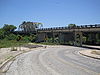
October 10, 1996 I-10 at the Bexar and Guadalupe Cnty. line
29°30′05″N 98°11′11″W / 29.501389°N 98.186389°WSchertz 12 Sweet Home Vocational and Agricultural High School November 19, 1998 10 mi (16 km). S of Seguin on Sweet Home Rd.
29°27′39″N 98°02′18″W / 29.460833°N 98.038333°WSeguin 13 Edward and Texanna Tewes House January 9, 1997 8280 Linne Rd.
29°28′03″N 98°06′11″W / 29.4675°N 98.103056°WSeguin 14 Wilson Utility Pottery Kilns Archeological District April 16, 1975 Address Restricted Seguin See also
- Registered Historic Places in Texas, Counties A-C
References
- ^ The latitude and longitude information provided in this table was derived originally from the National Register Information System, which has been found to be fairly accurate for about 99% of listings. For about 1% of NRIS original coordinates, experience has shown that one or both coordinates are typos or otherwise extremely far off; some corrections may have been made. A more subtle problem causes many locations to be off by up to 150 yards, depending on location in the country: most NRIS coordinates were derived from tracing out latitude and longitudes off of USGS topographical quadrant maps created under the North American Datum of 1927, which differs from the current, highly accurate WGS84 GPS system used by Google maps. Chicago is about right, but NRIS longitudes in Washington are higher by about 4.5 seconds, and are lower by about 2.0 seconds in Maine. Latitudes differ by about 1.0 second in Florida. Some locations in this table may have been corrected to current GPS standards.
- ^ "National Register of Historic Places: Weekly List Actions". National Park Service, United States Department of the Interior. Retrieved on November 10, 2011.
- ^ Numbers represent an ordering by significant words. Various colorings, defined here, differentiate National Historic Landmark sites and National Register of Historic Places Districts from other NRHP buildings, structures, sites or objects.
- ^ "National Register Information System". National Register of Historic Places. National Park Service. . http://nrhp.focus.nps.gov/natreg/docs/All_Data.html.
U.S. National Register of Historic Places Topics Lists by states Alabama • Alaska • Arizona • Arkansas • California • Colorado • Connecticut • Delaware • Florida • Georgia • Hawaii • Idaho • Illinois • Indiana • Iowa • Kansas • Kentucky • Louisiana • Maine • Maryland • Massachusetts • Michigan • Minnesota • Mississippi • Missouri • Montana • Nebraska • Nevada • New Hampshire • New Jersey • New Mexico • New York • North Carolina • North Dakota • Ohio • Oklahoma • Oregon • Pennsylvania • Rhode Island • South Carolina • South Dakota • Tennessee • Texas • Utah • Vermont • Virginia • Washington • West Virginia • Wisconsin • WyomingLists by territories Lists by associated states Other Categories:- Guadalupe County, Texas
- National Register of Historic Places in Texas
- Buildings and structures in Guadalupe County, Texas
-


Wikimedia Foundation. 2010.