- National Register of Historic Places listings in Hays County, Texas
-
List of Registered Historic Places in Hays County, Texas
This is intended to be a complete list of properties and districts listed on the National Register of Historic Places in Hays County, Texas. The locations of National Register properties and districts (at least for all showing latitude and longitude coordinates below) may be seen in a Google map by clicking on "Map of all coordinates".[1]
-
- This National Park Service list is complete through NPS recent listings posted November 10, 2011.[2]
[3] Landmark name [4] Image Date listed Location City or town Summary 1 Barber House August 26, 1983 100 Burleson St.
29°52′44″N 97°57′11″W / 29.878889°N 97.953056°WSan Marcos 2 Belger-Cahill Lime Kiln 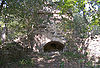
August 26, 1983 Lime Kiln Rd.
29°53′59″N 97°55′35″W / 29.899722°N 97.926389°WSan Marcos 3 Belvin Street Historic District December 1, 1983 700, 800, 900 blocks of Belvin St., and 227 Mitchell St.
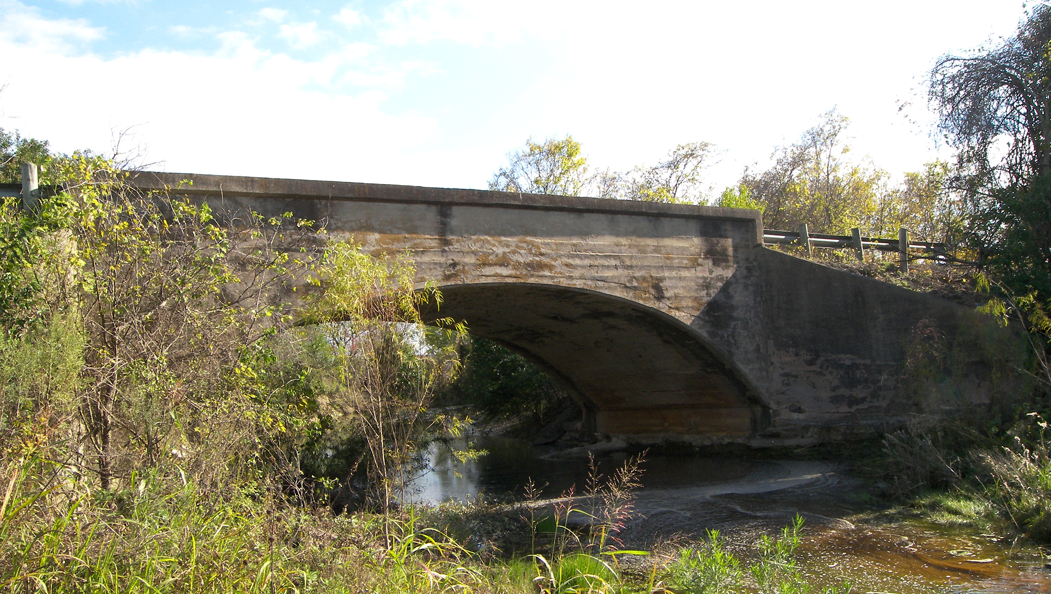
29°52′44″N 97°57′03″W / 29.878889°N 97.950833°WSan Marcos 4 Bunton Branch Bridge 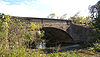
February 19, 2002 Cty. Rd. 210, approx. 0.2 mi (0.32 km). NW of jct. with IH-35 at Bunton Overpass
30°01′05″N 97°51′31″W / 30.018056°N 97.858611°WKyle 5 Burleson-Knispel House August 3, 1979 1.5 mi (2.4 km). N of San Marcos on Lime Kiln Rd
29°54′43″N 97°55′43″W / 29.911944°N 97.928611°WSan Marcos 6 Caldwell House August 26, 1983 619 Maury St.
29°53′00″N 97°57′05″W / 29.883333°N 97.951389°WSan Marcos 7 Camp Ben McCulloch October 12, 2004 18301 Ranch Rd. 1826
30°07′45″N 98°00′52″W / 30.129167°N 98.014444°WDriftwood 8 Cape House August 26, 1983 316 W. Hopkins St.
29°52′58″N 97°56′39″W / 29.882778°N 97.944167°WSan Marcos 9 Cemetery Chapel, San Marcos Cemetery December 1, 1983 TX 12
29°53′12″N 97°57′26″W / 29.886667°N 97.957222°WSan Marcos 10 Cen-Tex Wool Mill Historic District June 1, 2005 101 Uhland Rd.
29°54′02″N 97°54′59″W / 29.900556°N 97.916389°WSan Marcos 11 Cock House April 2, 1973 402 E. Hopkins St.
29°52′59″N 97°56′12″W / 29.883056°N 97.936667°WSan Marcos 12 John R. Dobie House August 18, 1992 282 Old Kyle Rd.
29°59′48″N 98°05′34″W / 29.996667°N 98.092778°WWimberley 13 Cora Jackman Donalson House October 28, 2010 200 S. Sledge St.
29°59′17″N 97°52′48″W / 29.988056°N 97.879931°WKyle Rural Properties of Hays County, Texas MPS 14 Downtown Buda Historic District November 7, 2003 Roughly bounded by Elm St., Main St., China St., and Austin St.
30°04′50″N 97°50′35″W / 30.080556°N 97.843056°WBuda 15 Episcopalian Rectory August 26, 1983 225 W. Hopkins St.
29°52′57″N 97°56′35″W / 29.8825°N 97.943056°WSan Marcos 16 Farmers Union Gin Company August 26, 1983 120 Grove St.
29°52′33″N 97°56′25″W / 29.875833°N 97.940278°WSan Marcos 17 Fire Station and City Hall August 26, 1983 224 N. Guadalupe St.
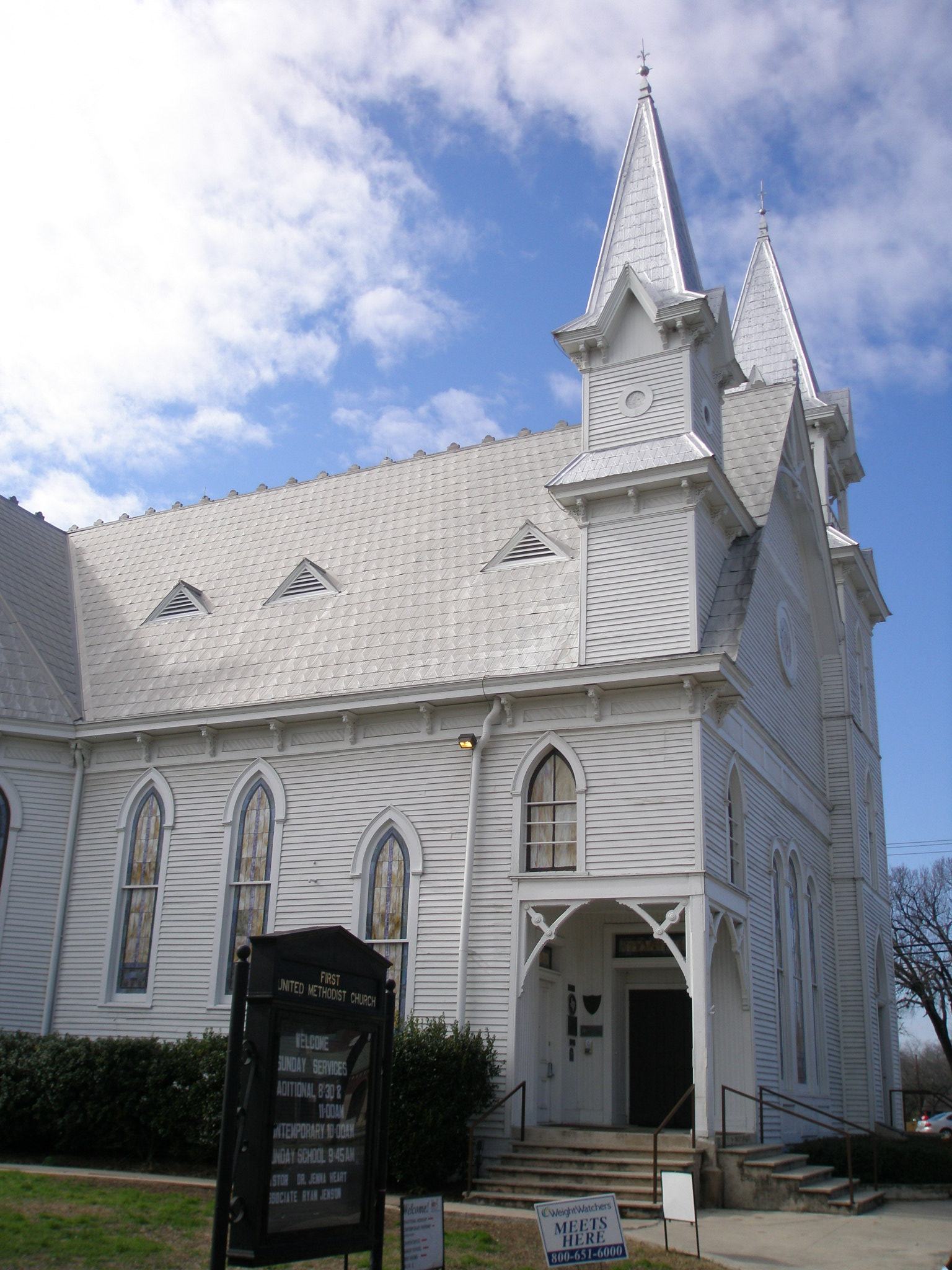
29°53′02″N 97°56′28″W / 29.883889°N 97.941111°WSan Marcos 18 First United Methodist Church 
November 8, 1974 129 W. Hutchison
29°53′02″N 97°56′34″W / 29.883889°N 97.942778°WSan Marcos 19 Fisher Hall August 26, 1983 1132 Belvin St. (destroyed by fire in 2007)
29°52′35″N 97°57′16″W / 29.876389°N 97.954444°WSan Marcos 20 Fort Street Presbyterian Church March 23, 1984 516 W. Hopkins St.
29°52′54″N 97°56′47″W / 29.881667°N 97.946389°WSan Marcos 21 Freeman, Harry, Site November 7, 1978 Address Restricted San Marcos 22 Goforth-Harris House August 26, 1983 401 Comanche St.
29°53′06″N 97°56′40″W / 29.885°N 97.944444°WSan Marcos 23 Isham Jones Good Homestead August 20, 2004 13401 Evergreen Way
30°10′09″N 97°57′43″W / 30.169167°N 97.961944°WAustin 24 Green and Faris Buildings August 26, 1983 136-144 E. San Antonio St.
29°52′54″N 97°56′24″W / 29.881667°N 97.94°WSan Marcos 25 Hardy-Williams Building August 26, 1983 127 E. Hopkins St.
29°53′00″N 97°56′25″W / 29.883333°N 97.940278°WSan Marcos 26 Hays County Courthouse 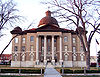
May 23, 1980 Public Sq.
29°52′56″N 97°56′25″W / 29.882222°N 97.940278°WSan Marcos 27 Hays County Courthouse Historic District September 10, 1992 Roughly bounded by the alleys behind N. Guadalupe, E. Hopkins, N. LBJ and E. San Antonio Sts.
29°52′57″N 97°56′25″W / 29.8825°N 97.940278°WSan Marcos 28 Hays County Jail August 26, 1983 170 Fredericksburg St.
29°52′49″N 97°56′32″W / 29.880278°N 97.942222°WSan Marcos 29 Heard House 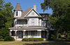
August 26, 1983 620 W. San Antonio St.
29°52′46″N 97°56′48″W / 29.879444°N 97.946667°WSan Marcos 30 Augusta Hofheinz House August 26, 1983 1104 W. Hopkins St.
29°52′35″N 97°57′09″W / 29.876389°N 97.9525°WSan Marcos 31 Walter Hofheinz House December 1, 1983 819 W. Hopkins St.
29°52′41″N 97°56′58″W / 29.878056°N 97.949444°WSan Marcos 32 Hutchison House August 26, 1983 LBJ Dr. and University St.
29°53′08″N 97°56′24″W / 29.885556°N 97.94°WSan Marcos 33 Johnson House 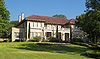
August 26, 1983 1030 Belvin St.
29°52′37″N 97°57′12″W / 29.876944°N 97.953333°WSan Marcos 34 Kone-Cliett House December 1, 1983 724 Burleson St.
29°52′51″N 97°57′02″W / 29.880833°N 97.950556°WSan Marcos 35 Kyle City Hall May 22, 2002 109 Burleson Rd.
29°59′18″N 97°52′37″W / 29.988333°N 97.876944°WKyle 36 Claiborne Kyle Log House May 28, 1981 SW of Kyle
29°57′55″N 97°54′08″W / 29.965278°N 97.902222°WKyle 37 James C. Lane House November 29, 2010 306 Wimberley Square
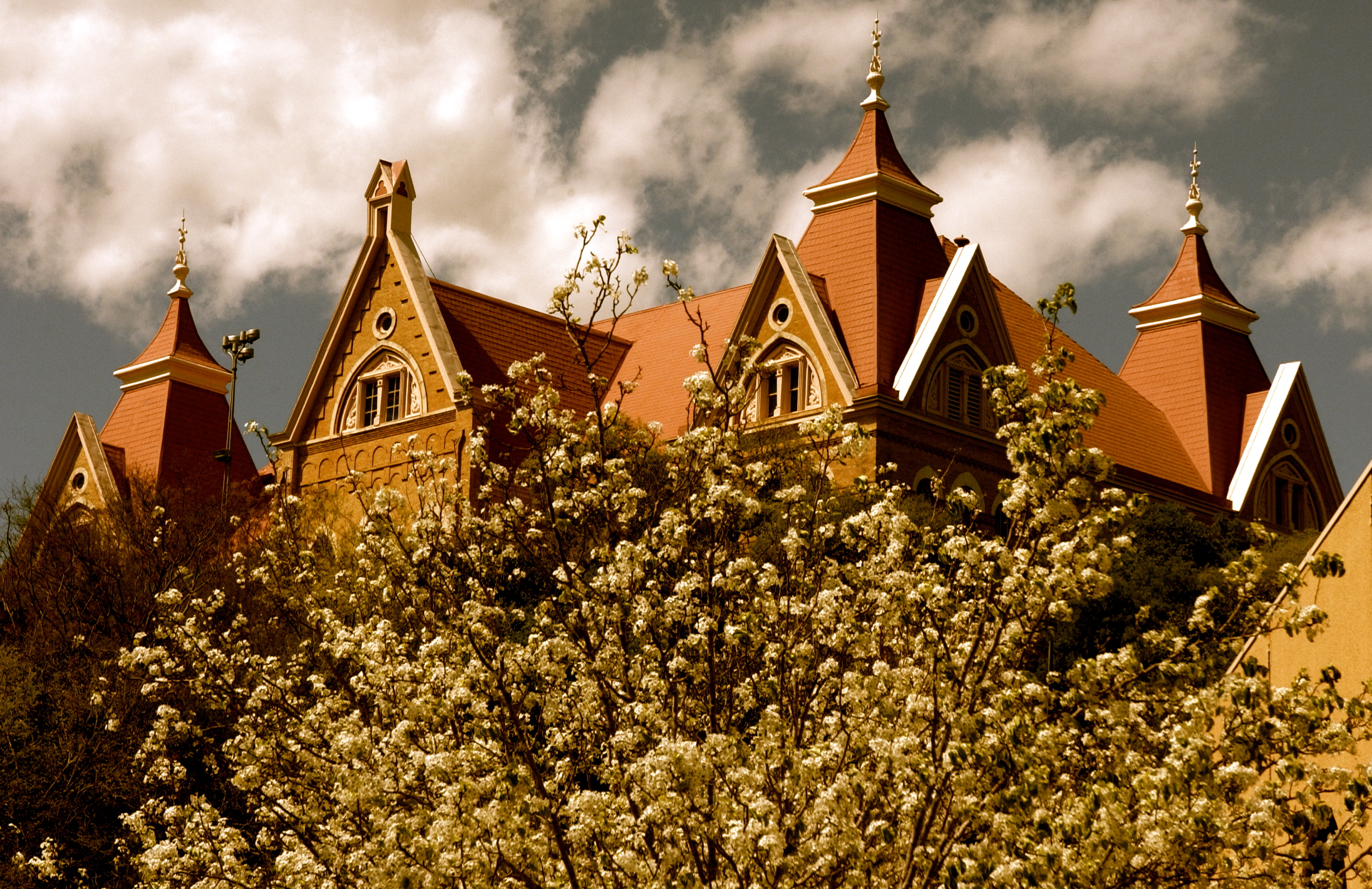
29°59′43″N 98°05′51″W / 29.995278°N 98.0975°WWimberley 38 Main Building, Southwest Texas Normal School 
August 26, 1983 Old Main St., Texas State University campus
29°53′21″N 97°56′19″W / 29.889167°N 97.938611°WSan Marcos 1903 Victorian Gothic building designed by Edward Northcraft; first building of the Southwest Texas State Normal School (now known as Texas State University–San Marcos)[5] 39 McKie-Bass Building December 1, 1983 111 N. Guadalupe St.
29°52′24″N 97°56′29″W / 29.873333°N 97.941389°WSan Marcos 40 Michaelis Ranch 
March 7, 2003 3600 FM 150 West
30°01′42″N 97°55′24″W / 30.0284°N 97.923217°WKyle 41 Moore Grocery Company August 26, 1983 101 S. Edward Gary St.
29°52′54″N 97°56′16″W / 29.881667°N 97.937778°WSan Marcos 42 Norman, Ruskin C., Site (41 HY 86) November 21, 1978 Address Restricted San Marcos 43 Onion Creek Post Office and Stagecoach House October 27, 2002 109 N. Loop 4
30°05′23″N 97°50′13″W / 30.089722°N 97.836944°WBuda 44 Pettey House June 20, 2008 714 Burleson St.
29°52′53″N 97°57′01″W / 29.881389°N 97.950278°WSan Marcos 45 Katherine Anne Porter House 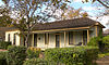
August 20, 2004 508 W. Center St.
29°59′22″N 97°52′49″W / 29.989444°N 97.880278°WKyle 46 Dr. Joseph M. and Sarah Pound Farmstead 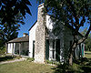
July 28, 1995 Ranch Rd. 12 N.
30°12′02″N 98°04′50″W / 30.200556°N 98.080556°WDripping Springs 47 Ragsdale-Jackman-Yarbough House August 26, 1983 621 W. San Antonio St.
29°52′45″N 97°56′46″W / 29.879167°N 97.946111°WSan Marcos 48 Rylander-Kyle House August 26, 1983 711 W. San Antonio St.
29°52′42″N 97°56′48″W / 29.878333°N 97.946667°WSan Marcos 49 San Marcos Milling Company December 1, 1983 Nicola Alley
29°52′33″N 97°56′18″W / 29.875833°N 97.938333°WSan Marcos 50 San Marcos Telephone Company 
August 26, 1983 138 W. San Antonio St.
29°52′56″N 97°56′32″W / 29.882222°N 97.942361°WSan Marcos 51 Simon Building August 26, 1983 124-126 W. Hopkins St.
29°52′59″N 97°56′28″W / 29.883056°N 97.941111°WSan Marcos 52 Smith House August 26, 1983 322 Scott St.
29°52′52″N 97°56′58″W / 29.881111°N 97.949444°WSan Marcos 53 Williams-Tarbutton House August 26, 1983 626 Lindsey St.
29°52′57″N 97°57′02″W / 29.8825°N 97.950556°WSan Marcos 54 Winters-Wimberley House May 22, 2002 14070 Ranch Road 12
29°59′53″N 98°05′54″W / 29.998056°N 98.098333°WWimberley See also
- Registered Historic Places in Texas, Counties H-J
References
- ^ The latitude and longitude information provided in this table was derived originally from the National Register Information System, which has been found to be fairly accurate for about 99% of listings. For about 1% of NRIS original coordinates, experience has shown that one or both coordinates are typos or otherwise extremely far off; some corrections may have been made. A more subtle problem causes many locations to be off by up to 150 yards, depending on location in the country: most NRIS coordinates were derived from tracing out latitude and longitudes off of USGS topographical quadrant maps created under the North American Datum of 1927, which differs from the current, highly accurate WGS84 GPS system used by Google maps. Chicago is about right, but NRIS longitudes in Washington are higher by about 4.5 seconds, and are lower by about 2.0 seconds in Maine. Latitudes differ by about 1.0 second in Florida. Some locations in this table may have been corrected to current GPS standards.
- ^ "National Register of Historic Places: Weekly List Actions". National Park Service, United States Department of the Interior. Retrieved on November 10, 2011.
- ^ Numbers represent an ordering by significant words. Various colorings, defined here, differentiate National Historic Landmark sites and National Register of Historic Places Districts from other NRHP buildings, structures, sites or objects.
- ^ "National Register Information System". National Register of Historic Places. National Park Service. . http://nrhp.focus.nps.gov/natreg/docs/All_Data.html.
- ^ "Old Main". San Marcos, Texas: Texas State University-San Marcos. http://www.txstate.edu/about/history-traditions/old-main.html. Retrieved May 23, 2009.
U.S. National Register of Historic Places Topics Lists by states Alabama • Alaska • Arizona • Arkansas • California • Colorado • Connecticut • Delaware • Florida • Georgia • Hawaii • Idaho • Illinois • Indiana • Iowa • Kansas • Kentucky • Louisiana • Maine • Maryland • Massachusetts • Michigan • Minnesota • Mississippi • Missouri • Montana • Nebraska • Nevada • New Hampshire • New Jersey • New Mexico • New York • North Carolina • North Dakota • Ohio • Oklahoma • Oregon • Pennsylvania • Rhode Island • South Carolina • South Dakota • Tennessee • Texas • Utah • Vermont • Virginia • Washington • West Virginia • Wisconsin • WyomingLists by territories Lists by associated states Other Categories:- Hays County, Texas
- National Register of Historic Places in Texas
- Buildings and structures in Hays County, Texas
-


Wikimedia Foundation. 2010.