- National Register of Historic Places listings in Rockbridge County, Virginia
-
This list includes properties and districts listed on the National Register of Historic Places in Rockbridge County, Virginia. Click the "Map of all coordinates" link to the right to view a Google map of all properties and districts with latitude and longitude coordinates in the table below.[1]
-
- This National Park Service list is complete through NPS recent listings posted November 10, 2011.[2]
[3] Landmark name[4] Image Date listed Location City or Town Summary 1 Anderson Hollow Archaeological District July 21, 1983 Address Restricted Lexington 2 Brownsburg Historic District July 2, 1973 Including the entire village extending .5 mi. along Rte. 252
37°55′43″N 79°19′9″W / 37.92861°N 79.31917°WBrownsburg 3 Buffalo Forge (081-0003) May 26, 2004 2694 Forge Rd.
37°41′12″N 79°26′11″W / 37.68667°N 79.43639°WGlasgow 4 Cedar Hill July 15, 1994 VA 608 E side, 2.25 mi. S of jct. with US 60
37°43′4″N 79°23′52″W / 37.71778°N 79.39778°WBuena Vista 5 Cedar Hill Church and Cemeteries February 11, 2002 Cedar Hill Church Rd. and Kygers Hill Rd.
37°44′32″N 79°32′6″W / 37.74222°N 79.535°WLexington 6 Chapel Hill June 8, 2011 68 Charming Ln.
37°43′14″N 79°24′42″W / 37.72056°N 79.41167°WLexington vicinity 7 Church Hill February 26, 1979 6.5 mi. NE of Lexington off U.S.11 at I-64
37°50′30″N 79°21′32″W / 37.84167°N 79.35889°WLexington 8 Clifton July 22, 1994 VA 631 N side, 2000 ft. E of jct. with US 11
37°47′30″N 79°25′10″W / 37.79167°N 79.41944°WLexington 9 Echols Farm October 30, 1998 Jct. of VA 130 and 501
37°37′54″N 79°26′13″W / 37.63167°N 79.43694°WGlasgow 10 Falling Spring Presbyterian Church Manse November 16, 2005 650 Falling Spring Rd.
37°41′12″N 79°27′8″W / 37.68667°N 79.45222°WGlasgow 11 Fancy Hill September 5, 1997 Jct. of US 11 and VA 680
37°41′23″N 79°29′12″W / 37.68972°N 79.48667°WGlasgow 12 Glasgow Historic District October 30, 1995 Bounded by Seventh, Tenth, Gordon and Powahtan Sts.
37°37′59″N 79°27′1″W / 37.63306°N 79.45028°WGlasgow Boundary increase (listed May 3, 2006): 900 Blks of Fizlee St. and Rockbridge Rd. 13 Glen Maury May 24, 1979 W of Buena Vista
37°43′48″N 79°21′46″W / 37.73°N 79.36278°WBuena Vista 14 Goshen Land Company Bridge 
May 15, 1978 E of Goshen on VA 746
37°59′7″N 79°29′39″W / 37.98528°N 79.49417°WGoshen 15 Hamilton Schoolhouse November 21, 2002 VA 611, S. Buffalo Rd.
37°42′6″N 79°35′49″W / 37.70167°N 79.59694°WLexington 16 Hays Creek Mill August 4, 1995 VA 724, 0.1 mi. N of jct. with VA 726
37°56′8″N 79°20′38″W / 37.93556°N 79.34389°WBrownsburg 17 Hickory Hill August 30, 2006 197 Hickory Hill Ln.
37°39′54″N 79°28′39″W / 37.665°N 79.4775°WGlasgow 18 Kennedy-Lunsford Farm June 7, 1996 Approximately .5 mi. S of VA 606, near jct. with VA 604
37°56′7″N 79°16′5″W / 37.93528°N 79.26806°WRaphine Boundary increase (listed February 22, 1999): 1194 Raphine Rd. 19 Kennedy-Wade Mill July 13, 1979 2.3 mi. NE of Brownsburg on VA 606
37°57′1″N 79°17′11″W / 37.95028°N 79.28639°WBrownsburg Kennedy-Wade's Mill Historic District boundary increase (listed May 26, 1994): VA 606 (Raphine Rd.), 2000 ft. NE of jct. with VA 721 20 Level Loop August 12, 1993 VA 724 1 mi. W of Brownsburg and 0.5 mi. E of McClung's Mill
37°55′57″N 79°20′6″W / 37.9325°N 79.335°WBrownsburg 21 Liberty Hall Site August 16, 1977 Address Restricted Lexington 22 Mechanicsville May 12, 1986 VA 608
37°43′55″N 79°24′5″W / 37.73194°N 79.40139°WMechanicsville 23 Lylburn Downing School October 23, 2003 300 Diamond St.
37°47′10″N 79°25′25″W / 37.78611°N 79.42361°WLexington 24 William Mackey House October 29, 1993 VA 716, .5 mi SE of jct. with US 11
37°50′12″N 79°20′43″W / 37.83667°N 79.34528°WCornwall 25 Maple Hall January 29, 1987 Jct. of US 11 and I-81 and I-64
37°50′39″N 79°21′45″W / 37.84417°N 79.3625°WLexington 26 Marlbrook September 14, 2002 4973 Forge Rd.
37°39′6″N 79°29′55″W / 37.65167°N 79.49861°WGlasgow 27 Cyrus McCormick Farm and Workshop October 15, 1966 S of Staunton on U.S. 11 and CR 606 at Walnut Grove
37°56′2″N 79°13′4″W / 37.93389°N 79.21778°WSteele's Tavern 28 John Moore House June 25, 1999 183 Big Hill Rd.
37°51′39″N 79°33′6″W / 37.86083°N 79.55167°WLexington 29 Mountain View Farm January 27, 2000 199 Fredericksburg Rd.
37°51′51″N 79°28′59″W / 37.86417°N 79.48306°WLexington 30 Mulberry Grove July 28, 1994 VA 724 S side, 5000 ft. SE of jct. with VA 252
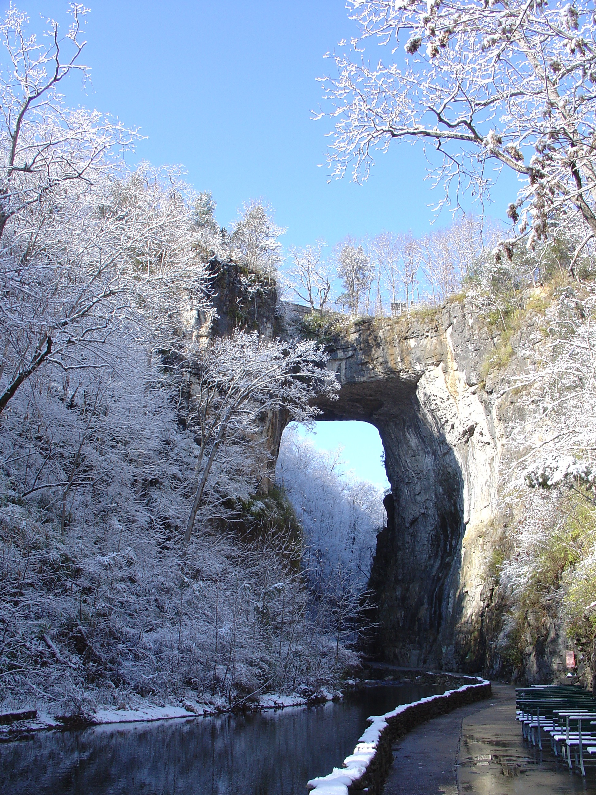
37°55′23″N 79°18′21″W / 37.92306°N 79.30583°WBrownsburg 31 Natural Bridge 
November 18, 1997 Jct. of VA 11 and VA 130
37°37′39″N 79°32′43″W / 37.6275°N 79.54528°WNatural Bridge 32 New Providence Presbyterian Church March 26, 1980 NE of Brownsburg
37°57′5″N 79°18′10″W / 37.95139°N 79.30278°WBrownsburg 33 Oak Spring Farm October 19, 1994 VA 706 at jct. with US 11
37°54′18″N 79°14′1″W / 37.905°N 79.23361°WFairfield 34 Margaret E. Poague House March 29, 2007 4907 S. Lee Hwy (US 11)
37°39′43″N 79°30′39″W / 37.66194°N 79.51083°WLexington 35 Rockbridge Alum Springs Historic District January 19, 1989 Address Restricted California 36 Rockbridge Inn April 7, 1995 Valley Rd., N side, at jct. with VA 743
37°39′20″N 79°32′14″W / 37.65556°N 79.53722°WNatural Bridge 37 Springdale February 14, 2006 70 Gilmore Ln.
37°44′31″N 79°25′11″W / 37.74194°N 79.41972°WLexington 38 Stone House 
May 24, 1979 W of Lexington on Ross Rd.
37°46′32″N 79°27′34″W / 37.77556°N 79.45944°WLexington 39 Sunnyside September 14, 2002 160 Kendal Dr.
37°46′47″N 79°27′39″W / 37.77972°N 79.46083°WLexington 40 Tankersley Tavern November 3, 1988 VA 631
37°47′37″N 79°25′43″W / 37.79361°N 79.42861°WLexington 41 Thorn Hill 
June 18, 1975 SW of Lexington off VA 251
37°45′50″N 79°28′11″W / 37.76389°N 79.46972°WLexington 42 Timber Ridge Presbyterian Church November 12, 1969 SW of jct. of Rtes. 11 and 716
37°50′33″N 79°21′31″W / 37.8425°N 79.35861°WLexington 43 Vine Forest August 23, 1991 US 11, 2 mi. W of Natural Bridge
37°37′30″N 79°34′43″W / 37.625°N 79.57861°WNatural Bridge 44 Virginia Manor September 10, 1987 VA 130
37°37′5″N 79°29′13″W / 37.61806°N 79.48694°WNatural Bridge 45 Willson House December 3, 2009 367 VA 673
37°48′28.26″N 79°30′1.44″W / 37.80785°N 79.5004°WLexington See also
- National Register of Historic Places listings in Virginia
- National Register of Historic Places listings in Buena Vista, Virginia
- National Register of Historic Places listings in Lexington, Virginia
- List of National Historic Landmarks in Virginia
References
- ^ The latitude and longitude information provided in this table was derived originally from the National Register Information System, which has been found to be fairly accurate for about 99% of listings. For about 1% of NRIS original coordinates, experience has shown that one or both coordinates are typos or otherwise extremely far off; some corrections may have been made. A more subtle problem causes many locations to be off by up to 150 yards, depending on location in the country: most NRIS coordinates were derived from tracing out latitude and longitudes off of USGS topographical quadrant maps created under the North American Datum of 1927, which differs from the current, highly accurate WGS84 GPS system used by Google maps. Chicago is about right, but NRIS longitudes in Washington are higher by about 4.5 seconds, and are lower by about 2.0 seconds in Maine. Latitudes differ by about 1.0 second in Florida. Some locations in this table may have been corrected to current GPS standards.
- ^ "National Register of Historic Places: Weekly List Actions". National Park Service, United States Department of the Interior. Retrieved on November 10, 2011.
- ^ Numbers represent an ordering by significant words. Various colorings, defined here, differentiate National Historic Landmark sites and National Register of Historic Places Districts from other NRHP buildings, structures, sites or objects.
- ^ "National Register Information System". National Register of Historic Places. National Park Service. 2008-04-24. http://nrhp.focus.nps.gov/natreg/docs/All_Data.html.
U.S. National Register of Historic Places Topics Lists by states Alabama • Alaska • Arizona • Arkansas • California • Colorado • Connecticut • Delaware • Florida • Georgia • Hawaii • Idaho • Illinois • Indiana • Iowa • Kansas • Kentucky • Louisiana • Maine • Maryland • Massachusetts • Michigan • Minnesota • Mississippi • Missouri • Montana • Nebraska • Nevada • New Hampshire • New Jersey • New Mexico • New York • North Carolina • North Dakota • Ohio • Oklahoma • Oregon • Pennsylvania • Rhode Island • South Carolina • South Dakota • Tennessee • Texas • Utah • Vermont • Virginia • Washington • West Virginia • Wisconsin • WyomingLists by territories Lists by associated states Other Municipalities and communities of Rockbridge County, Virginia Towns 
CDP East Lexington
Unincorporated
communitiesBrownsburg | Marlbrook | Mechanicsville | Raphine | Rockbridge Baths
Categories:- Rockbridge County, Virginia
- National Register of Historic Places in Virginia
- Virginia-related lists
-


Wikimedia Foundation. 2010.