- National Register of Historic Places listings in Taos County, New Mexico
-
 Location of Taos County in New Mexico
This is a list of the National Register of Historic Places listings in Taos County, New Mexico.
This is intended to be a complete list of the properties and districts on the National Register of Historic Places in Taos County, New Mexico, United States. Latitude and longitude coordinates are provided for many National Register properties and districts; these locations may be seen together in a Google map.[1]
There are 41 properties and districts listed on the National Register in the county, including 7 National Historic Landmarks.
-
- This National Park Service list is complete through NPS recent listings posted November 10, 2011.[2]
Contents: Counties in New Mexico Bernalillo – Catron – Chaves – Cibola – Colfax – Curry – De Baca – Doña Ana – Eddy – Grant – Guadalupe – Harding – Hidalgo – Lea – Lincoln – Los Alamos – Luna – McKinley – Mora – Otero – Quay – Rio Arriba – Roosevelt – San Juan – San Miguel – Sandoval – Santa Fe – Sierra – Socorro – Taos – Torrance – Union – Valencia Current listings
[3] Landmark name [4] Image Date listed Location City or town Summary 1 Bernard J. Beimer House March 22, 2006 215 Beimer Ave.
36°25′00″N 105°34′18″W / 36.416667°N 105.571667°WTaos 2 Governor Charles Bent House November 16, 1978 Bent St.
36°24′31″N 105°34′22″W / 36.408611°N 105.572778°WTaos 3 Black Copper Mine and Stamp Mill October 27, 2000 Black Copper Canyon Rd.
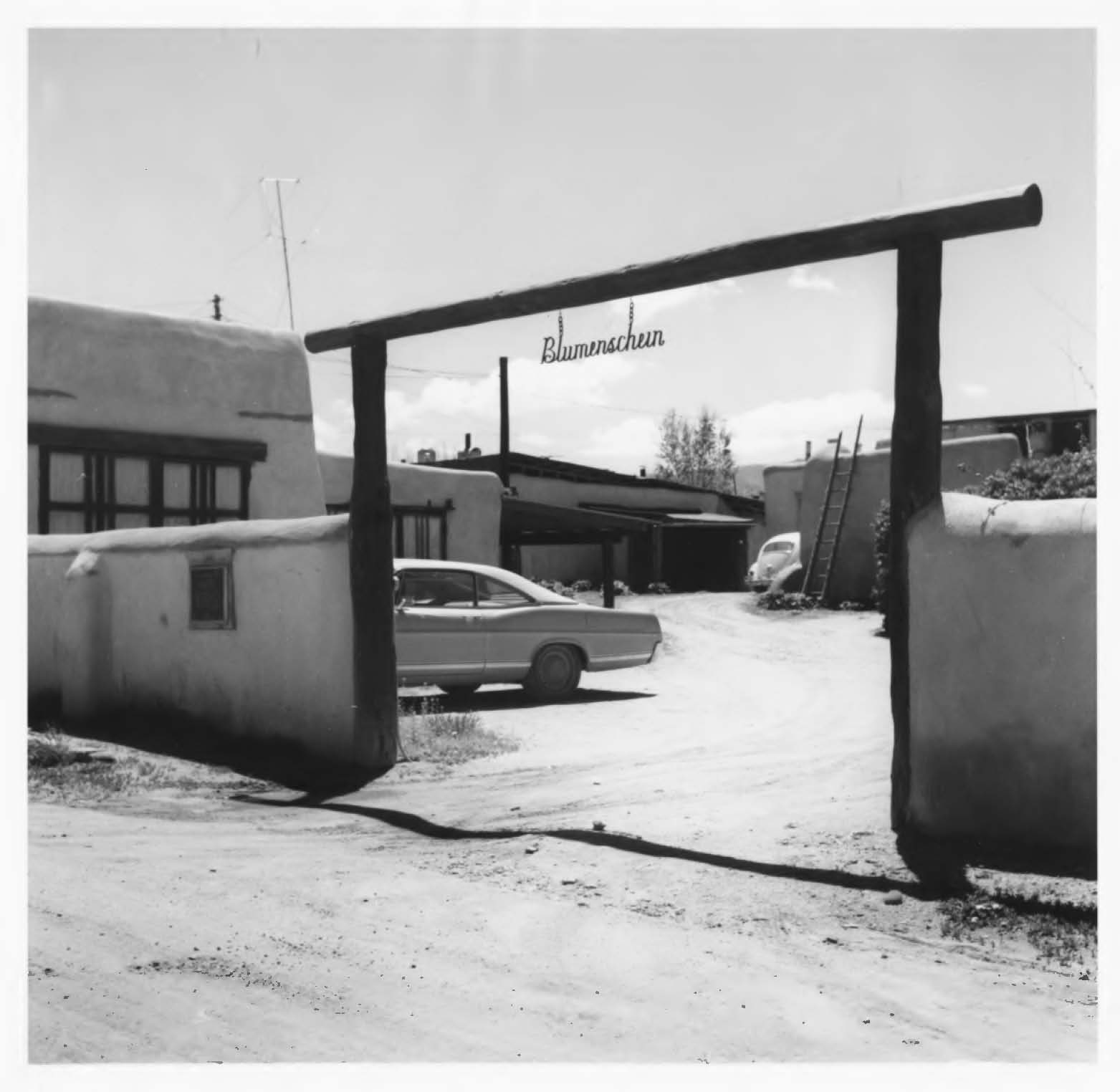
36°38′14″N 105°22′13″W / 36.637222°N 105.370278°WRed River 4 Ernest L. Blumenschein House 
October 15, 1966 Ledoux St.
36°24′21″N 105°34′34″W / 36.405833°N 105.576111°WTaos 5 Carson School February 13, 1986 State Road 96
36°21′53″N 105°45′55″W / 36.364722°N 105.765278°WCarson 6 Kit Carson House 
October 15, 1966 Kit Carson Ave.
36°24′25″N 105°34′20″W / 36.406944°N 105.572222°WTaos 7 Chapel of Santa Cruz April 14, 1975 Southern side of Plaza off U.S. Route 285
36°18′11″N 106°02′46″W / 36.303056°N 106.046111°WOjo Caliente 8 Eanger Irving Couse House and Studio—Joseph Henry Sharp Studios September 28, 2005 146 Kit Carson Rd.
36°24′29″N 105°34′18″W / 36.408056°N 105.571667°WTaos 9 Nicholai Fechin House 
December 31, 1979 227 Paseo del Pueblo Norte
36°24′37″N 105°34′09″W / 36.410278°N 105.569167°WTaos Now the Taos Art Museum 10 Leon Gaspard House February 23, 1979 Raton Rd.
36°23′46″N 105°33′50″W / 36.396111°N 105.563889°WTaos 11 Harwood Foundation December 22, 1976 LeDoux St.
36°24′20″N 105°34′36″W / 36.405556°N 105.576667°WTaos Now the Harwood Art Museum 12 E. Martin Hennings House and Studio Historic District July 5, 1990 Southeastern corner of the junction of Dolan St. and Kit Carson Rd.
36°24′01″N 105°34′03″W / 36.400278°N 105.5675°WTaos 13 Howiri-ouinge April 7, 1983 Address Restricted Ojo Caliente 14 La Loma Plaza Historic District July 8, 1982 State Road 240
36°24′23″N 105°34′50″W / 36.406389°N 105.580556°WTaos Aerial photo-map 15 La Morada de Nuestra Senora de Guadalupe June 29, 1976 East of Taos off U.S. Route 64
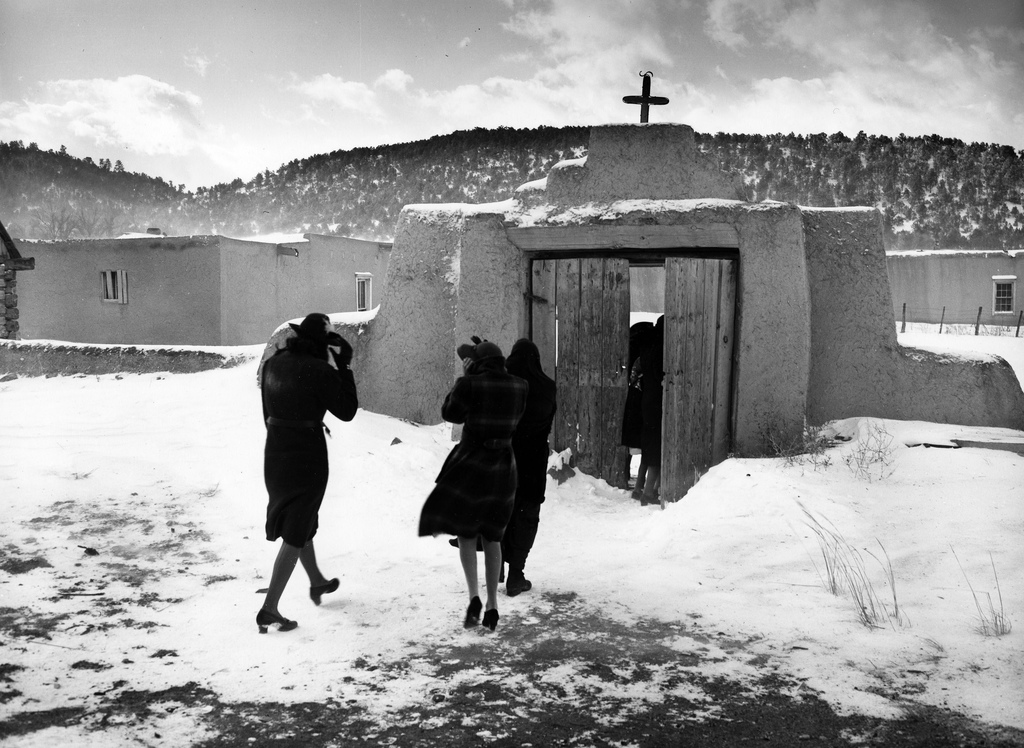
36°24′22″N 105°33′46″W / 36.406111°N 105.562778°WTaos 16 Las Trampas Historic District 
May 28, 1967 On State Road 76
36°07′57″N 105°45′48″W / 36.1325°N 105.763333°WLas Trampas 17 Laureano Cordova Mill November 5, 1974 Off State Road 75
36°11′26″N 105°40′08″W / 36.190556°N 105.668889°WVadito 18 D.H. Lawrence Ranch Historic District 
January 15, 2004 Lawrence Rd., approximately 2.75 miles east of State Road 522 on U.S. Forest Service Rd. 7
36°34′55″N 105°35′37″W / 36.581944°N 105.593611°WSan Cristobal 19 Mabel Dodge Luhan House 
November 15, 1978 Luhan Lane
36°24′29″N 105°33′52″W / 36.408056°N 105.564444°WTaos 20 Orin Mallette Cabin February 23, 1984 West of Red River
36°42′28″N 105°25′34″W / 36.707778°N 105.426111°WRed River 21 Sylvester M. Mallette Cabin February 23, 1984 River St. and Copper King
36°42′20″N 105°24′13″W / 36.705556°N 105.403611°WRed River 22 Severino Martinez House April 23, 1973 2 miles from Taos Plaza, on the Lower Ranchitos Rd.
36°24′01″N 105°36′32″W / 36.400278°N 105.608889°WTaos Hacienda de los Martinez -- Bird's-eye view 23 Melson-Oldham Cabin February 23, 1984 Southeast of Red River
36°41′18″N 105°23′13″W / 36.688333°N 105.386944°WRed River 24 Ojo Caliente Hot Springs Round Barn October 6, 2003 500 yards north of the western terminus of State Road 414
36°18′37″N 106°02′48″W / 36.310278°N 106.046667°WOjo Caliente 25 Ojo Caliente Mineral Springs November 17, 1985 State Road 414
36°18′17″N 106°03′06″W / 36.304722°N 106.051667°WOjo Caliente 26 Picuris Pueblo 
August 13, 1974 South of Taos
36°12′05″N 105°42′32″W / 36.201389°N 105.708889°WTaos 27 Pierce-Fuller House February 23, 1984 High St.
36°42′42″N 105°24′37″W / 36.711667°N 105.410278°WRed River 28 Posi-ouinge August 5, 1993 On a bluff southwest of Ojo Caliente
36°17′57.4296″N 106°3′22.23″W / 36.299286°N 106.056175°W[5]Ojo Caliente Extends into Rio Arriba County 29 Ranchos de Taos Plaza 
October 2, 1978 Off U.S. Route 64
36°21′30″N 105°36′28″W / 36.358333°N 105.607778°WRanchos de Taos 30 Red River Schoolhouse February 23, 1984 High St.
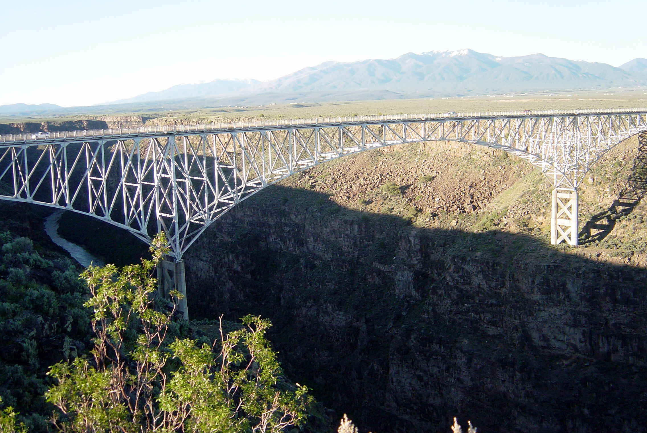
36°42′23″N 105°24′00″W / 36.706389°N 105.4°WRed River 31 Rio Grande Gorge Bridge 
July 15, 1997 State Road 111 over the Rio Grande Gorge
36°28′34″N 105°43′56″W / 36.476111°N 105.732222°WTaos 32 San Francisco de Assisi Mission Church 
April 15, 1970 The Plaza
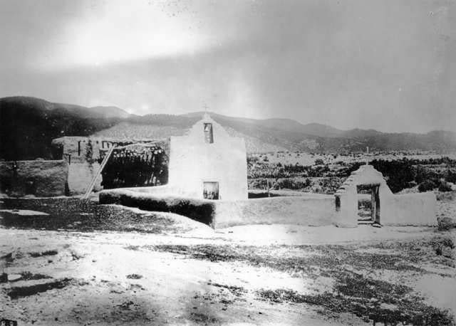
36°21′31″N 105°36′28″W / 36.358611°N 105.607778°WRanchos de Taos 33 San José de Gracia Church 
April 15, 1970 Northern side of the Plaza
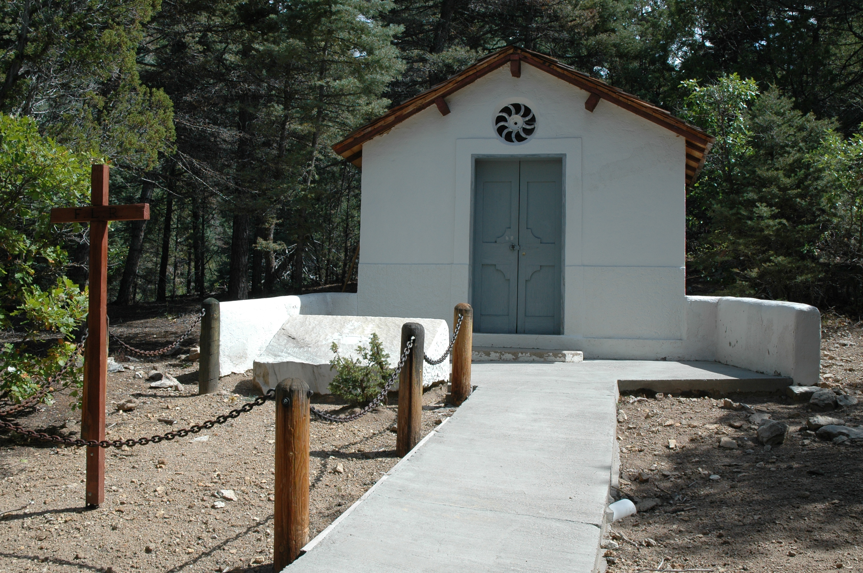
36°07′53″N 105°45′28″W / 36.131389°N 105.757778°WLas Trampas 34 San Ysidro Oratorio January 5, 1984 State Road 240
36°23′12″N 105°37′41″W / 36.386667°N 105.628056°WLos Cordovas 35 Taos Downtown Historic District July 8, 1982 State Roads 3 and 240
36°24′24″N 105°34′23″W / 36.406667°N 105.573056°WTaos 36 Taos Inn February 5, 1982 Pueblo del Norte
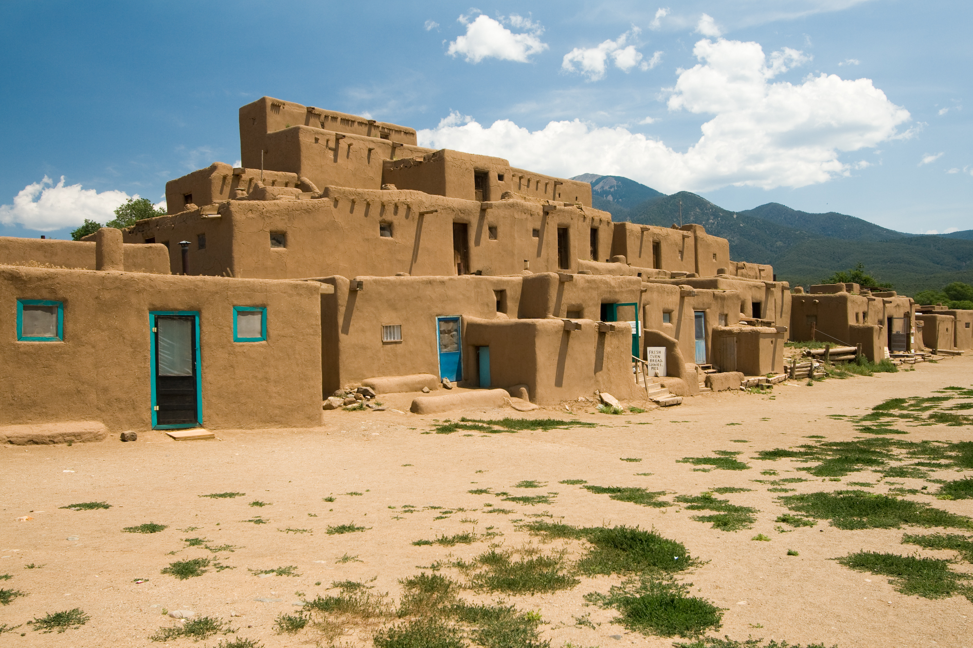
36°24′28″N 105°34′20″W / 36.407778°N 105.572222°WTaos 37 Taos Pueblo 
October 15, 1966 3 miles north of Taos
36°28′19″N 105°33′35″W / 36.47191°N 105.5597°WTaos 38 Tres Piedras Administrative Site August 5, 1993 West of U.S. Route 285, north of Tres Piedras
36°39′13″N 105°58′10″W / 36.653611°N 105.969444°WTres Piedras 39 Tres Piedras Railroad Water Tower February 2, 1979 Off U.S. Route 285
36°38′51″N 105°57′55″W / 36.6475°N 105.965278°WTres Piedras 40 Turley Mill and Distillery Site November 16, 1978 11 miles (17.6 km) north of Taos
36°32′23″N 105°37′19″W / 36.539722°N 105.621944°WTaos 41 Brigham J. Young House February 23, 1984 Main St.
36°42′23″N 105°24′00″W / 36.706389°N 105.4°WRed River See also
- List of National Historic Landmarks in New Mexico
- National Register of Historic Places listings in New Mexico
References
- ^ The latitude and longitude information provided in this table was derived originally from the National Register Information System, which has been found to be fairly accurate for about 99% of listings. For about 1% of NRIS original coordinates, experience has shown that one or both coordinates are typos or otherwise extremely far off; some corrections may have been made. A more subtle problem causes many locations to be off by up to 150 yards, depending on location in the country: most NRIS coordinates were derived from tracing out latitude and longitudes off of USGS topographical quadrant maps created under North American Datum of 1927, which differs from the current, highly accurate GPS system used by Google maps. Chicago is about right, but NRIS longitudes in Washington are higher by about 4.5 seconds, and are lower by about 2.0 seconds in Maine. Latitudes differ by about 1.0 second in Florida. Some locations in this table may have been corrected to current GPS standards.
- ^ "National Register of Historic Places: Weekly List Actions". National Park Service, United States Department of the Interior. Retrieved on November 10, 2011.
- ^ Numbers represent an ordering by significant words. Various colorings, defined here, differentiate National Historic Landmark sites and National Register of Historic Places Districts from other NRHP buildings, structures, sites or objects.
- ^ "National Register Information System". National Register of Historic Places. National Park Service. . http://nrhp.focus.nps.gov/natreg/docs/All_Data.html.
- ^ Location derived from this Bureau of Land Management webpage; the NRIS lists the site as "Address Restricted"
U.S. National Register of Historic Places Topics Lists by states Alabama • Alaska • Arizona • Arkansas • California • Colorado • Connecticut • Delaware • Florida • Georgia • Hawaii • Idaho • Illinois • Indiana • Iowa • Kansas • Kentucky • Louisiana • Maine • Maryland • Massachusetts • Michigan • Minnesota • Mississippi • Missouri • Montana • Nebraska • Nevada • New Hampshire • New Jersey • New Mexico • New York • North Carolina • North Dakota • Ohio • Oklahoma • Oregon • Pennsylvania • Rhode Island • South Carolina • South Dakota • Tennessee • Texas • Utah • Vermont • Virginia • Washington • West Virginia • Wisconsin • WyomingLists by territories Lists by associated states Other  Category:National Register of Historic Places •
  Portal:National Register of Historic Places
Municipalities and communities of Taos County, New Mexico County seat: Taos Towns 
Villages CDPs Chamisal | Penasco | Picuris Pueblo | Ranchos de Taos | Rio Lucio | Taos Pueblo | Vadito
Unincorporated
communitiesAmalia | Arroyo Hondo | Arroyo Seco | Carson | Cerro | Costilla | El Prado | El Rito | Las Trampas | Llano | Ojo Caliente | Pilar | San Cristóbal | Tres Piedras | Valdez
Indian reservation Categories:- National Register of Historic Places in New Mexico by county
- Taos County, New Mexico
- History of Taos County, New Mexico
-


Wikimedia Foundation. 2010.