- Vadito, New Mexico
Infobox Settlement
official_name = Vadito, New Mexico
settlement_type = CDP
nickname =
motto =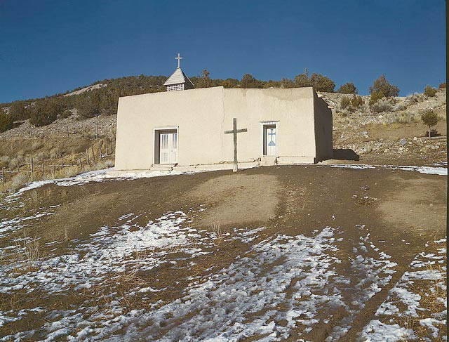
imagesize = 260px
image_caption = Vadito Chapel, 1943, photo by John Collier
image_
image_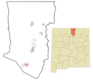
mapsize = 250px
map_caption = Location of Vadito, New Mexico
mapsize1 =
map_caption1 =subdivision_type = Country
subdivision_name =United States
subdivision_type1 = State
subdivision_name1 =New Mexico
subdivision_type2 = County
subdivision_name2 = Taos
government_footnotes =
government_type =
leader_title =
leader_name =
leader_title1 =
leader_name1 =
established_title =
established_date =unit_pref = Imperial
area_footnotes =area_magnitude =
area_total_km2 = 2.2
area_land_km2 = 2.2
area_water_km2 = 0.0
area_total_sq_mi = 0.9
area_land_sq_mi = 0.9
area_water_sq_mi = 0.0population_as_of = 2000
population_footnotes =
population_total = 242
population_density_km2 = 109.1
population_density_sq_mi = 282.5timezone = Mountain (MST)
utc_offset = -7
timezone_DST = MDT
utc_offset_DST = -6
elevation_footnotes =
elevation_m = 2271
elevation_ft = 7451
latd = 36 |latm = 11 |lats = 26 |latNS = N
longd = 105 |longm = 40 |longs = 8 |longEW = Wpostal_code_type =
ZIP code
postal_code = 87579
area_code = 575
blank_name = FIPS code
blank_info = 35-81520
blank1_name = GNIS feature ID
blank1_info = 0912019
website =
footnotes =Vadito is a
census-designated place (CDP) in Taos County,New Mexico ,United States . The population was 242 at the 2000 census.Geography
Vadito is located at coor dms|36|11|26|N|105|40|8|W|city (36.190643, -105.668761)GR|1.
According to the
United States Census Bureau , the CDP has a total area of 0.9square mile s (2.2km² ), all of it land.Demographics
As of the
census GR|2 of 2000, there were 242 people, 87 households, and 64 families residing in the CDP. Thepopulation density was 282.5 people per square mile (108.6/km²). There were 109 housing units at an average density of 127.3/sq mi (48.9/km²). The racial makeup of the CDP was 7.44% White, 2.48% Native American, 86.78% from other races, and 3.31% from two or more races. Hispanic or Latino of any race were 95.04% of the population.There were 87 households out of which 41.4% had children under the age of 18 living with them, 54.0% were married couples living together, 14.9% had a female householder with no husband present, and 25.3% were non-families. 23.0% of all households were made up of individuals and 13.8% had someone living alone who was 65 years of age or older. The average household size was 2.78 and the average family size was 3.31.
In the CDP the population was spread out with 30.2% under the age of 18, 7.4% from 18 to 24, 28.9% from 25 to 44, 18.2% from 45 to 64, and 15.3% who were 65 years of age or older. The median age was 35 years. For every 100 females there were 96.7 males. For every 100 females age 18 and over, there were 108.6 males.
The median income for a household in the CDP was $16,875, and the median income for a family was $20,625. Males had a median income of $31,875 versus $4,375 for females. The
per capita income for the CDP was $9,481. About 41.1% of families and 35.8% of the population were below thepoverty line , including 52.8% of those under the age of eighteen and 8.1% of those sixty five or over.References
External links
Wikimedia Foundation. 2010.