- Ojo Caliente, New Mexico
-
"Ojo Caliente" redirects here. For the Mexican town, see Ojocaliente.
Ojo Caliente is a small unincorporated community in Taos County, New Mexico, United States. It lies along U.S. Route 285 near the Rio Grande. The state capital, Santa Fe lies south of Ojo Caliente, which sits between Espanola and Taos, approximately 50 miles southeast of Ghost Ranch.[1] The community is known for its hot springs.References
Municipalities and communities of Taos County, New Mexico Towns 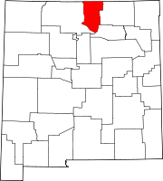
Villages CDPs Chamisal | Penasco | Picuris Pueblo | Ranchos de Taos | Rio Lucio | Taos Pueblo | Vadito
Unincorporated
communitiesAmalia | Arroyo Hondo | Arroyo Seco | Carson | Cerro | Costilla | El Prado | El Rito | Las Trampas | Llano | Ojo Caliente | Pilar | San Cristóbal | Tres Piedras | Valdez
Indian reservation Categories:- New Mexico geography stubs
- Populated places in Taos County, New Mexico
- Unincorporated communities in New Mexico

Wikimedia Foundation. 2010.