- Picuris Pueblo, New Mexico
-
Elmo country — what makes u think elmo wont cut you lol jk its a funny video — [[File:<3|250px|none|alt=|San Lorenzo de Picurís, circa 1915]]San Lorenzo de Picurís, circa 1915 Location of Picuris Pueblo, New Mexico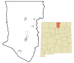
Coordinates: 36°12′9″N 105°42′42″W / 36.2025°N 105.71167°WCoordinates: 36°12′9″N 105°42′42″W / 36.2025°N 105.71167°W Country United States State New Mexico County Taos Area – Total 0.5 sq mi (1.2 km2) – Land 0.4 sq mi (1.2 km2) – Water 0.0 sq mi (0.0 km2) Elevation 7,323 ft (2,232 m) Population (2000) – Total 86 – Density 192.7/sq mi (74.4/km2) Time zone Mountain (MST) (UTC-7) – Summer (DST) MDT (UTC-6) Area code(s) 505 FIPS code 35-56810 GNIS feature ID 0928771 Picuris Pueblo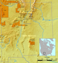 Location of Picuris Pueblo and neighboring pueblos in New Mexico
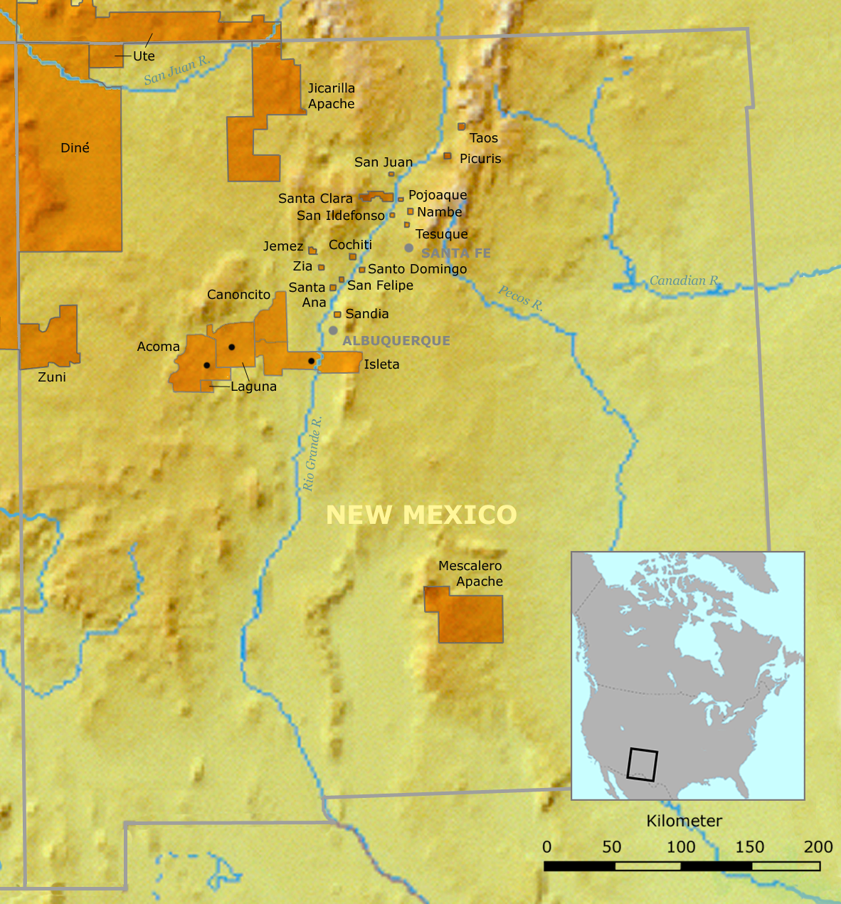
Nearest city: Taos, New Mexico Built: ca. 1776 Governing body: Pueblo of Picuris tribal government NRHP Reference#: 74001211 [1] Added to NRHP: August 13, 1974 Picuris Pueblo (
 /pɪkəˈriːs/; Tiwa: P'iwwel) is a census-designated place (CDP) in Taos County, New Mexico, United States. The population was 86 at the 2000 census. The Pueblo people are from the Tiwa ethnic group of Native Americans. Picurís Pueblo is a member of the Eight Northern Pueblos.
Picuris village has occupied its present location since around 750 CE.[citation needed] The Picuris people previously lived in an earlier, larger village now known as Pot Creek, near Taos.[2]
Spanish explorer Don Juan de Oñate called them "pikuria" - those who paint.[3]
Contents
Geography
Picuris Pueblo is located at 36°12′9″N 105°42′42″W / 36.2025°N 105.71167°W (36.202569, -105.711760)[4]. It sits on the western slopes of the Sangre de Cristo Mountains and is 18 miles south of Taos Pueblo. Average elevation in the pueblo is over 7,000 feet, making agriculture challenging.[5]
According to the United States Census Bureau, the CDP has a total area of 0.4 square miles (1.0 km2), all of it land.
Demographics
As of the census[6] of 2000, there were 86 people, 38 households, and 18 families residing in the CDP. The population density was 192.7 people per square mile (73.8/km²). There were 60 housing units at an average density of 134.4 per square mile (51.5/km²). The racial makeup of the CDP was 10.47% White, 70.93% Native American, 16.28% from other races, and 2.33% from two or more races. Hispanic or Latino of any race were 26.74% of the population.
There were 38 households out of which 10.5% had children under the age of 18 living with them, 21.1% were married couples living together, 13.2% had a female householder with no husband present, and 52.6% were non-families. 42.1% of all households were made up of individuals and 13.2% had someone living alone who was 65 years of age or older. The average household size was 2.26 and the average family size was 3.33.
In the CDP the population was spread out with 16.3% under the age of 18, 10.5% from 18 to 24, 30.2% from 25 to 44, 24.4% from 45 to 64, and 18.6% who were 65 years of age or older. The median age was 43 years. For every 100 females there were 95.5 males. For every 100 females age 18 and over, there were 105.7 males.
The median income for a household in the CDP was $11,528, and the median income for a family was $16,875. Males had a median income of $21,000 versus $23,333 for females. The per capita income for the CDP was $12,492. There were 36.0% of families and 28.7% of the population living below the poverty line, including no under eighteens and 45.0% of those over 64.
Tribe
The Pueblo of the Picuris is a federally recognized tribe, whose headquarters is in Penasco, New Mexico. Their own name for their pueblo is Pinguiltha, meaning "mountain warrior place" or "mountain pass place." They speak the Picuris language, a dialect of the Northern Tiwa language, part of the Tanoan language family.[5] Their tribal officers, led by a tribal governor, are elected every two years.[7]
In 1990, 147 of the 1,882 enrolled tribal members lived in the pueblo;[5] however, the number was reduced to 86 in 2000.
In 1991, the tribe opened the four-star Hotel Santa Fe and the Amaya Restaurant, serving Native American cuisine,[8] in Santa Fe, New Mexico.[7]
Picuris is known for its micaceous pottery. Their major feast day is San Lorenzo's Day on August 10.[7]
Notable Picuris people
- Anthony Durand (1956–2009), micaceous potter
- Joseph Rael (b. 1935), ceremonial dancer and shamanism writer
Gallery
-

Gerald Nailor, Jr., Governor of Picuris
-

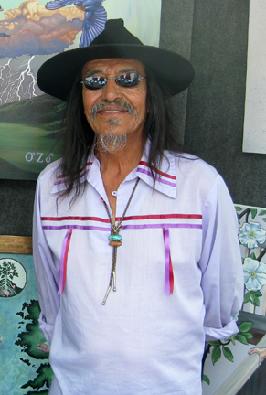
David Gaussoin, Picuris jeweler
-

Picuris ballplayer
-

Performance art by Wayne Gaussoin (Picuris Peublo), Museum of Contemporary Native Art, Santa Fe, NM, 2009
See also
- National Register of Historic Places listings in Taos County, New Mexico
- High Road to Taos, New Mexico
Notes
- ^ "National Register Information System". National Register of Historic Places. National Park Service. 2007-01-23. http://nrhp.focus.nps.gov/natreg/docs/All_Data.html.
- ^ Picuris history
- ^ http://www.laplaza.org/penasco/picuris/picuris.html
- ^ "US Gazetteer files: 2010, 2000, and 1990". United States Census Bureau. 2011-02-12. http://www.census.gov/geo/www/gazetteer/gazette.html. Retrieved 2011-04-23.
- ^ a b c Pritzker, 58
- ^ "American FactFinder". United States Census Bureau. http://factfinder.census.gov. Retrieved 2008-01-31.
- ^ a b c Pritzker, 61
- ^ "Amaya Restaurant." Hotel Santa Fe. (retrieved 19 Dec 2009)
References
- Pritzker, Barry M. A Native American Encyclopedia: History, Culture, and Peoples. Oxford: Oxford University Press, 2000. ISBN 978-0195138771.
External links
- Picuris article at New Mexico Magazine
- Pot Creek archeaological site
- Picuris Pueblo micaceous pottery, photo gallery
- Picuris Pueblo through time: eight centuries of change in a northern Rio Grande pueblo
Municipalities and communities of Taos County, New Mexico Towns 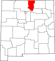
Villages CDPs Chamisal | Penasco | Picuris Pueblo | Ranchos de Taos | Rio Lucio | Taos Pueblo | Vadito
Unincorporated
communitiesAmalia | Arroyo Hondo | Arroyo Seco | Carson | Cerro | Costilla | El Prado | El Rito | Las Trampas | Llano | Ojo Caliente | Pilar | San Cristóbal | Tres Piedras | Valdez
Indian reservation Categories:- Census-designated places in New Mexico
- Federally recognized tribes in the United States
- Native American tribes in New Mexico
- Pueblo great houses
- Populated places in Taos County, New Mexico
- Tiwa
- Populated places in New Mexico with Native American majority populations


Wikimedia Foundation. 2010.