- National Register of Historic Places listings in Valencia County, New Mexico
-
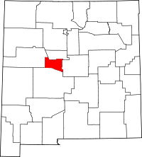 Location of Valencia County in New Mexico
This is a list of the National Register of Historic Places listings in Valencia County, New Mexico.
This is intended to be a complete list of the properties and districts on the National Register of Historic Places in Valencia County, New Mexico, United States. Latitude and longitude coordinates are provided for many National Register properties and districts; these locations may be seen together in a Google map.[1]
There are 21 properties and districts listed on the National Register in the county, including 4 National Historic Landmarks.
-
- This National Park Service list is complete through NPS recent listings posted November 10, 2011.[2]
Contents: Counties in New Mexico Bernalillo – Catron – Chaves – Cibola – Colfax – Curry – De Baca – Doña Ana – Eddy – Grant – Guadalupe – Harding – Hidalgo – Lea – Lincoln – Los Alamos – Luna – McKinley – Mora – Otero – Quay – Rio Arriba – Roosevelt – San Juan – San Miguel – Sandoval – Santa Fe – Sierra – Socorro – Taos – Torrance – Union – Valencia Current listings
[3] Landmark name [4] Image Date listed Location City or town Summary 1 Acoma 
October 15, 1966 13 miles south of Casa Blanca on State Road 23
34°53′43″N 107°35′34″W / 34.895278°N 107.592778°WCasa Blanca 2 Atchison, Topeka, and Santa Fe Railroad Depot August 1, 1979 U.S. Route 85
34°47′42″N 106°44′17″W / 34.795°N 106.738056°WLos Lunas 3 Miguel E. Baca House December 11, 1978 State Road 47
34°42′42″N 106°43′49″W / 34.711667°N 106.730278°WAdelino 4 Belen Hotel November 12, 1980 200 Becker Ave.
34°39′36″N 106°46′08″W / 34.66°N 106.768889°WBelen 5 Felipe Chaves House July 4, 1980 325 Lala St.
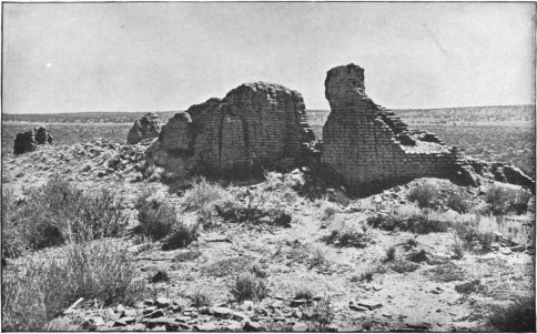
34°39′44″N 106°46′38″W / 34.662222°N 106.777222°WBelen 6 Dittert Site August 22, 1977 Address Restricted Granta 7 El Cerro Tome Site July 9, 1996 0.5 miles east of the junction of State Road 47 and Tome Hill Rd.
34°45′20″N 106°42′19″W / 34.755556°N 106.705278°WTome 8 El Morro National Monument 
October 15, 1966 2 miles west of El Morro via State Road 53
35°2′20″N 108°21′9″W / 35.03889°N 108.3525°WEl Morro 9 Belen Harvey House 
October 28, 1983 104 N. 1st St.
34°39′36″N 106°46′02″W / 34.66°N 106.767222°WBelen 10 Hawikuh 
October 15, 1966 12 miles southwest of Zuni on the Zuni Indian Reservation
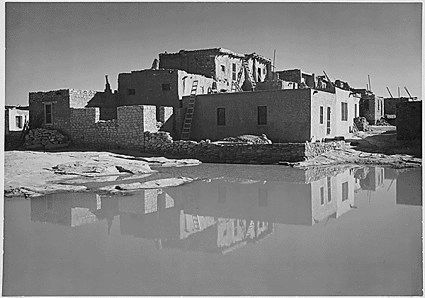
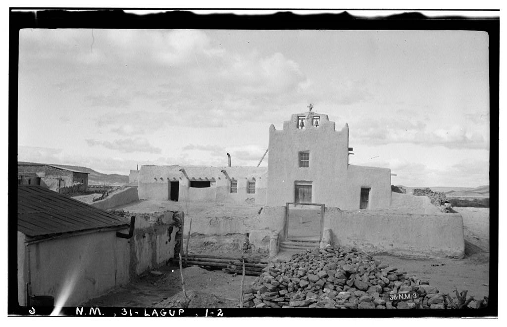
34°56′25″N 108°59′57″W / 34.940278°N 108.999167°WZuni Pueblo 11 Laguna Pueblo 
June 19, 1973 45 miles west of Albuquerque off old U.S. Route 66
35°02′08″N 107°23′05″W / 35.035556°N 107.384722°WAlbuquerque San Jose de la Laguna 12 Los Ojuelos (The Springs) December 10, 1987 Address Restricted Tome 13 Tranquilino Luna House April 16, 1975 Southwest of Los Lunas at the junction of U.S. Route 85 and State Road 6
34°48′26″N 106°44′08″W / 34.807222°N 106.735556°WLos Lunas 14 Otero's 66 Service February 13, 2003 100 Main St.
34°48′26″N 106°44′03″W / 34.80718°N 106.73420°WLos Lunas 15 San Estevan del Rey Mission Church 
April 15, 1970 On State Road 23
34°53′50″N 107°34′57″W / 34.897222°N 107.5825°WAcoma Pueblo 16 San Jose de la Laguna Mission and Convento 
January 29, 1973 Address unknown at this time
35°02′05″N 107°23′17″W / 35.034722°N 107.388056°WLaguna 17 San Mateo Archeological Site May 17, 1979 Address Restricted San Mateo 18 Tome Jail October 5, 1977 Tome Plaza
34°44′26″N 106°43′49″W / 34.740556°N 106.730278°WTome 19 Village of Encinal Day School August 8, 1980 Northwest of Encinal
35°07′14″N 107°27′48″W / 35.120556°N 107.463333°WEncinal 20 Dr. William Frederick Wittwer House February 27, 1987 State Road 6, west of U.S. Route 85
34°48′29″N 106°44′09″W / 34.808056°N 106.735833°WLos Lunas 21 Zuni-Cibola Complex December 2, 1974 Address Restricted Zuni Pueblo Extends into Cibola and McKinley counties See also
- List of National Historic Landmarks in New Mexico
- National Register of Historic Places listings in New Mexico
References
- ^ The latitude and longitude information provided in this table was derived originally from the National Register Information System, which has been found to be fairly accurate for about 99% of listings. For about 1% of NRIS original coordinates, experience has shown that one or both coordinates are typos or otherwise extremely far off; some corrections may have been made. A more subtle problem causes many locations to be off by up to 150 yards, depending on location in the country: most NRIS coordinates were derived from tracing out latitude and longitudes off of USGS topographical quadrant maps created under the North American Datum of 1927, which differs from the current, highly accurate WGS84 GPS system used by Google maps. Chicago is about right, but NRIS longitudes in Washington are higher by about 4.5 seconds, and are lower by about 2.0 seconds in Maine. Latitudes differ by about 1.0 second in Florida. Some locations in this table may have been corrected to current GPS standards.
- ^ "National Register of Historic Places: Weekly List Actions". National Park Service, United States Department of the Interior. Retrieved on November 10, 2011.
- ^ Numbers represent an ordering by significant words. Various colorings, defined here, differentiate National Historic Landmark sites and National Register of Historic Places Districts from other NRHP buildings, structures, sites or objects.
- ^ "National Register Information System". National Register of Historic Places. National Park Service. . http://nrhp.focus.nps.gov/natreg/docs/All_Data.html.
U.S. National Register of Historic Places Topics Lists by states Alabama • Alaska • Arizona • Arkansas • California • Colorado • Connecticut • Delaware • Florida • Georgia • Hawaii • Idaho • Illinois • Indiana • Iowa • Kansas • Kentucky • Louisiana • Maine • Maryland • Massachusetts • Michigan • Minnesota • Mississippi • Missouri • Montana • Nebraska • Nevada • New Hampshire • New Jersey • New Mexico • New York • North Carolina • North Dakota • Ohio • Oklahoma • Oregon • Pennsylvania • Rhode Island • South Carolina • South Dakota • Tennessee • Texas • Utah • Vermont • Virginia • Washington • West Virginia • Wisconsin • WyomingLists by territories Lists by associated states Other Municipalities and communities of Valencia County, New Mexico City 
Town Villages CDPs Categories:- National Register of Historic Places in New Mexico by county
- Valencia County, New Mexico
- History of Valencia County, New Mexico
-


Wikimedia Foundation. 2010.