- National Register of Historic Places listings in Valdez–Cordova Census Area, Alaska
-
 Location of the Valdez-Cordova Census Area in Alaska
This is a list of the National Register of Historic Places listings in Valdez-Cordova Census Area, Alaska.
This is intended to be a complete list of the properties and districts on the National Register of Historic Places in Valdez-Cordova Census Area, Alaska, United States. The locations of National Register properties and districts for which the latitude and longitude coordinates are included below, may be seen in a Google map.[1]
There are 25 properties and districts listed on the National Register in the census area, including three National Historic Landmarks.
-
- This National Park Service list is complete through NPS recent listings posted November 10, 2011.[2]
Current listings
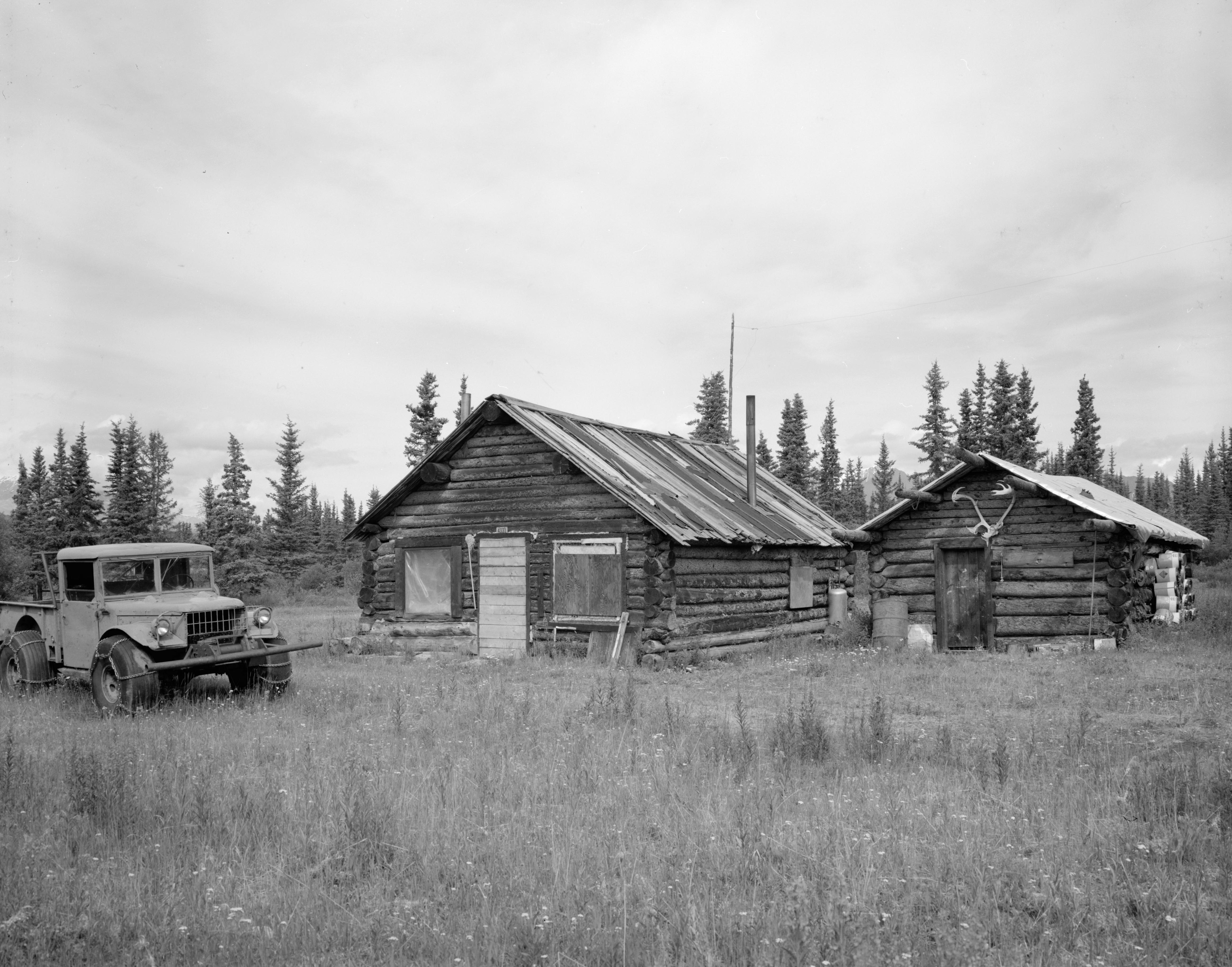
[3] Landmark name[4] Image Date listed Location Community Summary 1 Bering Expedition Landing Site July 20, 1977 South of Katalla on Kayak Island
59°53′40″N 144°29′8″W / 59.89444°N 144.48556°WKatalla 2 Bremner Historic Mining District 
June 15, 2000 Wrangell-St. Elias National Park and Preserve
61°1′28″N 143°26′24″W / 61.02444°N 143.44°WChitina 3 Cape Hinchinbrook Light Station July 29, 2005 Southwestern corner of Hinchinbrook Island on the eastern side of the Hinchinbrook Entrance of Prince William Sound
60°2′25″N 146°38′46″W / 60.04028°N 146.64611°WCordova 4 Cape St. Elias Lighthouse 
December 18, 1975 South of Katalla on Kayak Island
59°48′27″N 144°36′40″W / 59.8075°N 144.61111°WKatalla 5 Chilkat Oil Company Refinery Site September 6, 1974 Katalla Rd.
60°11′19″N 144°27′0″W / 60.18861°N 144.45°WKatalla 6 Chisana Historic District 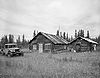
November 29, 1985 Extending west ¼ mile from the southeastern end of Chisana Airstrip and parallel to Johnson Creek
62°3′57″N 142°2′34″W / 62.06583°N 142.04278°WChisana 7 Chistochina Trading Post June 13, 1997 Junction of the Glenn Highway and the Tok Cutoff
62°34′7″N 144°40′59″W / 62.56861°N 144.68306°WGakona 8 Chitina Tin Shop June 11, 1979 Main St.
61°31′3″N 144°26′23″W / 61.5175°N 144.43972°WChitina 9 Copper River and Northwestern Railway 
April 24, 1973 Beginning at Chitina and following the Copper River to the Tasnuna River
61°17′34″N 144°42′48″W / 61.29278°N 144.71333°WChitina 10 Copper River and Northwestern Railway Bunkhouse and Messhouse December 5, 2002 3rd St.
61°30′58″N 144°26′2″W / 61.51611°N 144.43389°WChitina 11 Cordova Post Office and Courthouse 
August 2, 1977 2nd St.
60°32′42″N 145°45′18″W / 60.545°N 145.755°WCordova 12 Dakah De'nin's Village Site April 9, 1979 Address Restricted Chitina 13 Gakona Historic District 
February 2, 2001 Mile 2 on the Tok Cutoff-Glenn Highway
62°18′10″N 145°18′12″W / 62.30278°N 145.30333°WGakona 14 Gakona Roadhouse 
August 3, 1977 Mile 205 on the Glenn Highway
62°18′10″N 145°18′16″W / 62.30278°N 145.30444°WGakona 15 Kansky's May 16, 1997 Mile 42 on Skookum Rd., approximately 2 miles north of the Nabesna Mine
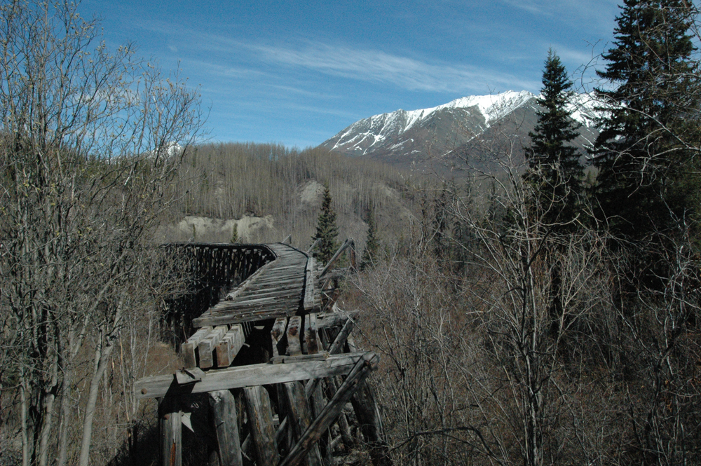
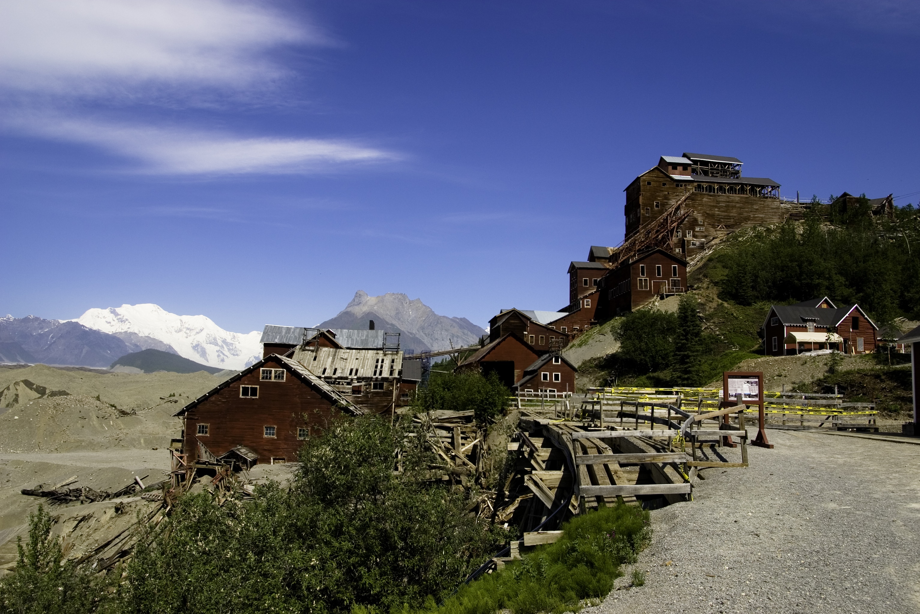
62°22′46″N 142°59′33″W / 62.37944°N 142.9925°WSlana 16 Kennecott Mines 
July 12, 1978 Southeast of the Kennecott Glacier on the northern bank of National Creek
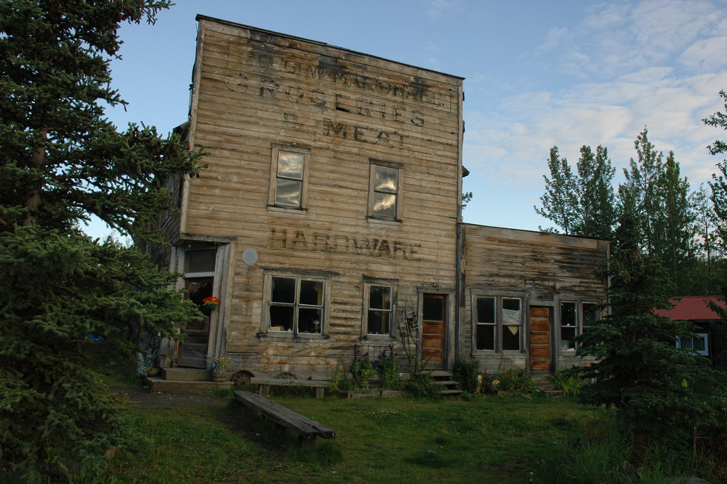
61°30′36″N 142°52′5″W / 61.51°N 142.86806°WKennecott 17 McCarthy General Store 
January 31, 1978 Kennecott and Sholai Sts.
61°26′3″N 142°55′16″W / 61.43417°N 142.92111°WMcCarthy 18 McCarthy Power Plant April 26, 1979 At McCarthy Creek
61°25′57″N 142°55′30″W / 61.4325°N 142.925°WMcCarthy 19 Million Dollar Bridge 
March 31, 2000 Mile 48 on the Copper River Highway
60°40′24″N 144°44′36″W / 60.67333°N 144.74333°WCordova 20 Palugvik Archeological District October 15, 1966 Address Restricted Cordova 21 Reception Building April 9, 1980 2nd and B Sts.
60°33′10″N 145°45′2″W / 60.55278°N 145.75056°WCordova 22 Red Dragon Historic District August 31, 1982 Lake St.
60°32′31″N 145°45′21″W / 60.54194°N 145.75583°WCordova 23 St. Michael the Archangel Church 
June 6, 1980 In Cordova
60°32′33″N 145°44′16″W / 60.5425°N 145.73778°WCordova 24 Tangle Lakes Archeological District November 12, 1971 Address Restricted Paxson 25 Valdez Trail-Copper Bluff Segment February 12, 1998 Milepost 106.5 on the Richardson Highway
62°1′16″N 145°21′52″W / 62.02111°N 145.36444°WCopper City See also
- List of National Historic Landmarks in Alaska
- National Register of Historic Places listings in Alaska
References
- ^ The latitude and longitude information provided in this table was derived originally from the National Register Information System, which has been found to be fairly accurate for about 99% of listings. For about 1% of NRIS original coordinates, experience has shown that one or both coordinates are typos or otherwise extremely far off; some corrections may have been made. A more subtle problem causes many locations to be off by up to 150 yards, depending on location in the country: most NRIS coordinates were derived from tracing out latitude and longitudes off of USGS topographical quadrant maps created under the North American Datum of 1927, which differs from the current, highly accurate WGS84 GPS system used by Google maps. Chicago is about right, but NRIS longitudes in Washington are higher by about 4.5 seconds, and are lower by about 2.0 seconds in Maine. Latitudes differ by about 1.0 second in Florida. Some locations in this table may have been corrected to current GPS standards.
- ^ "National Register of Historic Places: Weekly List Actions". National Park Service, United States Department of the Interior. Retrieved on November 10, 2011.
- ^ Numbers represent an ordering by significant words. Various colorings, defined here, differentiate National Historic Landmark sites and National Register of Historic Places Districts from other NRHP buildings, structures, sites or objects.
- ^ "National Register Information System". National Register of Historic Places. National Park Service. 2008-04-24. http://nrhp.focus.nps.gov/natreg/docs/All_Data.html.
U.S. National Register of Historic Places Topics Lists by states Alabama • Alaska • Arizona • Arkansas • California • Colorado • Connecticut • Delaware • Florida • Georgia • Hawaii • Idaho • Illinois • Indiana • Iowa • Kansas • Kentucky • Louisiana • Maine • Maryland • Massachusetts • Michigan • Minnesota • Mississippi • Missouri • Montana • Nebraska • Nevada • New Hampshire • New Jersey • New Mexico • New York • North Carolina • North Dakota • Ohio • Oklahoma • Oregon • Pennsylvania • Rhode Island • South Carolina • South Dakota • Tennessee • Texas • Utah • Vermont • Virginia • Washington • West Virginia • Wisconsin • WyomingLists by territories Lists by associated states Other Properties on the National Register of Historic Places in Alaska  Boroughs
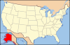 Census areasAleutians West • Bethel • Dillingham • Hoonah-Angoon • Nome • Petersburg • Prince of Wales-Hyder • Southeast Fairbanks • Valdez-Cordova • Yukon-KoyukukThere are no sites listed on the National Register of Historic Places in Wade Hampton Census Area
Municipalities and communities of Valdez-Cordova Census Area, Alaska Cities 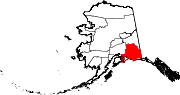
CDPs Chenega | Chisana | Chistochina | Chitina | Copper Center | Copperville | Gakona | Glennallen | Gulkana | Kenny Lake | McCarthy | Mendeltna | Mentasta Lake | Nelchina | Paxson | Silver Springs | Slana | Tatitlek | Tazlina | Tolsona | Tonsina | Willow Creek
Unincorporated
communitiesCategories:- National Register of Historic Places in Alaska by borough and census area
- Valdez–Cordova Census Area, Alaska
-


Wikimedia Foundation. 2010.