- Mentasta Lake, Alaska
-
Mentasta Lake
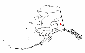
Mendaesde— CDP — Location of Mentasta Lake, Alaska
Coordinates: 62°55′26″N 143°32′0″W / 62.92389°N 143.533333°WCoordinates: 62°55′26″N 143°32′0″W / 62.92389°N 143.533333°W Country United States State Alaska Census Area Valdez-Cordova Area - Total 305.1 sq mi (790.1 km2) - Land 303.1 sq mi (784.9 km2) - Water 2.0 sq mi (5.2 km2) Population (2000) - Total 142 - Density 0.5/sq mi (0.2/km2) Time zone Alaska (AKST) (UTC-9) - Summer (DST) AKDT (UTC-8) Area code(s) 907 FIPS code 02-48540 Mentasta Lake (Mendaesde in Ahtna) is a census-designated place (CDP) in Valdez-Cordova Census Area, Alaska, United States. At the 2000 census the population was 142.
Contents
Geography
Mentasta Lake is located at 62°55′26″N 143°32′00″W / 62.92389°N 143.5333333°W (62.923924, -143.533240)[1].
According to the United States Census Bureau, the CDP has a total area of 305.1 square miles (790 km2), of which, 303.1 square miles (785 km2) of it is land and 2.0 square miles (5.2 km2) of it (0.66%) is water.
Demographics
As of the census[2] of 2000, there were 142 people, 54 households, and 32 families residing in the CDP. The population density was 0.5 people per square mile (0.2/km²). There were 89 housing units at an average density of 0.3/sq mi (0.1/km²). The racial makeup of the CDP was 28.87% White, 62.68% Native American, and 8.45% from two or more races.
There were 54 households out of which 31.5% had children under the age of 18 living with them, 38.9% were married couples living together, 16.7% had a female householder with no husband present, and 38.9% were non-families. 29.6% of all households were made up of individuals and 5.6% had someone living alone who was 65 years of age or older. The average household size was 2.63 and the average family size was 3.33.
In the CDP the age distribution of the population shows 35.2% under the age of 18, 7.7% from 18 to 24, 23.9% from 25 to 44, 26.8% from 45 to 64, and 6.3% who were 65 years of age or older. The median age was 32 years. For every 100 females there were 102.9 males. For every 100 females age 18 and over, there were 119.0 males.
The median income for a household in the CDP was $17,344, and the median income for a family was $24,167. Males had a median income of $20,833 versus $30,417 for females. The per capita income for the CDP was $11,275. There were 21.9% of families and 35.7% of the population living below the poverty line, including 40.0% of under eighteens and none of those over 64.
Education
Mentasta Lake is part of the Alaska Gateway School District. Mentasta Lake Katie John School, a K-12 campus, serves community students.
References
- ^ "US Gazetteer files: 2010, 2000, and 1990". United States Census Bureau. 2011-02-12. http://www.census.gov/geo/www/gazetteer/gazette.html. Retrieved 2011-04-23.
- ^ "American FactFinder". United States Census Bureau. http://factfinder.census.gov. Retrieved 2008-01-31.
so far it only has a few people and it has like 2 people in each grade and none in some grades too. other than that it is a great school
Municipalities and communities of Valdez-Cordova Census Area, Alaska Cities 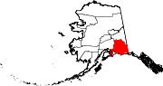
CDPs Chenega | Chisana | Chistochina | Chitina | Copper Center | Copperville | Gakona | Glennallen | Gulkana | Kenny Lake | McCarthy | Mendeltna | Mentasta Lake | Nelchina | Paxson | Silver Springs | Slana | Tatitlek | Tazlina | Tolsona | Tonsina | Willow Creek
Unincorporated
communitiesCategories:- Census-designated places in Alaska
- Populated places in Valdez–Cordova Census Area, Alaska
- Populated places in Alaska with Native American majority populations

Wikimedia Foundation. 2010.