- Chitina, Alaska
-
Chitina
Tsedi Na’ ("copper stream" or Copper River)[1]— CDP — A building in Chitina Location of Chitina, Alaska
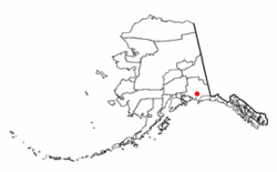
Coordinates: 61°32′21″N 144°25′30″W / 61.53917°N 144.425°WCoordinates: 61°32′21″N 144°25′30″W / 61.53917°N 144.425°W Country United States State Alaska Census Area Valdez-Cordova Area - Total 95.8 sq mi (248 km2) - Land 84.6 sq mi (219.2 km2) - Water 11.1 sq mi (28.8 km2) Population (2000) - Total 123 Time zone Alaska (AKST) (UTC-9) - Summer (DST) AKDT (UTC-8) Area code(s) 907 FIPS code 02-14110 Chitina (Tsedi Na’ in Ahtna) is a census-designated place (CDP) in Valdez-Cordova Census Area, Alaska, United States. At the 2000 census the population was 123.
Contents
Geography
Chitina is located at 61°32′21″N 144°25′30″W / 61.53917°N 144.425°W (61.539033, -144.424881)[2].
Chitina is located on the west bank of the Copper River at its confluence with the Chitina River on the Edgerton Highway, and junction with the McCarthy Road. It is 85 km (53 mi) southeast of Copper Center and 106 km (66 mi) southeast of Glennallen. It is outside the western boundary of the Wrangell - St Elias National Park and Preserve.
In 1945, work had begun to convert the CR&NW railroad line, from Cordova to Kennicott, into a highway, but work halted with the 1964 Good Friday Earthquake, leaving a significant gap between Chitina and the Million Dollar Bridge near Cordova. The rail route from Chitina to Kennicott is a roadway, the McCarthy Road.
According to the United States Census Bureau, the CDP has a total area of 95.8 square miles (248 km2), of which, 84.6 square miles (219 km2) of it is land and 11.1 square miles (29 km2) of it (11.62%) is water.
Demographics
As of the census[3] of 2000, there were 123 people, 52 households, and 30 families residing in the CDP. The population density was 1.5 people per square mile (0.6/km²). There were 54 housing units at an average density of 0.6/sq mi (0.2/km²). The racial makeup of the CDP was 51.22% White, 33.33% Alaskan Native, and 15.45% from two or more races.
There were 52 households out of which 23.1% had children under the age of 18 living with them, 42.3% were married couples living together, 13.5% had a female householder with no husband present, and 42.3% were non-families. 36.5% of all households were made up of individuals and 9.6% had someone living alone who was 65 years of age or older. The average household size was 2.37 and the average family size was 3.07.
In the CDP the population was spread out with 29.3% under the age of 18, 7.3% from 18 to 24, 23.6% from 25 to 44, 30.9% from 45 to 64, and 8.9% who were 65 years of age or older. The median age was 39 years. For every 100 females there were 86.4 males. For every 100 females age 18 and over, there were 102.3 males.
The median income for a household in the CDP was $26,000, and the median income for a family was $28,750. Males had a median income of $31,250 versus $17,500 for females. The per capita income for the CDP was $10,835. There were 3.3% of families and 12.7% of the population living below the poverty line, including no under eighteens and 15.4% of those over 64.
History
Athabascans have lived in the area around Chitina for centuries as evidenced by the archaeological sites south and east of Chitina. Before 1900, Chitina was the site of large village whose population was slowly decimated by the influx of people, disease and conflicts.
Copper ore was discovered in about 1900 along the northern edge of the Chitina River valley. This brought a rush of prospectors and homesteaders to the area. The Copper River and Northwestern Railway enabled Chitina to develop into a thriving community by 1914. It had a general store, a clothing store, a meat market, stables, a tinsmith, five hotels, several rooming houses, a pool hall, bars, restaurants, dance halls and a movie theater. The mines closed in 1938 and the remaining support activities moved to what is now the Glennallen area. Chitina became a virtual ghost town. Otto Adrian Nelson, a surveying engineer for the Kennecott Mines, eventually bought up much of the town. He built a unique hydroelectric system that supplied electric power to all his buildings. He also supplied much of the town center with hot and cold running water.
Current activity in Chitina revolves around the dipnet fishing for salmon that occurs every summer. Alaskans are allowed to dip a large number of salmon during their spawning runs and Chitina is an accessible and popular place for this activity.
In late 1977, jeweler Art Koeninger purchased the "Chitina Tin Shop” with the intention of turning it into a residence. In 1979, the site, formerly known as “Fred’s Place” and “Schaupp’s,” was placed on the National Register of Historic Places and has won two historic preservation grants. It currently houses the Spirit Mountain Artworks.
References
- ^ http://books.google.com/books?id=5XfxzCm1qa4C&pg=PA104&lpg=PA104&dq=Tsedi+Na%E2%80%99&source=bl&ots=ZSbDn5lmtm&sig=u06cTepVPmEX20YyuYlSlT5g2wo&hl=en&ei=0FgNTurwLYvWiALylLzvDQ&sa=X&oi=book_result&ct=result&resnum=8&ved=0CEoQ6AEwBw#v=onepage&q=Tsedi%20Na%E2%80%99&f=false
- ^ "US Gazetteer files: 2010, 2000, and 1990". United States Census Bureau. 2011-02-12. http://www.census.gov/geo/www/gazetteer/gazette.html. Retrieved 2011-04-23.
- ^ "American FactFinder". United States Census Bureau. http://factfinder.census.gov. Retrieved 2008-01-31.
Municipalities and communities of Valdez-Cordova Census Area, Alaska Cities 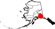
CDPs Chenega | Chisana | Chistochina | Chitina | Copper Center | Copperville | Gakona | Glennallen | Gulkana | Kenny Lake | McCarthy | Mendeltna | Mentasta Lake | Nelchina | Paxson | Silver Springs | Slana | Tatitlek | Tazlina | Tolsona | Tonsina | Willow Creek
Unincorporated
communitiesCategories:- Archaeological sites in Alaska
- Census-designated places in Alaska
- Ghost towns in Alaska
- Populated places in Valdez–Cordova Census Area, Alaska


Wikimedia Foundation. 2010.