- Nelchina, Alaska
-
Nelchina
Xaz Ghae Na’— CDP — Location within the state of Alaska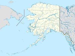
 Nelchina
Coordinates: 61°58′30″N 146°49′33″W / 61.975°N 146.82583°WCoordinates: 61°58′30″N 146°49′33″W / 61.975°N 146.82583°W Country United States State Alaska Census Area Valdez-Cordova Area – Total 46.7 sq mi (121.0 km2) – Land 46.0 sq mi (119.2 km2) – Water 0.7 sq mi (1.8 km2) Elevation 2,402 ft (732 m) Population (2000) – Total 71 – Density 1.5/sq mi (0.6/km2) Time zone Alaska (AKST) (UTC-9) – Summer (DST) AKDT (UTC-8) Zip Code 99588 Area code(s) 907 FIPS code 02-52915 GNIS feature ID 1865559 Nelchina (Xaz Ghae Na’ in Ahtna) is a census-designated place (CDP) in Valdez-Cordova Census Area, Alaska, United States. The population was 71 at the 2000 census.
Contents
Geography
Nelchina is located at 61°58′30″N 146°49′33″W / 61.975°N 146.82583°W (61.975035, -146.825861)[1].Nelchina appears on the Valdez D-8 on the U.S.Geological Survey Map.The elevation is 2,402 feet. Nelchina is located between Milepost 137.5 and 150.5 of the Glenn Highway, at the junction of the Little Nelchina River and Crooked Creek. It is about 30 miles west of Glennallen and Mendeltna, just east of Mat-Su Borough Boundary. Nelchina is located at the Chitina Recording Districet.
According to the United States Census Bureau, the CDP has a total area of 46.7 square miles (121 km2), of which, 46.0 square miles (119 km2) of it is land and 0.7 square miles (1.8 km2) of it (1.48%) is water.
Climate
Nelchina is located at the continental climate zone. Temperature extremes range from -74 to 96. Snowfall averages 39 inches, with total precipitation of 9 inches per year.
History
Nelchina is an Athabascan Indian name. Gold in the creeks draining from Chugach Mountains brought prospectors to this area in the late 1800s. Nelchina area offered several trails into the mountains. Nelchina was a mining settlement established in 1913. It was first reported by Theodore Chaplin in a 1915 USGS publication.
Demographics
As of the census[2] of 2000, there were 71 people, 27 households, and 20 families residing in the CDP. The population density was 1.5 people per square mile (0.6/km²). There were 33 housing units at an average density of 0.7/sq mi (0.3/km²). The racial makeup of the CDP was 90.14% White, 4.23% Native American, and 5.63% from two or more races.
There were 27 households out of which 25.9% had children under the age of 18 living with them, 66.7% were married couples living together, and 25.9% were non-families. 25.9% of all households were made up of individuals and 3.7% had someone living alone who was 65 years of age or older. The average household size was 2.63 and the average family size was 3.15.
In the CDP the age distribution of the population shows 28.2% under the age of 18, 5.6% from 18 to 24, 19.7% from 25 to 44, 32.4% from 45 to 64, and 14.1% who were 65 years of age or older. The median age was 43 years. For every 100 females there were 153.6 males. For every 100 females age 18 and over, there were 131.8 males.
The median income for a household in the CDP was $40,625, and the median income for a family was $40,625. Males had a median income of $37,917 versus $18,750 for females. The per capita income for the CDP was $10,742. There were 19.0% of families and 17.8% of the population living below the poverty line, including 10.0% of under eighteens and none of those over 64.
References
- ^ "US Gazetteer files: 2010, 2000, and 1990". United States Census Bureau. 2011-02-12. http://www.census.gov/geo/www/gazetteer/gazette.html. Retrieved 2011-04-23.
- ^ "American FactFinder". United States Census Bureau. http://factfinder.census.gov. Retrieved 2008-01-31.
Municipalities and communities of Valdez-Cordova Census Area, Alaska Cities 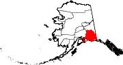
CDPs Chenega | Chisana | Chistochina | Chitina | Copper Center | Copperville | Gakona | Glennallen | Gulkana | Kenny Lake | McCarthy | Mendeltna | Mentasta Lake | Nelchina | Paxson | Silver Springs | Slana | Tatitlek | Tazlina | Tolsona | Tonsina | Willow Creek
Unincorporated
communitiesCategories:- Census-designated places in Alaska
- Populated places in Valdez–Cordova Census Area, Alaska


Wikimedia Foundation. 2010.