- National Register of Historic Places listings in North Slope Borough, Alaska
-
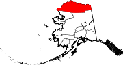
 Location of the North Slope Borough in Alaska
This is a list of the National Register of Historic Places listings in North Slope Borough, Alaska.
This is intended to be a complete list of the properties and districts on the National Register of Historic Places in North Slope Borough, Alaska, United States. The locations of National Register properties and districts for which the latitude and longitude coordinates are included below, may be seen in a Google map.[1]
There are 18 properties and districts listed on the National Register in the borough, including four National Historic Landmarks.
-
- This National Park Service list is complete through NPS recent listings posted November 10, 2011.[2]
[3] Landmark name[4] Image Date listed Location Community Summary 1 Aluakpak March 18, 1980 Address unknown
70°24′39″N 159°51′18″W / 70.41083°N 159.855°WWainwright 2 Anaktuuk March 18, 1980 Address Restricted Wainwright 3 Atanik March 18, 1980 On the shoreline of the Chukchi Sea, 20 miles (32 km) northeast of Wainwright
70°50′35″N 159°21′36″W / 70.84306°N 159.36°W[5]Wainwright 4 Avalitkuk March 18, 1980 Address Restricted Wainwright 5 Birnirk Site 
October 15, 1966 Address Restricted Barrow 6 Gallagher Flint Station Archeological Site 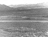
June 16, 1978 Address Restricted Sagwon 7 Ipiutak Archeological District May 25, 1979 Address Restricted Point Hope 8 Ipiutak Site 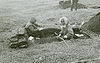
October 15, 1966 Address Restricted Point Hope 9 Ivishaat March 18, 1980 Address Restricted Wainwright 10 Kanitch March 18, 1980 Address Restricted Wainwright 11 Leffingwell Camp Site 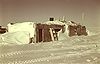
June 21, 1971 58 miles west of Barter Island on the Arctic Ocean coastline
70°11′7″N 146°3′0″W / 70.18528°N 146.05°WFlaxman Island 12 Napanik March 18, 1980 Address Restricted Wainwright 13 Negilik Site April 15, 1980 Address Restricted Wainwright 14 Point Barrow Refuge Station 
December 2, 1980 Browersville
71°17′52″N 156°46′23″W / 71.29778°N 156.77306°WBarrow 15 Prudhoe Bay Oil Field Discovery Well Site March 23, 2000 200 miles southeast of Barrow, about 2 miles north of the mouth of the Putuligayuk River along the western shore of Prudhoe Bay
70°19′26″N 160°32′29″W / 70.32389°N 160.54139°WPrudhoe Bay 16 Rogers-Post Site April 22, 1980 13 miles southwest of Barrow
71°9′20″N 157°2′58″W / 71.15556°N 157.04944°WBarrow 17 Utkeagvik Church Manse 
October 6, 1983 Off Momegan St.
71°17′34″N 156°46′49″W / 71.29278°N 156.78028°WBarrow 18 Uyagaagruk March 18, 1980 Address Restricted Wainwright See also
- List of National Historic Landmarks in Alaska
- National Register of Historic Places listings in Alaska
References
- ^ The latitude and longitude information provided in this table was derived originally from the National Register Information System, which has been found to be fairly accurate for about 99% of listings. For about 1% of NRIS original coordinates, experience has shown that one or both coordinates are typos or otherwise extremely far off; some corrections may have been made. A more subtle problem causes many locations to be off by up to 150 yards, depending on location in the country: most NRIS coordinates were derived from tracing out latitude and longitudes off of USGS topographical quadrant maps created under North American Datum of 1927, which differs from the current, highly accurate GPS system used by Google maps. Chicago is about right, but NRIS longitudes in Washington are higher by about 4.5 seconds, and are lower by about 2.0 seconds in Maine. Latitudes differ by about 1.0 second in Florida. Some locations in this table may have been corrected to current GPS standards.
- ^ "National Register of Historic Places: Weekly List Actions". National Park Service, United States Department of the Interior. Retrieved on November 10, 2011.
- ^ Numbers represent an ordering by significant words. Various colorings, defined here, differentiate National Historic Landmark sites and National Register of Historic Places Districts from other NRHP buildings, structures, sites or objects.
- ^ "National Register Information System". National Register of Historic Places. National Park Service. 2008-04-24. http://nrhp.focus.nps.gov/natreg/docs/All_Data.html.
- ^ Location derived from its GNIS feature record; the NRIS lists the site as "Address Restricted"
U.S. National Register of Historic Places Topics Lists by states Alabama • Alaska • Arizona • Arkansas • California • Colorado • Connecticut • Delaware • Florida • Georgia • Hawaii • Idaho • Illinois • Indiana • Iowa • Kansas • Kentucky • Louisiana • Maine • Maryland • Massachusetts • Michigan • Minnesota • Mississippi • Missouri • Montana • Nebraska • Nevada • New Hampshire • New Jersey • New Mexico • New York • North Carolina • North Dakota • Ohio • Oklahoma • Oregon • Pennsylvania • Rhode Island • South Carolina • South Dakota • Tennessee • Texas • Utah • Vermont • Virginia • Washington • West Virginia • Wisconsin • WyomingLists by territories Lists by associated states Other  Category:National Register of Historic Places •
  Portal:National Register of Historic Places
Properties on the National Register of Historic Places in Alaska  Boroughs
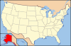 Aleutians East • Anchorage • Bristol Bay • Denali • Fairbanks North Star • Haines • Juneau • Kenai Peninsula • Ketchikan Gateway • Kodiak Island • Lake and Peninsula • Matanuska-Susitna • North Slope • Northwest Arctic • Sitka • Skagway • Wrangell • YakutatCensus areasAleutians West • Bethel • Dillingham • Hoonah-Angoon • Nome • Petersburg • Prince of Wales-Hyder • Southeast Fairbanks • Valdez-Cordova • Yukon-KoyukukThere are no sites listed on the National Register of Historic Places in Wade Hampton Census Area
Municipalities and communities of North Slope Borough, Alaska Borough seat: Barrow Cities Anaktuvuk Pass | Atqasuk | Barrow | Kaktovik | Nuiqsut | Point Hope | Wainwright
CDPs Unincorporated
communitiesCategories:- National Register of Historic Places in Alaska by borough and census area
- North Slope Borough, Alaska
-


Wikimedia Foundation. 2010.