- National Register of Historic Places listings in Petersburg Census Area, Alaska
-
 Location of the Petersburg Census Area in Alaska
This is a list of the National Register of Historic Places listings in Petersburg Census Area, Alaska.
This is intended to be a complete list of the properties and districts on the National Register of Historic Places in Petersburg Census Area, Alaska, United States. The locations of National Register properties and districts for which the latitude and longitude coordinates are included below, may be seen in a Google map.[1]
There are 7 properties and districts listed on the National Register in the census area, including one National Historic Landmark.
-
- This National Park Service list is complete through NPS recent listings posted November 10, 2011.[2]
Current listings
[3] Landmark name[4] Image Date listed Location Community Summary 1 Cape Decision Light Station 
February 2, 2005 Southwestern extremity of Kuiu Island, north of the junction of Chatham and Sumner Straits, approximately 63 miles south of Sitka
56°0′4″N 134°8′4″W / 56.00111°N 134.13444°WSitka 2 Chief Shakes Historic Site 
October 27, 1970 Shakes Island
56°28′49″N 133°11′24″W / 56.48028°N 133.19°WPetersburg 3 Petersburg 4 Petersburg 5 Five Finger Light Station 
May 12, 2004 Island of The Five Fingers, approximately 37 miles northwest of the city of Petersburg
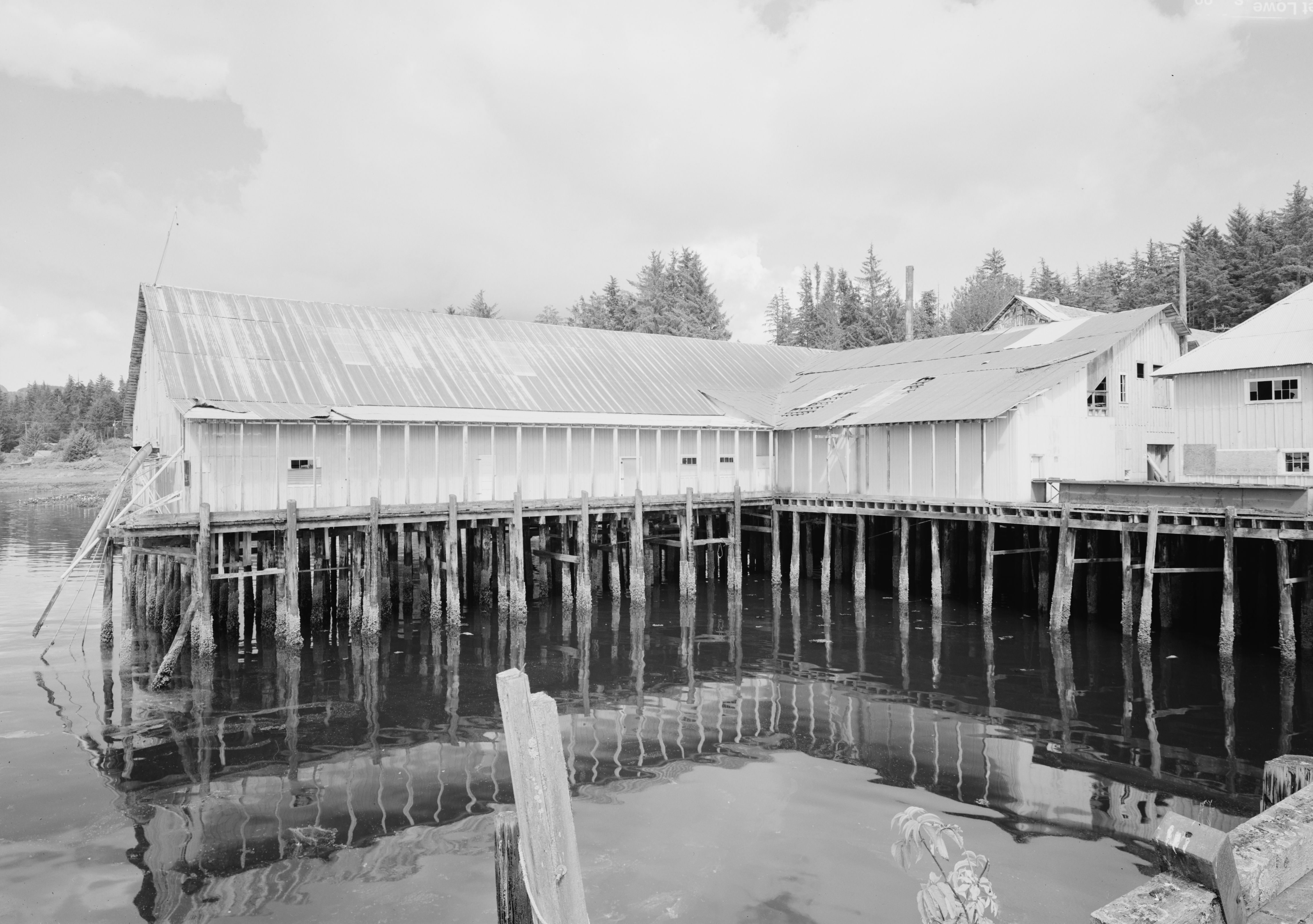
57°16′14″N 133°37′49″W / 57.27056°N 133.63028°WPetersburg 6 Kake Cannery 
December 9, 1997 1.5 miles south of Kake
56°57′55″N 133°55′26″W / 56.96528°N 133.92389°WKake 7 Sons of Norway Hall 
July 10, 1979 Indian St.
56°48′38″N 132°57′27″W / 56.81056°N 132.9575°WPetersburg See also
- List of National Historic Landmarks in Alaska
- National Register of Historic Places listings in Alaska
References
- ^ The latitude and longitude information provided in this table was derived originally from the National Register Information System, which has been found to be fairly accurate for about 99% of listings. For about 1% of NRIS original coordinates, experience has shown that one or both coordinates are typos or otherwise extremely far off; some corrections may have been made. A more subtle problem causes many locations to be off by up to 150 yards, depending on location in the country: most NRIS coordinates were derived from tracing out latitude and longitudes off of USGS topographical quadrant maps created under North American Datum of 1927, which differs from the current, highly accurate GPS system used by Google maps. Chicago is about right, but NRIS longitudes in Washington are higher by about 4.5 seconds, and are lower by about 2.0 seconds in Maine. Latitudes differ by about 1.0 second in Florida. Some locations in this table may have been corrected to current GPS standards.
- ^ "National Register of Historic Places: Weekly List Actions". National Park Service, United States Department of the Interior. Retrieved on November 10, 2011.
- ^ Numbers represent an ordering by significant words. Various colorings, defined here, differentiate National Historic Landmark sites and National Register of Historic Places Districts from other NRHP buildings, structures, sites or objects.
- ^ "National Register Information System". National Register of Historic Places. National Park Service. 2008-04-24. http://nrhp.focus.nps.gov/natreg/docs/All_Data.html.
U.S. National Register of Historic Places Topics Lists by states Alabama • Alaska • Arizona • Arkansas • California • Colorado • Connecticut • Delaware • Florida • Georgia • Hawaii • Idaho • Illinois • Indiana • Iowa • Kansas • Kentucky • Louisiana • Maine • Maryland • Massachusetts • Michigan • Minnesota • Mississippi • Missouri • Montana • Nebraska • Nevada • New Hampshire • New Jersey • New Mexico • New York • North Carolina • North Dakota • Ohio • Oklahoma • Oregon • Pennsylvania • Rhode Island • South Carolina • South Dakota • Tennessee • Texas • Utah • Vermont • Virginia • Washington • West Virginia • Wisconsin • WyomingLists by territories Lists by associated states Other  Category:National Register of Historic Places •
  Portal:National Register of Historic Places
Properties on the National Register of Historic Places in Alaska  Boroughs
 Census areasAleutians West • Bethel • Dillingham • Hoonah-Angoon • Nome • Petersburg • Prince of Wales-Hyder • Southeast Fairbanks • Valdez-Cordova • Yukon-KoyukukThere are no sites listed on the National Register of Historic Places in Wade Hampton Census Area
Municipalities and communities of Petersburg Census Area, Alaska Cities  Categories:
- National Register of Historic Places in Alaska by borough and census area
- Petersburg Census Area, Alaska
-


Wikimedia Foundation. 2010.