- National Register of Historic Places listings in Petersburg, Virginia
-
This list includes properties and districts listed on the National Register of Historic Places in the independent city of Petersburg, Virginia. Click the "Map of all coordinates" link to the right to view a Google map of all properties and districts with latitude and longitude coordinates in the table below.[1]
-
- This National Park Service list is complete through NPS recent listings posted November 10, 2011.[2]
[3] Landmark name [4] Image Date listed Location City or town Summary 1 Appomattox Iron Works 
August 11, 1976 20-28 Old St.
37°13′58″N 77°24′22″W / 37.232778°N 77.406111°WPetersburg 2 Atlantic Coast Line Railroad Commercial and Industrial Historic District 
August 27, 2009 200-300 W. Washington, 4-42 S. Market, 100-100 Perry, 200-300 block W. Wythe, 200 block Brown Sts.
37°13′34″N 77°24′28″W / 37.226156°N 77.407797°WPetersburg 3 Battersea 
November 12, 1969 1289 Upper Appomattox St.
37°13′38″N 77°25′45″W / 37.227222°N 77.429167°WPetersburg 4 Blandford Cemetery 
October 15, 1992 319 S. Crater Rd.
37°13′33″N 77°22′50″W / 37.225833°N 77.380556°WPetersburg Burial ground for 30,000 Confederates killed in the Siege of Petersburg (1864–65); asserted to be site of the first Memorial Day ceremony, in 1866, in the United States (there are competing claims). 5 Blandford Church 
May 31, 1972 319 S. Crater Rd.
37°13′33″N 77°23′16″W / 37.225833°N 77.387778°WPetersburg 6 Anna P. Bolling Junior High School 
October 30, 1998 35 W. Fillmore St.
37°13′25″N 77°24′07″W / 37.223611°N 77.401944°WPetersburg 7 Centre Hill December 27, 1972 Center Hill Lane
37°13′50″N 77°24′06″W / 37.230556°N 77.401667°WPetersburg 8 Centre Hill Historic District June 13, 1986 Henry, N. Adams, N. Jefferson, Franklin, and E. Washington Sts., Centre Hill Ct., and Centre Hill Ave.
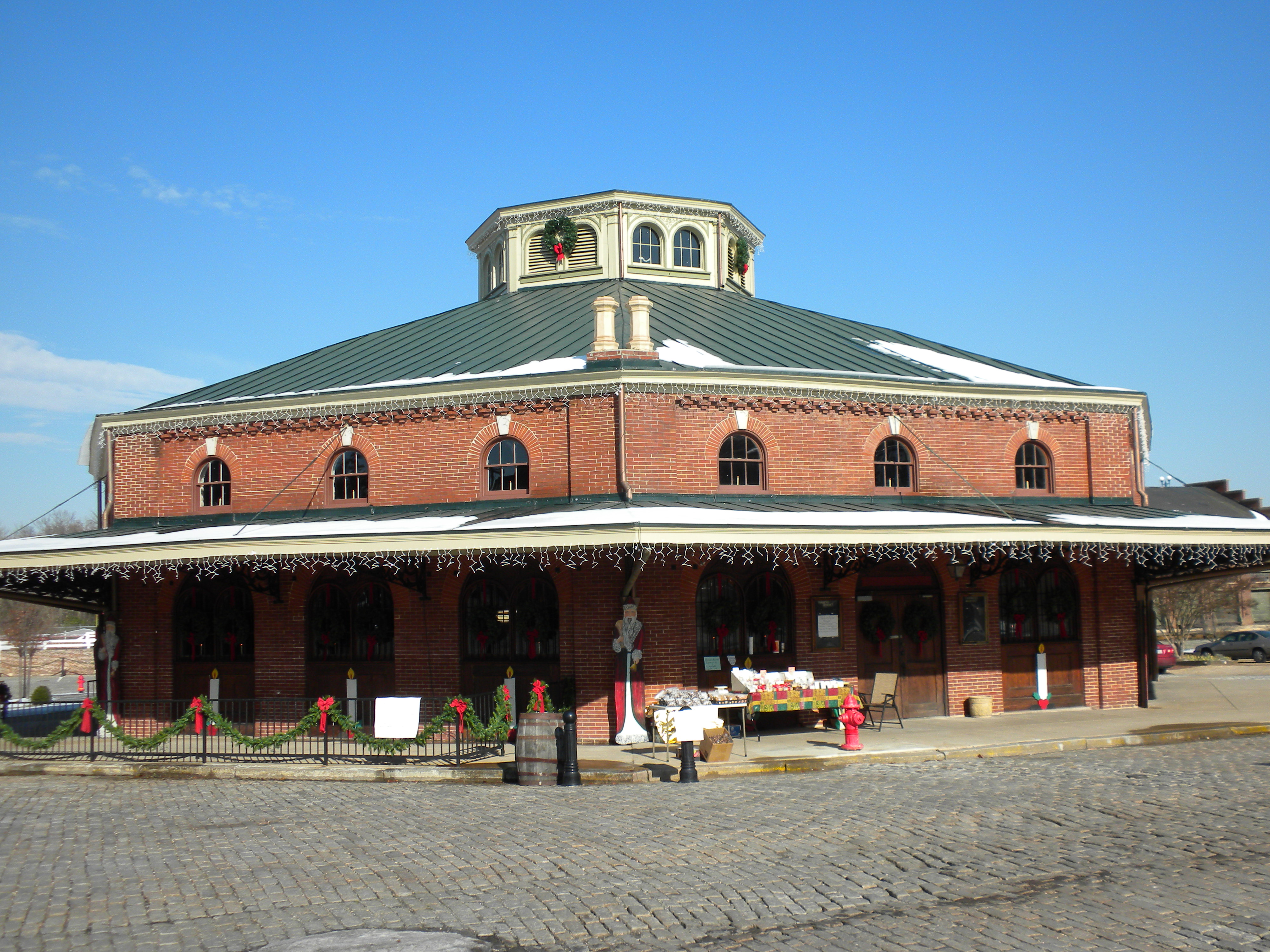
37°13′46″N 77°24′00″W / 37.229444°N 77.4°WPetersburg 9 City Market 
June 11, 1969 Rock, W. Old and River Sts., and Cockade Alley
37°14′00″N 77°24′18″W / 37.233333°N 77.405°WPetersburg 10 Cohen House 
November 1, 2007 32 S. Adams St.
37°13′36″N 77°24′07″W / 37.226667°N 77.401944°WPetersburg 11 Commerce Street Industrial Historic District September 12, 2008 Commerce, Upper Appomattox, West, Dunlop, and South Sts.
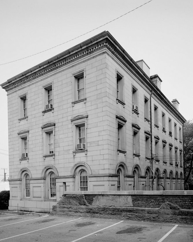
37°13′29″N 77°25′18″W / 37.224786°N 77.421561°WPetersburg 12 Exchange Building 
June 11, 1969 15-19 W. Bank St.
37°13′55″N 77°24′16″W / 37.231944°N 77.404444°WPetersburg 13 Farmers' Bank 
April 13, 1972 NW corner of Bollingbrook St. and Cockade Alley
37°13′57″N 77°24′15″W / 37.2325°N 77.404167°WPetersburg 14 Folly Castle Historic District 
July 16, 1980 Perry and W. Washington Sts.
37°13′36″N 77°24′36″W / 37.226667°N 77.41°WPetersburg Boundary increase (listed April 14, 1992): 235—618 Washington, 235—580 Hinton, 15—37 Guarantee, 18—115 Lafayette and 18—42 Perry Sts.; Boundary increase (listed January 10, 2000): Roughly along South St. from Commerce St. to Farmer St. 15 Nathaniel Friend House 
August 11, 1976 27-29 Bollingbrook St.
37°13′58″N 77°24′14″W / 37.232778°N 77.403889°WPetersburg 16 Lee Memorial Park August 14, 2000 1832 Johnson Rd.
37°11′57″N 77°24′24″W / 37.199167°N 77.406667°WPetersburg 17 McIlwaine House July 16, 1973 Market Square at corner of Pelham and Cockade Alleys
37°13′59″N 77°24′15″W / 37.233056°N 77.404167°WPetersburg 18 William McKenney House December 6, 1990 250 S. Sycamore St.
37°13′29″N 77°24′41″W / 37.224722°N 77.411389°WPetersburg 19 North Battersea-Pride's Field Historic District May 26, 2005 Roughly along the Appomatox River bank, McKenzie, W. High., Upper Appomattox Sts., from 1250 W. High to Fleet Sts.
37°13′48″N 77°25′20″W / 37.23°N 77.422222°WPetersburg 20 Peabody Building of the Peabody-Williams School August 2, 2000 Jones St.
37°13′23″N 77°24′25″W / 37.223056°N 77.406944°WPetersburg 21 People's Memorial Cemetery March 28, 2008 334 S. Crater Rd.
37°13′30″N 77°23′20″W / 37.224978°N 77.388892°WPetersburg 22 Petersburg City Hall 
November 16, 1978 129-141 N. Union St.
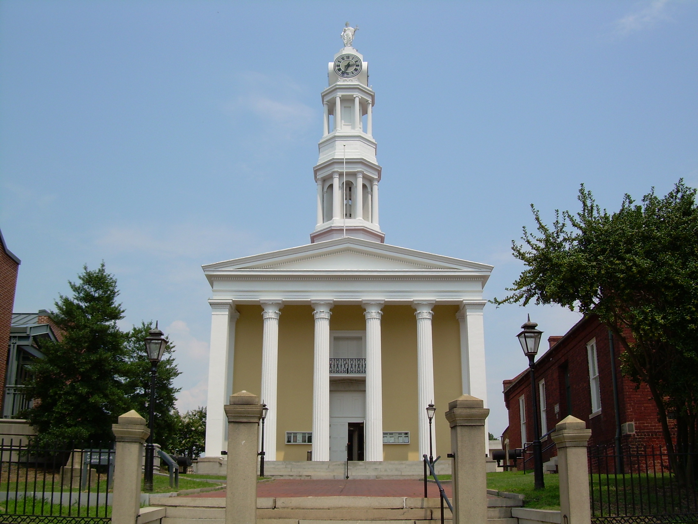
37°13′47″N 77°24′19″W / 37.229722°N 77.405278°WPetersburg 23 Petersburg Courthouse 
May 14, 1973 Court House Sq.
37°13′50″N 77°24′12″W / 37.230556°N 77.403333°WPetersburg 24 Petersburg Courthouse Historic District December 21, 1990 Roughly bounded by W. Bank, N. Adams, W. Washington and N. Market Sts.
37°13′45″N 77°24′20″W / 37.229167°N 77.405556°WPetersburg 25 Petersburg Old Town Historic District July 4, 1980 U.S. 1 and VA 36
37°13′55″N 77°24′37″W / 37.231944°N 77.410278°WPetersburg Boundary increase (listed September 12, 2008): 241 4th St., 223-225 Henry St., 230 and 316 E. Bank St. 26 Pocahontas Island Historic District November 3, 2006 Pocahontas, Witten, Rolfe, Logan, and Sapony Sts.
37°14′19″N 77°23′59″W / 37.238611°N 77.399722°WPetersburg 27 Poplar Lawn Historic District 
May 23, 1980 Roughly bounded by Surrey Lane, St. Jefferson, Mars and Harrison Sts.
37°13′23″N 77°24′03″W / 37.223056°N 77.400833°WPetersburg Boundary increase (listed February 10, 2006): Jct. of E Wythe and S. Jefferson, from SE of orig. HD to Lieutenant Run, Along both sides of Harrison St. at SW corner 28 Saint Paul's Church 
May 30, 1986 102 N. Union St.
37°13′43″N 77°24′22″W / 37.228611°N 77.406111°WPetersburg 29 Second Presbyterian Church 
January 14, 1991 419 W. Washington St.
37°13′36″N 77°24′38″W / 37.226667°N 77.410556°WPetersburg 30 South Chappell Street Car Barn February 25, 2009 124 South Chappell St.
37°13′12″N 77°25′28″W / 37.220064°N 77.424556°WPetersburg 31 South Market Street Historic District 
April 22, 1992 S. Market St. from Washington St. to Halifax St.
37°13′29″N 77°24′23″W / 37.224722°N 77.406389°WPetersburg 32 Stewart-Hinton House January 14, 2004 416 High St.
37°13′52″N 77°24′42″W / 37.231111°N 77.411667°WPetersburg 33 Strawberry Hill December 23, 1974 231-235-237 Hinton St.
37°13′43″N 77°24′30″W / 37.228611°N 77.408333°WPetersburg 34 Tabb Street Presbyterian Church 
May 31, 1979 21 W. Tabb St.
37°13′49″N 77°24′20″W / 37.230278°N 77.405556°WPetersburg 35 Virginia Trunk & Bag Company December 23, 2009 600 W. Wythe St.
37°13′27″N 77°24′47″W / 37.224236°N 77.413164°WPetersburg 36 Thomas Wallace House 
May 2, 1975 SW corner of Brown and S. Market Sts.
37°13′26″N 77°24′22″W / 37.223889°N 77.406111°WPetersburg 37 Washington Street Methodist Church 
November 24, 1980 14-24 E. Washington St.
37°13′39″N 77°24′10″W / 37.2275°N 77.402778°WPetersburg See also
- National Register of Historic Places listings in Virginia
- National Register of Historic Places listings in Chesterfield County, Virginia
- National Register of Historic Places listings in Dinwiddie County, Virginia
- List of National Historic Landmarks in Virginia
References
- ^ The latitude and longitude information provided in this table was derived originally from the National Register Information System, which has been found to be fairly accurate for about 99% of listings. For about 1% of NRIS original coordinates, experience has shown that one or both coordinates are typos or otherwise extremely far off; some corrections may have been made. A more subtle problem causes many locations to be off by up to 150 yards, depending on location in the country: most NRIS coordinates were derived from tracing out latitude and longitudes off of USGS topographical quadrant maps created under North American Datum of 1927, which differs from the current, highly accurate GPS system used by Google maps. Chicago is about right, but NRIS longitudes in Washington are higher by about 4.5 seconds, and are lower by about 2.0 seconds in Maine. Latitudes differ by about 1.0 second in Florida. Some locations in this table may have been corrected to current GPS standards.
- ^ "National Register of Historic Places: Weekly List Actions". National Park Service, United States Department of the Interior. Retrieved on November 10, 2011.
- ^ Numbers represent an ordering by significant words. Various colorings, defined here, differentiate National Historic Landmark sites and National Register of Historic Places Districts from other NRHP buildings, structures, sites or objects.
- ^ "National Register Information System". National Register of Historic Places. National Park Service. . http://nrhp.focus.nps.gov/natreg/docs/All_Data.html.
U.S. National Register of Historic Places Topics Lists by states Alabama • Alaska • Arizona • Arkansas • California • Colorado • Connecticut • Delaware • Florida • Georgia • Hawaii • Idaho • Illinois • Indiana • Iowa • Kansas • Kentucky • Louisiana • Maine • Maryland • Massachusetts • Michigan • Minnesota • Mississippi • Missouri • Montana • Nebraska • Nevada • New Hampshire • New Jersey • New Mexico • New York • North Carolina • North Dakota • Ohio • Oklahoma • Oregon • Pennsylvania • Rhode Island • South Carolina • South Dakota • Tennessee • Texas • Utah • Vermont • Virginia • Washington • West Virginia • Wisconsin • WyomingLists by territories Lists by associated states Other  Category:National Register of Historic Places •
  Portal:National Register of Historic PlacesCategories:
- Petersburg, Virginia
- National Register of Historic Places in Virginia
- Virginia-related lists
-


Wikimedia Foundation. 2010.