- National Register of Historic Places listings in Person County, North Carolina
-

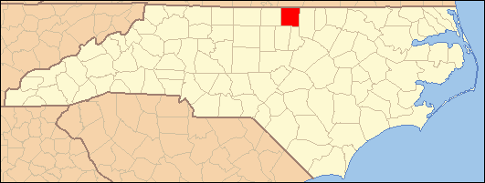
This list includes properties and districts listed on the National Register of Historic Places in Person County, North Carolina. Click the "Map of all coordinates" link to the right to view a Google map of all properties and districts with latitude and longitude coordinates in the table below.[1]
-
- This National Park Service list is complete through NPS recent listings posted November 10, 2011.[2]
[3] Landmark name[4] Image Date listed Location City or Town Summary 1 Burleigh May 1, 1980 NW of Concord on NC 57
36°29′8″N 79°7′10″W / 36.48556°N 79.11944°WConcord 2 Henry-Vernon House February 3, 1983 SW of Bushy Fork on NC 49
36°18′0″N 79°6′14″W / 36.3°N 79.10389°WBushy Fork 3 Holloway-Jones-Day House June 9, 1988 US 501 and SR 1322
36°29′37″N 78°55′6″W / 36.49361°N 78.91833°WRoxboro 4 Holloway-Walker Dollarhite House June 1, 1982 SR 1514
36°29′8″N 78°54′27″W / 36.48556°N 78.9075°WBethel Hill 5 House on Wagstaff Farm April 5, 2006 NE side NC 57, 1.4 miles NW of jct. with NC 1300
36°27′45″N 79°4′48″W / 36.4625°N 79.08°WRoxboro 6 James A. and Laura Thompson Long House April 6, 2005 217 S. Main St.
36°23′31.21″N 78°59′7.94″W / 36.3920028°N 78.9855389°WRoxboro 7 Merritt-Winstead House September 15, 2005 7891 Boston Rd.
36°28′56″N 78°55′7″W / 36.48222°N 78.91861°WRoxboro 8 Person County Courthouse 
May 10, 1979 Main St. between Abbitt and Court Sts.
36°23′37.8″N 78°59′3.33″W / 36.393833°N 78.9842583°WRoxboro 9 Roxboro Commercial Historic District March 1, 1984 Roughly bounded by Courthouse Sq., Court, Abbit, Reams, Depot, N. and S. Main Sts.
36°23′38″N 78°59′3″W / 36.39389°N 78.98417°WRoxboro 10 Roxboro Cotton Mill August 27, 2009 115 Lake Dr.
36°23′33.82″N 78°58′42.25″W / 36.3927278°N 78.9784028°WRoxboro 11 Roxboro Male Academy and Methodist Parsonage July 29, 1982 315 N. Main St.
36°23′48.61″N 78°58′51.24″W / 36.3968361°N 78.9809°WRoxboro 12 Waverly Plantation October 9, 1974 S of U.S. 58
36°32′19.71″N 79°4′44.38″W / 36.5388083°N 79.0789944°WCunningham See also
- National Register of Historic Places listings in North Carolina
- List of National Historic Landmarks in North Carolina
References
- ^ The latitude and longitude information provided in this table was derived originally from the National Register Information System, which has been found to be fairly accurate for about 99% of listings. For about 1% of NRIS original coordinates, experience has shown that one or both coordinates are typos or otherwise extremely far off; some corrections may have been made. A more subtle problem causes many locations to be off by up to 150 yards, depending on location in the country: most NRIS coordinates were derived from tracing out latitude and longitudes off of USGS topographical quadrant maps created under the North American Datum of 1927, which differs from the current, highly accurate WGS84 GPS system used by Google maps. Chicago is about right, but NRIS longitudes in Washington are higher by about 4.5 seconds, and are lower by about 2.0 seconds in Maine. Latitudes differ by about 1.0 second in Florida. Some locations in this table may have been corrected to current GPS standards.
- ^ "National Register of Historic Places: Weekly List Actions". National Park Service, United States Department of the Interior. Retrieved on November 10, 2011.
- ^ Numbers represent an ordering by significant words. Various colorings, defined here, differentiate National Historic Landmark sites and National Register of Historic Places Districts from other NRHP buildings, structures, sites or objects.
- ^ "National Register Information System". National Register of Historic Places. National Park Service. 2008-04-24. http://nrhp.focus.nps.gov/natreg/docs/All_Data.html.
U.S. National Register of Historic Places Topics Lists by states Alabama • Alaska • Arizona • Arkansas • California • Colorado • Connecticut • Delaware • Florida • Georgia • Hawaii • Idaho • Illinois • Indiana • Iowa • Kansas • Kentucky • Louisiana • Maine • Maryland • Massachusetts • Michigan • Minnesota • Mississippi • Missouri • Montana • Nebraska • Nevada • New Hampshire • New Jersey • New Mexico • New York • North Carolina • North Dakota • Ohio • Oklahoma • Oregon • Pennsylvania • Rhode Island • South Carolina • South Dakota • Tennessee • Texas • Utah • Vermont • Virginia • Washington • West Virginia • Wisconsin • WyomingLists by territories Lists by associated states Other Municipalities and communities of Person County, North Carolina City 
Unincorporated
communitiesHurdle Mills | Leasburg | Moriah | Rougemont | Semora | Somerset | Surl | Timberlake
Categories:- Person County, North Carolina
- National Register of Historic Places in North Carolina
- Buildings and structures in Person County, North Carolina
-

Wikimedia Foundation. 2010.