- National Register of Historic Places listings in Franklin County, North Carolina
-

This list includes properties and districts listed on the National Register of Historic Places in Franklin County, North Carolina. Click the "Map of all coordinates" link to the right to view a Google map of all properties and districts with latitude and longitude coordinates in the table below.[1]
-
- This National Park Service list is complete through NPS recent listings posted November 10, 2011.[2]
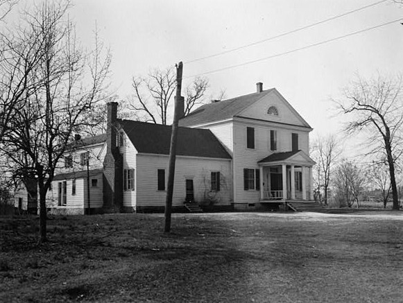
[3] Landmark name[4] Image Date listed Location City or Town Summary 1 Andrews-Moore House December 10, 1998 95 Simon Collie Rd.
36°0′9″N 78°11′14″W / 36.0025°N 78.18722°WBunn 2 Baker Farm October 5, 1982 SW of Bunn on SR 1720
35°56′59″N 78°18′50″W / 35.94972°N 78.31389°WBunn 3 Cascine 
April 26, 1973 S of Louisburg on SR 1702; also the northern side of NC 1702
36°2′21″N 78°19′25″W / 36.03917°N 78.32361°WLouisburg Second set of boundaries represents a boundary increase of December 4, 1985 4 Clifton House and Mill Site April 17, 1980 SR 1103
36°0′5″N 78°21′0″W / 36.00139°N 78.35°WRoyal 5 Cooke House October 14, 1975 SW of Louisburg near jct. of SR 1114 and SR 1109
36°3′19″N 78°20′23″W / 36.05528°N 78.33972°WLouisburg 6 Archibald H. Davis Plantation July 24, 1975 SE of Louisburg off NC 581
36°3′12″N 78°11′45″W / 36.05333°N 78.19583°WJustice 7 Dean Farm May 2, 1975 6 miles E of Louisburg on NC 56
36°5′21″N 78°10′46″W / 36.08917°N 78.17944°WLouisburg 8 Franklinton Depot December 27, 1990 201 E. Mason St.
36°6′11″N 78°27′20″W / 36.10306°N 78.45556°WFranklinton 9 Fuller House November 17, 1978 307 N. Main St.
36°6′13″N 78°17′58″W / 36.10361°N 78.29944°WLouisburg 10 Green Hill House 
June 10, 1975 S of Louisburg near jct. of SR 1760 and 1761
36°4′51″N 78°18′19″W / 36.08083°N 78.30528°WLouisburg 11 Dr. J. H. Harris House August 1, 1975 312 E. Mason St.
36°6′15″N 78°27′4″W / 36.10417°N 78.45111°WFranklinton 12 William A. Jeffreys House June 23, 1976 SE of Youngsville on SR 1101
35°57′22″N 78°23′41″W / 35.95611°N 78.39472°WYoungsville 13 Jones-Wright House March 12, 1992 NC 1003 W side, 0.2 miles S of jct. with NC 1252
36°12′44″N 78°20′54″W / 36.21222°N 78.34833°WRocky Ford 14 Shemuel Kearney House June 5, 1975 1 miles S of Franklinton on U.S. 1
36°4′36″N 78°28′53″W / 36.07667°N 78.48139°WFranklinton 15 Laurel Mill and Col. Jordan Jones House May 30, 1975 SW of Gupton at jct. of SR 1432 and 1436
36°10′40″N 78°11′30″W / 36.17778°N 78.19167°WGupton 16 Locust Grove November 20, 1975 N of Louisburg on U.S. 401
36°10′31″N 78°17′26″W / 36.17528°N 78.29056°WIngleside 17 Louisburg Historic District February 18, 1987 Roughly bounded by Allen Lane, Main and Cedar Sts., Franklin, Elm, and King St.
36°6′12″N 78°17′57″W / 36.10333°N 78.29917°WLouisburg 18 Main Building, Louisburg College December 8, 1978 Louisburg College campus
36°6′17″N 78°18′0″W / 36.10472°N 78.3°WLouisburg 19 Massenburg Plantation July 30, 1975 Address Restricted; also 821 NC 561 Louisburg 821 NC 561 represents a boundary increase of March 15, 2000 20 C.L. and Bessie G. McGhee House September 5, 2007 103 W. Mason St.
36°6′13″N 78°27′34″W / 36.10361°N 78.45944°WFranklinton 21 Monreath August 6, 1975 S of Ingleside on NC 39
36°10′0″N 78°17′34″W / 36.166667°N 78.29278°WIngleside 22 Dr. Samuel Perry House June 5, 1975 East of Gupton on SR 1436
36°11′52″N 78°9′6″W / 36.19778°N 78.15167°WGupton 23 Perry School January 3, 2011 2266 Laurel Mill-Centerville Rd.
36°11′35″N 78°7′28″W / 36.19306°N 78.12444°WCenterville vicinity 24 Person Place 
June 19, 1972 603 N. Main St.
36°6′22.1″N 78°17′46.43″W / 36.106139°N 78.2962306°WLouisburg 25 Person-McGhee Farm June 26, 1979 US 1
36°9′36″N 78°27′11″W / 36.16°N 78.45306°WFranklinton 26 Portridge March 1, 1990 SR 1224, 0.3 miles N of jct. with NC 56
36°5′25″N 78°21′4″W / 36.09028°N 78.35111°WLouisburg 27 Rose Hill May 3, 2006 W side of US 401 S, 0.25 miles N of NC 1110
36°4′15″N 78°19′54″W / 36.07083°N 78.33167°WLouisburg 28 Dr. J. A. Savage House September 22, 1980 124 College St.
36°5′55″N 78°27′27″W / 36.09861°N 78.4575°WFranklinton 29 Speed Farm December 27, 1991 W side NC 1436 between NC 1432 and NC 1434
36°11′17″N 78°11′26″W / 36.18806°N 78.19056°WGupton 30 Sterling Cotton Mill May 16, 1996 SE jct. of Seabord RR tracks and E. Green St.
36°5′59″N 78°27′25″W / 36.09972°N 78.45694°WFranklinton 31 Archibald Taylor House May 12, 1975 Address Restricted Wood 32 Patty Person Taylor House February 13, 1975 Address Restricted Louisburg 33 Aldridge H. Vann House January 9, 2008 115 N Main St.
36°6′20″N 78°27′23″W / 36.10556°N 78.45639°WFranklinton 34 Vine Hill May 28, 1975 Address Restricted Centerville 35 Thomas and Lois Wheless House August 28, 2007 106 John St.
36°6′1″N 78°17′44″W / 36.10028°N 78.29556°WLouisburg 36 Williamson House June 20, 1975 401 Cedar St.
36°6′3″N 78°17′45″W / 36.10083°N 78.29583°WLouisburg See also
- National Register of Historic Places listings in North Carolina
- List of National Historic Landmarks in North Carolina
References
- ^ The latitude and longitude information provided in this table was derived originally from the National Register Information System, which has been found to be fairly accurate for about 99% of listings. For about 1% of NRIS original coordinates, experience has shown that one or both coordinates are typos or otherwise extremely far off; some corrections may have been made. A more subtle problem causes many locations to be off by up to 150 yards, depending on location in the country: most NRIS coordinates were derived from tracing out latitude and longitudes off of USGS topographical quadrant maps created under the North American Datum of 1927, which differs from the current, highly accurate WGS84 GPS system used by Google maps. Chicago is about right, but NRIS longitudes in Washington are higher by about 4.5 seconds, and are lower by about 2.0 seconds in Maine. Latitudes differ by about 1.0 second in Florida. Some locations in this table may have been corrected to current GPS standards.
- ^ "National Register of Historic Places: Weekly List Actions". National Park Service, United States Department of the Interior. Retrieved on November 10, 2011.
- ^ Numbers represent an ordering by significant words. Various colorings, defined here, differentiate National Historic Landmark sites and National Register of Historic Places Districts from other NRHP buildings, structures, sites or objects.
- ^ "National Register Information System". National Register of Historic Places. National Park Service. 2008-04-24. http://nrhp.focus.nps.gov/natreg/docs/All_Data.html.
U.S. National Register of Historic Places Topics Lists by states Alabama • Alaska • Arizona • Arkansas • California • Colorado • Connecticut • Delaware • Florida • Georgia • Hawaii • Idaho • Illinois • Indiana • Iowa • Kansas • Kentucky • Louisiana • Maine • Maryland • Massachusetts • Michigan • Minnesota • Mississippi • Missouri • Montana • Nebraska • Nevada • New Hampshire • New Jersey • New Mexico • New York • North Carolina • North Dakota • Ohio • Oklahoma • Oregon • Pennsylvania • Rhode Island • South Carolina • South Dakota • Tennessee • Texas • Utah • Vermont • Virginia • Washington • West Virginia • Wisconsin • WyomingLists by territories Lists by associated states Other Municipalities and communities of Franklin County, North Carolina Towns Bunn | Centerville | Franklinton | Louisburg | Wake Forest‡ | Youngsville

Unincorporated
communitiesFootnotes ‡This populated place also has portions in an adjacent county or counties
Categories:- Franklin County, North Carolina
- National Register of Historic Places in North Carolina
- Buildings and structures in Franklin County, North Carolina
-


Wikimedia Foundation. 2010.