- National Register of Historic Places listings in Stokes County, North Carolina
-

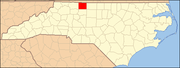
This list includes properties and districts listed on the National Register of Historic Places in Stokes County, North Carolina. Click the "Map of all coordinates" link to the right to view a Google map of all properties and districts with latitude and longitude coordinates in the table below.[1]
-
- This National Park Service list is complete through NPS recent listings posted November 10, 2011.[2]
[3] Landmark name[4] Image Date listed Location City or Town Summary 1 Christ Episcopal Church January 28, 2005 412 Summit Ave.
36°17′59″N 80°8′22″W / 36.29972°N 80.13944°WWalnut Cove 2 Danbury Historic District July 15, 1986 Main St. between Danbury Cemetery Rd. and NC 89
36°24′30″N 80°12′24″W / 36.40833°N 80.20667°WDanbury 3 R. W. George Mill October 10, 1997 NC 89, 0.6 mi NE of jct. of NC 89 and NC 66
36°29′33″N 80°23′33″W / 36.4925°N 80.3925°WFrancisco 4 Germanton Methodist Church and Cemetery March 19, 1998 Main St., jct. of Main St. and Willow St.
36°15′39″N 80°14′0″W / 36.26083°N 80.233333°WGermanton 5 Hanging Rock State Park Bathhouse October 24, 1991 End of NC 2015 S of jct. with NC 1001, Hanging Rock State Park
36°23′25″N 80°16′10″W / 36.39028°N 80.26944°WDanbury 6 Jessup's Mill July 15, 1982 SR 4132
36°31′32″N 80°22′17″W / 36.52556°N 80.37139°WCollinstown 7 King Historic District September 6, 2002 Dalton Rd., Main St., School St. and Railroad Right of Way
36°16′50″N 80°21′33″W / 36.28056°N 80.35917°WKing 8 Leak-Chaffin-Browder House September 6, 2002 NC 8, 0.1 miles S of jct. with NC 1941
36°16′33″N 80°13′14″W / 36.27583°N 80.22056°WGermanton 9 Matthew Moore House October 29, 1974 W of Danbury
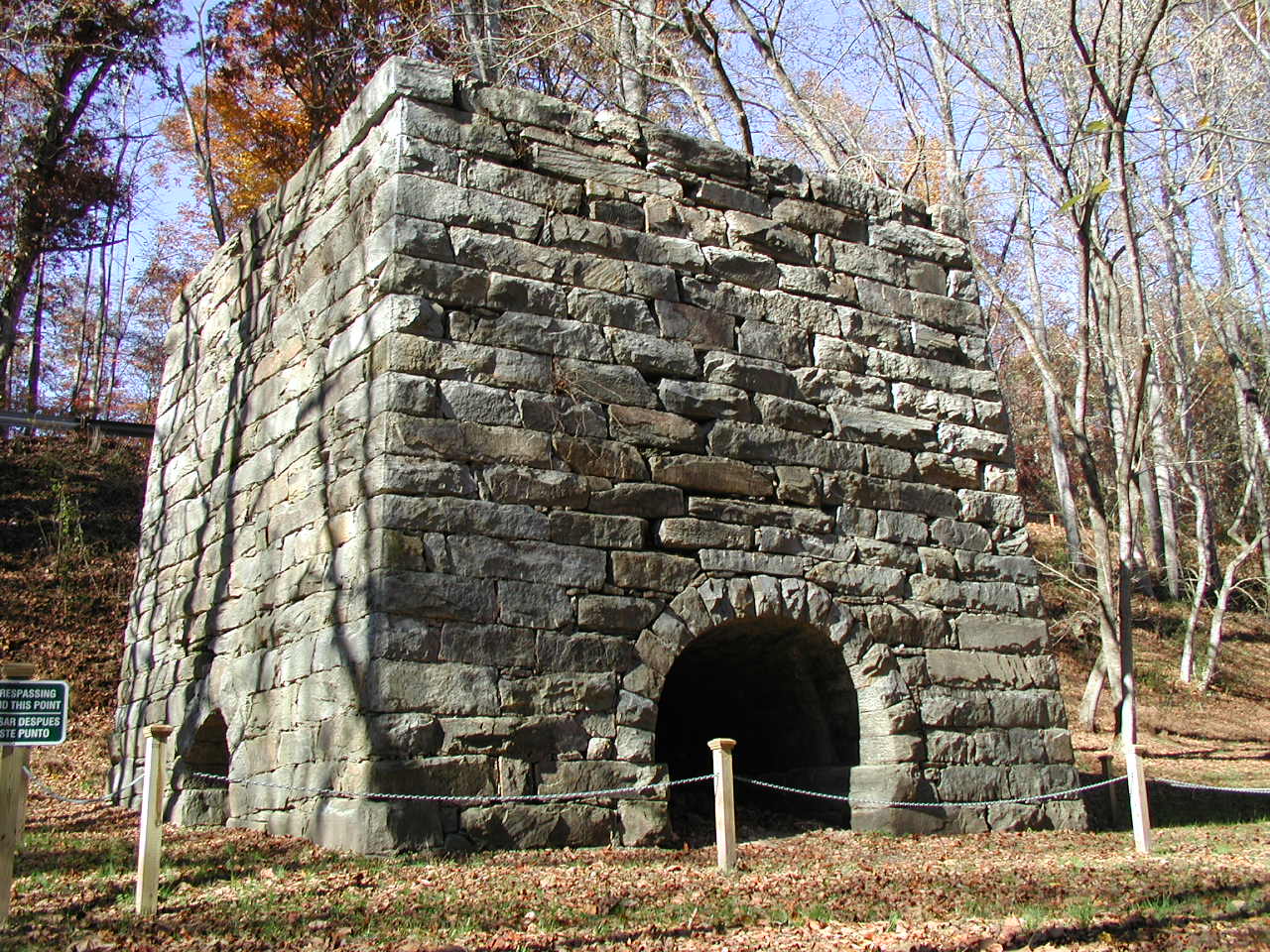
36°26′6″N 80°17′32″W / 36.435°N 80.29222°WDanbury 10 Moratock Iron Furnace 
July 30, 1974 E of Danbury off NC 89
36°24′27″N 80°11′59″W / 36.4075°N 80.19972°WDanbury 11 Pine Hall July 16, 1979 SR 1901 and NC 772
36°19′40″N 80°2′31″W / 36.32778°N 80.04194°WPine Hall 12 Rock House 
October 1, 1975 N of King on SR 1186
36°24′17″N 80°21′44″W / 36.40472°N 80.36222°WKing 13 St. Philip's Episcopal Church July 15, 1982 NC 65 and 8 and SR 1957
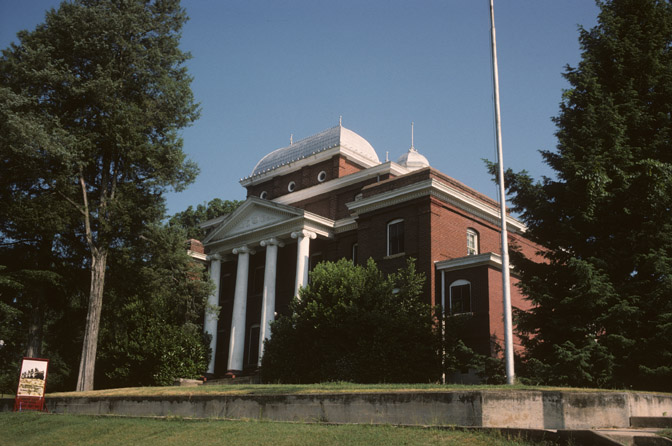
36°15′35″N 80°14′11″W / 36.25972°N 80.23639°WGermanton 14 Stokes County Courthouse 
May 10, 1979 Main St. between North St. and Courthouse Rd.
36°24′34″N 80°12′22″W / 36.40944°N 80.20611°WDanbury 15 Walnut Cove Colored School February 24, 1995 Jct. of Brook and Dalton Sts., NW corner
36°18′12″N 80°8′39″W / 36.30333°N 80.14417°WWalnut Cove See also
- National Register of Historic Places listings in North Carolina
- List of National Historic Landmarks in North Carolina
References
- ^ The latitude and longitude information provided in this table was derived originally from the National Register Information System, which has been found to be fairly accurate for about 99% of listings. For about 1% of NRIS original coordinates, experience has shown that one or both coordinates are typos or otherwise extremely far off; some corrections may have been made. A more subtle problem causes many locations to be off by up to 150 yards, depending on location in the country: most NRIS coordinates were derived from tracing out latitude and longitudes off of USGS topographical quadrant maps created under the North American Datum of 1927, which differs from the current, highly accurate WGS84 GPS system used by Google maps. Chicago is about right, but NRIS longitudes in Washington are higher by about 4.5 seconds, and are lower by about 2.0 seconds in Maine. Latitudes differ by about 1.0 second in Florida. Some locations in this table may have been corrected to current GPS standards.
- ^ "National Register of Historic Places: Weekly List Actions". National Park Service, United States Department of the Interior. Retrieved on November 10, 2011.
- ^ Numbers represent an ordering by significant words. Various colorings, defined here, differentiate National Historic Landmark sites and National Register of Historic Places Districts from other NRHP buildings, structures, sites or objects.
- ^ "National Register Information System". National Register of Historic Places. National Park Service. 2008-04-24. http://nrhp.focus.nps.gov/natreg/docs/All_Data.html.
U.S. National Register of Historic Places Topics Lists by states Alabama • Alaska • Arizona • Arkansas • California • Colorado • Connecticut • Delaware • Florida • Georgia • Hawaii • Idaho • Illinois • Indiana • Iowa • Kansas • Kentucky • Louisiana • Maine • Maryland • Massachusetts • Michigan • Minnesota • Mississippi • Missouri • Montana • Nebraska • Nevada • New Hampshire • New Jersey • New Mexico • New York • North Carolina • North Dakota • Ohio • Oklahoma • Oregon • Pennsylvania • Rhode Island • South Carolina • South Dakota • Tennessee • Texas • Utah • Vermont • Virginia • Washington • West Virginia • Wisconsin • WyomingLists by territories Lists by associated states Other Municipalities and communities of Stokes County, North Carolina Towns Danbury | King‡ | Walnut Cove
Village Townships Beaver Island | Big Creek | Danbury | Meadows | Peters Creek | Quaker Gap | Sauratown | Snow Creek | Yadkin
CDPs Aarons Corner | Asbury | Boyles Chapel | Brook Cove | Brown Mountain | Campbell | Capella | Ceramic | Chestnut Grove | Collinstown | Dalton | Delta | Dillard | Dodgetown | Flat Rock | Flat Shoals | Francisco | Gap | Germanton | Hartman | Lawsonville | Meadows | Moores Springs | Mountain View | Mount Olive | Neatman | Oak Ridge | Pine Hall | Pinnacle | Poplar Springs | Prestonville | Quaker Gap | Rosebud | Sandy Ridge | Volunteer
Categories:- Stokes County, North Carolina
- National Register of Historic Places in North Carolina
- Buildings and structures in Stokes County, North Carolina
-


Wikimedia Foundation. 2010.